Before and After: Downtown Aerial Photos


Aerial photos have been around for more than a century, ever since someone thought to take photos from airplanes. These photos go back to at least the 1910s, when the airplane was still very much a new technology. I thought it might be interesting to do show a few of these before and after Downtown aerial photos to give an idea of how the same areas look today.

Before

before and after downtown aerial photos

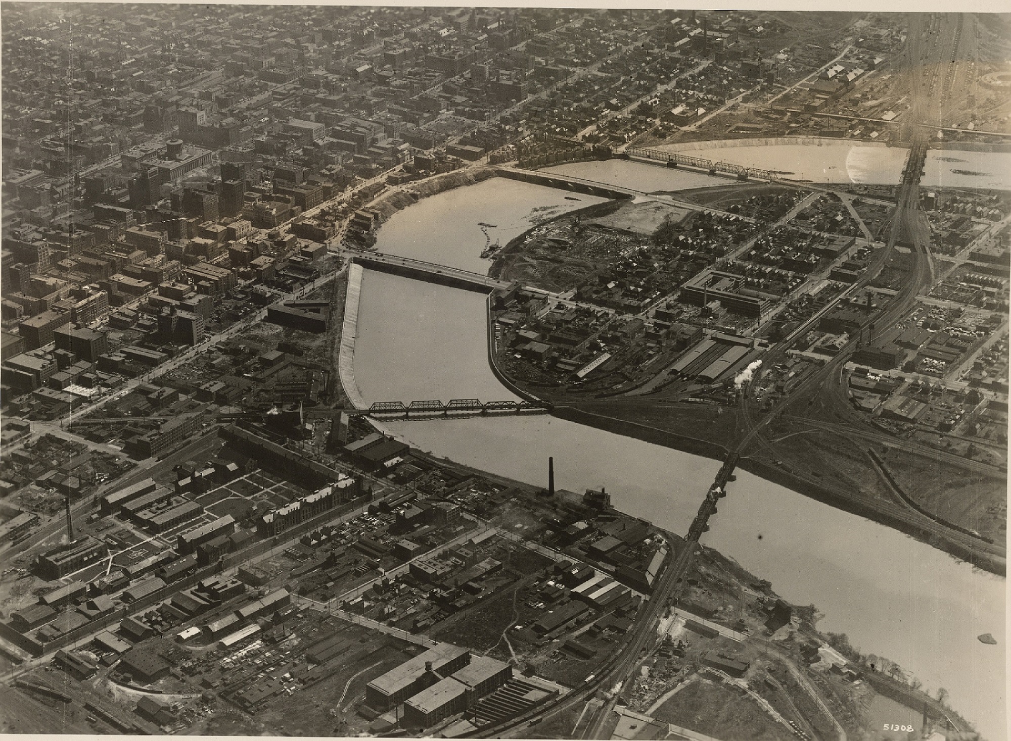
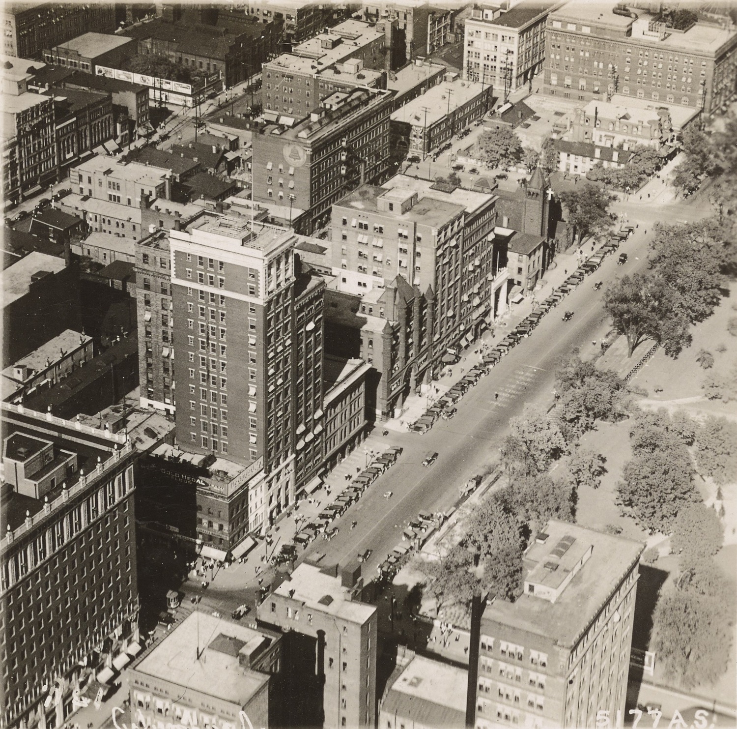
Downtown around 1923.


This photo of Downtown was likely taken sometime between 1922 and 1923. The main clue is that the old Central High School is clearly under construction on the Scioto Peninsula, but seemingly in the early phases. The school would later open in the fall of 1924.
Also in the photo is the new Scioto River floodwall under construction just a decade after the Great Flood of 1913. The buildings near and along the riverfront would eventually be demolished for this project, as well as the eventual Civic Center project that would later build the Post Office and Ohio Supreme Court building. Notice as well the lack of Columbus’ signature building- LeVeque Tower. That project would be constructed over the next few years.
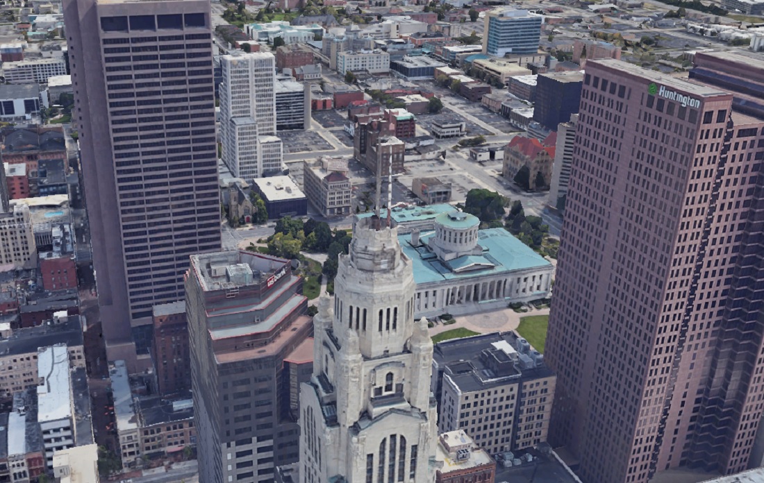
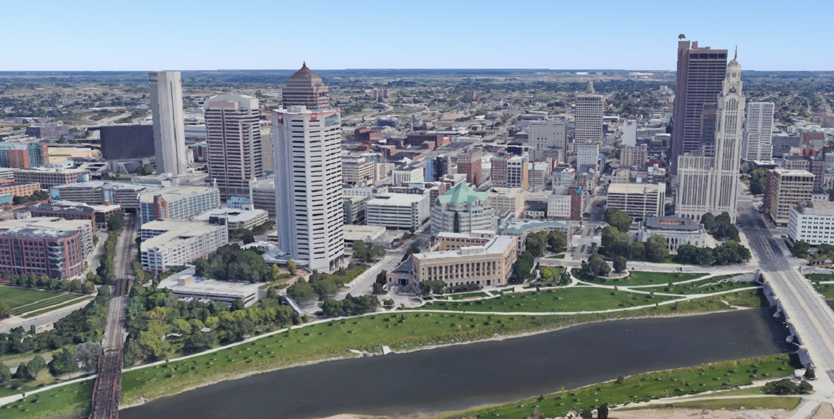
After
before and after downtown aerial photos

Downtown in 2019.


Downtown has obviously changed enormously in the past century. Skyscrapers now dominate Downtown, and the highway system now cuts through many neighborhoods. The riverfront itself is also significantly nicer and less industrial looking.
Before
before and after downtown aerial photos

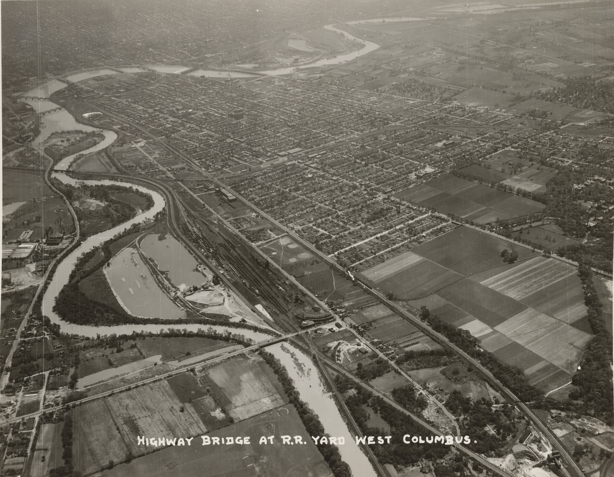
Photo taken in 1929.


This 1929 photo looks west over Franklinton towards Downtown. The most revealing part of this photo is how compact the developed area of Columbus really was at the time. Farm fields can be seen to the south and west of Columbus.
After
before and after downtown aerial photos

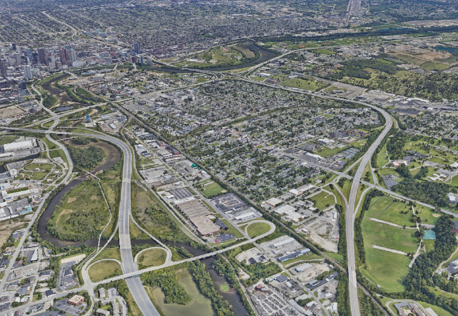
Photo taken in 2019.


In the after photo, nearly all the vacant land is gone except for park space, Greenlawn Cemetery and areas along the rivers.

Before
before and after downtown aerial photos
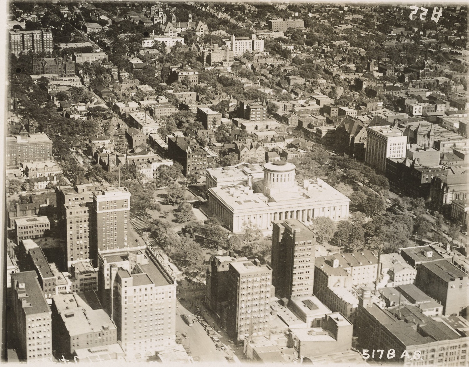
This photo of Capitol Square in 1919 is one of the earliest aerials of Downtown I was able to find. This photo predates all highrise construction. The city was compact, dense and dominated by brick buildings.
After
before and after downtown aerial photos
In the 2019 image, skyscrapers have now replaced many of the older buildings. While the Capitol itself a handful of other buildings remain, the density has largely been lost over the years, with parking lots where many once stood.
Before
before and after downtown aerial photos
The 1919 image shows the intersection of High and Broad Streets, arguably the very center of Columbus.
After
before and after downtown aerial photos
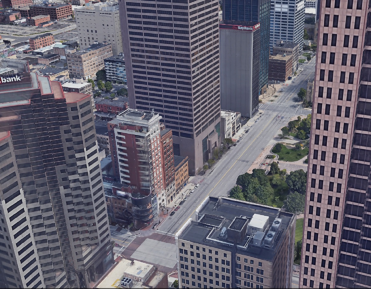
Aside from the 8 on the Square building, virtually everything else from 1919 is long gone.
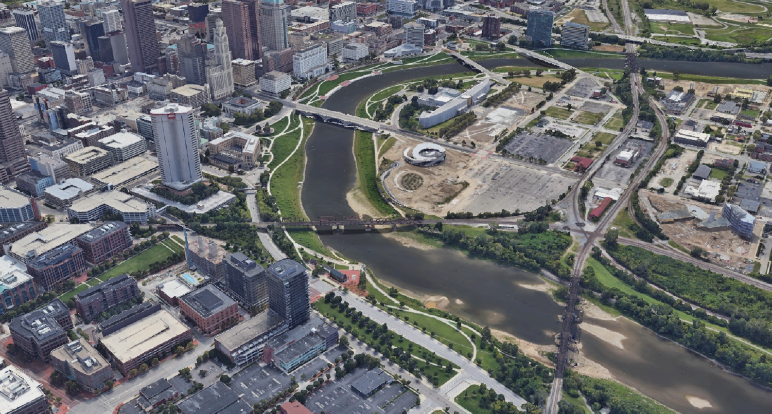
Before
before and after downtown aerial photos
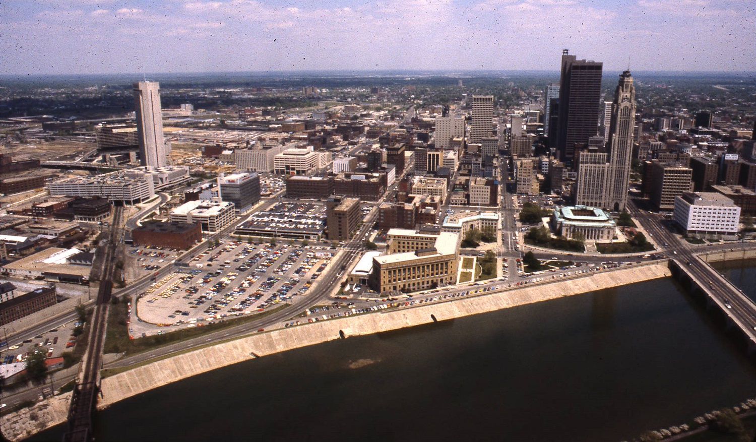
This much more modern image of Downtown and the riverfront was taken in 1980.
After
before and after downtown aerial photos
The 2019 Google Earth image from the same angle shows significant changes in 40 years. New skyscrapers and other development are obvious, but the massive changes to the riverfront itself almost make this look like a different city altogether.

What might these areas look like in another century?

Thousands of additional before and after photo sequences can be found at the Historic Building Database
General information about Downtown can be found at https://www.experiencecolumbus.com/neighborhoods/downtown/


Before and After Franklinton


*Some photos have been updated since the time of the original post.

Before: South Central Avenue, looking north, during the flood of January 21-24, 1959.
Before and After Franklinton
After: 2015

The 1959 flood was the 2nd worst in the history of Franklinton after the 1913 disaster. The Frank Road crest on the Scioto River came on January 22, 1959 and was 27.22 ft, 3.22 ft above flood stage and a few feet below the 1913 crest. This crest would not cause serious flooding in Franklinton today, as the Franklinton Floodwall, completed in 2004, will protect the area to crests of up to 30.9 ft. Few people know that, prior to the wall’s completion, federal guidelines prohibited almost all types of construction in Franklinton, a contributing factor in the gradual decline it faced after the 1950s.

Before: Bellows Avenue Elementary on Bellows Avenue in 1922.

After: 2017

Bellows Elementary was opened in 1905 and barely escaped destruction during the I-70/315 highway construction. The building remained a school through the 1970s before closing and being sold by the city in 1984. It has remained vacant since then. Recent proposals to turn it into apartments, particularly as Franklinton has begun a massive revitalization, and the building has received a new roof, so further deterioration has been stopped for now. The building, however, is threatened by possible demolition once the 70/71 split is reconstructed in sometime in the mid-2020s.

Before: The Columbus Heating and Ventilation Company building at 433 W. Town Street in 1916.

After: 2016

The Columbus Heating and Ventilating Company began in 1903 and still exists in the city, although obviously not at its original location. It later served as factories and parts of the complex were even used to enrich uranium for the Manhattan Project. The old building eventually went into severe disrepair and most of the roof had collapsed by the time it was demolished in 2011 as one of the first steps in the area’s rebirth. Multiple redevelopment plans have come and gone for the site, but so far, nothing has come of them.

Before: Mt. Carmel Hospital, looking southwest on Davis, in 1909.

After: 2018

Mt. Carmel was originally known as Hawkes Hospital. The first section was completed in 1886, with later expansions in 1891 and 1908. Eventually, the old structures were deemed outdated for modern hospital purposes, and the entire complex was demolished in the late 1940s. Today, the site is very different, with the current buildings built on top of the old Davis and State Street intersection. The hospital moved most services to a new location in Grove City in recent years, with plans to demolish part of the complex to create a new mixed-use development.

For thousands more before and after photos from all parts of the city, click here:
Historic Building Database