

Central Ohio is not known to be a big tornado hotspot, either in Ohio or the greater Midwest region. Despite this, the area has recorded dozens of tornadic events through history. This page will detail Columbus tornado history not just within the city itself, but all events across the entire metro area. Descriptions of damage come from newspaper articles, NCDC storm events summaries and other sources. Individual event tornadoes are listed by county and chronological order. Multi-county or multi-county path tornadoes are listed under the Multi-County list after individual tornadoes.
**Last updated: 3/12/2026- Added June 22, 1990 to Multi-County Outbreaks.
Tornado Warning Texts
https://forecast.weather.gov/wwamap/wwatxtget.php?cwa=ILN&wwa=tornado%20warning
Local and Regional Radar
https://weather.cod.edu/satrad/nexrad/?parms=ILN-N0Q-0-24-100-usa-rad
https://www.spc.noaa.gov/climo/reports/today.html
Wilmington National Weather Service
Good for local warnings.
https://www.weather.gov/ILN
To view all historic text tornado and severe thunderstorm advisories, the Thunderstorm and Tornado Advisory Archive lists them through 1983.
County-Specific Events
Delaware County
Delaware County has recorded 14 tornadoes through 2024.
Wednesday, June 5, 2024
**See Multi-County Outbreaks**
Wednesday, April 17, 2024
Severe thunderstorms moved through the area during the late afternoon. Most severe weather reports across the metro area consisted of large hail, some being up to 1.5″ in diameter. However, extreme southeast Delaware County near the Franklin County border also saw a brief EF1 tornado. No tornado warning was issued for the storm.
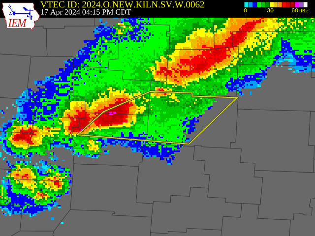
Radar near the time of the tornado touchdown of April 17, 2024.
Public Information Statement
National Weather Service Wilmington OH
331 PM EDT Thu Apr 18 2024
…NWS DAMAGE SURVEY FOR 04/17/2024 TORNADO EVENT…
…EF1 Tornado Confirmed in Southeast Delaware County…
Start Location………….3 N New Albany in Delaware County OH
End Location……………4 N New Albany in Delaware County OH
Date………………………4/17/2024
Estimated Start Time………..5:26 PM EDT
Estimated End Time………….05:28 PM EDT
Maximum EF-Scale Rating……..EF1
Estimated Maximum Wind Speed…90 mph
Maximum Path Width………….100 yards
Path Length………………..0.9 miles
Beginning Lat/Lon…………..40.1320 / -82.8097
Ending Lat/Lon……………..40.1338 / -82.7936
* Fatalities…0
* Injuries…..0
…Summary…
The brief tornado quickly developed and likely reached the maximum intensity near the intersection of Fancher Road and State Route 605 South causing damage to a residence on the south side of Fancher Road. Multiple homes on the south side of Fancher Road were also damaged, with damage ranging from blown out windows, garage door failures to moderate roof material loss. The tornado likely weakened as it crossed Fancher Road near Hatch Road and Kean Road,
causing damage to trees in the area. The last known damage was found north of Fancher Road where an outbuilding lost most of its metal panels.
Monday, September 7, 2020
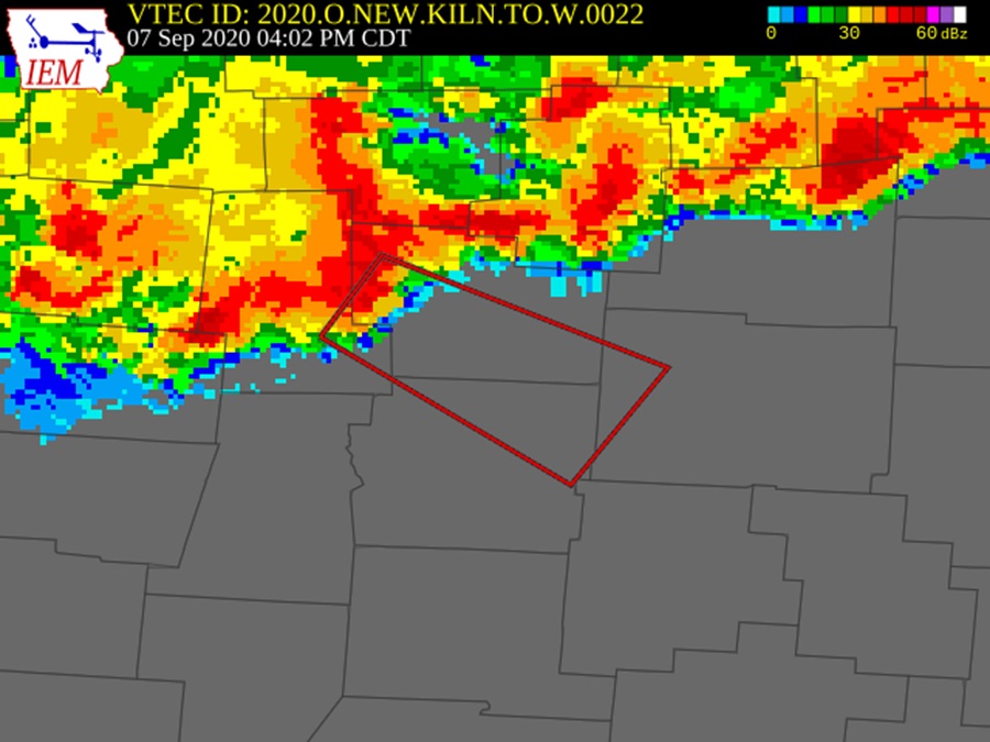
Radar image at the time of the 9/7/2020 tornado warning.
A line of strong storms moving through Delaware County produced a brief EF0 tornado. This tornado touched down first just southwest of the Jumper Road and Bowtown Road intersection. From there, the tornado moved generally east-southeast to Old State Road before turning southeast. It moved across Alum Creek at Howard Road and then continued southeast until just past Three B’s and K Road, where it lifted. Most of the damage in the 3.4-mile path consisted of downed trees and limbs, though at least one home had its roof partially lifted in winds that reached about 80MPH. There were no injuries or deaths.
BULLETIN – EAS ACTIVATION REQUESTED
Tornado Warning
National Weather Service Wilmington OH
502 PM EDT Mon Sep 7 2020
The National Weather Service in Wilmington has issued a
* Tornado Warning for…
Northeastern Franklin County in central Ohio…
Southern Delaware County in central Ohio…
West central Licking County in central Ohio…
Southeastern Union County in central Ohio…
* Until 530 PM EDT.
* At 502 PM EDT, a severe thunderstorm capable of producing a tornado was located near Delaware, moving southeast at 45 mph.
SOURCE…Radar indicated rotation.
IMPACT…Flying debris will be dangerous to those caught without shelter. Mobile homes will be damaged or destroyed. Damage to roofs, windows, and vehicles will occur. Tree damage is likely.
* Locations impacted include…
Columbus, Dublin, Westerville, Reynoldsburg, Delaware, Gahanna, Worthington, Pataskala, Powell, Johnstown, Sunbury, Minerva Park, Polaris, Easton, Whitehall, New Albany, Jersey, Shawnee Hills, Galena and Ostrander.
This includes I-71 in Ohio between mile markers 114 and 131.
The NWS provides additional information for this event.
Saturday, August 20, 2016
An EF0 tornado touched down at 6:37PM just south of Buckeye Valley Middle School in Delaware County. It was part of severe thunderstorms that moved through the area during the afternoon and early evening. No warning was issued for the storm. Here is the damage path and description.
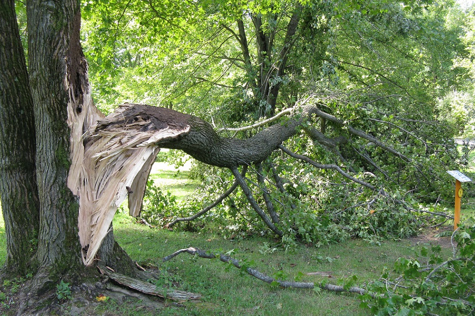
Tree damage from the August 20, 2016 tornado in Delaware State Park.
Friday, February 21, 2014
A weak, brief tornado touched down in the early morning hours near Kilbourne.
BULLETIN – EAS ACTIVATION REQUESTED
TORNADO WARNING
NATIONAL WEATHER SERVICE WILMINGTON OH
1257 AM EST FRI FEB 21 2014
THE NATIONAL WEATHER SERVICE IN WILMINGTON HAS ISSUED A
* TORNADO WARNING FOR…
NORTHEASTERN DELAWARE COUNTY IN CENTRAL OHIO…
* UNTIL 130 AM EST.
* AT 1252 AM EST…RADAR INDICATED A SEVERE THUNDERSTORM CAPABLE OF PRODUCING A TORNADO LOCATED NEAR KILBOURNE…MOVING NORTHEAST AT 30 MPH.
* LOCATIONS IMPACTED INCLUDE…
SUNBURY…
ASHLEY…
IN ADDITION…LEONARDSBURG…KILBOURNE AND OLIVE GREEN ARE NEAR THE PATH OF THIS DANGEROUS THUNDERSTORM.
THIS INCLUDES THE FOLLOWING INTERSTATE…
I-71 BETWEEN MILE MARKERS 128 AND 139…
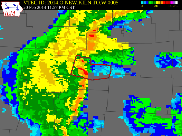
The radar around the time of the 2/21/2014 tornado.
The damage path is described in detail here.
Thursday, June 13, 2013
Severe storms moved through during the late night of the 12th into the early morning of the 13th. Three separate rounds of storms occurred during this period, with most severe weather reports consisting of wind damage. Three tornadoes were also reported in the state, with this tornado being the only one within the metro area. A warning was issued a few minutes before the event.
BULLETIN – EAS ACTIVATION REQUESTED
TORNADO WARNING
NATIONAL WEATHER SERVICE WILMINGTON OH
108 AM EDT THU JUN 13 2013
THE NATIONAL WEATHER SERVICE IN WILMINGTON HAS ISSUED A
* TORNADO WARNING FOR…
NORTHERN DELAWARE COUNTY IN CENTRAL OHIO…
EASTERN UNION COUNTY IN CENTRAL OHIO…
* UNTIL 145 AM EDT.
* AT 107 AM EDT…RADAR INDICATED A SEVERE THUNDERSTORM CAPABLE OF PRODUCING A TORNADO LOCATED NEAR MAGNETIC SPRINGS…MOVING EAST AT 65 MPH. IN ADDITION TO THE TORNADO…THIS STORM IS CAPABLE OF PRODUCING DESTRUCTIVE STRAIGHT LINE WINDS.
* LOCATIONS IMPACTED INCLUDE…
DELAWARE…
SUNBURY…
IN ADDITION…RADNOR…WARRENSBURG…LEONARDSBURG…KILBOURNE…GALENA AND OLIVE GREEN ARE NEAR THE PATH OF THIS DANGEROUS THUNDERSTORM.
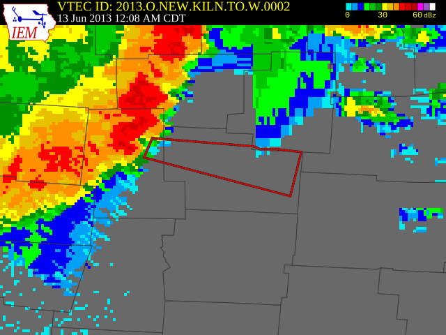
The radar image just a few minutes before the Delaware County tornado of 6/13/2013.
PUBLIC INFORMATION STATEMENT
NATIONAL WEATHER SERVICE WILMINGTON OH
251 PM EDT FRI JUN 14 2013
…TORNADO CONFIRMED NEAR RADNOR IN DELAWARE COUNTY OHIO…
LOCATION…2.5 MILES SOUTHWEST OF RADNOR IN DELAWARE COUNTY OHIO
DATE…JUNE 13 2013
ESTIMATED TIME…115 AM EDT
MAXIMUM EF-SCALE RATING…EF-0
ESTIMATED MAXIMUM WIND SPEED…85 MPH
MAXIMUM PATH WIDTH…50 YARDS
PATH LENGTH…0.25 MILES
BEGINNING LAT/LON…40.36N 83.19W ENDING
LAT/LON…40.36N 83.18W
* FATALITIES…0
* INJURIES…0
…SUMMARY…
THE NATIONAL WEATHER SERVICE IN WILMINGTON OH HAS CONFIRMED A TORNADO NEAR RADNOR IN DELAWARE COUNTY OHIO ON JUNE 13 2013.
A NWS DAMAGE SURVEY CONFIRMED A BRIEF TORNADO TOUCHED DOWN ON THE WEST SIDE OF STATE HIGHWAY 257 SOUTHWEST OF RADNOR. THE TORNADO INITIALLY HIT TWO BARNS…DESTROYING ONE AND HEAVILY DAMAGING ANOTHER. ONE BARN CONSISTED OF CINDER BLOCK WALLS AND TIN/METAL ROOFING. WHILE MUCH OF THE CINDER BLOCK COLLAPSED…THE ROOFING OF THIS STRUCTURE ALONG WITH SOME OF THE CINDER BLOCK ATTACHED…AND THE OTHER BARN ROOFING AND WALLS WAS LIFTED ACROSS HIGHWAY 257
WHERE MUCH OF THE MATERIAL WAS WRAPPED AROUND TREES ALONG THE SCIOTO RIVER. SOME OF THE CINDER BLOCK WAS LIFTED/CARRIED ACROSS HIGHWAY 257 AND DEPOSITED IN RESIDENTIAL YARDS ACROSS THE ROAD.
LARGE PORTIONS OF THE BARN ROOFING WAS LOFTED OVER THE TREE LINE ALONG THE SCIOTO RIVER…AND DEPOSITED IN THE BACK YARDS OF RESIDENCES ALONG RIVER ROAD…ON THE EAST SIDE OF THE RIVER…A DISTANCE OF TWO TENTHS OF A MILE. TREE DAMAGE ALONG THE SOUTH SIDE OF BRIEF TORNADO TRACK WAS LAYING IN A NORTHEAST ORIENTATION…WHICH IS INWARD TOWARD THE TORNADO TRACK…WHICH SUPPORTS THE IDEA OF A BRIEF CIRCULATION /CONVERGENT DAMAGE PATTERN/ ALONG THE SHORT PATH.
OTHER DAMAGE ALONG THE BRIEF PATH INCLUDED SNAPPED LARGE TREES…COMPLETE DESTRUCTION AND LIFTING OF A SMALL SHED WHICH WAS THROWN ABOUT 50 FEET…AND LARGE AMOUNTS OF DEBRIS WRAPPED AROUND TREES. CORN STALKS WERE FOUND IN THE YARDS OF RESIDENCES ON THE EAST SIDE OF THE SCIOTO RIVER…WITH THE NEAREST CORN FIELD UPSTREAM TO BE THE FIELD BEHIND THE DESTROYED BARNS ON THE WEST SIDE OF THE RIVER…SUGGESTING THESE STALKS WERE LIFTED FROM THE GROUND AND CARRIED AROUND A QUARTER OF A MILE. CONSIDERING ALL DAMAGE INDICATORS…A WIND SPEED OF 85 MPH APPEARS CONSISTENT WITH THIS DAMAGE…WHICH MAKES TORNADO A HIGH-END EF-0 ON THE ENHANCED FUJITA SCALE.
THE COLUMBUS OHIO TERMINAL DOPPLER WEATHER RADAR /TCMH TDWR/ CONFIRMS A STRONG LOW LEVEL ROTATION SIGNAL IN THIS AREA WHICH FURTHER CORROBORATES THE RESULTS OF THIS SURVEY.
Thursday, September 16, 2010
*See Multi-County Outbreaks below.*
Wednesday, September 20, 2000
*See Multi-County Outbreaks below.*
Sunday, August 17, 1997
At around 1:15PM, an EF0 touched down along Miller Paul Road about 3 miles southeast of Sunbury. The tornado was on the ground roughly 5 minutes and traveled about half a mile. The tornado damaged a pair of homes and destroyed a barn before lifting near Trenton Road. Trenton Road had to be closed for a time until crews removed large trees that had blown down into it. This severe storm was isolated and not within any watch and did not have any attached warnings.
https://www.ncdc.noaa.gov/stormevents/eventdetails.jsp?id=5611920
Tuesday, April 18, 1978
*See Multi-County Outbreaks below.*
Tuesday, May 8, 1973
*See Multi-County Outbreaks below.*
Sunday, April 11, 1965
*See Multi-County Outbreaks below.*
Thursday, August 14, 1958
A brief EF0 tornado touched down southeast of the 165/229 intersection in Delaware County. The 33-yard-ward tornado caused no damage, but did result in one injury.
https://www.ncdc.noaa.gov/stormevents/eventdetails.jsp?id=10084514
April 10, 1922
The Ohio Meterological Report for the month reported “a very destructive tornado, or tornadoes, in Champaign, Clark, Delaware and Greene counties.” However, the Columbus Dispatch the following few days only mentioned a tornado affecting Champaign, Clark and Greene counties, which caused at least $100,000 in damage. It’s unclear what impact occurred in Delaware County.
Fairfield County
Fairfield County has seen 21 tornadoes through 2024.
Wednesday, February 28, 2024
**See Multi-County Outbreaks below**
Wednesday, April 20, 2011
*See Multi-County Outbreaks below.*
Monday, February 28, 2011
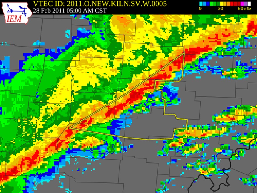
The radar image at the time of the tornado.
This EF1 tornado first touched down south of Millersport near the intersection of Millersport Road and Canal Road, and then continued east-northeast until it lifted near Cattail Road just south of Walnut Creek. The tornado damaged several farm buildings, as well as at least 2 homes along its nearly 2.5 mile path. The area had been under a Tornado Watch at the time of the tornado, but only a Severe Thunderstorm Warning was actually issued during this event in Fairfield County. For more information, check here:
https://www.ncdc.noaa.gov/stormevents/eventdetails.jsp?id=279804
https://www.weather.gov/iln/20110228_Millersport
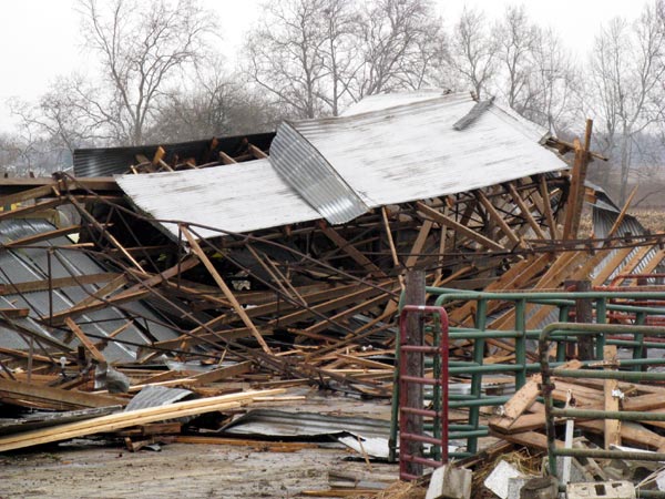
Destroyed farm buildings from the tornado.
Saturday, September 23, 2000
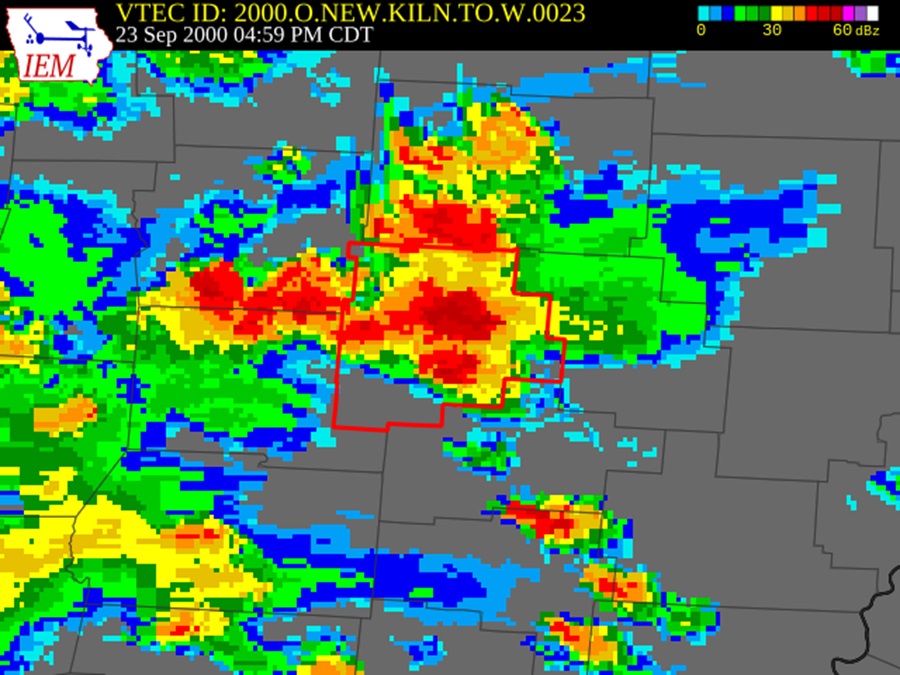
The radar image at the time of the tornado warning on 9/23/2000.
An EF0 tornado made a few short touchdowns in the northern half of Lancaster in Fairfield County, destroying a garage and downing trees and power lines. The 50-yard-wide tornado caused no deaths or injuries, but about $30,000 in damage along a less than half-mile total path.
A 2nd tornado, a 50-yard-wide EF1 began a short 0.2 mile path a few miles northeast of Bremen in Fairfield County where it damaged a home and garage. It caused $150,000 in damage, but no injuries or deaths.
BULLETIN – EAS ACTIVATION REQUESTED
TORNADO WARNING
NATIONAL WEATHER SERVICE WILMINGTON OH
500 PM EDT SAT SEP 23 2000
THE NATIONAL WEATHER SERVICE IN WILMINGTON HAS ISSUED A
* TORNADO WARNING FOR…
PICKAWAY COUNTY IN CENTRAL OHIO…
FAIRFIELD COUNTY IN CENTRAL OHIO…
* UNTIL 530 PM EDT…
* AT 500 PM EDT…NATIONAL WEATHER SERVICE DOPPLER RADAR INDICATED A SEVERE THUNDERSTORM CAPABLE OF PRODUCING A TORNADO 6 MILES
NORTHEAST OF ASHVILLE…OR ABOUT 9 MILES SOUTHWEST OF
PICKERINGTON…MOVING NORTHEAST AT 10 MPH.
* SOME LOCATIONS NEAR THE PATH OF THIS STORM INCLUDE…
WILLIAMSPORT…
SOUTH BLOOMFIELD…
PLEASANTVILLE…
PICKERINGTON…
THE SAFEST PLACE TO BE DURING A TORNADO IS IN A BASEMENT. GET UNDER A WORKBENCH OR OTHER PIECE OF STURDY FURNITURE. IF NO BASEMENT IS AVAILABLE…SEEK SHELTER ON THE LOWEST FLOOR OF THE BUILDING IN AN INTERIOR HALLWAY OR ROOM SUCH AS A CLOSET.
Tuesday, May 23, 2000
*See Multi-County Outbreaks below.*
Friday, June 22, 1990
*See Multi-County Outbreaks below*
Thursday, April 3, 1974
*See Multi-County Outbreaks below.*
Thursday, May 10, 1973
*See Multi-County Outbreaks below.*
Sunday, May 16, 1971
An EF2 tornado briefly touched down just inside the Fairfield County line just south of the Lithopolis-Winchester Road and Winchester Road intersection at around 6:11PM. It destroyed a mobile home before lifting.
May 1971 Tornado
Monday, October 8, 1962
*See Multi-County Outbreaks below.*
Thursday, May 22, 1958
*See Multi-County Outbreaks below.*
June 25, 1877
Severe weather may have brought some tornadoes to the state. In Lancaster, it was reported that several homes and commercial buildings had their roofs blown off, and the Catholic church steeple was blown down.
Franklin County
There have been 36 confirmed tornadoes in the county since 1950.
March 30, 2025
A weak EF0 tornado touched down from a line of severe storms that moved through late on March 30th.
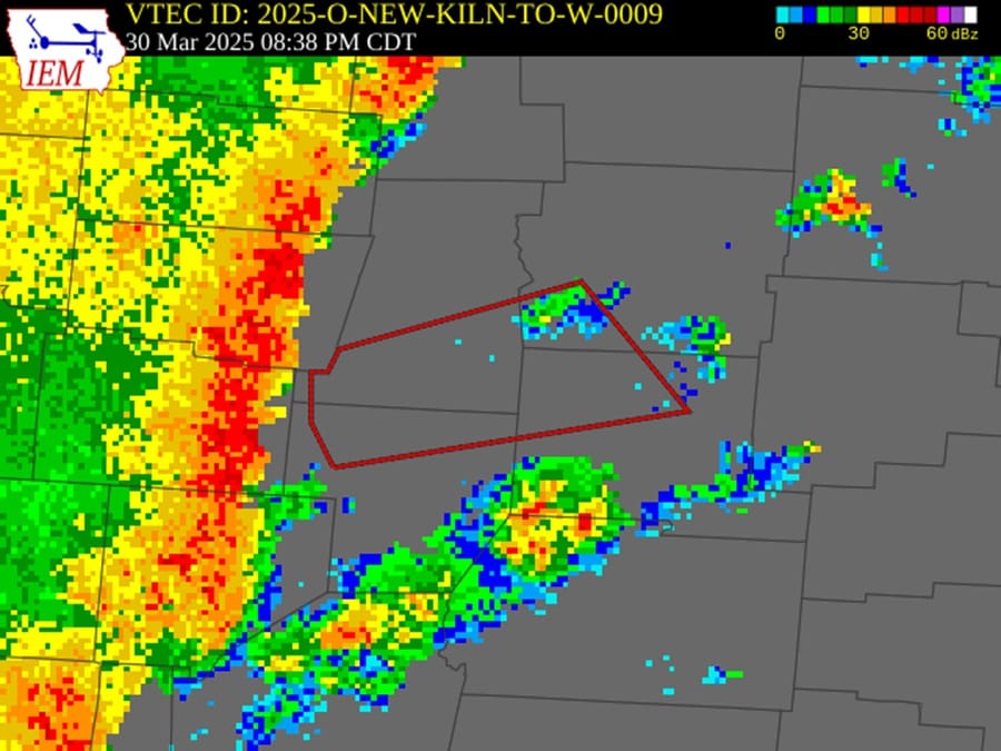
The radar on March 30th when the tornado warning for Franklin County was issued.
BULLETIN – EAS ACTIVATION REQUESTED
Tornado Warning
National Weather Service Wilmington OH
938 PM EDT Sun Mar 30 2025
The National Weather Service in Wilmington has issued a
* Tornado Warning for…
Southwestern Franklin County in central Ohio…
Northern Fayette County in central Ohio…
Northwestern Pickaway County in central Ohio…
Southern Madison County in central Ohio…
* Until 1015 PM EDT.
* At 938 PM EDT, a severe thunderstorm capable of producing a tornado was located near Jeffersonville, moving east at 55 mph.
HAZARD…Tornado and quarter size hail.
SOURCE…Radar indicated rotation.
IMPACT…Flying debris will be dangerous to those caught without shelter. Mobile homes will be damaged or destroyed. Damage to roofs, windows, and vehicles will occur. Tree damage is likely.
* Locations impacted include…
Newport, Jeffersonville, Commercial Point, Chenoweth, Orient, Interstate 71 at State Route 38, Darbyville, Derby, Lilly Chapel, South Solon, Georgesville, South Bloomfield, Madison Mills, Harrisburg, Bookwalter, Darbydale, Midway, Big Plain, Mount Sterling, and Wrightsville.
This includes I-71 in Ohio between mile markers 67 and 98.
https://www.weather.gov/iln/20250330_Obetz
Wednesday, February 28, 2024
**See Multi-County Outbreaks below**
Wednesday, September 26, 2018
An EF1 touched down in Olde Towne East on East Mound Street between S. Ohio and S. Champion Avenue at 5:53AM. From there, the tornado moved east-northeastward for 3.73 miles to a position just south of Broad Street near the Town & Country Shopping Center. The 150-yard-wide tornado damaged trees and power poles in Olde Towne East and Bexley before damaging several homes in the Mayfair neighborhood near E. Broad and James Road. The tornado lifted at 5:57AM. Damage totaled about $750K, but there were no injuries or deaths. There were no watches or warnings at the time of the storm.
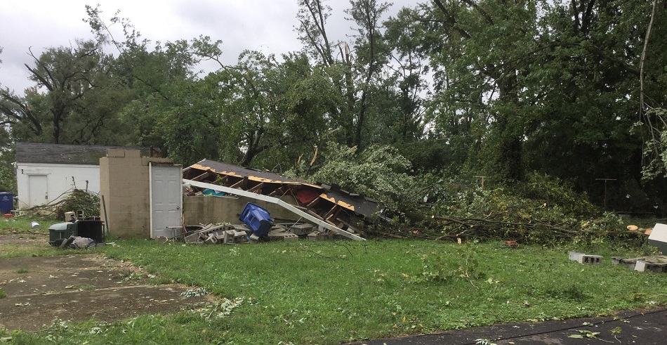
September 26, 2018 tornado damage in the Mayfair neighborhood.
More information and damage photos can be found here:
https://www.weather.gov/iln/20180926
Tuesday, April 3, 2018
*See Multi-County Outbreaks below.*
Wednesday, July 2, 1997
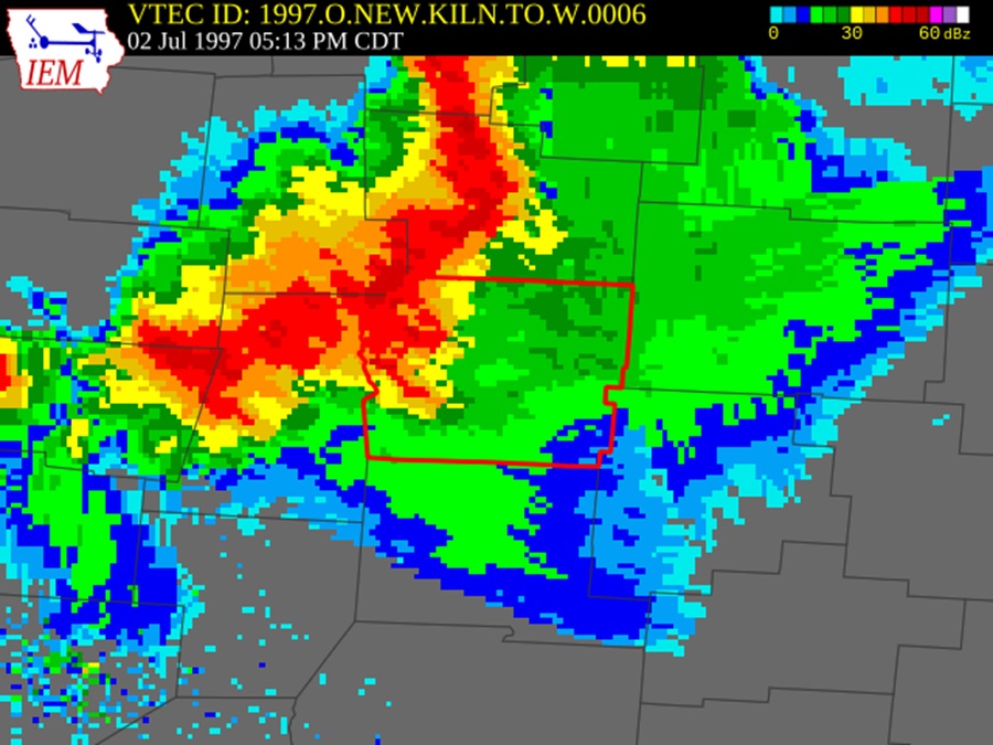
The radar at the time of the tornado warning, 7/2/1997.
BULLETIN – EAS ACTIVATION REQUESTED
TORNADO WARNING
NATIONAL WEATHER SERVICE WILMINGTON OH
613 PM EDT WED JUL 2 1997
THE NATIONAL WEATHER SERVICE IN WILMINGTON OH HAS ISSUED A
TORNADO WARNING EFFECTIVE UNTIL 715 PM EDT
FOR PEOPLE IN THE FOLLOWING LOCATION…
IN CENTRAL OHIO
…FRANKLIN COUNTY
AT 614 PM EDT…DOPPLER RADAR INDICATED A POSSIBLE TORNADO NEAR
DUBLIN IN NORTHWEST FRANKLIN COUNTY. THE STORM WAS MOVING SOUTHEAST AROUND 40 MPH AND WILL CROSS COLUMBUS THROUGH 7 PM EDT.
THIS IS A DANGEROUS STORM. YOUR QUICK REACTION TO THIS TORNADO
WARNING MAY SAVE YOUR LIFE. GO TO A SMALL INTERIOR ROOM ON THE
LOWEST FLOOR POSSIBLE. ABANDON CARS AND MOBILE HOMES FOR A
STRONGER SHELTER. REMEMBER…MOST TORNADO DEATHS OCCUR IN MOBILE HOMES.
A weak EF0 tornado spun up with a line of severe thunderstorms. A tornado warning was issued at 6:13PM as radar indicated rotation in northwest Franklin County. The tornado briefly dropped for about 2/10ths of a mile in Dublin, where it damaged 6 homes and downed trees, but caused no injuries or deaths.
https://www.ncdc.noaa.gov/stormevents/eventdetails.jsp?id=5611988
Sunday, June 2, 1991
Around 4pm, a weak EF0 tornado touched down for about 10 seconds near the intersection of Morse Road and Cherry Bottom Road. The 30-yard-wide tornado traveled a less than 0.5 mile path, damaging a few dozen trees and destroying a construction trailer. Damage was in the $25,000 range. There were no injuries or deaths.
BULLETIN – EBS ACTIVATION REQUESTED
TORNADO WARNING
NATIONAL WEATHER SERVICE COLUMBUS OH
535 PM EDT SUN JUN 2 1991
THE NATIONAL WEATHER SERVICE IN COLUMBUS HAS ISSUED A
TORNADO WARNING EFFECTIVE UNTIL 615 PM EDT
FOR PEOPLE IN THE FOLLOWING COUNTY……
IN CENTRAL OHIO
…FRANKLIN COUNTY
AT 535 PM A FUNNEL CLOUD WAS REPORTED NEAR UPPER ARLINGTON IN FRANKLIN COUNTY… AND HAIL WAS ALSO REPORTED NEAR THIS AREA. THE STORM WAS MOVING SOUTHEAST AT 20 MILES AN HOUR… AND THE CITY OF COLUMBUS IS IN THE PATH OF THIS STORM.
IF YOU ARE IN THE PATH OF A TORNADO…THE SAFEST PLACE IS A
BASEMENT. GET UNDER A WORKBENCH OR PIECE OF STURDY FURNITURE.
IF NO BASEMENT lIS AVAILABLE…SEEK SHELTER IN AN INTERIOR ROOM
SUCH AS A CLOSET ON THE LOWEST FLOOR. USE BLANKETS…PILLOWS…
OR CUSHIONS TO COVER YOUR BODY. AVOID WINDOWS.
Tuesday, June 17, 1975
*See Multi-County Outbreaks below.*
Thursday, April 3, 1974
*See Multi-County Outbreaks below.*
Wednesday, May 30, 1973
At 1:55PM, an EF2 tornado touched down at the Defense Construction Supply Center (DCSC) at 3990 E. Broad Street. The tornado heavily damaged 4 warehouses and destroyed dozens of cars in a parking lot. The tornado moved in a northeasterly direction from there, lifting up and touching back down several times. It struck the plant of Rockwell International Corporation at 4300 E. 5th Avenue next, tearing off most of the roof of a plant building. The tornado then hit Port Columbus (now John Glenn International) where it moved a jetliner 800 feet. Operations there were suspended for only about 15 minutes. Finally, the tornado destroyed a house east of Hamilton Road and south of Havens Corners Road. The 17-yard-wide tornado traveled about 2 miles in all, caused 2 injuries and $2.6 million in damages.
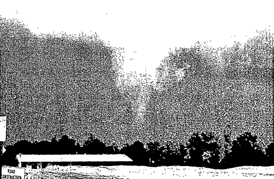
The 5/30/1973 tornado as it passed over the Airport Golf Course.
Friday, May 25, 1973
At around 6:30PM, the public reported a funnel cloud on the West Side of Columbus, about 6 miles outside of Downtown. The EF2 tornado touched down shortly afterward, first striking the Westinghouse Electric Corporation complex at 300 Phillipi Road. There, it blew out 450 feet of a plant building wall while removing part of the roof of another. A man in the Westinghouse parking lot was picked up and carried approximately 75 feet, but was not injured. The tornado also blew out showroom windows and knocked down signs in the area before lifting. The less than quarter-mile track of the 133-yard-wide tornado caused about $250,000 in damage. No injuries were reported.

The damage at Westinghouse Electric Corporation caused by the 5/25/1973 tornado.
Thursday, May 10, 1973
*See Multi-County Outbreaks below.*
Monday, February 22, 1971
A strong EF3 tornado struck the east side of Columbus at around 4:55PM, moving north-northeast from the intersection of Alum Creek Drive and E. Main Street. The storm caused multiple injuries and heavy damage along a roughly 7-mile path.
February 1971 Tornado Part 1
February 1971 Tornado Part 2
February 1971 Tornado Part 3
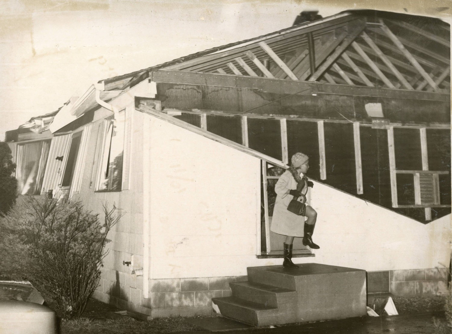
A damaged house at 2756 Kenilworth Avenue after the February 22, 1971 tornado.
Thursday, September 12, 1963
*See Multi-County Outbreaks below.*
Monday, October 8, 1962
*See Multi-County Outbreaks below*
Friday, July 28, 1961
A 500-yard-wide EF0 tornado traveled about 1 mile along Scioto-Darby Creek Road west of Hilliard. Touching down just before midnight, it destroyed several farm buildings, caused significant damage to a pair of homes and killed about 100 chickens. No injuries or deaths occurred.
https://www.ncdc.noaa.gov/stormevents/eventdetails.jsp?id=10083393
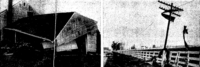
Damage to a home at 7207 Scioto-Darby Creek Road on 7/28/1961.
Sunday, July 5, 1959
At 4:20PM, an EF1 tornado touched down between Darbydale and Lambert Road just south of London-Groveport Road in southwest Franklin County. The tornado did not last long and caused no injuries or deaths. The only damage was to some trees and outbuildings.
https://www.ncdc.noaa.gov/stormevents/eventdetails.jsp?id=10085614
Friday, June 13, 1958
A small tornado hit Lockbourne Air Force Base (now Rickenbacker) during the late morning hours. The tornado damaged a pair of hangers, took the roof off of a shop, flipped cars and pushed large planes down the runway. Due to base security, formal damage surveys were not done and therefore information on EF rank, path, etc. are not known. No injuries or deaths occurred.
Monday, April 28, 1958
A strong cold front spun up a brief EF0 tornado just southeast of the Dublin Road/Grandview Avenue intersection on the West Side of Columbus. The 30-yard-wide tornado was only on the ground for a few seconds, limiting damage and causing no injuries or deaths.
https://www.ncdc.noaa.gov/stormevents/eventdetails.jsp?id=10084488
Monday, October 11, 1954
An EF1 tornado struck farm buildings at around 6:30PM at 1254 Georgesville Road. The farm had the roofs of 3 barns removed while other buildings received damage as well. Trees and power lines were also downed across the street. No injuries or deaths were reported, and damage was in the $3,000 range in the less than quarter-mile path.
https://www.ncdc.noaa.gov/stormevents/eventdetails.jsp?id=10083326
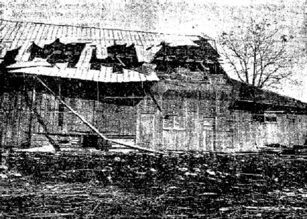
A damaged barn from the 10/11/1954 tornado.
Monday, June 26, 1954
An EF0 tornado briefly touched down near the intersection of Cranwood Drive and Ambleside Drive in North Columbus. The 30-yard-wide tornado caused about $25,000 in damages, particularly to trees and power lines.
https://www.ncdc.noaa.gov/stormevents/eventdetails.jsp?id=10083321
Thursday, May 2, 1929
A tornado briefly touched down in Franklinton during the afternoon. It struck the area around 515 Sullivant Avenue, where the Columbus Police Headquarters and workhouse were located. The tornado destroyed most of the workhouse, killing 2 prisoners residing there on misdemeanor charges. Several other inmates were injured and 7 took advantage of the situation and escaped the building. The tornado also downed trees, tore off the roofs of a few houses and destroyed a gas station. The HQ and workhouse, built in 1896, were eventually demolished in 1931.
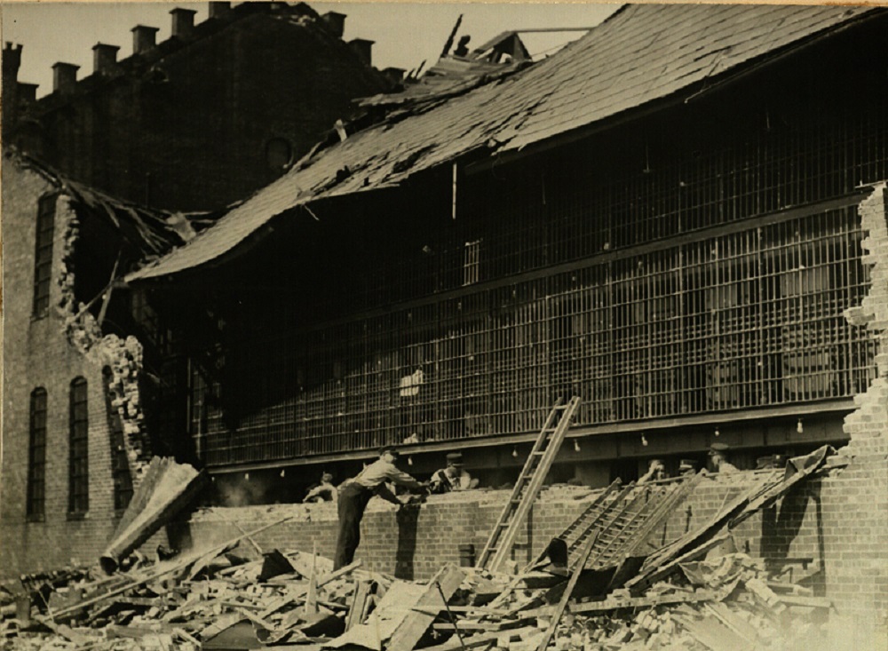
Damage to the workhouse at the Columbus Police HQ building from the 5/2/1929 tornado.
Wednesday, December 7, 1927
A very strong cold front brought severe weather and strong winds across Ohio. During the evening of December 7th, a “cyclonic” storm moved through parts of Columbus, causing significant damage, particularly to the Linden area. While a tornado was not officially reported, the swirling nature of the wind, how significant the damage was and the general southwest to northeasterly path all make it likely that at least a low-level tornadic event occurred. Even the Dispatch itself called the event a “twister”.
December 7, 1927 Part 1
December 7, 1927 Part 2
Linden Damage Part 1
Linden Damage Part 2
Linden Damage Part 3
1918
The Columbus Metropolitan Library photo archives of Mirror Lake on the OSU Campus mention a tornado felling trees and causing damage in and around the lake, requiring an extensive redesign of the area. It’s unclear when exactly this event occurred, only that it is listed as taking place in 1918. I could find no other mentions of this event.
Tuesday, April 13, 1897
A tornado struck the Driving Park section of Columbus just after 5pm. The following article clip comes from the Dispatch the following day.
April 1897 Tornado
Wednesday, July 23, 1879
Between 4 and 5pm, a storm rolled across the city with a likely low end tornado. Damage was not particularly severe, with most consisting of downed trees and limbs. However, a home under construction near Mt. Vernon Avenue was destroyed down to the first floor. Multiple sheds, a stable, the brick front of a store, chimneys and many roofs were damaged or destroyed throughout the Downtown area, as well as the Near East Side. The reported swirling motion of the winds and debris patterns strongly suggests this was a tornado.
The day also brought severe weather to Plain City in Union County, where straight-line winds damaged roofs and flattened crops.
Hocking County
The county has recorded only 6 tornadoes through 2024.
September 25, 2024
Severe thunderstroms moved through during the afternoon, particular across south-central Ohio. A weak EF-0 struck Hocking County just after 5pm. There was no warning associated with this storm.
Public Information Statement
National Weather Service Wilmington OH
508 PM EDT Wed Oct 2 2024
…NWS Damage Survey for 09/25/2024 Tornado Event…
Rating: EF0
Estimated Peak Wind: 70 mph
Path Length /statute/: 2.00 miles
Path Width /maximum/: 50 yards
Fatalities: 0
Injuries: 0
Start Date: 09/25/2024
Start Time: 07:47 AM EDT
Start Location: 6 ENE Laurelville / Hocking County / OH
Start Lat/Lon: 39.5040 / -82.6291
End Date: 09/25/2024
End Time: 07:51 AM EDT
End Location: 7 SSW Sugar Grove / Hocking County / OH
End Lat/Lon: 39.5218 / -82.5998
Survey Summary:
The weak tornado began to the east of Laurelville, Ohio in Hocking County, near the intersection of 180 and 374. Just to the east of this intersection, several large tree limbs were knocked down and the roof of an outbuilding was lifted off. External metal walls were also removed from the outbuilding, and debris from the outbuilding was thrown in multiple directions. Tree damage was also noted on Clapper Hollow Road. Additional tree damage was sporadic along 180, with the last damage observed along 180 just east of Big Cola Road. The damage to the outbuilding and trees occurred along a convergent path, confirming a weak EF0 tornado with maximum winds up to 70 mph.
May 27-28th, 2019 Outbreak
*See Multi-County Outbreaks below.*
Thursday, September 16, 2010
*See Multi-County Outbreaks below.*
Friday, March 19, 1954
*See Multi-County Outbreaks below.*
Licking County
Licking County has had 29 confirmed tornadoes through 2024.
Wednesday, June 5, 2024
**See Multi-County Outbreaks**
Tuesday, April 2, 2024
A significant severe weather and tornado outbreak was predicted for this day in the few days leading up to the event. Despite nearly every metric supporting that outcome, a few waves of clouds and showers during the morning and early afternoon ultimately sapped much of the energy out of the atmosphere, and the few periods of sunshine weren’t nearly long enough to re-destabilize the atmosphere. While some of the storms that did arrive produced some severe weather, most of Ohio was spared. A few tornadoes, however, did manage to be produced. The only one in Ohio within the Columbus Metro Area occurred in Licking County. This storm never had a tornado warning with it.
Public Information Statement
National Weather Service Wilmington OH
855 AM EDT Thu Apr 4 2024
…NWS DAMAGE SURVEY FOR 04/02/2024 TORNADO EVENT…
..Licking County Tornado…
Start Location…5 W Gratiot in Licking County OH
End Location…2 N Gratiot in Licking County OH
Date…04/02/2024
Estimated Start Time…08:08 PM EDT
Estimated End Time…08:15 PM EDT
Maximum EF-Scale Rating…EF0
Estimated Maximum Wind Speed…75 mph
Maximum Path Width…150.0 yards
Path Length…5.3 miles
Beginning Lat/Lon…39.9691 / -82.3146
Ending Lat/Lon…39.9835 / -82.2164
* Fatalities…0
* Injuries…0
…Summary…
With assistance from the National Weather Service in Pittsburgh, and coordination and assistance from the Licking County Emergency Management Agency, the National Weather Service in Wilmington has confirmed a brief and weak tornado occurred in rural areas of southeast Licking County during the evening of April 2nd, 2024. A tornado developed initially in Franklin Township near Sand Hollow Road SE, and moved northeast causing mainly tree and minor structural damage along its path. Tree damage was noted in a path from Sand Hollow Road SE, then northeast along Fairview Road, and then on Brownsville Road SE and then across Poplar Forks Road SE before it dissipated. Minor structural damage to barns and outbuildings was also noted on Poplar Forks Road SE, as well as Fairview Road. Damage along the entire path was estimated to be caused by 70-75 mph winds.
Wednesday, February 28, 2024
**See Multi-County Outbreaks below**
Monday, February 27, 2023
*See Multi-County Outbreaks below.*
Wednesday, September 20, 2000
*See Multi-County Outbreaks below.*
Friday, June 22, 1990
*See Multi-County Outbreaks below*
Monday, June 22, 1986
STORM REPORT
NATIONAL WEATHER SERVICE COLUMBUS OH
445 PM EDT MON JUN 23 1986
LICKING COUNTY TORNADO REPORT..
A TORNADO TOUCHED DOWN ON THE SOUTH SIDE OF NEWARK OHIO AROUND 1030 TO 1040 PM EDT SUNDAY JUNE 22 1986. STORM MOVED FROM THE WEST TO EAST, PATH 40 – 50 YDS WIDE BY 2 MILES LONG. TORNADO WAS UP AND DOWN MOSTLY UP SEVERAL HOMES WITH ROOF DAMAGE, ONE CHURCH AT WILLWOOD AND POPLAR STREETS DESTROYED.. NUMEROUS TREES DOWN. NO FATALITIES REPORTED.
Sunday, June 1, 1980
*See Multi-County Outbreaks below.*
Sunday, May 16, 1965
A small EF0 tornado touched down briefly on the southwest side of Utica in Licking County, causing only minor damage and no injuries or deaths.
https://www.ncdc.noaa.gov/stormevents/eventdetails.jsp?id=10084004
Thursday, September 12, 1963
*See Multi-County Outbreaks below.*
Thursday, June 5, 1963
*See Multi-County Outbreaks below.*
Friday, June 24, 1960
A tornado touched down around 5:30am just west of Benedict Drive in Johnstown. The EF1 tornado traveled less than 1000 feet, but managed to destroy a barn and hurl the pieces into a house at 85 Benedict Drive before taking off the roof as well. The tornado then lifted before coming down again briefly in Downtown Johnstown where it brought down trees and power lines and damaged more buildings. There was only 1 injury.
https://www.ncdc.noaa.gov/stormevents/eventdetails.jsp?id=10085642

Damage to 85 Benedict Drive from the 6/24/1960 tornado.
Tuesday, July 22, 1958
*See Multi-County Outbreaks below.*
Sunday, May 22, 1949
A probable small tornado struck near St. Louisville, 4 miles north of Newark in Licking County. The storm did about $5,000 in damage when it destroyed a barn, some outbuildings and about 25 trees.
June 11, 1922
A tornado struck Buckeye Lake at about 5pm on Sunday afternoon. The tornado caused about $150,000 worth of damage and killed 3 people. The tornado destroyed at least 40 cottages and heavily damaged a busy park and bathing beach. At least one person was killed when the bathhouse was tossed into the lake. The tornado was described as funnel-shaped, with a width of about 200 feet and a damage path of about half a mile.
Wednesday, May 18, 1825
Early in the afternoon, a strong tornado moved through Burlington Township in Licking County. Described as having a damage path a quarter-mile wide, the tornado traveled at least 1.5 miles. It killed at least one person when the roof of a cabin blew into an orchard, striking a man working there. The tornado also reportedly carried an ox half a mile and a coat was carried into Coshocton County.
Madison County
Madison County has had 15 tornadoes through 2024.
Wednesday, February 28, 2024
**See Multi-County Outbreaks below**
Monday, May 18, 2020
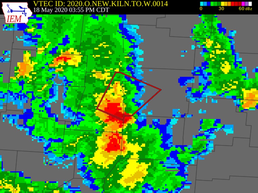
The radar on 5/18/2020 around the time of the tornado.
An EF0 tornado struck Lilly Chapel in Madison County. The tornado was only on the ground for about 5 minutes on a 1.9-mile path, packing winds of 85MPH. There were no injuries or deaths.
BULLETIN – EAS ACTIVATION REQUESTED
Tornado Warning
National Weather Service Wilmington OH
436 PM EDT Mon May 18 2020
The National Weather Service in Wilmington has issued a
* Tornado Warning for…
Southwestern Franklin County in central Ohio…
Northwestern Pickaway County in central Ohio…
Southeastern Madison County in central Ohio…
* Until 500 PM EDT.
* At 436 PM EDT, a severe thunderstorm capable of producing a tornado was located over Mount Sterling, moving northeast at 20 mph.
SOURCE…Radar indicated rotation.
IMPACT…Flying debris will be dangerous to those caught without shelter. Mobile homes will be damaged or destroyed.
Damage to roofs, windows, and vehicles will occur. Tree damage is likely.
* Locations impacted include…
Columbus, Grove City, Jefferson, West Jefferson, Mount Sterling, Lake Darby, Urbancrest, Harrisburg, Orient, Chenoweth, Derby, Lilly Chapel, Georgesville, Darbydale, Big Plain and Wrightsville.
This includes the following Interstates…
I-70 in Ohio between mile markers 82 and 85.
I-71 in Ohio between mile markers 79 and 101.
More information can be found here:
https://www.weather.gov/iln/20200518_lillychapel
https://www.ncdc.noaa.gov/stormevents/eventdetails.jsp?id=882250
Tuesday, April 3, 2018
*See Multi-County Outbreaks below.*
Thursday, April 3, 1974
*See Multi-County Outbreaks below.*
Thursday, May 10, 1973
*See Multi-County Outbreaks below.*
Morrow County
Morrow County has recorded 15 tornadoes through 2024.
Tuesday, May 11, 2010
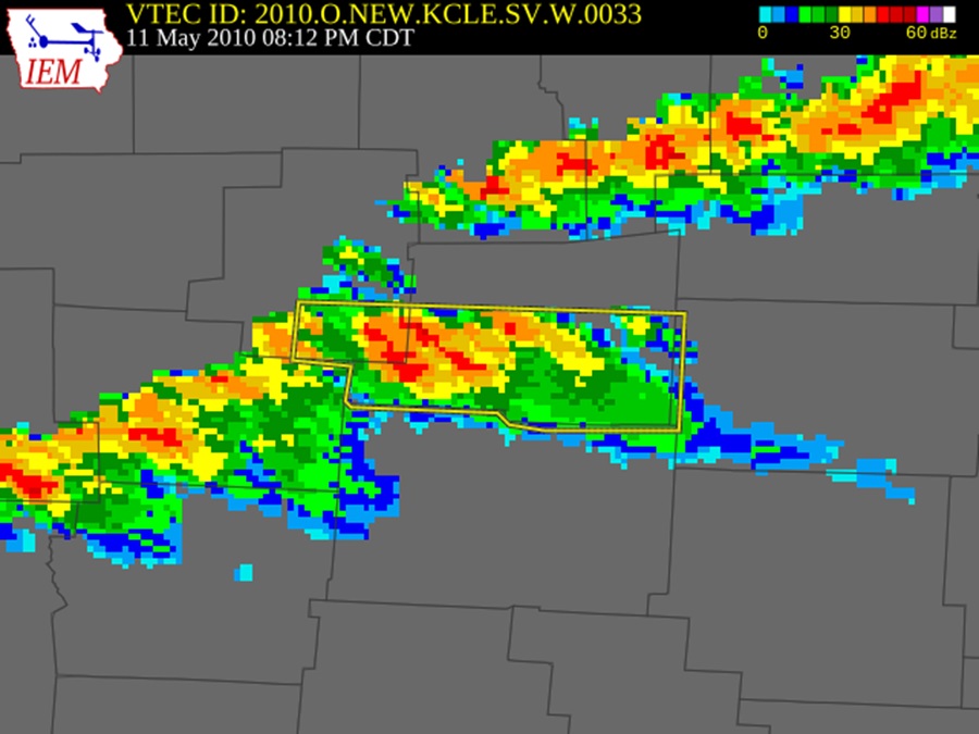
The 5/11/2010 radar around the time of the tornado.
An EF0 tornado touched down in rural Morrow County just to the southeast of Marengo at 7:58PM. The initial touchdown was near the intersection of County Road 212 and Webb Road. The tornado continued east northeast for around two miles before lifting near the intersection of Township Roads 208 and 211. Five homes were damaged and dozens of trees downed along the damage path which was no more than 50 yards in width. Four of the five homes sustained minor damage, mostly from lost shingles or siding. The fifth, a manufactured home, lost most of it’s roof and large sections of siding. The tornado lifted at 8:02PM. It caused about $100,000 in damage, but no injuries or deaths. The tornado touched down prior to any warning, and only a Severe Thunderstorm Warning was issued.
Friday, June 22, 1990
*See Multi-County Outbreaks below*
Perry County
Perry County has recorded 12 tornadoes through 2024.
May 27-28th, 2019 Outbreak
*See Multi-County Outbreaks below.*
Tuesday, April 3, 2018
*See Multi-County Outbreaks below.*
Thursday, September 16, 2010
*See Multi-County Outbreaks below.*
Tuesday, May 23, 2000
*See Multi-County Outbreaks below.*
Pickaway County
Pickaway County has had 23 confirmed tornadoes through 2024.
Monday, February 27, 2023
*See Multi-County Outbreaks below.*
Saturday, October 16, 2021
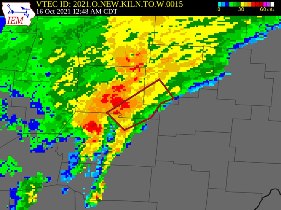
The radar at the time of the tornado warning.
Severe thunderstorms moving east-northeast moved into southern Pickaway County just before 2AM. The storms had produced a series of tornadoes in southwest Ohio, with the Pickaway County tornado being the final one in the series and the only one in the Columbus Metro Area. The tornado touched down on top of a residence along Wolfe Road about 3/4 of a mile east of Rt. 23. It moved on an east-northeast path for about 2.7 miles with maximum winds reaching up to 110MPH. Its path ended north of Boggs Road about a quarter-mile west of State Route 159. The EF1 tornado damaged several homes and buildings and snapped trees along its path, but there were no injuries or deaths.
BULLETIN – EAS ACTIVATION REQUESTED
Tornado Warning
National Weather Service Wilmington OH
148 AM EDT Sat Oct 16 2021
The National Weather Service in Wilmington has issued a
* Tornado Warning for…
Southwestern Fairfield County in central Ohio…
Southeastern Pickaway County in central Ohio…
Northeastern Ross County in southwestern Ohio…
* Until 215 AM EDT.
* At 148 AM EDT, a severe thunderstorm capable of producing a tornado was located near Kingston, moving northeast at 60 mph.
SOURCE…Radar indicated rotation.
IMPACT…Flying debris will be dangerous to those caught without shelter. Mobile homes will be damaged or destroyed.
Damage to roofs, windows, and vehicles will occur. Tree damage is likely.
* Locations impacted include…
Circleville, Kingston, Logan Elm Village, Amanda, Stoutsville, Tarlton, Aw Marion State Park, Clearport, Pickaway County Airport and Whisler.
https://www.ncdc.noaa.gov/stormevents/eventdetails.jsp?id=982617
Thursday, July 29, 2021
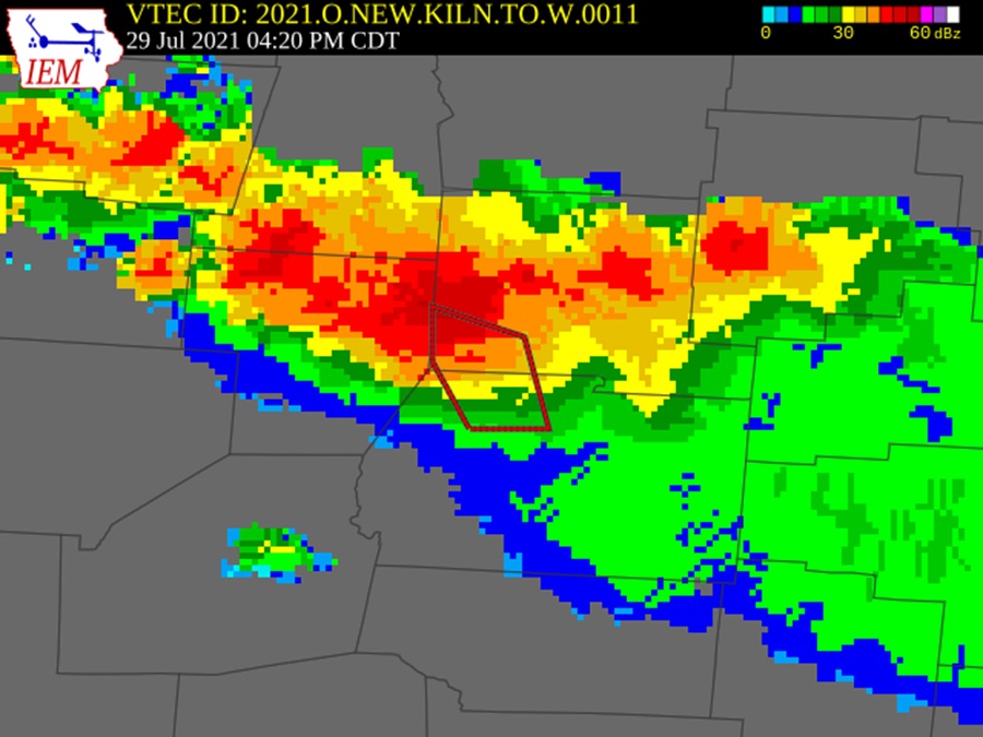
The radar at the time of the tornado warning.
A weak EF0 tornado with winds of up to 85MPH struck the New Holland area of Pickaway County during the afternoon. Severe thunderstorms would spawn several tornadoes across the state, but this was the only one to occur in the Columbus Metro Area. The tornado touched down just north of Dick Road about half a mile east of Egypt Pike. It moved southeast, an unusual tornado movement, for about 0.9 miles before lifting just north of Rt. 22. The tornado destroyed barns and outbuildings, and damaged one house.
BULLETIN – EAS ACTIVATION REQUESTED
Tornado Warning
National Weather Service Wilmington OH
520 PM EDT Thu Jul 29 2021
The National Weather Service in Wilmington has issued a
* Tornado Warning for…
Southwestern Pickaway County in central Ohio…
North central Ross County in southwestern Ohio…
* Until 545 PM EDT.
* At 520 PM EDT, a severe thunderstorm capable of producing a tornado was located over New Holland, moving southeast at 30 mph.
SOURCE…Radar indicated rotation.
IMPACT…Flying debris will be dangerous to those caught without shelter. Mobile homes will be damaged or destroyed.
Damage to roofs, windows, and vehicles will occur. Tree damage is likely.
* Locations impacted include…
Williamsport, New Holland, Clarksburg and State Route 207 at US Route 22.
https://www.ncdc.noaa.gov/stormevents/eventdetails.jsp?id=965375
May 27-28th, 2019 Outbreak
*See Multi-County Outbreaks below.*
Thursday, September 16, 2010
*See Multi-County Outbreaks below.*
Saturday, June 2, 2001
A weak EF0 tornado moved through southern portions of Circleville at around 455PM. The tornado touched down between Canal Road and the Scioto River to the northwest of Logan Elm Village. It moved eastward on a half-mile track, damaging a restaurant roof, pushing a trailer off its foundation, damaging several cars at a dealership and downing trees and power lines. There were no watches or warnings for Pickaway County at the time.
Saturday, September 23, 2000
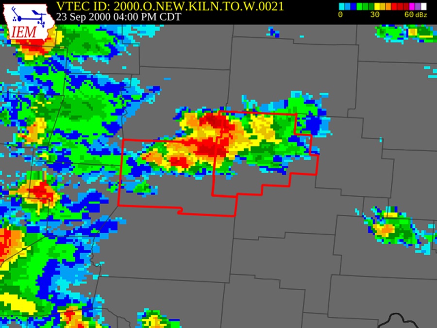
The radar at the time of the tornado warning.
An 25-yard-wide EF0 tornado briefly touched down in a field about half a mile directly south of Rickenbacker in Pickaway County. It was only only the ground a few seconds and caused no damage.
BULLETIN – EAS ACTIVATION REQUESTED
TORNADO WARNING
NATIONAL WEATHER SERVICE WILMINGTON OH
500 PM EDT SAT SEP 23 2000
THE NATIONAL WEATHER SERVICE IN WILMINGTON HAS ISSUED A
* TORNADO WARNING FOR…
PICKAWAY COUNTY IN CENTRAL OHIO…
FAIRFIELD COUNTY IN CENTRAL OHIO…
* UNTIL 530 PM EDT…
* AT 500 PM EDT…NATIONAL WEATHER SERVICE DOPPLER RADAR INDICATED A SEVERE THUNDERSTORM CAPABLE OF PRODUCING A TORNADO 6 MILES
NORTHEAST OF ASHVILLE…OR ABOUT 9 MILES SOUTHWEST OF
PICKERINGTON…MOVING NORTHEAST AT 10 MPH.
* SOME LOCATIONS NEAR THE PATH OF THIS STORM INCLUDE…
WILLIAMSPORT…
SOUTH BLOOMFIELD…
PLEASANTVILLE…
PICKERINGTON…
THE SAFEST PLACE TO BE DURING A TORNADO IS IN A BASEMENT. GET UNDER A WORKBENCH OR OTHER PIECE OF STURDY FURNITURE. IF NO BASEMENT IS AVAILABLE…SEEK SHELTER ON THE LOWEST FLOOR OF THE BUILDING IN AN INTERIOR HALLWAY OR ROOM SUCH AS A CLOSET.
Wednesday, October 13, 1999
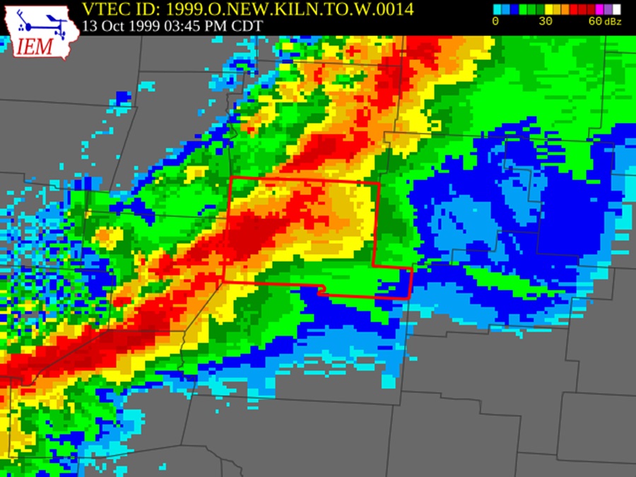
The October 13th radar at the time of the warning.
BULLETIN – EAS ACTIVATION REQUESTED
TORNADO WARNING
NATIONAL WEATHER SERVICE WILMINGTON OH
445 PM EDT WED OCT 13 1999
THE NATIONAL WEATHER SERVICE IN WILMINGTON HAS ISSUED A
* TORNADO WARNING FOR…
PICKAWAY COUNTY IN CENTRAL OHIO.
* UNTIL 550 PM EDT
* AT 444 PM EDT… NATIONAL WEATHER SERVICE DOPPLER RADAR INDICATED
A TORNADO 11 MILES WEST OF CIRCLEVILLE… MOVING EAST AT 50 MPH.
* THE TORNADO IS EXPECTED TO BE NEAR…
WILLIAMSPORT AT 447 PM EDT .
CIRCLEVILLE AT 457 PM EDT .
GO TO THE BASEMENT OR A SMALL INTERIOR ROOM ON THE LOWEST FLOOR!
At about 4:55PM an EF3 tornado hit parts of Circleville in Pickaway County. The tornado touched down first about 1.5 west of Circleville just west of the State Rt 56/22 intersection where it pulled a small shed off of its foundation before destroying a section of a construction building along Rt 22. After this, the tornado lifted and then touched down in a more developed area in town. It destroyed a building housing two businesses on North Court Street and ripped the roof off of a section of a strip mall, ejecting furniture from inside the structure. A large sign weighing several hundred pounds was ripped from its foundation and blown twenty feet away. A tractor trailer with a load of 18 to 19 tons was blown over and dragged ten feet away from where it landed. The tornado then proceeded to a housing development where several homes were destroyed along and near Fairlawn Avenue. Several roofs were ripped off and garages were either destroyed or moved from their foundations. Trees were twisted and broken off at their bases and carports were also torn from nearby houses. Damage exceeded $4 Million and there were 6 injuries. The tornado packed winds up to 200MPH, reached a maximum width of 440 yards and traveled about 3.5 miles.
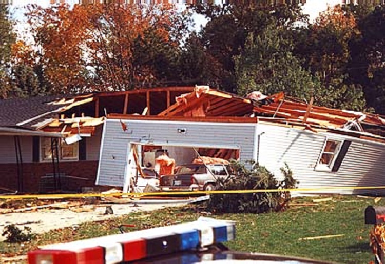
Damage to a home from the 10/13/1999 Circleville tornado.
Thursday, April 3, 1974
*See Multi-County Outbreaks below.*
Palm Sunday Tornado Outbreak
April 11-12, 1965
*See Multi-County Outbreaks below.*
Thursday, June 5, 1963
*See Multi-County Outbreaks below.*
Friday, April 19, 1963
This 33-yard-wide EF1 tornado was part of an outbreak of 10 tornadoes across Ohio. It was the only one within the Columbus metro during the outbreak. It touched down for less than half a mile at 3:15PM just north of Williamsport in Pickaway County. Damage details are not known, but the tornado caused 1 injury and about $25,000 in damage.
https://www.ncdc.noaa.gov/stormevents/eventdetails.jsp?id=10084246
Thursday, May 22, 1958
*See Multi-County Outbreaks below.*
Friday, March 19, 1954
*See Multi-County Outbreaks below.*
Union County
Union County has recorded 11 tornadoes through 2024.
Sunday, December 29, 2024
A storm system moving through the area brought rain and high winds of 40MPH-50MPH across the area. The storms were generally not severe, but a weak tornado did form in Union County during the evening. There were no severe thunderstorm or tornado warnings at the time of the event. This was to be the final 2024 tornado not only within the Columbus Metro Area, but also in Ohio.
Public Information Statement
National Weather Service Wilmington OH
303 PM EST Mon Dec 30 2024
…NWS Damage Survey for 12/29/2024 Tornado Event…
Rating: EF0
Estimated Peak Wind: 70 mph
Path Length /statute/: 0.35 miles
Path Width /maximum/: 50 yards
Fatalities: 0
Injuries: 0
Start Date: 12/29/2024
Start Time: 03:08 PM EST
Start Location: 2 SW Marysville / Union County / OH
Start Lat/Lon: 40.2158 / -83.4027
End Date: 12/29/2024
End Time: 03:09 PM EST
End Location: 2 SW Marysville / Union County / OH
End Lat/Lon: 40.2208 / -83.4015
Survey Summary:
The weak tornado began on a property near Payne Road just west of Marysville, Ohio. The tornado toppled a small silo, several small to medium-sized trees, and caused minor damage to an older barn and a few roof shingles. Additional damage occurred to a large metal barn located around a third of a mile to the north. This barn sustained
uplift of the roof along with partial collapse of the metal walls. In addition, several trees were snapped in the woods adjacent to the barn.
Palm Sunday Tornado Outbreak
April 11-12, 1965
*See Multi-County Outbreaks below.*
Thursday, September 12, 1963
*See Multi-County Outbreaks below.*
Multi-County Outbreaks and Tornadoes with Multi-County Paths
Wednesday, June 5, 2024
A few weak tornadoes touched down across the metro area during the afternoon as thunderstorms moved through the area. No Severe Thunderstorm Watch or Tornado Watch was in place at the time, as little severe weather was anticipated.
Tornado #1
BULLETIN – EAS ACTIVATION REQUESTED
Tornado Warning
National Weather Service Wilmington OH
849 PM EDT Wed Jun 5 2024
The National Weather Service in Wilmington has issued a
* Tornado Warning for…
Northwestern Delaware County in central Ohio…
Northeastern Union County in central Ohio…
* Until 915 PM EDT.
* At 848 PM EDT, a severe thunderstorm capable of producing a tornado was located over Richwood, moving east at 25 mph.
HAZARD…Tornado.
SOURCE…Radar indicated rotation.
IMPACT…Flying debris will be dangerous to those caught without shelter. Mobile homes will be damaged or destroyed. Damage to roofs, windows, and vehicles will occur. Tree damage is likely.
* Locations impacted include…
Richwood, Ashley, Radnor, Essex, and Delaware State Park.
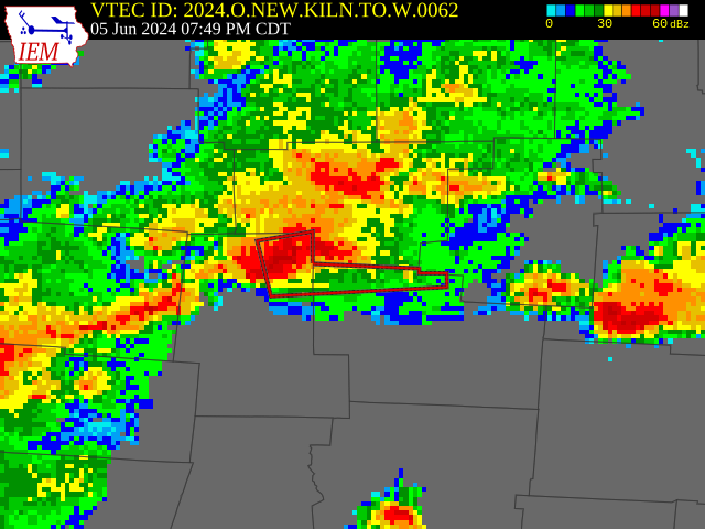
Radar at the time of the 6/5/2024 Delaware County tornado.
Public Information Statement
National Weather Service Wilmington OH
1037 AM EDT Thu Jun 6 2024
…BRIEF TORNADO CONFIRMED IN NORTHEAST DELAWARE COUNTY…
Start Location…5 W Centerburg in Delaware County OH
End Location…5 W Centerburg in Delaware County OH
Date…06/05/2024
Estimated Start Time…08:02 PM EDT
Estimated End Time…8:03 PM EDT
Maximum EF-Scale Rating…EF0
Estimated Maximum Wind Speed…65 mph
Maximum Path Width…50.0 yards
Path Length…0.25 miles
Beginning Lat/Lon…40.3156 / -82.8008
Ending Lat/Lon…40.3161 / -82.7956
* Fatalities…0
* Injuries…0
…Summary…
With considerable assistance from the Delaware County Emergency Management Agency, the National Weather Service in Wilmington, OH has confirmed a brief and weak tornado in extreme northeast Delaware County from thunderstorms which occurred during the evening of June 5th, 2024.
Video taken from the near the intersection of Olive Green Road and Fredricks road, looking east, shows a brief tornado developing and then dissipating rather quickly as it moves through a wooded area along Porter Central Road. EMA confirms minor tree damage in this area, which supports an estimated wind speed of 65 mph.
Tornado #2
BULLETIN – EAS ACTIVATION REQUESTED
Tornado Warning
National Weather Service Wilmington OH
1034 PM EDT Wed Jun 5 2024
The National Weather Service in Wilmington has issued a
* Tornado Warning for…
Southeastern Licking County in central Ohio…
* Until 1100 PM EDT.
* At 1034 PM EDT, a severe thunderstorm capable of producing a tornado was located over Hebron, moving east at 25 mph.
HAZARD…Tornado.
SOURCE…Radar indicated rotation.
IMPACT…Flying debris will be dangerous to those caught without shelter. Mobile homes will be damaged or destroyed. Damage to roofs, windows, and vehicles will occur. Tree damage is likely.
* Locations impacted include…
Newark, Heath, Buckeye Lake, Hebron, Hanover, Marne, Harbor Hills, Gratiot, Interstate 70 at State Route 37, Toboso, Interstate 70 at State Route 13, and Brownsville.
This includes I-70 in Ohio between mile markers 126 and 142, and near mile marker 144.
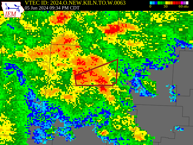
Radar at the time of the June 5, 2024 tornado.
Public Information Statement
National Weather Service Wilmington OH
951 AM EDT Fri Jun 7 2024
…UPDATED INFORMATION ON EF0 TORNADO SOUTHWEST OF HANOVER INLICKING COUNTY OH…
Start Location…3 SW Hanover in Licking County OH
End Location…2 SW Hanover in Licking County OH
Date…06/05/2024
Estimated Start Time…10:56 PM EDT
Estimated End Time…10:57 PM EDT
Maximum EF-Scale Rating…EF0
Estimated Maximum Wind Speed…80 mph
Maximum Path Width…150.0 yards
Path Length…0.6 miles
Beginning Lat/Lon…40.0538 / -82.3088
Ending Lat/Lon…40.0589 / -82.2997
* Fatalities…0
* Injuries…0
…Summary…
With considerable assistance from the Licking County Emergency Management Agency, the National Weather Service in Wilmington, OH has confirmed a brief tornado southwest of Hanover in Licking County, OH, specifically in the Claylick area, from thunderstorms which occurred late in the evening on June 5th, 2024.
A swath of concentrated tree and minor structural damage was assessed along Lesley and Claylick Roads. The damage has been determined to be tornadic in nature, with estimated maximum wind speeds around 80 mph (EF0 rating).
A number of trees were snapped and uprooted, and a few structures received minor soffit/fascia and roof damage.
Thursday, March 14, 2024
The second Ohio tornado outbreak of 2024 occurred just two weeks after the first. The outbreak of March 14th produced 6 tornadoes in the state, including a deadly EF-3. 2 of the tornadoes occurred within the Columbus metro area. Both of these tornadoes had relatively long tracks to them. Those tracks can be viewed at Storm Damage Viewer
A Tornado Watch was issued for most of Western and Central Ohio at 5:13PM.
WATCH COUNTY NOTIFICATION FOR WATCH 44
NATIONAL WEATHER SERVICE WILMINGTON OH
513 PM EDT THU MAR 14 2024
THE NATIONAL WEATHER SERVICE HAS ISSUED TORNADO WATCH 44 IN EFFECT UNTIL MIDNIGHT EDT TONIGHT FOR THE FOLLOWING AREAS
IN INDIANA THIS WATCH INCLUDES 6 COUNTIES
IN EAST CENTRAL INDIANA
FAYETTE UNION WAYNE
IN SOUTHEAST INDIANA
DEARBORN FRANKLIN RIPLEY
IN OHIO THIS WATCH INCLUDES 26 COUNTIES
IN CENTRAL OHIO
DELAWARE FAIRFIELD FAYETTE
FRANKLIN HOCKING LICKING
MADISON PICKAWAY UNION
IN SOUTH CENTRAL OHIO
ROSS
IN SOUTHWEST OHIO
BUTLER CLINTON HAMILTON
WARREN
IN WEST CENTRAL OHIO
AUGLAIZE CHAMPAIGN CLARK
DARKE GREENE HARDIN
LOGAN MERCER MIAMI
MONTGOMERY PREBLE SHELBY
THIS INCLUDES THE CITIES OF ADA, AURORA, BATESVILLE, BEAVERCREEK, BELLEFONTAINE, BLANCHESTER, BRIGHT, BROOKVILLE, CAMDEN, CELINA, CHILLICOTHE, CIRCLEVILLE, COLDWATER, CONNERSVILLE, DELAWARE, DILLSBORO, DOWNTOWN CINCINNATI, DOWNTOWN COLUMBUS, DOWNTOWN DAYTON, EATON, FAIRBORN, FAIRFIELD, FRANKLIN, GREENDALE, GREENVILLE, HAMILTON, HIDDEN VALLEY, KENTON, KETTERING, LANCASTER, LANDEN, LAWRENCEBURG, LEBANON, LIBERTY, LOGAN, LONDON, MARYSVILLE, MASON, MIDDLETOWN, MILAN, MINSTER, NEW BREMEN, NEWARK, OSGOOD, OXFORD, PICKERINGTON, PIQUA, PLAIN CITY, RICHMOND, SIDNEY, SPRINGBORO, SPRINGFIELD, ST. MARYS, TIPP CITY, TROY, URBANA, VERSAILLES, WAPAKONETA, WASHINGTON COURT HOUSE, WEST COLLEGE CORNER, WEST JEFFERSON, WILMINGTON, AND XENIA.
Storms entered the state after 6:30PM, with the first tornado warning issued for Mercer County at 6:47PM. After that, a cascade of warnings were issued for the next 3 hours. The first warning for the Columbus metro area came at 7:51PM.
Tornado #1
BULLETIN – EAS ACTIVATION REQUESTED
Tornado Warning
National Weather Service Wilmington OH
751 PM EDT Thu Mar 14 2024
The National Weather Service in Wilmington has issued a
* Tornado Warning for…
Central Logan County in west central Ohio…
Northwestern Union County in central Ohio…
* Until 830 PM EDT.
* At 750 PM EDT, a large and extremely dangerous tornado was located near Russells Point, moving east at 40 mph.
This is a PARTICULARLY DANGEROUS SITUATION. TAKE COVER NOW!
HAZARD…Damaging tornado.
SOURCE…Radar indicated rotation.
IMPACT…You are in a life-threatening situation. Flying debris may be deadly to those caught without shelter. Mobile homes will be destroyed. Considerable damage to homes, businesses, and vehicles is likely and complete
destruction is possible.
* Locations impacted include…
Bellefontaine, Russells Point, Lakeview, Belle Center, West Mansfield, Chippewa Park, Northwood, Rushsylvania, Huntsville, Ridgeway, Valley Hi, Zanesfield, Raymond, New Jerusalem, Byhalia, Broadway, Middleburg, Mcmorran, Somersville, and Big Springs.
To repeat, a large, extremely dangerous and potentially deadly tornado is on the ground. To protect your life, TAKE COVER NOW! Move to a basement or an interior room on the lowest floor of a sturdy building. Avoid windows. If you are outdoors, in a mobile home, or in a vehicle, move to the closest substantial shelter and protect yourself from flying debris.
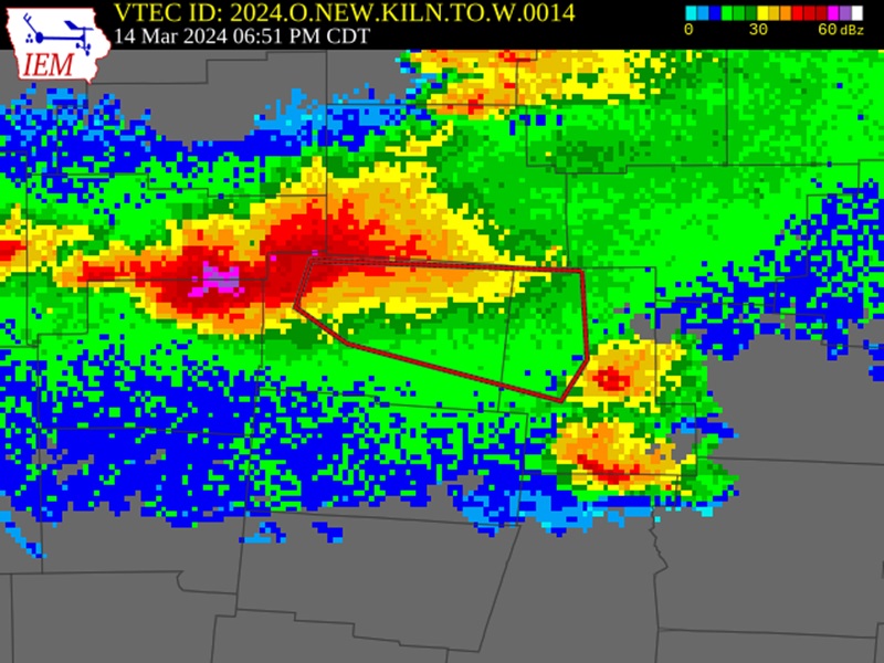
The radar at the time of Union County’s first tornado warning. This storm was producing an EF-3 tornado at the time.

The radar near the time that the Union-Delaware County EF-2 tornado began.
Public Information Statement
National Weather Service Wilmington OH
707 PM EDT Tue Mar 19 2024
…NWS DAMAGE SURVEY FOR 03/14/2024 TORNADO EVENT…
…EF2 tornado confirmed in Union County and Delaware County OH…
Start Location……….2 SE West Mansfield in Union County OH
End Location…………2 NE Ostrander in Delaware County OH
Date………………………03/14/2024
Estimated Start Time………..8:24 PM EDT
Estimated End Time………….8:52 PM EDT
Maximum EF-Scale Rating……..EF2
Estimated Maximum Wind Speed…125 mph
Maximum Path Width………….600 yards
Path Length………………..19.7 miles
Beginning Lat/Lon…………..40.3718 / -83.5251
Ending Lat/Lon……………..40.2827 / -83.1760
* Fatalities…0
* Injuries…..0
…Summary…
With considerable assistance from the Union County and Delaware County Emergency Management Agencies, the National Weather Service in Wilmington, OH conducted a storm survey across much of Union County and western Delaware County in relation to the severe thunderstorms on the evening of March 14th, 2024.
The survey concluded that a tornado developed in far western Union County near Newton Perkins Road, strengthening as it moved east across Lunda Road and Morse Road. Here, the tornado damaged some homes causing some roof damage. The tornado quickly strengthened further, and affected a number of homes along Evans Road as it crossed Highway 739, and then continued southeast to areas just north of Broadway. Across portions of that corridor, damage consistent with wind speeds from 115-125 mph were noted. One modular home was completely destroyed with contents thrown downstream nearly a half mile, and another home lost a majority of its roof with exterior wall collapse.
Significant tree damage was observed near Broadway, including in a cemetery just to the east of Broadway. As the tornado passed Broadway and continued southeast across Highway 31 and State Route 4, a number of additional homes and barns were impacted, with roof damage being common. Tree damage along the entire length of the tornado was considerable, trunk snapping and uprooting. The tornado crossed into Delaware County as an EF1 tornado, producing
additional damage as it moved east to Marysville Road.
The second- and longest-tracked tornado in the metro area- touched down shortly after Delaware County was issued a tornado warning at 8:51PM.
Tornado #2
BULLETIN – EAS ACTIVATION REQUESTED
Tornado Warning
National Weather Service Wilmington OH
851 PM EDT Thu Mar 14 2024
The National Weather Service in Wilmington has issued a
* Tornado Warning for…
Delaware County in central Ohio…
* Until 945 PM EDT.
* At 850 PM EDT, a severe thunderstorm capable of producing a tornado was located near Ostrander, moving east at 40 mph.
HAZARD…Tornado and half dollar size hail.
SOURCE…Radar indicated rotation.
IMPACT…Flying debris will be dangerous to those caught without shelter. Mobile homes will be damaged or destroyed. Damage to roofs, windows, and vehicles will occur. Tree damage is likely.
* Locations impacted include…
Delaware, Sunbury, Radnor, Galena, Ostrander, Alum Creek State Park, Olive Green, Stratford, Bellepoint, Warrensburg, Center Village, Leonardsburg, Kilbourne and Lewis Center.
This includes I-71 in Ohio between mile markers 124 and 138.
PRECAUTIONARY/PREPAREDNESS ACTIONS…
TAKE COVER NOW! Move to a basement or an interior room on the lowest floor of a sturdy building. Avoid windows. If you are outdoors, in a mobile home, or in a vehicle, move to the closest substantial shelter and protect yourself from flying debris.
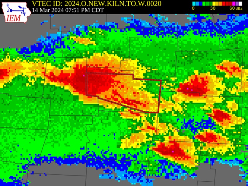
The radar just before the Delaware-Licking County tornado touched down.
Public Information Statement
National Weather Service Wilmington OH
706 PM EDT Tue Mar 19 2024
…NWS DAMAGE SURVEY FOR 03/14/2024 TORNADO EVENT…
…EF1 tornado confirmed in Delaware County and Licking County OH…
Start Location……….3 S Delaware in Delaware County OH
End Location…………1 SSE St. Louisville in Licking County OH
Date………………………03/14/2024
Estimated Start Time………..9:01 PM EDT
Estimated End Time………….9:50 PM EDT
Maximum EF-Scale Rating……..EF1
Estimated Maximum Wind Speed…110 mph
Maximum Path Width………….600 yards
Path Length………………..35.6 miles
Beginning Lat/Lon…………..40.2599 / -83.0678
Ending Lat/Lon……………..40.1575 / -82.4108
* Fatalities…0
* Injuries…..0
…Summary…
The tornado developed across central Delaware County near U.S. Highway 23. As the tornado crossed U.S. Highway 23, the tornado strengthened and widened, and began causing more structural damage as it crossed the Olentangy River, and then especially so as it moved along Berlin Station Road and other areas of Berlin Township. Along this portion of the track, a number of homes sustained siding and roof damage, and numerous tree snaps and uproots were seen. Several barns were also destroyed. In vicinity of Olentangy Berlin High School, parts of the school campus and
athletic fields were damaged, signs were bent over, and several free-standing transmission towers were felled. Among all of the damage indicators in this area, wind speeds around 110 mph were estimated as the maximum wind speed.
The tornado crossed Alum Creek Reservoir and moved into neighborhoods southwest of Sunbury and west of Galena, continuing to cause widespread and significant tree damage, along with a large number of homes having windows blown out, partial roof removal, and power poles snapped. Damage in these areas was consistent with wind speeds from 95 to 105 mph.
As the tornado moved through the Galena area, there was a complex mix of straight-line wind damage through southern parts of the town of Galena, with tornadic damage embedded across the north side of Galena. The damage field through this area is notably wide.
As the tornado crossed into Licking County, the damage path remains quite wide and likely a complex mix of straight-line winds on the immediate southern flank of the tornadic circulation. However, the damage is very consistent with wind speeds ranging from 90-100 mph across most of Licking County. Along this entire stretch of the damage path, the damage is a combination of partial roof removal on some homes, barns being completely destroyed or
heavily damaged, widespread tree uproots and snapped trunks, and power poles snapped.
The tornado dissipated between Highway 13 and Horns Hills Road south of St. Louisville.
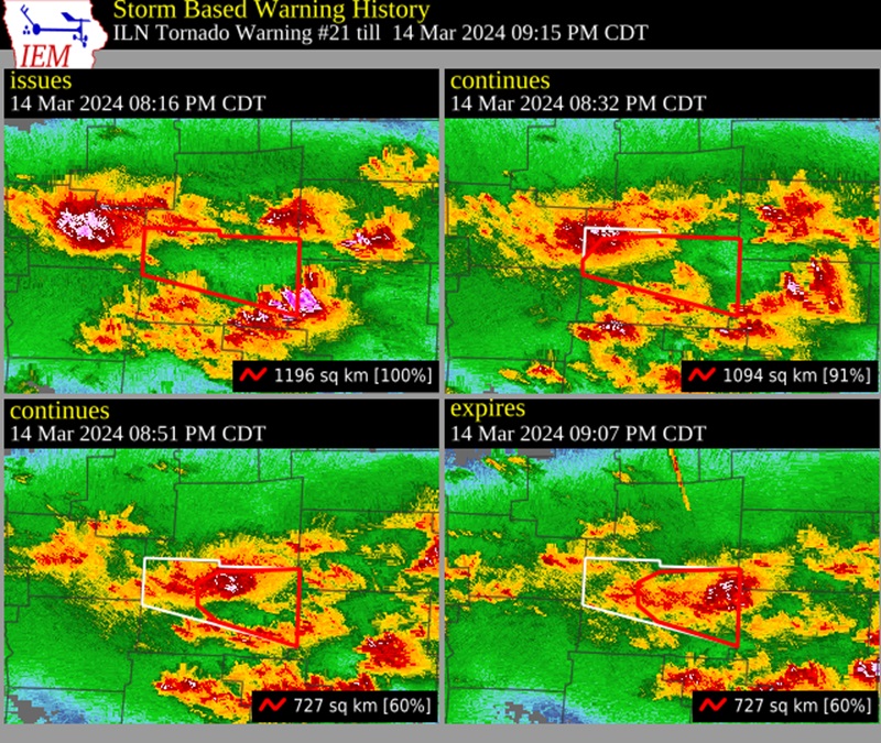
The radar progression as the EF-1 producing storm moved from Delaware into Licking County.
Wednesday, February 28, 2024
Almost a year to the day after a small tornadic event in Central Ohio, another very rare winter outbreak occurred, this time much larger. A low pressure system and very strong cold front brought warm, unstable air into Ohio during the 27th and the early part of the day on the 28th. A Tornado Watch was issued at 4:40AM on the 28th, less than 1 hour before the tornadic storms entered the Columbus area.
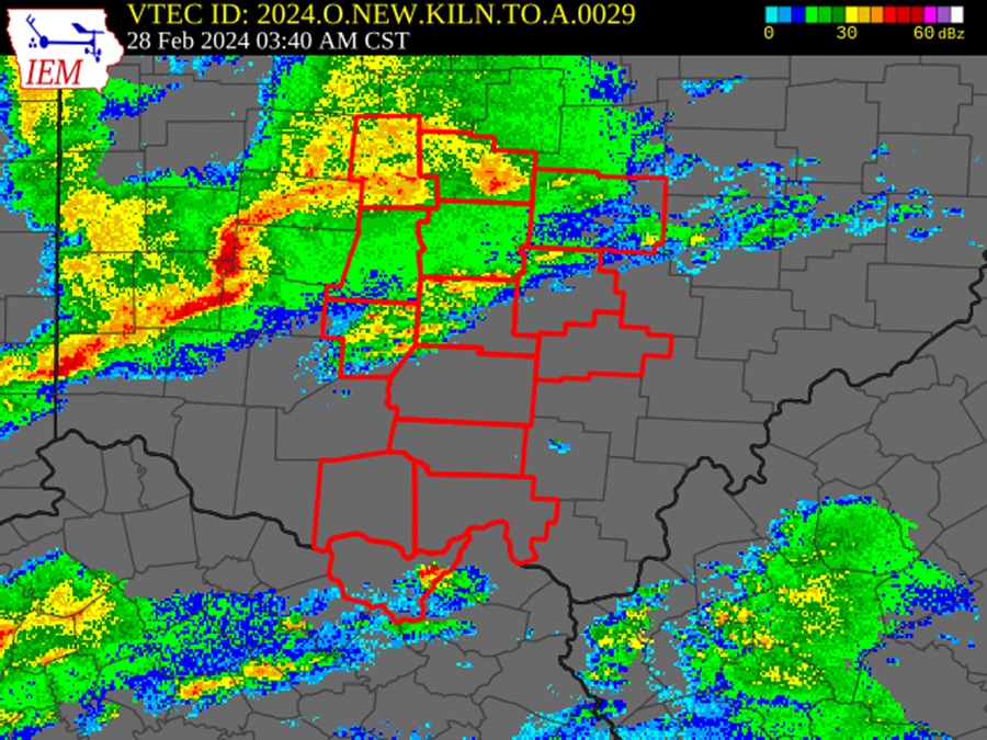
The radar image at the time of the February 28, 2024 tornado watch issuance. The storm that would go on to cause the tornadoes around Columbus is the S-shaped red blob on the left.
The first tornado, an EF1 with 100MPH winds, would take a 2.4 mile path through Montgomery and Greene counties. It would be spawned at 4:37AM, just before the watch was issued. It would form from a rotating cell that would ultimately be responsible for 9 tornadoes in the state, 7 within the Columbus Metro itself, all on a consistent west-to-east-path across Madison, Franklin and Licking counties. The following information for each tornado includes the tornado warning texts, radar images at the time of warning and National Weather Service storm surveys.
Tornado #1
BULLETIN – EAS ACTIVATION REQUESTED
Tornado Warning
National Weather Service Wilmington OH
454 AM EST Wed Feb 28 2024
The National Weather Service in Wilmington has issued a
* Tornado Warning for…
Southeastern Clark County in west central Ohio…
Northeastern Greene County in west central Ohio…
Southwestern Madison County in central Ohio…
* Until 530 AM EST.
* At 454 AM EST, a severe thunderstorm capable of producing a tornado was located near Springfield, moving east at 45 mph.
HAZARD…Tornado.
SOURCE…Radar indicated rotation.
IMPACT…Flying debris will be dangerous to those caught without shelter. Mobile homes will be damaged or destroyed. Damage to roofs, windows, and vehicles will occur. Tree damage is likely.
* Locations impacted include…
Springfield, London, West Jefferson, Cedarville, South Charleston, Choctaw Lake, Harmony, Lisbon, Brighton, Lafayette, South Vienna, South Solon, Midway, Newport, Selma, Pitchin, Interstate 70 at State Route 56, Gladstone, Madison Lake, and Plattsburg.
This includes the following Interstates…
I-70 in Ohio between mile markers 57 and 79.
I-71 in Ohio near mile marker 80.
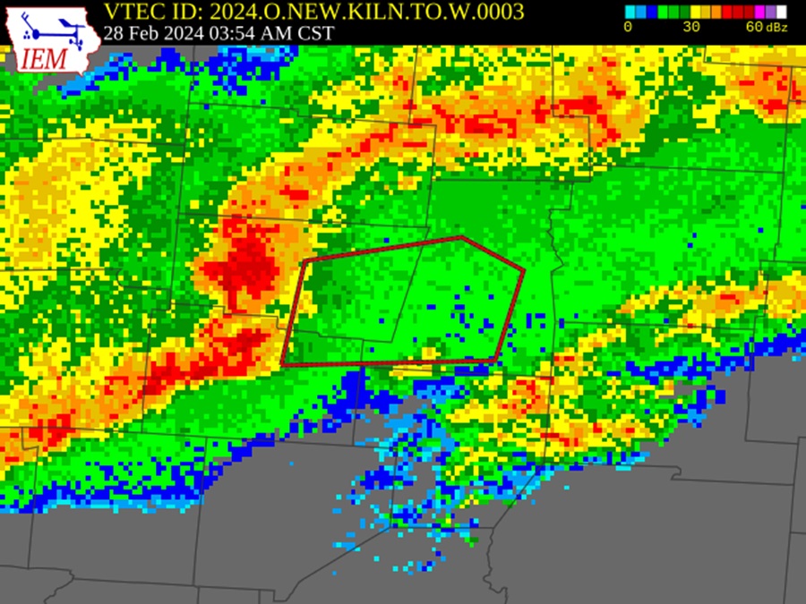
Radar at the time of the Clark/Madison tornado warning.
…NWS DAMAGE SURVEY FOR 2/28/2024 TORNADO EVENT…
…Clark/Madison County Tornado..
Start Location…4 SSE Springfield in Clark County OH
End Location…3 ESE Choctaw Lake in Madison County OH
Date…02/28/2024
Estimated Time…04:52 AM EST
Maximum EF-Scale Rating…EF2
Estimated Maximum Wind Speed…120 mph
Maximum Path Width…500.0 yards
Path Length…18.7044 miles
Beginning Lat/Lon…39.8662 / -83.7788
Ending Lat/Lon…39.9387 / -83.4431
* Fatalities…0
* Injuries…0
…Summary…
The tornado touched down south of Shawnee High School on Selma Pike where several trees were snapped. The tornado then strengthened and broadened as it moved east northeast eventually reaching EF2 intensity along Ridge Rd near Highway 41 where three homes had complete roof loss. After this, there was intermittent EF1 and EF2 damage consisting of around a dozen barns and outbuildings destroyed and more homes with complete roof loss. The tornado then continued for around 10 miles to the east northeast continuing into Madison county. The survey team was
unable to complete the survey north of London as roads were still impassable so some extension of the track is still possible.
One note about the path width of this tornado. In a couple areas, including along Hwy 41 near the Rose Hill Cemetery, the total damage path was more than a half mile wide, however, the maximum width of the tornado circulation was estimated to be around 500 yards wide. The damage pattern was extremely complex and included
a significant amount of straight line wind damage to the south of the tornado track.
Tornado #2
BULLETIN – EAS ACTIVATION REQUESTED
Tornado Warning
National Weather Service Wilmington OH
516 AM EST Wed Feb 28 2024
The National Weather Service in Wilmington has issued a
* Tornado Warning for…
Franklin County in central Ohio…
Northwestern Pickaway County in central Ohio…
Southeastern Madison County in central Ohio…
* Until 545 AM EST.
* At 515 AM EST, a severe thunderstorm capable of producing a tornado was located over London, moving east at 50 mph.
HAZARD…Tornado.
SOURCE…Radar indicated rotation.
IMPACT…Flying debris will be dangerous to those caught without shelter. Mobile homes will be damaged or destroyed. Damage to roofs, windows, and vehicles will occur. Tree damage is likely.
* Locations impacted include…
Columbus, Grove City, Upper Arlington, Gahanna, Hilliard, Bexley, Jefferson, Groveport, West Jefferson, Ohio State University, Lake Darby, Easton, Whitehall, Grandview Heights, Obetz, Commercial Point, Urbancrest, Valleyview, Marble Cliff, and Lafayette.
This includes the following Interstates…
I-70 in Ohio between mile markers 78 and 108.
I-71 in Ohio between mile markers 81 and 115.
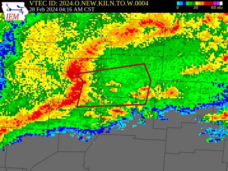
Radar image at the time of the second Madison County tornado and just a few minutes before the Hilliard tornado.
Security camera footage of the Madison County tornado, near West Jefferson.
…NWS DAMAGE SURVEY FOR 02/28/2024 TORNADO EVENT…
…Madison County Tornado…
Start Location…1 E London in Madison County OH
End Location…1 S West Jefferson in Madison County OH
Date…02/28/2024
Estimated Start Time…05:14 AM EST
Estimated End Time… 05:23 AM
Maximum EF-Scale Rating…EF1
Estimated Maximum Wind Speed…110 mph
Maximum Path Width…250.0 yards
Path Length…8.0243 miles
Beginning Lat/Lon…39.8856 / -83.4128
Ending Lat/Lon…39.9272 / -83.2754
* Fatalities…0
* Injuries…0
…Summary…
With considerable assistance from the State of Ohio EMA, and the Madison County EMA, the National Weather Service in Wilmington, OH surveyed tornado damage east of London and southwest of West Jefferson on Wednesday afternoon, in the wake of severe storms which rolled through the area earlier in the morning.
The damage revealed that a tornado developed near State Route 665 east of London, and traversed about 8 miles to the east-northeast. While initially beginning with minor tree and structural damage, including a tipped over trailer, the tornado increased intensity as it crossed Spring Valley Road and then across Glade Run Road, peaking in intensity as it crossed Wilson Road. At this location, a home lost part of its roof, and tree damage was considerable with snapped off trunks. Damage in this area was consistent with wind speeds around 110 mph. The tornado continued across West Jefferson-Klousville Road where it shifted more abruptly northeast and weakened as it crossed Olmstead Road and dissipated.
Tornado #3
Both the tornado warning and radar image for Tornado #2 are also relevant for this tornado and tornadoes #4 and #5, as these events occurred only a few minutes after issuance.
…NWS DAMAGE SURVEY FOR 02/28/2024 TORNADO EVENT…
…Franklin County Tornado…
Start Location…3 SW Hilliard in Franklin County OH
End Location…2 SSE Hilliard in Franklin County OH
Date…02/28/2024
Estimated Start Time…05:26 AM EST
Estimated End Time…05:29 AM EST
Maximum EF-Scale Rating…EF1
Estimated Maximum Wind Speed…110 mph
Maximum Path Width…200.0 yards
Path Length…2.3802 miles
Beginning Lat/Lon…40.005 / -83.1844
Ending Lat/Lon…40.0067 / -83.1396
* Fatalities…0
* Injuries…0
…Summary…
With considerable assistance from Franklin County EMA, the National Weather Service in Wilmington completed a damage survey from severe storms which occurred during the early morning of Wednesday, February 28th.
The survey revealed that a weak tornado developed on the west side of Alton and Darby Creek Road and moved along the north side of Roberts Road through portions of the city of Hilliard. Along the path, damage was a consistent mix of snapped trees, uprooted trees, numerous instances of minor roof and siding damage. One home on Hilliard Rome Road lost part of its roof, and another home near Westbreeze Drive had an attached garage peeled away and shifted. Damage in this area was consistent with wind speeds of around 110 mph. The tornado weakened as it approached Interstate 270 and dissipated on the west side of the Interstate.
Tornado #4
…NWS DAMAGE SURVEY FOR 02/28/2024 TORNADO EVENT…
…EF0 Confirmed near Darbydale OH…
Start Location…2 W Darbydale in Franklin County OH
End Location…..2 W Darbydale in Franklin County OH
Date………………………02/28/2024
Estimated Start Time………..05:28 AM EST
Estimated End Time………….05:29 AM EST
Maximum EF-Scale Rating……..EF0
Estimated Maximum Wind Speed…70 mph
Maximum Path Width………….60 yards
Path Length………………..0.5 miles
Beginning Lat/Lon…………..39.8497 / -83.2246
Ending Lat/Lon……………..39.8505 / -83.2150
* Fatalities…0
* Injuries…..0
…Summary…
The National Weather Service has confirmed an EF0 tornado west of Darbydale in Franklin County, Ohio.
The first known damage from this tornado occurred on the southeast corner of the intersection of Biggert Road and London Groveport Road. Several stands of trees in this area were damaged, and some minor roof damage to outbuildings was also observed. One stand of trees south of London Groveport Road had several trees snapped at the trunk.
Additional minor tree damage was observed further west on London Groveport Road. After this, the tornado is believed to have moved over a forested area near Big Darby Creek, and no additional damage was found.
Tornado #5
…NWS DAMAGE SURVEY FOR 02/28/2024 TORNADO EVENT…
…EF0 Confirmed near Harrisburg OH…
Start Location…2 WSW Harrisburg in Pickaway County OH
End Location…..South of Harrisburg in Pickaway County OH
Date………………………02/28/2024
Estimated Start Time………..05:29 AM EST
Estimated End Time………….05:32 AM EST
Maximum EF-Scale Rating……..EF0
Estimated Maximum Wind Speed…70 mph
Maximum Path Width………….80 yards
Path Length………………..2.2 miles
Beginning Lat/Lon…………..39.8038 / -83.2097
Ending Lat/Lon……………..39.8057 / -83.1687
* Fatalities…0
* Injuries…..0
…Summary…
The National Weather Service has confirmed an EF0 tornado near Harrisburg in Pickaway County, Ohio.
The first known damage from this tornado occurred south of Carson Road, where several trees were damaged. With thanks to the Ohio Department of Transportation, it was noted that storm damage was blown onto southbound Interstate 71 at this location.
Additional damage was found further east on Carson Road, with roof damage to some homes, and a stand of trees with a notable but narrow path of damage. More tree damage was located on the southwest side of Harrisburg, along Harrisburg Road and US Route 62. Finally, some trees and tree branches were downed on Ohio State Route 762, just south of US Route 62.
Tornado #6
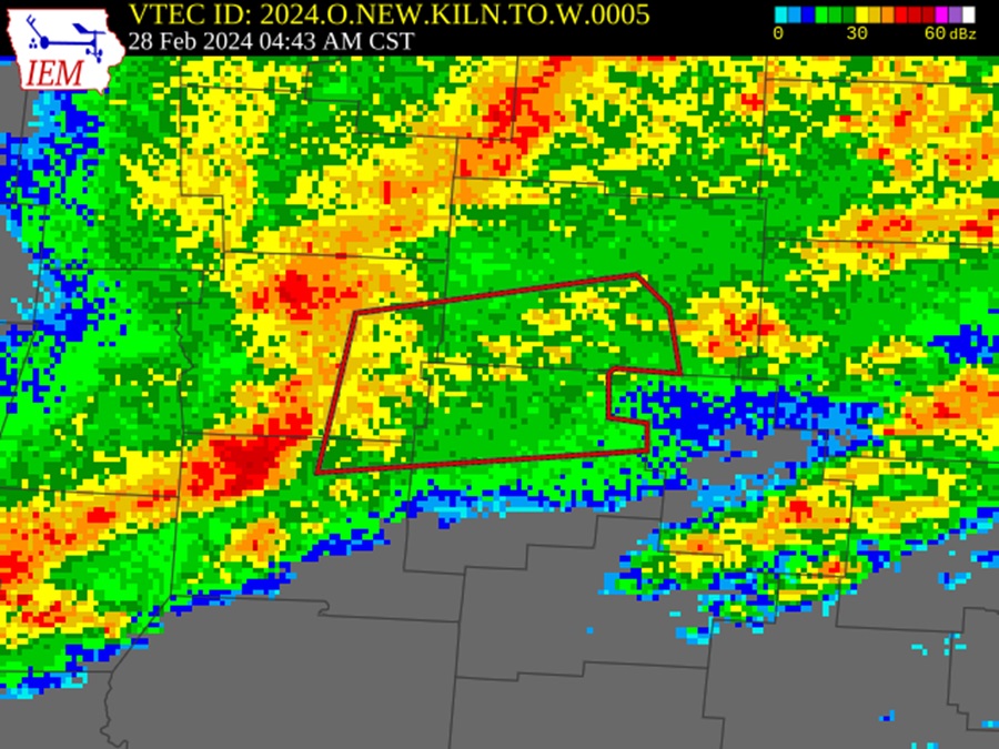
The Groveport tornado occurred just a few minutes after this radar image was taken.
…NWS DAMAGE SURVEY FOR 02/28/24 TORNADO EVENT…
…Franklin County Tornado…
Start Location…1 S Groveport in Franklin County OH
End Location…..1 ENE Canal Winchester in Franklin County OH
Date………………………02/28/2024
Estimated Time……………..05:48 AM EST
Estimated End Time………….05:52 AM EST
Maximum EF-Scale Rating……..EF0
Estimated Maximum Wind Speed…75 mph
Maximum Path Width………….50 yards
Path Length………………..4.4 miles
Beginning Lat/Lon…………..39.8381 / -82.8863
Ending Lat/Lon……………..39.8489 / -82.8046
* Fatalities…0
* Injuries…..0
…Summary…
The tornado likely began within our near the Walnut Woods Metro Park area, more specifically west of Richardson Road. Numerous pine trees were snapped and uprooted, likely indicating the strongest period of the tornado. The tornado continued eastward over Lithopolis Road where more tree damage was observed. Into the Canal Winchester area, additional tree damage and light structure was observed throughout the city with the damage centered on West Waterloo Street on the north side of town. Based on available data, the tornado is suspected to have dissipated on
the north side of town west of US 33 where light damage was observed on North High Street.
Tornado #7
BULLETIN – EAS ACTIVATION REQUESTED
Tornado Warning
National Weather Service Wilmington OH
543 AM EST Wed Feb 28 2024
The National Weather Service in Wilmington has issued a
* Tornado Warning for…
Southeastern Franklin County in central Ohio…
Northern Fairfield County in central Ohio…
North central Pickaway County in central Ohio…
Southwestern Licking County in central Ohio…
* Until 615 AM EST.
* At 543 AM EST, a severe thunderstorm capable of producing a tornado was located near Ashville, moving east at 50 mph.
HAZARD…Tornado.
SOURCE…Radar indicated rotation.
IMPACT…Flying debris will be dangerous to those caught without shelter. Mobile homes will be damaged or destroyed. Damage to roofs, windows, and vehicles will occur. Tree damage is likely.
* Locations impacted include…
Columbus, Newark, Reynoldsburg, Gahanna, Pickerington, Bexley, Heath, Granville, Pataskala, Canal Winchester, Groveport, Baltimore, Buckeye Lake, Hebron, South Bloomfield, Millersport, Pleasantville, Harbor Hills, Granville South, and Fairfield Beach.
This includes I-70 in Ohio between mile markers 103 and 136.
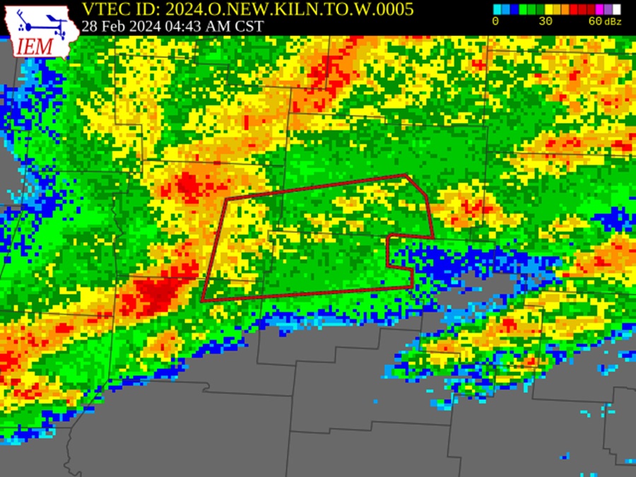
The radar image just before the 7th and 8th Columbus Metro tornadoes touched down near Gahanna.
This tornado warning and storm would produce two different tornadoes (#6 and #7), the first moving from Franklin into Licking County, and the other moving from Franklin into Fairfield County.
…NWS DAMAGE SURVEY FOR 02/28/2024 TORNADO EVENT…
…Franklin/Licking County Tornado…
Start Location…3 E Gahanna in Franklin County OH
End Location…1 W Granville South in Licking County OH
Date…02/28/2024
Estimated Start Time…05:49 AM EST
Estimated End Time…06:03 AM EST
Maximum EF-Scale Rating…EF2
Estimated Maximum Wind Speed…120 mph
Maximum Path Width…300.0 yards
Path Length…14.0943 miles
Beginning Lat/Lon…40.0221 / -82.8191
Ending Lat/Lon…40.0568 / -82.5595
* Fatalities…0
* Injuries…0
…Summary…
With considerable assistance from the State of Ohio EMA, the Franklin County EMA, and the Licking County EMA, the National Weather Service in Wilmington, Ohio surveyed tornado damage from eastern Franklin into western Licking County.
The tornado began in the Havens Corners area near the intersection of Highway 605 and Havens Corners Road, and quickly strengthened as it moved through the Havenswood neighborhood in Franklin County, producing tree and minor structural damage indicative of winds between 85 mph and 100 mph. The tornado continued to rapidly strengthen as it approached McOwen Road, where considerable tree damage was observed, with numerous stands of soft and hard wood trees snapped off completely or uprooted. A shipping container was tossed, and a home suffered extensive roof
loss and the loss of one exterior wall, with debris thrown hundreds of yards downstream. In this area, winds were estimated to be around 120 mph.
The tornado began weakening just a bit as it crossed into Licking County, but still produced a wide swath of tree and structural damage along its path across Graham Road SW and Highway 41. Structural damage was mainly in the form of windows blown out, destroyed barns, and minor roof removal. The tornado continued to slowly weaken as it moved east-northeast from the Jersey area toward the southwest side of Granville where it dissipated. Along this stretch, mainly tree and very minor structural damage was noted.
The historical context of the February 28, 2024 tornadic event cannot be understated. While there have of course been other winter and other February tornadoes- including the aforementioned 2023 event- this is the largest single event on record for the Columbus metro in February and during the December-February winter period. Indeed, the 5 tornadoes that struck Franklin County is the most ever recorded for a single date at any time of year. The anomalously warm weather that is increasingly becoming more common during winter months is certainly playing a role in the amount of severe weather during the season. The high of 66 on the 28th and the low of 56 on the 27th both represent the warmest high and warmest low ever recorded for those dates.
Monday, February 27, 2023
A rare winter mini-outbreak occurred across Southwest and Central Ohio with 4 confirmed tornadoes, all of them week. Supercell thunderstorms with strong rotation moved through the region between 3PM-5PM, prompting numerous severe thunderstorm and tornado warnings. 2 of the 4 tornados occurred in the Columbus Metro.
Tornado #1
The first tornado in the Columbus area touched down southwest of Orient in far northern Pickaway County, just a few miles from the Franklin County border. The EF0 tornado had winds of up to 85MPH and traveled along a southwest to northeast path for about 1.4 miles. The tornado damaged several buildings and downed many trees along its path, but did not cause any injuries or fatalities.
BULLETIN – EAS ACTIVATION REQUESTED
Tornado Warning
National Weather Service Wilmington OH
357 PM EST Mon Feb 27 2023
The National Weather Service in Wilmington has issued a
* Tornado Warning for…
Southwestern Franklin County in central Ohio…
Northwestern Pickaway County in central Ohio…
Southeastern Madison County in central Ohio…
* Until 430 PM EST.
* At 357 PM EST, a severe thunderstorm capable of producing a tornado was located near Mount Sterling, moving northeast at 40 mph.
HAZARD…Tornado and quarter size hail.
SOURCE…Radar indicated rotation.
IMPACT…Flying debris will be dangerous to those caught without shelter. Mobile homes will be damaged or destroyed. Damage to roofs, windows, and vehicles will occur. Tree
damage is likely.
* Locations impacted include…
Columbus, Grove City, Upper Arlington, Groveport, Ohio State University, Lake Darby, Grandview Heights, Obetz, Urbancrest, Valleyview, Marble Cliff, Harrisburg, Orient, Derby, Lilly Chapel, Georgesville, Madison Lake, Darbydale, Big Plain and Wrightsville.
This includes the following Interstates…
I-70 in Ohio between mile markers 90 and 101.
I-71 in Ohio between mile markers 83 and 108.
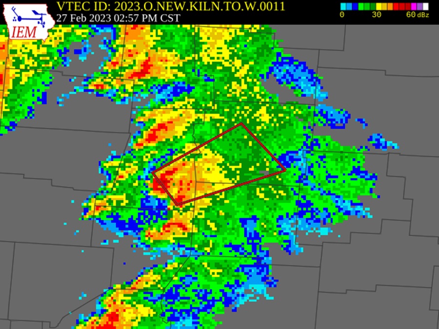
The Orient tornado occurred around the time of this radar image.
Tornado #2
The second tornado– produced by the same storm as the Pickaway County tornado- touched down in Licking County about 3 miles WSW of Kirkersville. This tornado also registered as an EF0, but with slightly weaker 75MPH winds. This short-lived tornado largely damaged trees on its 1/3rd-mile path. There was no tornado warning for the cell while it was in Licking County.
May 27-28th, 2019 Outbreak
In the 2nd largest tornado outbreak in Ohio history, 21 tornadoes would strike the state. The worst tornado was a long-track EF4 in the Dayton area. These same storms would go on to enter the Columbus metro and produce a handful of weaker tornadoes in Pickaway, Perry and Hocking counties, as listed below.
Tornado #1
This EF1 tornado touched down southeast of Circleville around 1AM and travelled 3.77 miles in a general east-southeast direction. The 150-yard-wide tornado had winds that reached up to 100MPH and caused damage to trees, homes and other buildings along its path. Full details on the damage can be found here:
https://www.ncdc.noaa.gov/stormevents/eventdetails.jsp?id=818384
BULLETIN – EAS ACTIVATION REQUESTED
Tornado Warning
National Weather Service Wilmington OH
1249 AM EDT Tue May 28 2019
The National Weather Service in Wilmington has issued a
* Tornado Warning for…
Southwestern Fairfield County in central Ohio…
Western Hocking County in central Ohio…
Southeastern Pickaway County in central Ohio…
Northeastern Ross County in southwestern Ohio…
* Until 115 AM EDT.
* At 1248 AM EDT, a severe thunderstorm capable of producing a tornado was located over Logan Elm Village, moving southeast at 40 mph.
HAZARD…Tornado and quarter size hail.
SOURCE…Radar indicated rotation.
IMPACT…Flying debris will be dangerous to those caught without shelter. Mobile homes will be damaged or destroyed. Damage to roofs, windows, and vehicles will occur. Tree damage is likely.
* Locations impacted include…
Circleville, Kingston, Hocking Hills State Park, Logan Elm Village, Fox, Stoutsville, Laurelville, Adelphi, Tarlton, Aw Marion State Park, Buena Vista in Hocking County, Gibisonville, Whisler, South Bloomingville, Clearport, Pickaway County Airport, State Route 138 at US Route 22, Rockbridge and Hallsville.
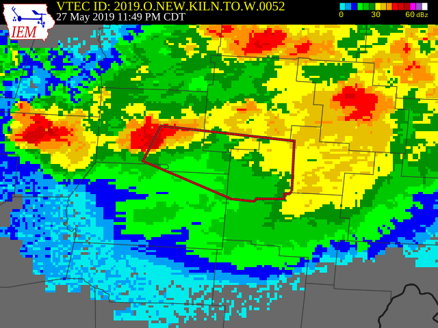
The Circleville tornado spawned around the time of this radar image.
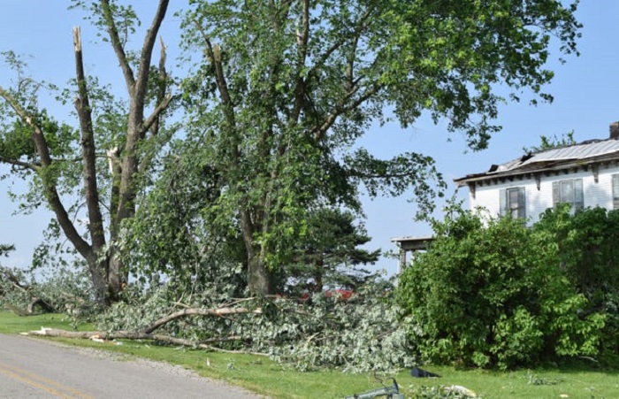
Damage along Ludwig-Dresback Road in Pickaway County.
Tornado #2
The second tornado in the series dropped at 1:09AM on State Route 56 just west of Salt Creek Elementary School in Pickaway County before lifting a few minutes later near Tarlton-Adelphi Road. The EF1 tornado had a 1.64-mile path and was about 75 yards in width. Winds reached 100MPH or more. More details can be found here:
https://www.ncdc.noaa.gov/stormevents/eventdetails.jsp?id=818383
BULLETIN – EAS ACTIVATION REQUESTED
Tornado Warning
National Weather Service Wilmington OH
107 AM EDT Tue May 28 2019
The National Weather Service in Wilmington has issued a
* Tornado Warning for…
Southwestern Fairfield County in central Ohio…
Hocking County in central Ohio…
Southeastern Pickaway County in central Ohio…
* Until 145 AM EDT.
* At 107 AM EDT, a tornado-producing storm was located near Tarlton, moving east at 30 mph.
HAZARD…Damaging tornado and quarter size hail.
SOURCE…Radar confirmed tornado. Radar shows tornado debris in the air.
IMPACT…Flying debris will be dangerous to those caught without shelter. Mobile homes will be damaged or destroyed. Damage to roofs, windows, and vehicles will occur. Tree damage is likely.
* Locations impacted include…
Logan, Hocking Hills State Park, Starr, Laurelville, Tarlton, Buena Vista in Hocking County, Gibisonville, Ilesboro, Haydenville, Lake Logan State Park, Whisler, South Bloomingville, Clearport, Enterprise, Union Furnace and Rockbridge.
Tornado #2 was on the ground around the time of this radar image.
Tornado #3
At 1:17AM, the strongest tornado in the series, an EF2, touched down just inside Hocking County at the Union Road/Twp. Highway 145 intersection and moved east-northeast on a 5.31-mile path. Winds were estimated at 125MPH or higher. Both the warning and radar image from Tornado #2 are relevant for this tornado, as the tornado occurred just after issuannce. Damage details can be found here:
https://www.ncdc.noaa.gov/stormevents/eventdetails.jsp?id=817746
Tornado #4
The final tornado in the Columbus metro area was also the 2nd to last to be confirmed in Ohio (An EF0 briefly touched down from this storm in Vinton County). This 700-yard-wide EF1 touched down in Perry County at Twp. Road 71A at 1:35AM and travelled to the east-southeast on a 1.67-mile path that ended just inside Muskingum County. Winds reached at least 100MPH. At the time, there was no Tornado Warning. Details can be found here:
https://www.ncdc.noaa.gov/stormevents/eventdetails.jsp?id=817933
The 4th tornado touched down in Perry County around the time of this image.
Overall, the Central Ohio tornadoes caused about $4 million in damages, but luckily did not kill or injure any people.
Tuesday, April 3, 2018
A mini outbreak of 5 tornadoes hit Ohio, 3 of which occurred within the Columbus metro.
Tornado #1
An EF0 tornado with winds of about 85MPH touched down briefly on a farm along Roberts Mill Road in Madison County at 5:14PM. The tornado damaged some buildings on the farm before lifting.
https://www.weather.gov/iln/20180403_London
Tornado #2
At 5:37PM, an EF1 tornado touched down in Grove City just south of Orders Road near the Grove City First Baptist Church. From there it moved generally northeast for 2.63 miles. Winds reached 105MPH along its path. It lifted near Stringtown Road. More information can be found here:
https://www.weather.gov/iln/20180403_grovecity
Tornado #3
The 3rd and final Central Ohio tornado of April 3, 2018 touched down in Perry County about an hour after the Grove City tornado. An EF0 first touched down just north of Baltimore-Somerset Road NE between Twp. Road 15 and Ridenour Road. From there, the tornado travelled about 1.25 miles in an easterly direction before lifting up at Bruno Road. The area is sparsely populated, so the tornado’s 75MPH-80MPH winds mostly down trees and caused damage to a few residential trailers. More information can be found here:
https://www.ncdc.noaa.gov/stormevents/eventdetails.jsp?id=741930
Sunday, November 5, 2017
A Midwest tornado outbreak brought 16 Ohio tornadoes, now the 4th largest outbreak in Ohio history.
**Coming Soon**
Wednesday, April 20, 2011
An outbreak of 15 tornadoes hit Ohio between April 19-20. The Columbus metro recorded 6, all of which occurred in the early morning hours of the 20th. This multi-state outbreak was the opening event of a very active tornadic week across the Eastern US that would eventually spawn 132 tornadoes through April 24th.
Tornado #1: The first tornado in the series came down in Pickaway County at 2:14AM. The EF1, having winds of 105MPH, had the longest path of the 6 at 4.2 miles. The tornado touched down on Main Street (Egypt Pike) on the south side of New Holland. The tornado moved slight north of due east to Rt. 207 east-southeast of Atlanta before lifting. It destroyed several farm buildings, including 3 barns and grain bin. Several treees were also downed. No injuries or deaths occurred.
Tornado #3: The second tornado touched down at 2:25AM on the morning of April 20th. Touchdown occurred at London-Lancaster Road on the border of Rickenbacker in southern Franklin County. The EF1 travelled about 2.6 miles almost due east to a point just west of Richardson Road. The 100-yard-wide tornado’s winds reached up to 109MPH along its path. Due to the area being mostly undeveloped, damage was limited. Damage consisted of uprooted trees, roof damage to two homes, downed power poles and significant damage to a large storage shed. No injuries or deaths were reported.
Tornado #3: The second tornado touched down about 2 miles east-northeast of Groveport in Franklin County at 2:27AM. This small EF0 had a path of about 250 yards and winds up to 83MPH. Touchdown occurred at Rager Road about midway between Groveport Road and US 33, and travelled eastward. Damage was almost entirely concentrated at a greenhouse complex near the touchdown site. Several greenhouse structures were damaged or destroyed, and plants and equipment were tossed about. No injuries or deaths were reported.
Tornado #4: An EF1 with winds of 110MPH touched down at 2:36AM near Baltimore in Fairfield County. It came down along Canal Road northeast of Baltimore, and then moved 2.4 miles east to Millersport Road. Damage consisted of of destroyed garage at a house, downed trees and a damaged barn. There were no injuries or deaths.
Tornado #5: At 2:42AM, the strongest tornado in the metro outbreak occurred in Licking County. The EF2, packing winds of up to 120MPH, touched down on Aerospace Drive at Ramp Creek just to the southwest of Heath. The tornado tracked east-northeast about 3.8 miles to Jacksontown Road south of Linville Road. Damage included downed trees and damage to several retail and commercial buildings. There were no injuries or deaths.
Tornado #6: The final tornado in the metro touched down at 2:48AM in Licking County. Touchdown of the EF1 occurred just northeast of Albright Road and south of Brushy Fork Road about 6 miles east-southeast of Newark. The 100-yard-wide tornado travelled about 500 yards in total. Damage included the destruction of a mobile home, snapped trees and damage to a second home. No injuries or deaths occurred.
To find out more about these tornadoes and this outbreak, go here: https://www.weather.gov/iln/20110420
Thursday, September 16, 2010
An outbreak of tornadoes across central and southeastern Ohio brought 4 tornadoes to the Columbus metro area.
Tornado #1
This EF0 tornado touched down about 3 miles south of Galena in Delaware County. First coming down just north of Big Walnut Road west of Pinehaven Drive, the tornado moved east-northeast for about 0.12 miles before lifting at Hoover Reservoir. The tornado’s 75MPH winds mostly caused damage to trees and ripped some shingles off of one house. No injuries or deaths were reported. More information on this tornado can be found here:
https://www.weather.gov/iln/20100916_Galena
https://www.ncdc.noaa.gov/stormevents/eventdetails.jsp?id=251493
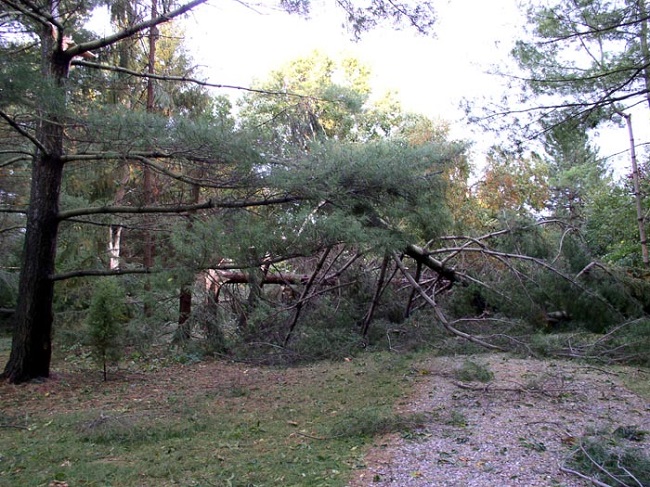
Tree damage near Hoover Reservoir.
Tornado #2
The next, and strongest tornado came down in Fairfield County. First touching down at Fairfield Union Road, the tornado moved generally eastward just north of West Rushville and Rushville before turning southeast and crossing into Perry County near the County Line Road and Twp. Road 140 intersection. The 75MPH winds in Fairfield County caused tree and roof damage along its path. As the tornado moved into Perry County, it strengthened into EF2 status with winds reaching 120MPH and a width of 800 yards. In Perry County, the tornado travelled 7 miles and destroyed 8 homes. No deaths occurred, but one woman was injured when a door hit her in the back. More information can be found here:
https://www.weather.gov/iln/20100916_WestRushville
https://www.ncdc.noaa.gov/stormevents/eventdetails.jsp?id=251492
https://www.ncdc.noaa.gov/stormevents/eventdetails.jsp?id=255613
Minor damage to a home from the West Rushville tornado.
Tornado #3
This EF1 tornado first touched down near the intersection of Dozer Road and Valentine Road in southwest Fairfield County. It moved east-southeast on its roughly 4-mile total path, but was not on the ground the entire time- there were likely 3 separate touchdowns. The tornado damage continued in Hocking County near Ellis Road and Middlefork Road before the tornado finally lifted. Winds were estimated to be up to 90MPH along the path. Damage to trees, farm buildings, some homes and businesses occurred along its path, particularly in the Tarlton area, though there were no injuries or deaths.
More information can be found here:
https://www.weather.gov/iln/20100916_Tarlton
https://www.ncdc.noaa.gov/stormevents/eventdetails.jsp?id=256303
https://www.ncdc.noaa.gov/stormevents/eventdetails.jsp?id=256305
https://www.ncdc.noaa.gov/stormevents/eventdetails.jsp?id=256299
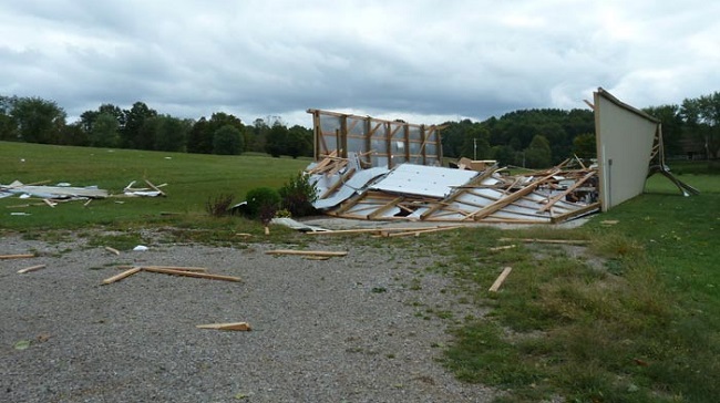
Damage near Tarlton.
Tornado #4
This tornado, an EF1, was spawned by the same storm that produced the Fairield-Perry County tornado. First touching down at the Melon Road and Twp. Road 211 intersection, this tornado moved east-northeast until it entered Morgan County just west of Misco, finally ending north of Ogg Creek east of Whitehouse Road. During the 4.6 mile path, winds reached up to 110MPH in the 300-yard wide tornado. 8 homes were destroyed, with an additional 28 being damaged. No deaths or injuries were reported. The NWS officially lists this event as 2 tornadoes, though their beginning and end points are essentally the same. This was just the 2nd confirmed tornado in Morgan County since 1928. More information on this tornado can be found here:
https://www.ncdc.noaa.gov/stormevents/eventdetails.jsp?id=255614
https://www.ncdc.noaa.gov/stormevents/eventdetails.jsp?id=255615
https://www.weather.gov/rlx/perry09162010#:~:text=THE%20NATIONAL%20WEATHER%20SERVICE%20IN%20CHARLESTON%20WV%20HAS,STARTED%20IN%20FAIRFIELD%20COUNTY%20OHIO%20NEAR%20WEST%20RUSHVILLE.
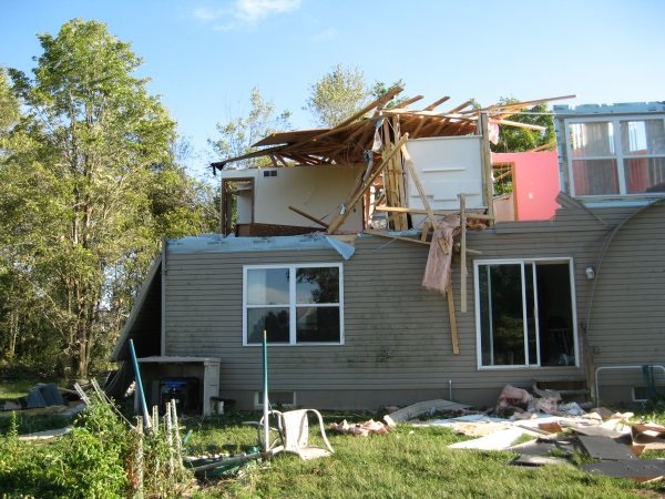
Damage to a Perry County home from the Perry-Morgan tornado.
Wednesday, September 20, 2000
On the same day that Xenia was struck by a deadly EF4, an EF2 tornado traveled a broken 25-mile path through Delaware, Licking and Knox counties. The tornado first touched down along Harlem Road about a mile north of the Franklin County line. From there it moved northeasterly for several miles. It destroyed 2 high-tension power towers and 14 homes before lifting just west of the Licking County line.
The tornado touched down again just inside Licking County just northeast of the Clover Valley Golf Club, moving generally east-northeast. At least 15 homes were damaged or destroyed along with several barns and outbuildings. Additionally, a dozen buildings at Buckeye Egg Company were destroyed, trapping at least 1 million chickens, most of which had to eventually be killed. The tornado continued into Knox County, causing damage to some farm buildings and 4 homes. Overall the 100-yard-wide tornado injured 2 people and caused about $2.5 million in damage.
Tuesday, May 23, 2000
An EF0 tornado briefly touched down just east of the Jerusalem Road/Lancaster-New Lexington Road intersection northeast of Bremen in Fairfield County. It downed trees, destroyed a shed and damaged some farm machinery. It caused about $50,000 damage along its 130-yard-wide, half-mile track. There were no injuries or deaths.
A second tornado in the family, an EF1, touched down to the east in Perry County on Jackson Township Road 371. It then moved east for about 2 miles along County Road 9 (Pen Road) where it ripped off the roof of a house, pushed a modular home off its foundation, removed the roof another trailer before destroying a barn and garage on Palomino Road. The 150-yard-wide tornado caused about $185,000 in damage, but no injuries or deaths.
Sunday, July 12, 1992
The most active tornado day in Ohio history, a total of 28 tornadoes would touch down across the state.
Friday, June 22, 1990
5 tornadoes would touch down in Ohio during the evening, including 3 within the boundaries of the modern Columbus metro area. The area was under a Tornado Watch at the time, which went into effect just after 4:30PM and went to 10PM, and included Delaware, Franklin, Madison and Union counties in the metro.
Tornado #1
This tornado touched down in Fairfield County at 8PM.
BULLETIN – EBS ACTIVATION REQUESTED
TORNADO WARNING
NATIONAL WEATHER SERVICE COLUMBUS OH
804 PM EDT FRI JUN 22 1990
THE NATIONAL WEATHER SERVICE IN COLUMBUS HAS ISSUED A
TORNADO WARNING EFFECTIVE UNTIL 845 PM EDT
FOR PEOPLE IN THE FOLLOWING COUNTY…
IN CENTRAL OHIO
…FAIRFIELD
AT 800 PM FAIRFIELD COUNTY SHERIFF REPORTED A TORNADO TOUCHDOWN ONHORNESVILLE RD. IN THE CITY OF SUGAR GROVE. A HOUSE WAS DESTROYED.
THE TORNADO WAS MOVING EAST AT 30 MPH.
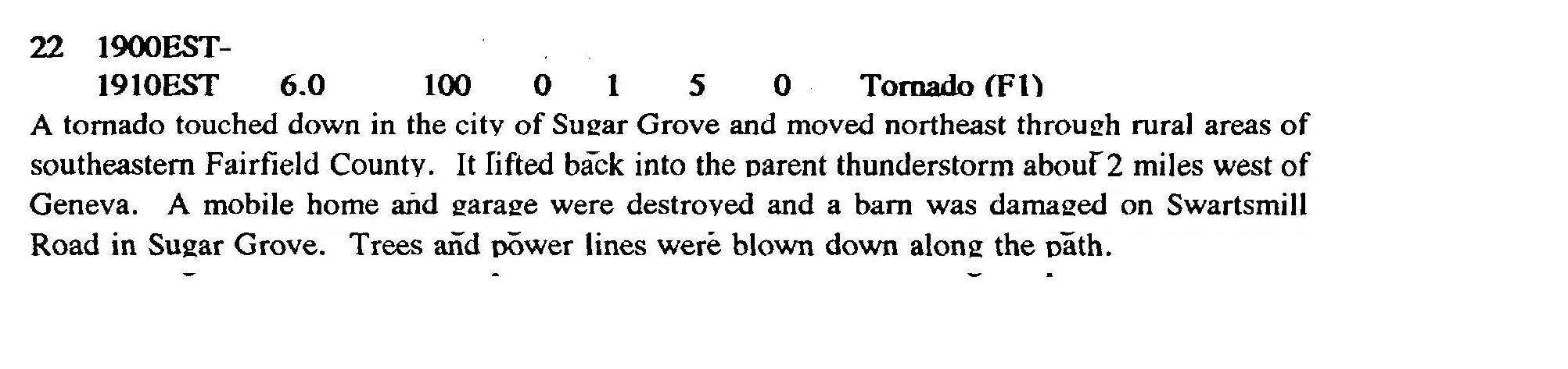
Tornado #2
The Morrow County tornado did not get a warning. It touched down southwest of State Route 314 and Woodbury-Bellville Road before moving southeast for about 3 miles. It peaked in strength at the equivalent of an EF2. The tornado caused 1 injury and about $2.5 million in damage.
Tornado #3
BULLETIN – EBS ACTIVATION REQUESTED
TORNADO WARNING
NATIONAL WEATHER SERVICE COLUMBUS OH
822 PM EDT FRI JUN 22 1990
THE NATIONAL WEATHER SERVICE IN COLUMBUS HAS ISSUED A
TORNADO WARNING EFFECTIVE UNTIL 900 PM EDT
FOR PEOPLE IN THE FOLLOWING COUNTY…
IN CENTRAL OHIO
…LICKING
RADAR INDICATED AND THE LICKING COUNTY FIRE DEPARTMENT REPORTED AbFUNNEL CLOUD NEAR NORTH RIDGE HIGH SCHOOL AT 815 PM EDT. THE TORNADO WAS MOVING NORTHEAST 35 MPH.
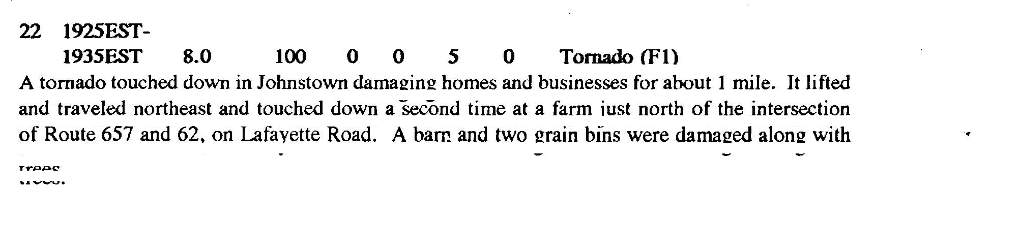
Tornadoes Cause Havoc in Central Ohio
Sunday, June 1, 1980
An EF1 tornado touched down on the southwest side of Croton in Licking County at around 3PM. It was only on the ground a few miles, but 8 homes were destroyed, and the fairgrounds sustained heavy damage. Three people were injured.
https://www.ncdc.noaa.gov/stormevents/eventdetails.jsp?id=10097793
Another brief EF1 tornado touched down on the east side of Pataskala in Licking County at 2:30PM, damaging a home and some trees.
https://www.ncdc.noaa.gov/stormevents/eventdetails.jsp?id=10097792
Tuesday, April 18, 1978
An EF1 tornado touched down on the north side of Big Darby Creek to the north of Plain City east of Rt. 42 at about 7PM. This tornado tracked generally east-northeast to a point just east of the Converse Road-Mitchell Dewitt Road intersection. The tornado lifted briefly at that point before touching down again, continuing on an east-northeast path just north of the Franklin-Delaware County line. It continued through the Muirfield area, across O’Shaughnessy Reservoir and then through southern Delaware county suburban areas to a point just north of Seldom Seen Road just west of Liberty Road. Overall, the tornado’s path was about 9.5 miles long and about 33 yards across. Luckily, only minor damage was reported throughout the path.
**Note, although the Storm Events page lists this as occurring on April 19th, media articles from the time indicate it happened during the evening of April 18th.
https://www.ncdc.noaa.gov/stormevents/eventdetails.jsp?id=10098835
https://www.ncdc.noaa.gov/stormevents/eventdetails.jsp?id=10098836
Tuesday, June 17, 1975
A weak tornado touched down just outside the Scarlett Manor trailer park at 555 Greenlawn Avenue in Franklin County. The tornado proceeded to destroy 3 trailers, with dozens more damaged or knocked off their foundations. The tornado lifted briefly before coming down again and damaging the roofs of 4 buildings at the Greenbriar Apartments at 910 Eaton Avenue.
A separate tornado hit Grove City in Franklin County, damaging about 30 homes in a 4-block area bounded by Parlin Drive, Yates Avenue, Hoover Road and Devin Road.
Yet another small EF1 tornado touched down briefly in SE Franklin County northeast of Bixby Road and Rohr Road.
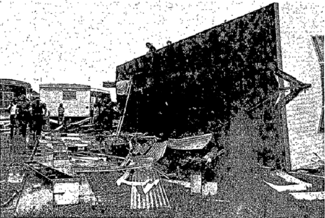
Damage to the mobile home park from the 6/17/1975 tornado.
April 3-4, 1974- The Super Outbreak
At one time, the Super Outbreak of April 1974 was the largest tornado outbreak in US history, but was eventually surpassed by the Southeast outbreak in April 2011. Still, the 1974 event is still legendary among US tornado events, and is perhaps most infamous for producing the Xenia EF5, which leveled a large portion of the city and, along with an EF4 in 2000, cemented the city’s reputation as a tornado magnet. Ohio recorded 13 separate tornadoes, 38 deaths and more than 1100 injuries. Central Ohio itself was largely spared from the destruction that western Ohio saw, but there were still 3 tornadoes from the event in the region, 2 of which were from the same storm that produced the Xenia monster.
Tornado #1
The first tornado in the Columbus Metro was an EF2 that touched down on the border of Madison and Clark counties near the intersection of Botkin Road and Neil Road. This 180-yard-wide tornado moved generally east-northeast, barely missing London to the south. The storm paralleled Rt 142 just to the its south for much of its path before lifting less than a mile to the southwest of West Jefferson. Despite staying on the ground for almost 16 miles, the tornado’s fortunate path prevented it from hitting much of anything except farmland, a warehouse and a few farm outbuildings, and there were no injuries or deaths. The storm that spawned this tornado, however, was so severe that Downtown London was heavily damaged by high winds and had to be evacuated. It was initially assumed it was caused by the tornado itself, but storm surveys show the tornado to have missed to the south and the London damage caused by high straight-line winds. This tornado was spawned by the Xenia storm.
Tornado #2
The second tornado was a short-lived EF1 in Pickaway County. It touched down northeast of the Rt 104/Rt 22 intersection and travelled about 1 mile to the northeast before lifting northeast of SR 56. Ironically, the smallest, most short-lived and weakest tornado in the Columbus series caused the most injuries when it destroyed the mobile home of a family of 7.
https://www.ncdc.noaa.gov/stormevents/eventdetails.jsp?id=10086994
Tornado #3
At around 6:05PM, a tornado touched down just northeast of the intersection of East Dublin-Granville and Hamilton Road in Franklin County. This EF2 tornado moved generally northeast for just over 5 miles, passing over 161 near Harlem Road and continuing northeast until it crossed the Franklin-Delaware County line and ending just south of Fancher Road. The 400-yard-wide tornado damaged or destroyed about 20 homes and toppled a large transmission tower. There were no injuries or fatalities. This was the final tornado from the Xenia storm cell.
For more information on this tornado, go here: https://www.ncdc.noaa.gov/stormevents/eventdetails.jsp?id=10086991
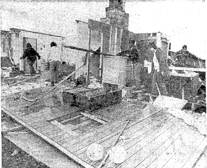
A home damaged near New Albany after the 1974 tornado.
Columbus’ Worst Tornado
Thursday, May 10, 1973
Arguably the most significant tornado in Columbus history got its start with a storm in Northern Champaign County southwest of Couchman Road and Glady Creek at around 6:45PM. This EF3 tornado touched down and lifted numerous times, never staying on the ground for very long. The tornado first moved southeastward, passing just east of Urbana where it damaged 34 homes and several farm buildings, injuring 3 people. It then touched down again just north of Springfield and began moving more toward the east, but damage was minor in Clark County. The tornado first moved into the Columbus Metro when it touched down in northern Madison County. As it moved just to the north of London, the tornado damaged or destroyed 34 houses and caused 14 injuries. The storm then entered Franklin County on the northeast side of West Jefferson. In Franklin County, it first destroyed a mobile home near the intersection of Hall Road/Alton Road at about 8:30PM before destroying about 10 homes under construction in the Quail Hollow subdivision southeast of the Hall Road/Alton Road intersection. The tornado crossed Norton Road at the railroad tracks and then lifted. It would cause damage again by tearing the roof off a house on Big Run Road just north of 270 before damaging a business at 2375 Harrisburg Pike. It continued to sporadically damage buildings a 2380 Harrisburg Pike, 2500 Gantz Road and several homes along Dyer and Brown roads. It then struck the South High Drive-in at 3050 S. High Street, destroying one of the screens. The tornado next damaged homes, buildings and trees on Basswood Road and Stockbridge Road. After that, the tornado lifted again, before coming down near the intersection of Williams Road and Lockbourne Road, destroying the roof of a building. After that, the tornado lifted once more until it reached Fairfield County, where it destroyed a mobile home. Although not continuous, the tornado affected a path of about 85 miles overall. In Franklin County, the tornado damaged or destroyed 97 homes and dozens more other buildings. Damage was estimated above $1 million. There were also 3 injuries, but no deaths.
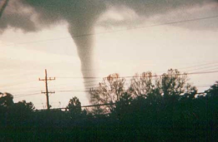
The 5/10/1973 tornado as it passed through South Columbus.
Tuesday, May 8, 1973
**Coming Soon**
Palm Sunday Tornado Outbreak
April 11-12, 1965
The Palm Sunday outbreak was one of the largest tornadic events in the Midwest up to that time, and still ranks as one of the deadliest nationally. The outbreak had 47 tornadoes with 271 fatalities. Ohio had 11 tornadoes during the event, 2 of which hit the Columbus metro area and will be detailed here.
Tornado #1
The most significant tornado within the Columbus metro, this EF2 touched down in Union County just west of the Delaware County line near the intersection of Smokey Road and Donovan Road after 11pm. From there it moved generally east-northeast along and just south of Smokey Road. The 400-yard-wide tornado caused only scattered damage until striking the northern sections of Radnor, destroying homes and other buildings. From there it crossed Delaware Stare Park and hit Westfield before the path ended in the far southwestern corner of Morrow County. Overall, the tornado killed 4 people and injured more than 60. It destroyed at least 25 homes and several farm buildings along its path, with damage exceeding $2.5 million.
https://www.ncdc.noaa.gov/stormevents/eventdetails.jsp?id=10083991
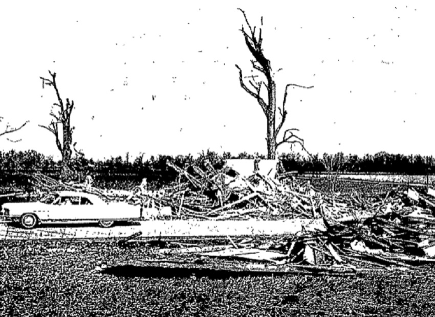
Damage at Radnor.
Tornado #2
The second tornado in the metro areas was an EF1 that touched down after Midnight on Gibson Road north of Rt 316 to the northwest of South Bloomfield in Pickaway County. It moved generally east-northeast just to the north of Ashville and across dozens of farms before the path ended at the intersection of Marcy Road and Cedar Hill Road in Fairfield County. It touched down again shortly after and traveled across north-central Fairfield county, moving a few miles north of Lancaster before lifting again in southwest Perry County. From there, it touched down a 3rd time, traveling 3 more miles to just northeast of Somerset. The 300-yard-wide tornado injured about 10 people near Ashville and another 4 in Fairfield and Perry counties, causing damage to farms, homes and trees along its path, but caused no fatalities. It caused about $750,000 in damage along its 3 paths.
https://www.ncdc.noaa.gov/stormevents/eventdetails.jsp?id=10083995
https://www.ncdc.noaa.gov/stormevents/eventdetails.jsp?id=10083996
https://www.ncdc.noaa.gov/stormevents/eventdetails.jsp?id=10083998
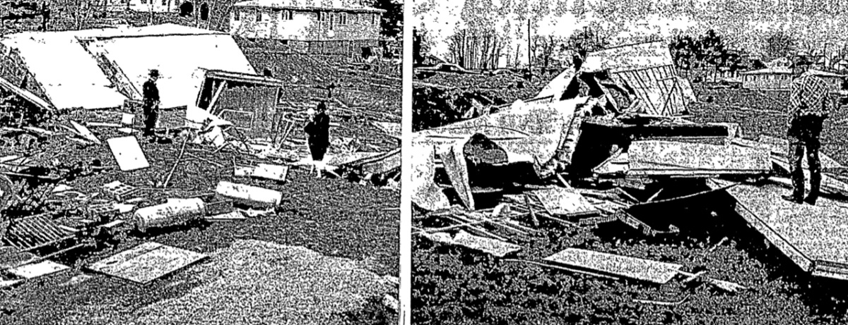
Damage at Somerset, in Perry County.
Thursday, September 12, 1963
Tornado #1: An EF1 tornado struck near Broadway in Union County around 11:30AM. It destroyed a barn and garage, damaged Broadway Elementary School and broke windows at Pickerington School, causing 9 students to be covered in glass, injuring two.
https://www.ncdc.noaa.gov/stormevents/eventdetails.jsp?id=10084280
Tornado #2: An EFO touched down at Price Field, a small airport at roughly 4588 Refugee Road in Franklin County. There, the tornado flipped and damaged several small planes and ripped a wall from a hangar.
https://www.ncdc.noaa.gov/stormevents/eventdetails.jsp?id=10084283
Tornado #3: The 3rd tornado of the day apparently came from the same storm that spawned #2. The EF1 hit about a quarter mile north of Pickerington on County Rd 20 in Licking County where it damaged or destroyed several farm buildings on 2 separate farms.
https://www.ncdc.noaa.gov/stormevents/eventdetails.jsp?id=10084284
There were no deaths from this outbreak.
Wednesday, June 5, 1963
Tornado #1: An EF1 tornado struck Trailer Terrace Court on Rt. 40 about 1.25 miles west of Kirkersville in Licking County. The tornado destroyed a trailer during its less than half-mile track. No injuries or deaths were reported.
https://www.ncdc.noaa.gov/stormevents/eventdetails.jsp?id=10084259
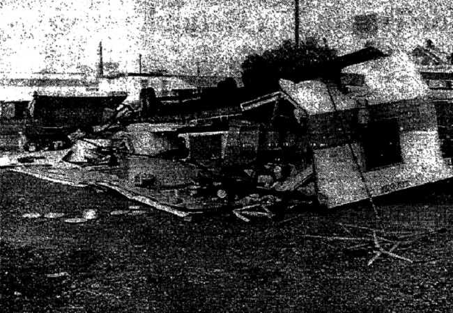
A destroyed trailer in the Licking County tornado of 6/5/1963.
Tornado #2: An EF2 tornado touched down for less than half a mile at 6:30PM about 2 miles southwest of Commercial Point in Pickaway County. The tornado lifted a house trailer off its foundations and rolled it over a fence. 2 children were injured and about $25,000 in damages occurred.
https://www.ncdc.noaa.gov/stormevents/eventdetails.jsp?id=10084260
Monday, October 8, 1962
A small tornado occurred in Columbus and Pickerington between 12:30AM-1AM, but while it was confirmed by the US Weather Bureau at the time, it does not show up in the official storm records at NCDC. In any case, the reported tornado first hit the Joyce Iron and Metal Company building in Columbus, taking its roof. It then hit a farm near the intersection of Refugee Road and Miller Road (Milnor?) in northern Fairfield County, damaging 4 buildings and carrying debris half a mile. No EF ranking or other data exists for this tornado.
October 8, 1962 Tornado
Tuesday, July 22, 1958
An EF2 tornado touched down in Licking County just to the east of Mt Vernon Boulevard and north of Pierson Boulevard just north of Newark at around 1pm. The 200-yard-wide tornado traveled 8.6 miles in a general east-southeast direction to a point just to the east-northeast of Rt. 16 and Rock Haven Road SE. Besides many trees and power lines being knocked down, at least 20 farms reported heavy damage to barns, outbuildings and homes. The tornado also reportedly carried a 1.5 ton boiler half a mile. This would be the first tornado from the storm, which also produced tornadoes and damage in Muskingum, Guernsey, Coshocton and Tuscarawas counties. Meanwhile, storms brought over 2″ of rain across Columbus, flooding many streets.
https://www.ncdc.noaa.gov/stormevents/eventdetails.jsp?id=10084507
Thursday, May 22, 1958
An EF2 tornado touched down about 3:15pm near Canal Road west of the Scioto River just southwest of Circleville. From there, the 30-yard-wide tornado traveled in a northeasterly direction, crossing Rt 23 and traveling along Crites Road. It continued moving northeast over Pickaway Country Club, passed the Pickaway/Fairfield County line less than half a mile north of Stoutsville, and ended to the southwest of the Justus Road SW and Wyandott Road SW intersection. The 9-mile path caused more than $250,000 in damage and 3 injuries. Strangely, I couldn’t find any news articles about this.
https://www.ncdc.noaa.gov/stormevents/eventdetails.jsp?id=10084491
Friday, March 19, 1954
At 8:50PM an EF1 tornado moved through a valley between the towns of Laurelville and Adelphi on the border of Pickaway, Ross and Hocking counties. This tornado was roughly 100 yards wide and traveled a path of about 1 mile. The tornado destroyed some outbuildings, trees and at least 4 homes in Laurelville. One home was punctured with 10-foot beams from a destroyed barn, narrowly missing a sleeping boy’s head. Losses were estimated between $20,000-$35,000. No injuries or deaths were reported.
https://www.ncdc.noaa.gov/stormevents/eventdetails.jsp?id=10083314
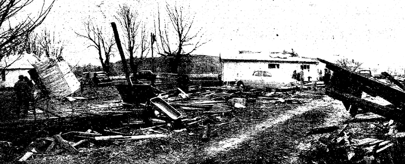
Damage from the 3/19/1954 tornado.
June 12, 1912
Storms hit the metro area during the afternoon and caused damage across the region. Several possible tornadoes touched down. In Dublin, the Christie Methodist Church, as well as the local Presbyterian church, were destroyed, trees were downed and several other buildings sustained roof damage. From Downtown Columbus to Linden, trees were downed, roofs were blown off, electric poles were snapped and billboards were demolished. Most of the damage in Columbus occurred between the northern part of Downtown through the Short North and east through southern Linden.
In addition, a tornado struck Downtown Plain City, causing significant damage to many buildings. In Grove City, a schoolhouse was destroyed and a few homes lost roofs. At least one person was killed in Worthington. One other interesting fact is that it was reported the storms were moving from southeast to northwest, a very unusual storm motion.
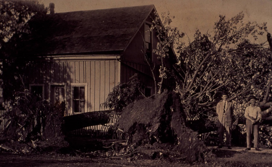
Damage at North High Street in Dublin after the 6/16/1912 tornado.
Tornado Events that will be added at a later date.
March 8, 1964
**Coming Soon**
https://www.ncdc.noaa.gov/stormevents/eventdetails.jsp?id=10084287
May 16, 1965 #2
**Coming Soon**
https://www.ncdc.noaa.gov/stormevents/eventdetails.jsp?id=10084010
November 16, 1965
**Coming Soon**
https://www.ncdc.noaa.gov/stormevents/eventdetails.jsp?id=10089739
November 27, 1965
**Coming Soon**
https://www.ncdc.noaa.gov/stormevents/eventdetails.jsp?id=10089751
Ohio Tornado Statistics By Year
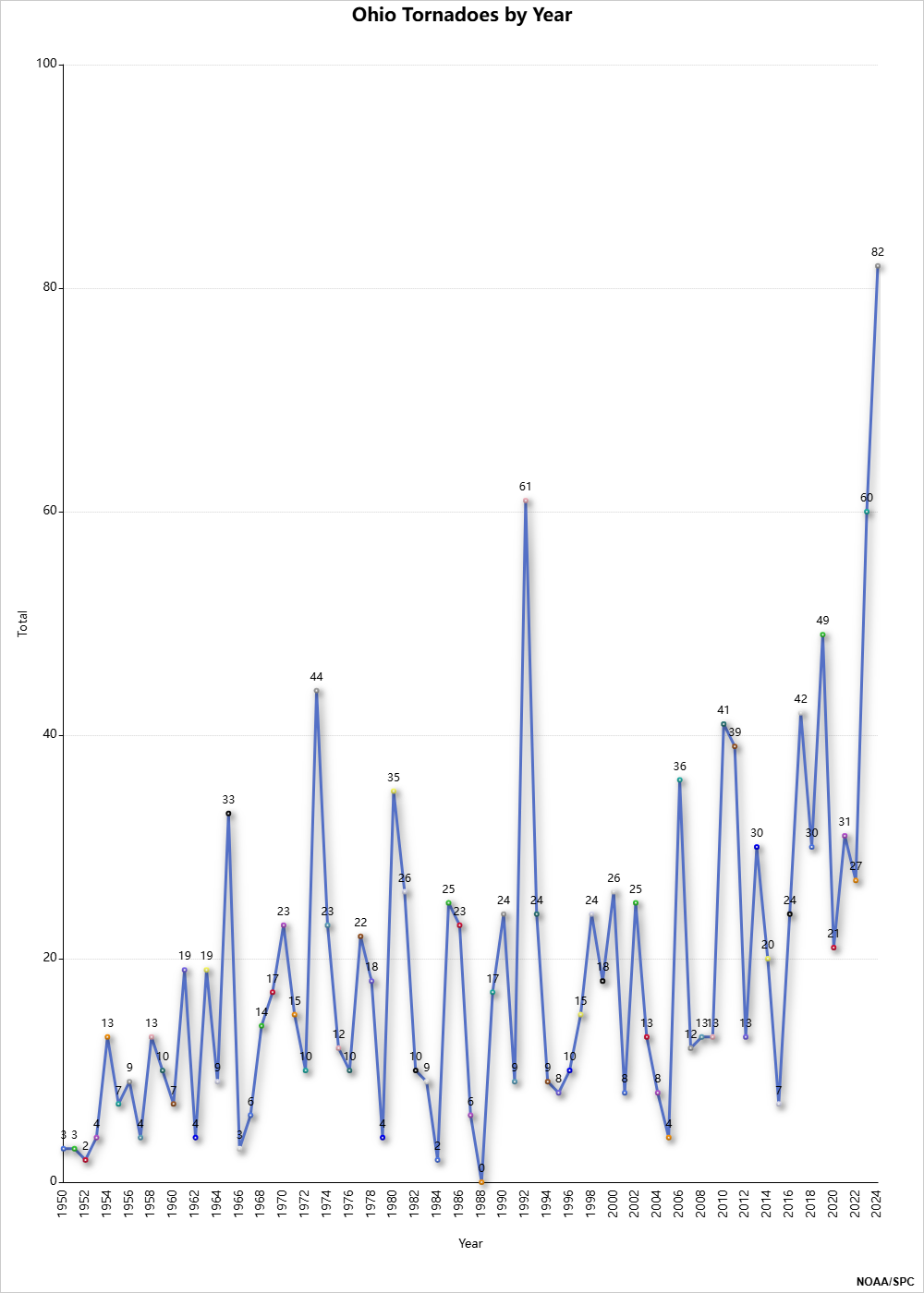
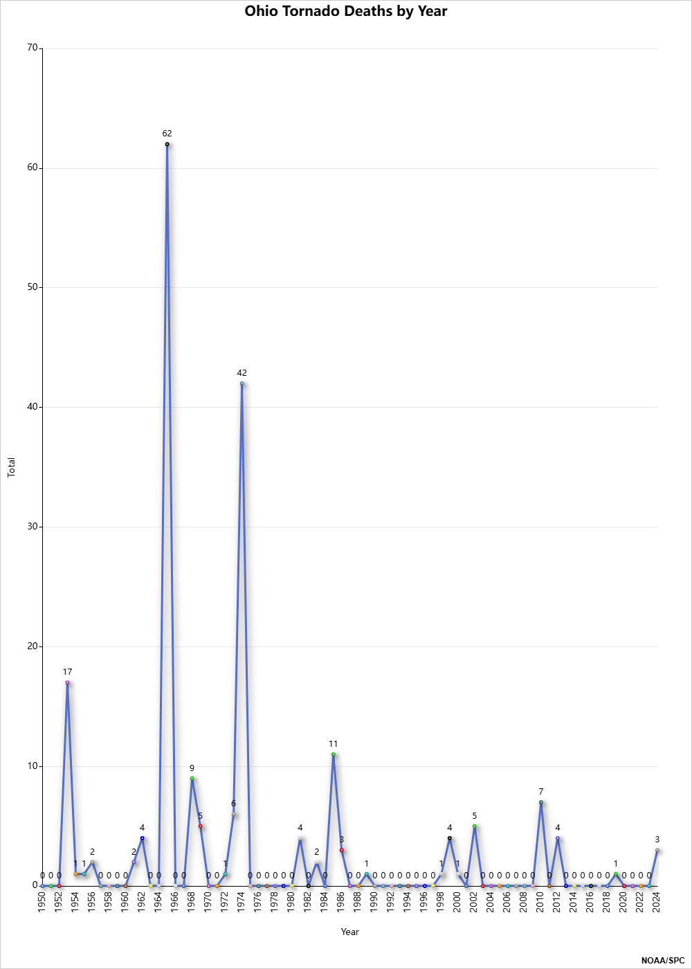
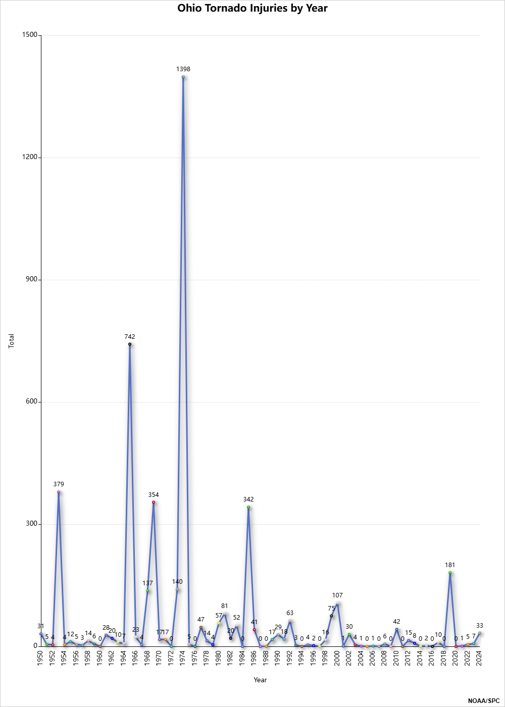
Tornadoes aren’t the only severe weather events in the Columbus area. The Weather History page provides links to all types of events going back to the 19th Century.


