
Part of a 1901 Columbus annexation map.
This page highlights Columbus and Franklin County historic maps going back to the 19th Century. Depending on a map’s file size, it is either offered as a plain image or PDF file.
**Last Updated: 7/10/2025- Added to 1930-1939.
1970-1979
1977
Soil Map of Franklin County
1976
Southwest Columbus Highways
1975
Franklin County Transit Service
1960-1969
1965
Columbus City School District and Schools
1950-1959
1959
Franklin County Highway Map
1951
Columbus
1940-1949
1943
Southeast Columbus
1930-1939
1936
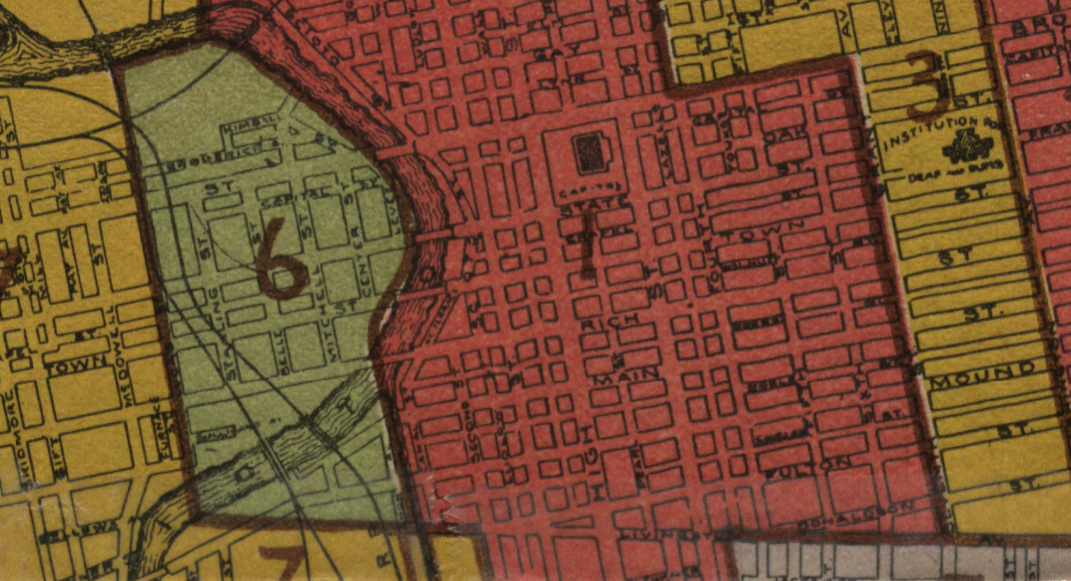
Columbus Redlining Map
Columbus Rental Rates
1933
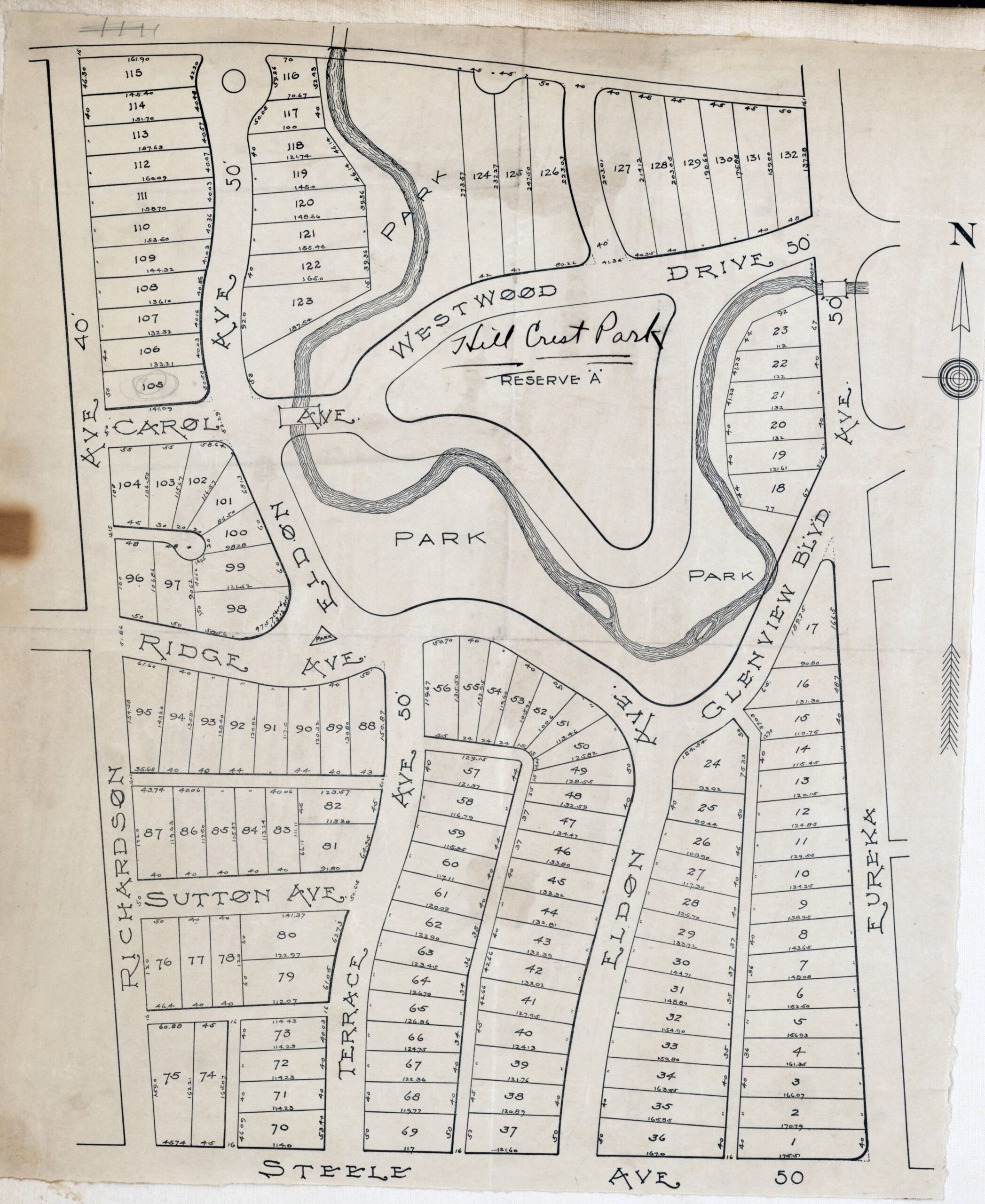
Blendon Township
1920-1929
1925
Southwest Columbus
Westgate
1920
Perry Township
1910-1919
1914
Ohio Historic Native American Trails and Towns
1911
![]()
![]()
1910
Ardmore Subdivision
Beechwold
Bexley Height Subdivision
Dominion Park
1900-1909
1907
Columbus
Old North Columbus and Clintonville
1890-1899
1899
City of Columbus Property Atlas 1
City of Columbus Property Atlas 2
City of Columbus Property Atlas 3
1895
Georgesville
Pleasant Township
1893
Norfolk & Western Railroad Terminals
1891
Ohio Railroads
1880-1889
1886
Ohio Railroads
1883
Franklin County Landowners
1870-1879
1878
Columbus
1876
Columbus
1860-1869
1865
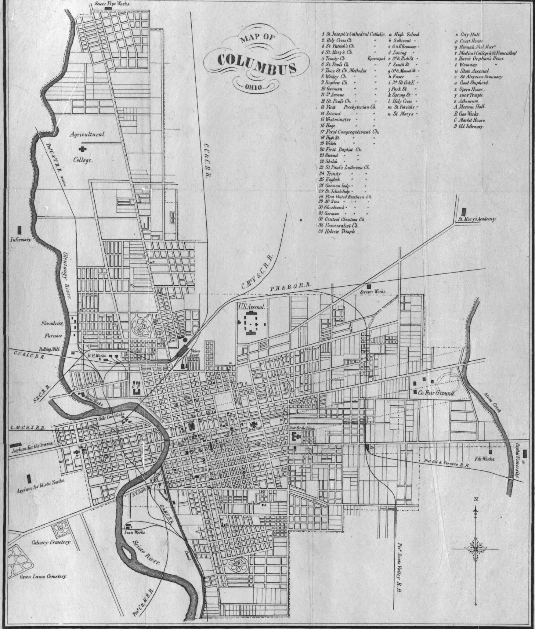
Columbus
1850-1859
1856
Columbus
Franklin County
1840-1849
1842
Franklin County Landowners
1810-1819
1812
Columbus and Franklinton Plots
The History Links page offers much more local history information for Columbus and the surrounding area, as does the https://www.ohiohistory.org/