
This page contains information about Columbus flood history, specifically about severe weather where flooding was the main event. Maps with severe weather and flooding reports are shown by year, where available.
For current river and stream levels and any flood warnings, go here: Advanced Hydrologic Prediction Service
If you are interested in viewing historic flood and precipitation-related text advisories, the the Flood Advisory Archive has them going back to 1983.
**Last Updated: 6/13/2025- Added to 1970.
2020-2029 Events
2022
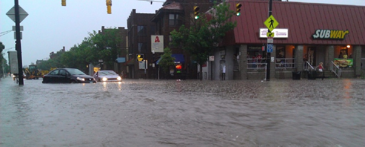
February 17-18, 2022
Waves of low pressure moving up a front boundary brought persistently heavy rains along the I-71 corridor through Columbus. Most areas in the Columbus metro received 1″-3″ of rainfall, causing widespread flooding. The Olentangy River overflowed its banks, flooding large sections of the Olentangy Trail through Columbus, and several area roads and underpasses were closed due to high water.
https://www.weather.gov/iln/20220217
2020
May 18-19, 2020
A very slow moving upper low brought persistent heavy rain beginning during the afternoon of the 18th and continuing through the early 19th. The hardest hit areas of Ohio were Southwest Ohio and Central Ohio, particularly the Columbus area. A general 3″-5″ fell during this period, most of it coming within a 12-hour period. Flash flooding was common throughout Columbus and rivers rose rapidly. The Olentangy River at Worthington rose to 13.57′ on the 19th, the 3rd highest crest since 1950. The Olentangy Bike Trail was flooded in multiple locations, as well as Olentangy Park, where buildings were flooded. The Scioto River at Frank Road reached 24.19′, the 9th highest crest since 1920, and the Scioto Greenways parks were heavily flooded Downtown. Rt. 23 at 270 was flooded over, shutting down the highway in both directions. At least 20 people were evacuated near Big Walnut Creek in NE Franklin County. Rt. 161 in Worthington was impassable at some flooded underpasses, and the athletic fields at Thomas Worthington HS were flooded. I-71 in and out of Downtown had some lane closures due to high water. At least one person was killed in SE Columbus. For more reports and rainfall totals, visit here: https://www.weather.gov/iln/20200518
March 20, 2020
Storms developed over the early morning and trained across the same areas for several hours. 2″-4″ fell, with the heaviest totals focused along I-70. Flash flooding was common and some neighborhoods were flooded.
https://www.weather.gov/iln/20200319
2010-2019 Events
2019
July 6, 2019
Slow-moving storms trained across portions of the area, dropping 1″-3″ of rain, causing flash flooding in several locations, particularly in Pickaway and Licking counties. See details here: https://www.weather.gov/iln/20190706
July 3, 2019
Slow-moving storms dumped 1-3″ of rain across the metro area, causing widespread flooding issues. See details here: https://www.weather.gov/iln/20190703
June 15-16, 2019
Multiple waves of storms moved across the area from the 15th into the 16th, bringing 1-3″ of heavy rain to the entire metro area. This caused localized street and creek flooding. See details here: https://www.weather.gov/iln/20190615
2018
February 6-7, 2018
Several waves of low pressure along a stalled front brought persistent heavy rains, leading to flooding across the area.
2016
August 28, 2016
Rounds of storms moved across the city during the day. A strong storm during the afternoon brought a microburst that downed trees. The main story, however, was rain. Up to 3″ of rain fell in a short time in some eastern neighborhoods as the microburst went through, flooding numerous streets and trapping some people in their cars.
2012
March 15, 2012
Thunderstorms developed over Central Ohio in the early morning hours, redeveloping over the same areas. Severe weather was limited to small hail in Worthington and Hebron, but the big story was flooding. The training storms brought heavy rain across Fairfield, Licking and Hocking counties. Hebron and the Buckeye Lake area experienced flash flooding in creeks and streams, as well as flooding over multiple roadways, with one woman becoming trapped in her car. Widespread flooding was also reported across Hocking County.
2000-2009 Events
1990-1999 Events
June 16th-18th, 1997
Rounds of thunderstorms brought heavy rain totaling 2″-4″ on already saturated ground. Roads were closed in Franklin and Delaware counties, but significant river flooding did not occur. The rains capped off the 12th wettest June since 1879.
May 31-June 2, 1997
A stationary upper level system dropped heavy rain across central and southern Ohio. Rainfall totals were generally 3″-5″, but totals reached 10″ in some areas, flooding roads and causing rivers to overflow. The Scioto River at Frank Road in Columbus crested at 24.78′, the 4th highest level since 1920, but levees and floodwalls protected the city. At Circleville, the Scioto crested almost 7′ above flood stage, at near 21′. Big Darby Creek reached 15.6′, the 2nd highest since the 1950s, extensively flooding farmland. In other areas, homes were evacuated in Milford Center in Union County and the Marysville Police Station flooded.
March 1-2, 1997
Several rounds of heavy rainfall across Central and Southern Ohio caused streams and rivers in the area to reach and surpass flood stage. Columbus received between 1-2″, but just to the south in Pickaway, Hocking and Perry counties, up to 4″ of rain fell. The Scioto River reached a height of 14.9′ at Circleville, causing lowland flooding. The Hocking River at Enterprise rose out of its banks and damaged buildings around Sugar Grove, reaching a height of 15.1′, more than 3 feet above flood stage. The major flooding in Ohio, however, was to the south. The Ohio River corridor had up to a foot of rain in 36 hours, washing out numerous bridges and flooding hundreds of homes. The Ohio River crest at Cincinnati of 64.7′ on March 5th- more than 24′ above flood stage- was the 9th greatest in history. Damage in Central Ohio was several million dollars, but was a billion-dollar disaster in the Ohio River valley.
May 1-May 18, 1996
Persistent heavy rainfall kept the Scioto river in flood stage for most of the month. Agricultural areas and low lying county roads close to the river were flooded. Also, the high water levels caused backwater flooding where the Ohio Brush and Darby creeks meet the Scioto river. State Highway 56 was under water and a trailer was swept into the river. The crest for the month was 20.4 feet at Circleville, 6.4 feet above flood stage.
1980-1989 Events
Monday, June 2, 1980
**See the Severe Weather Outbreaks Page**
1970-1979 Events
April 24, 1970
Heavy rain brought by thunderstorms caused flooding across the Columbus area.
Columbus Dispatch 4-24-1970 Part 1
Columbus Dispatch 4-24-1970 Part 2
1950-1959 Events
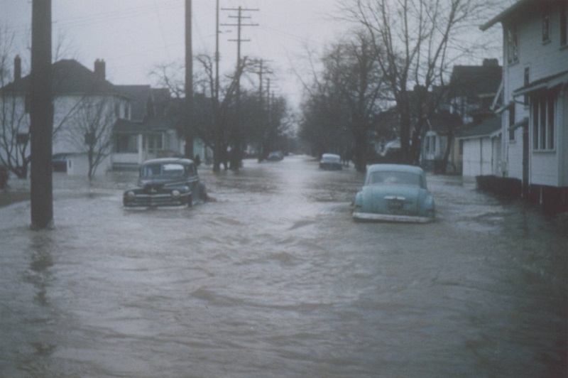
January 21-22, 1959 Severe Floods
On the 19th and 20th, a light rain and snow gradually became a heavy rain late on the 20th. The heavy rains were concentrated in a 50-mile-wide band from the southwest to northeast, focused along and just northwest of I-71. 4″-6″ of rain fell between the 19th and 21st, with the majority occurring during a 12-hour period on the 21st. Frozen ground caused high runoff, creating flood conditions across the area.
In what would be the worst flood in Columbus since 1913, Alum Creek flooded large sections of the East Side. The Near East Side was flooded all the way west to Miller Avenue, and Bexley was almost completely cut off as every bridge but Agler Road were flooded. The East Side flood encompassed an area from Fairwood Avenue to just east of Alum Creek, and from 5th Avenue south to Champion Avenue. This was the first flood known on Alum Creek in the city’s history.
On the West Side, a levee failure caused the Scioto River to flood Franklinton between Glenwood and Central Avenues and south along the Scioto River across Whittier Street and Greenlawn Avenue. The Scioto River at Frank Road crested at a record 27.22 feet, still the highest known since 1913.
More than 2000 people in Columbus had to be evacuated, and schools were shut down citywide. The cities of Newark, Gahanna and Circleville also had evacuations and significant flooding. Damage across Central Ohio was in the tens of millions, but there were relatively few deaths.
Franklinton in the 1959 flood.
April 3-5, 1957
Heavy thunderstorms moving across the area produced 2″-5″ across the area, causing nearly all area rivers and streams to meet and exceed flood stage. A teenager drowned in Deer Creek near the Madison County/Fayette County line, and some families had to be evacuated along Alum and Big Walnut Creek. The Scioto River flooded lowland areas and parks along its banks through Franklin and Pickaway counties, and recreational areas were flooded under feet of water around Griggs, O’Shaughnessy and Hoover Dam.
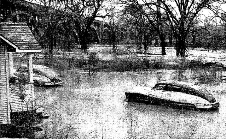
Flooding along Alum Creek near Sunbury and Agler Roads in April, 1957.
Sunday, July 8, 1956
Thunderstorm moving through Central Ohio brought strong winds and up to 5″ of rain to some areas in just a few hours. In Licking and Perry Counties, flash floods destroyed bridges and flooded a 4-H camp, where 18 campers had to be rescued.
Tuesday, July 3, 1956
A “sudden” thunderstorm struck Clintonville, Worthington and Westerville hardest during the evening. Aside from hail up to 1″ in diameter, lightnight that struck at least 5 homes and causing a fire in one of them, the main story was heavy rain. Up to 3″ of rain fell across northern Franklin County communities in about an hour, causing many roads to become flooded. Water reached 3 feet deep across Rt. 33 between Bethel Road and Dublin.
Thursday, June 21, 1956
Heavy thunderstorms on Thursday night caused a flash flood across parts of three counties in the Columbus area. Blacklick Creek in Franklin County damaged parts of Reynoldsburg and Pickerington, and French Creek destroyed a bridge on Reynoldsburg-New Albany Road. Dozens of roads were closed by high water in Franklin, Licking and Fairfield counties, with at least 9 of them due to washed out bridges. In Pickerington, the storm was described as one of the worst in memory with up to 4″ of rain reported there in about an hour, with water flowing 6 feet deep in some buildings. More than 100 homes overall were damaged by flooding, as well as high winds and hail.
January 1-6, 1950
A constant rain across the state brought 3-5″ across Central Ohio during the first week of January, 1950, culminating in an ice storm on the 5th and widespread flooding by the 6th. At least 18 families had to be evacuated when Big Walnut Creek threatened to overtop a levee. 5 additional families were evacuated by boat in the Wonderland Park neighborhood north of the airport. At least 12 Franklin County roads were closed and lowland flooding was common in many neighborhoods.
1940-1949 Events
June 2, 1944
A severe thunderstorm struck Columbus during the afternoon. Lightning-caused fires damaged several buildings across the city and high winds brought down trees and power lines. 1″-3″ of rain accompanied the storm, flooding many streets and basements.
1910-1919 Events
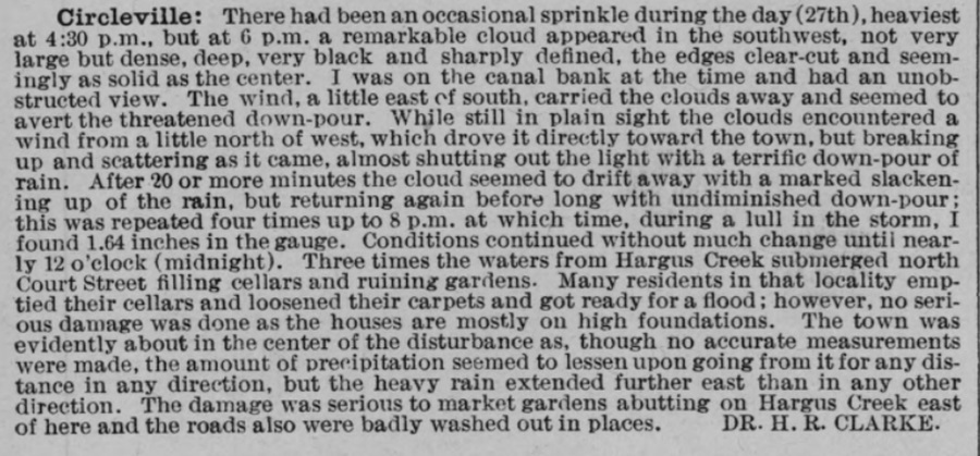
August 27, 1920
Repeated rounds of heavy rain in Circleville brought flooding. A description of the event was provided in the July, 1920 Weather Bureau report.
March 22nd, 1916
A strong early spring system over the Great Lakes brought severe weather and high winds to Northern Ohio, with heavy rains across the eastern portions of Central Ohio. The Scioto River flooded lowlands around Columbus, but did not rise enough to trigger evacuations. The story was different along the Licking River in Licking County, as the river overran its banks, damaging lines for the Electric Traction Company between Newark and Zanesville.
March 23-27, 1913- The Great Flood
The Great Flood of 1913 began on the 23rd of March, when two low pressure systems moved along a similar path through the Great Lakes, the first on the 24th and the second on the 26th. The lows followed each other so closely that the rain from them merged into a single enormous rain shield that brought rain to all of Ohio beginning on the 23rd and continuing through the 27th.
The rain was most heavily concentrated from about Preble County north and west through Mansfield and Akron. All but the far southeastern part of the state had 6″ or more, with more than 11″ reported in parts of the northern Miami Valley. Columbus received 6.97″ over the period. This rain was coincidentally heaviest along the headwaters of many of the state’s major rivers, including the Scioto.
Flooding in Columbus began on the 25th, when the first levee failed on the West Side. Nearly ever building for 4 blocks was washed away on Central and Glenwood Avenues in Franklinton, and water reached more than 17′ deep in parts of the neighborhood. Many bridges along the Olentangy and Scioto rivers collapsed, including the Broad Street bridge Downtown. Hundreds of residents were stuck clinging to trees and roofs in low-lying areas. Fires would also break out in several areas, burning down factories, homes and other buildings to the water line. In total, more than 300 homes and businesses were destroyed, with another 4,000 damaged. 93 people died in Columbus during the flooding.
Outside of Columbus, every other river in the metro- and most in the state- reached record or near record flood stages for the time. In Delaware, for example, dozens of homes and businesses were destroyed and 18 people died from the Olentangy.
Across the state, the flooding killed at least 467 people, flooded more than 40,600 homes- with more than 2,200 destroyed- and caused about $113 million in damage, or the equivalent of about $3.4 billion today. It is still the deadliest and one of the costliest natural disasters in both Columbus and state history.
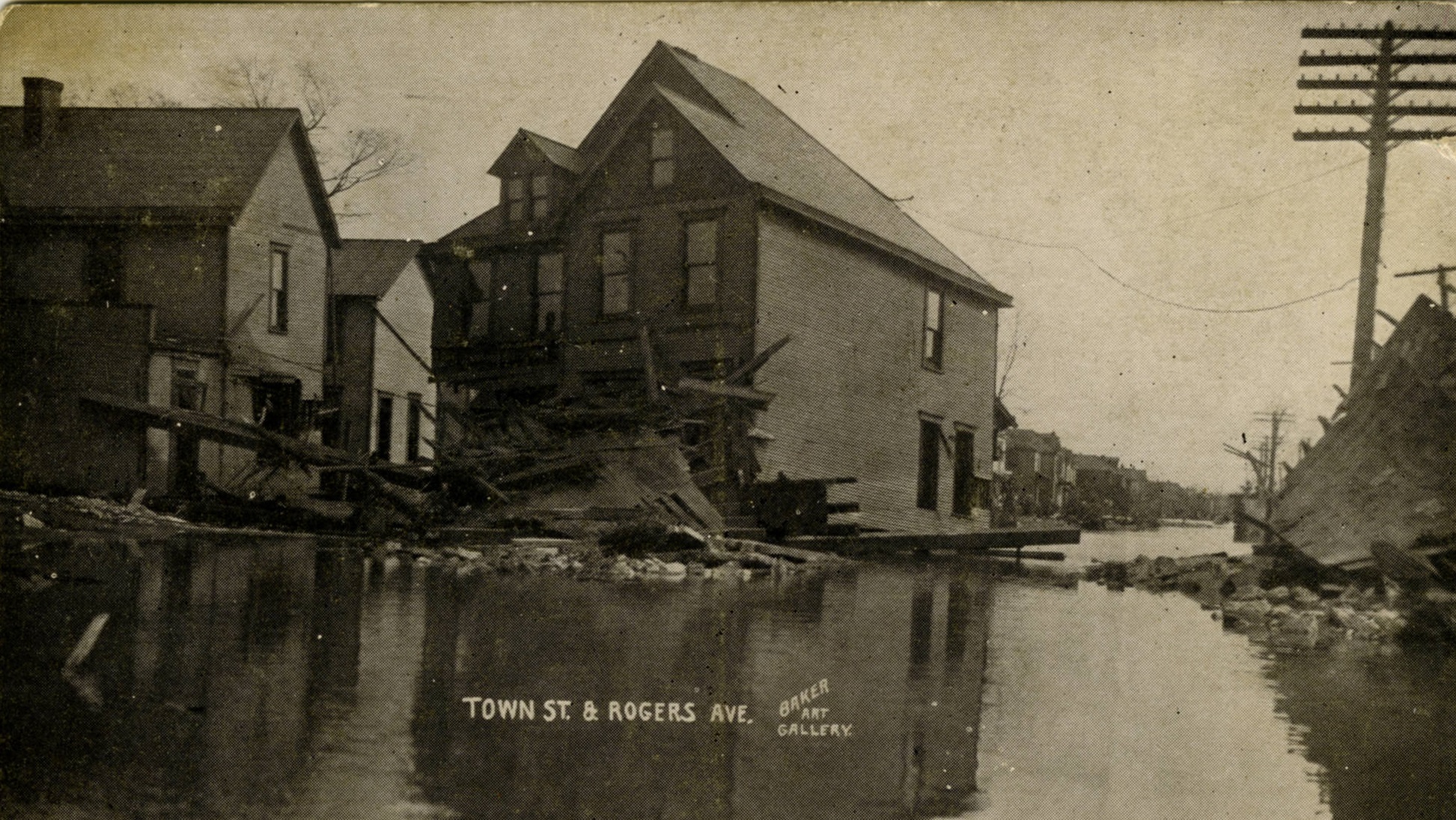
West Town Street and Rogers Avenue in March, 1913, after the flood.
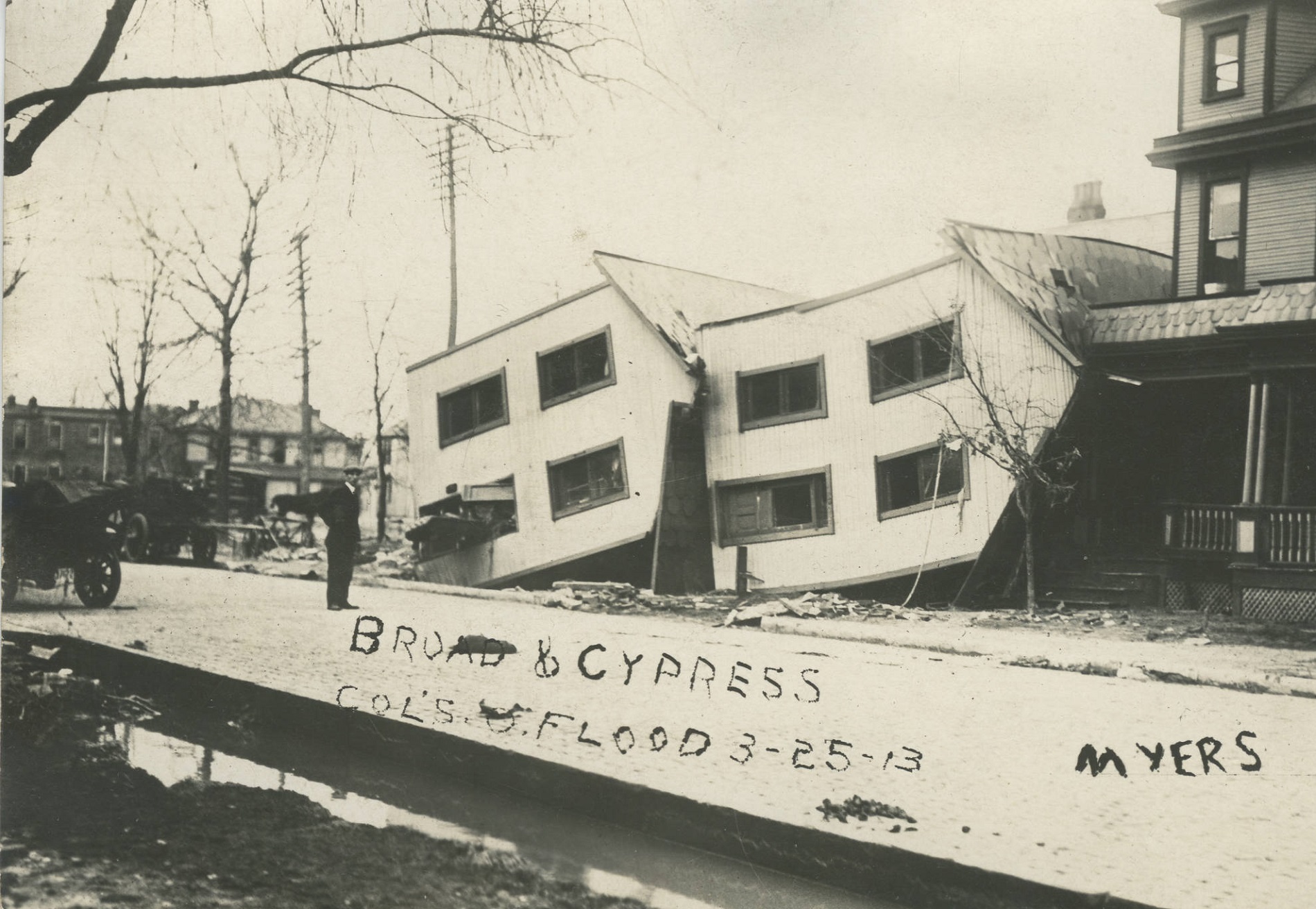
West Broad Street and Cypress Avenue in March , 1913.
1900-1909 Events
May 11-12, 1905
Heavy rain “pelted down” all day and into the night on Thursday, May 11th, with the area receiving at least 2″. By early Friday morning, both the Scioto River and Alum Creek were rising rapidly. The Scioto crested at 10AM at 14 feet, which washed out roads and railways, and damaged the city light plant. Alum Creek washed out of its banks and flooded Main Street with more than a foot of water. Holtzman Manufacturing company along Alum Creek had its basement flooded and caused about $15,000 damage, and water rose to the front doors of houses along Holtzman and Hamilton avenues. Other businesses and homes along Alum Creek also suffered flood damage.
1880-1889 Events
August 28, 1883
From the Columbus Evening Dispatch:
The rain storm which passed over the city this afternoon was the heaviest this year. In the short space of thirty-nine minutes, one inch and forty one-hundredths of an inch of rain fell, being about as much as fell during the balance of the month.
Cellars on Spring Street near High were flooded by the overflow, and the water in the Spring Street sewer filled it so full that it overflowed through the pipe into the cellar of the new building being constructed by Stevens & Thacker. Some small wooden crossings near the City Prison were swept off and almost carried into the river, while High Street was covered between the curbstones.
Historic weather events, advisories and other data can be found at Weather History