The Recovery of Ohio Downtowns Revisited


A little more than 4 years ago, I posted numbers on the recovery of Ohio downtowns, and what that might mean for the future. That post has proven to be one of the site’s most popular. I figured it was time to take a look at their continuing changes.

recovery of Ohio downtowns
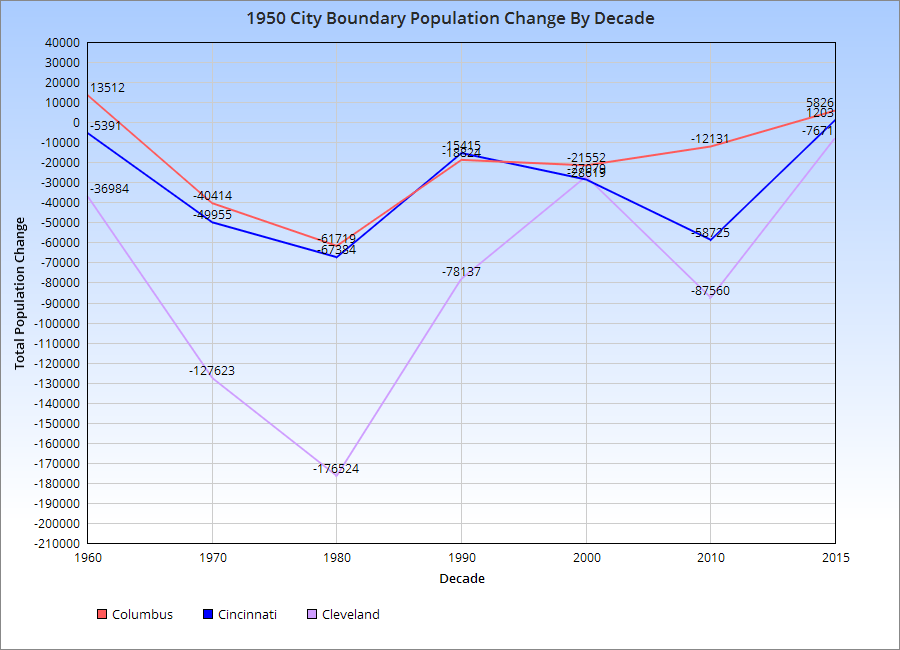
You can see by the chart for the 1950 Boundary population, the urban core of each city, that all 3-Cs suffered population losses post-1950. However, the rate of losses gradually declined, and 2 of the cities, Columbus and Cincinnati, appear to be growing in this boundary since at least 2010. Cleveland continues to lose.

This is shown further by the chart below.

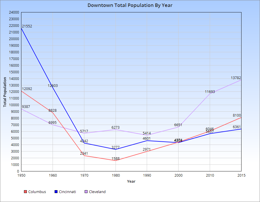
As far as the actual Downtowns of each, here are the population trends.

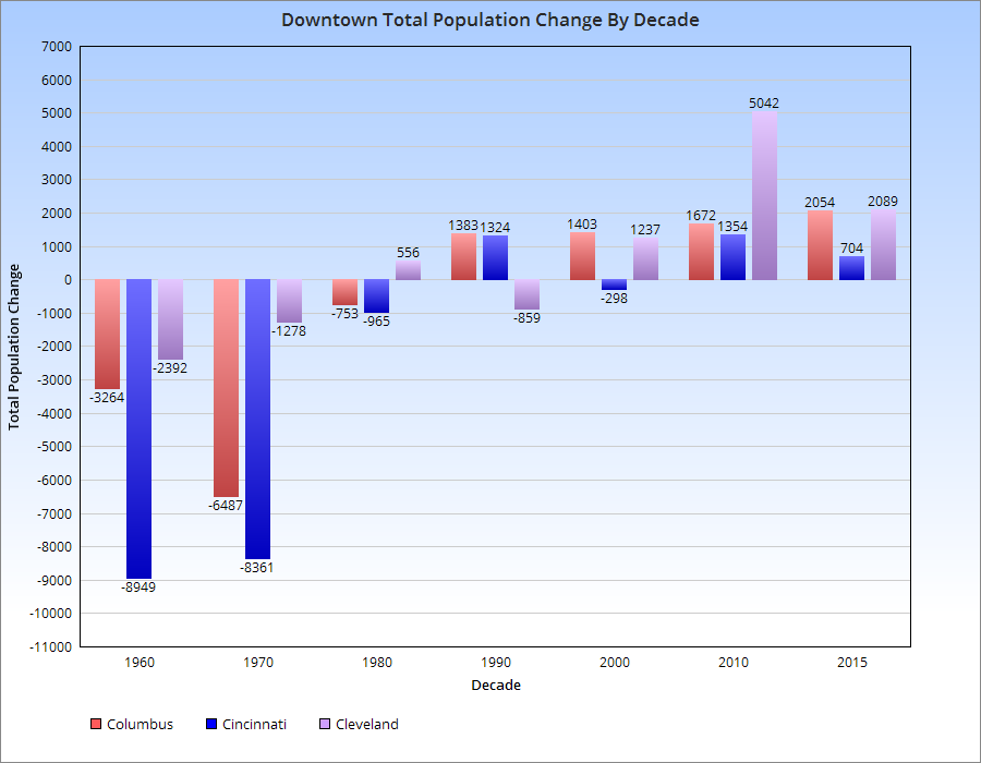
For the most part, population declines in the 3-Cs peaked around 1980, give or take a decade. Since then, all of them have seen increases, with Cleveland seeing the most rapid increase and Cincinnati the least. Columbus has seen steady, but increasingly rapid growth with each subsequent decade since 1980.

Here is the chart for Downtown growth by decade.


Random Columbus Photos 4


The Random Columbus Photos 4 edition takes a look back at Downtown in the 1980s.

Date Photo Taken: 1989
Photo Location: Looking west on Broad Street from LeVeque Tower.
Random Columbus photos 4
This photo is interesting for a few reasons. First, it shows the beginning of construction to replace the Broad Street Bridge over the Scioto River. After the Great Flood of 1913 destroyed an earlier Broad Street Bridge, the one in the photo was finished in 1921. By the early 1980s, the bridge was rapidly deteriorating and the decision was made to replace it. It’s reconstruction start, however, was delayed until 1988 due to a contract to keep the Columbus 500 auto race going, which used the bridge. The nearly identical new bridge was completed in 1992 at a cost of $13.2 million.
Across the bridge is the Scioto Peninsula. On the right is Vets Memorial, built in the 1950s and recently demolished to make way for a new memorial and museum as part of the redevelopment of the peninsula. On the left is the old Central High School, years before it was converted into COSI’s new location. Also of note are warehouse and other buildings that still existed on the peninsula, remnants of when this area was largely manufacturing. These were mostly demolished in the 1990s and early 2000s and were left as vacant lots for well over a decade, some of them becoming parking lots for COSI. These lots will soon become part of a large mixed-use development and park.