Before and After Franklinton


*Some photos have been updated since the time of the original post.

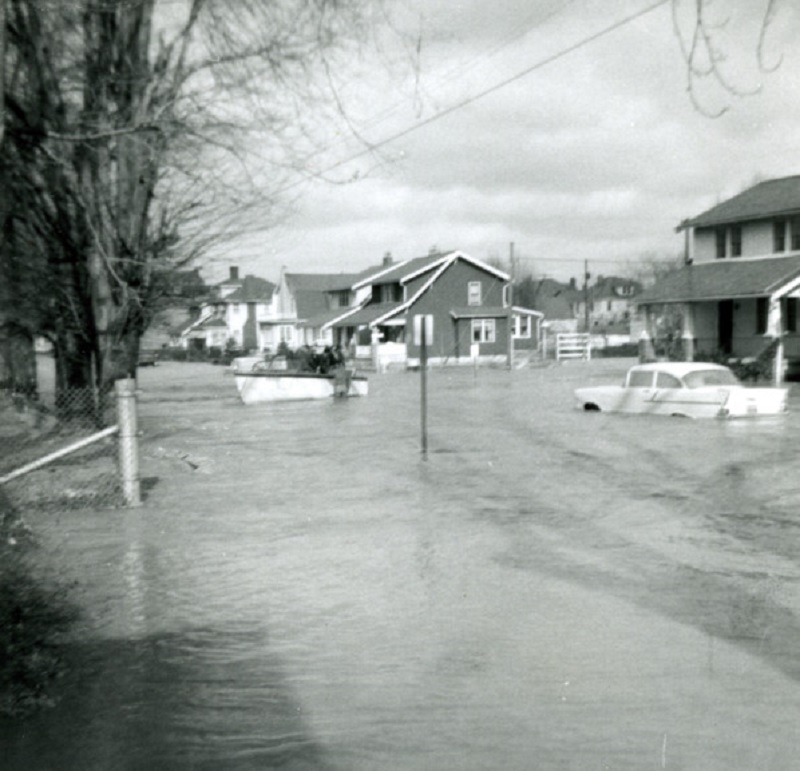
Before: South Central Avenue, looking north, during the flood of January 21-24, 1959.
Before and After Franklinton
After: 2015

The 1959 flood was the 2nd worst in the history of Franklinton after the 1913 disaster. The Frank Road crest on the Scioto River came on January 22, 1959 and was 27.22 ft, 3.22 ft above flood stage and a few feet below the 1913 crest. This crest would not cause serious flooding in Franklinton today, as the Franklinton Floodwall, completed in 2004, will protect the area to crests of up to 30.9 ft. Few people know that, prior to the wall’s completion, federal guidelines prohibited almost all types of construction in Franklinton, a contributing factor in the gradual decline it faced after the 1950s.

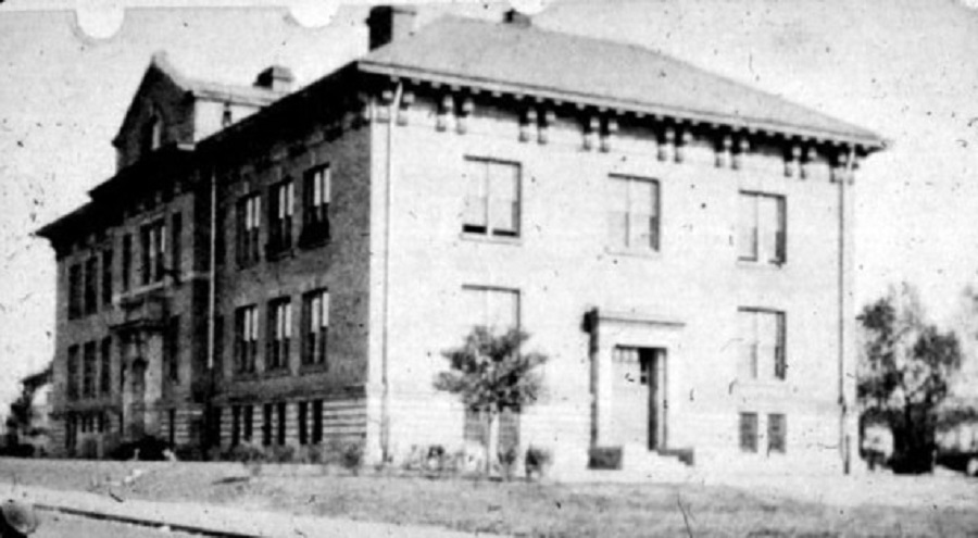
Before: Bellows Avenue Elementary on Bellows Avenue in 1922.

After: 2017

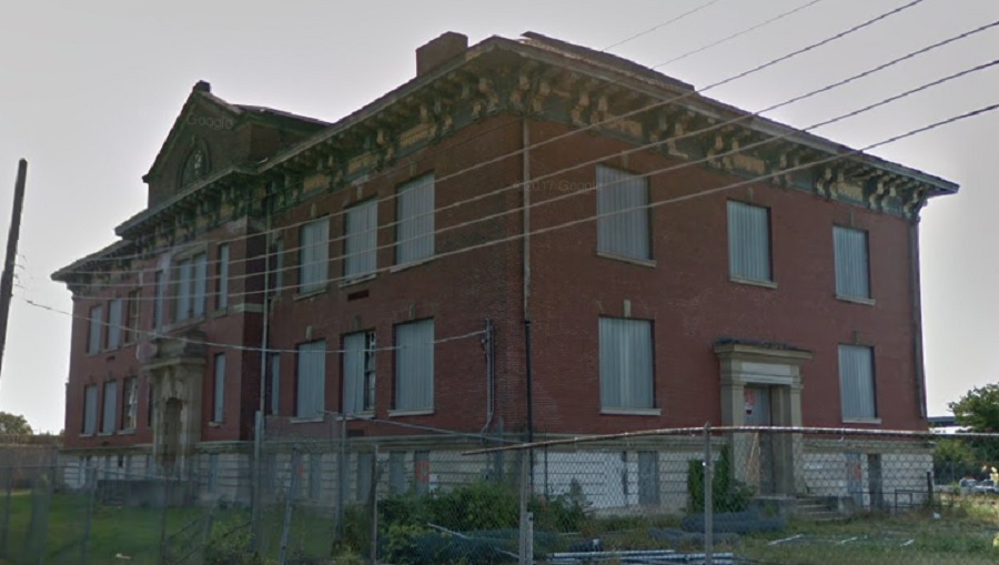
Bellows Elementary was opened in 1905 and barely escaped destruction during the I-70/315 highway construction. The building remained a school through the 1970s before closing and being sold by the city in 1984. It has remained vacant since then. Recent proposals to turn it into apartments, particularly as Franklinton has begun a massive revitalization, and the building has received a new roof, so further deterioration has been stopped for now. The building, however, is threatened by possible demolition once the 70/71 split is reconstructed in sometime in the mid-2020s.

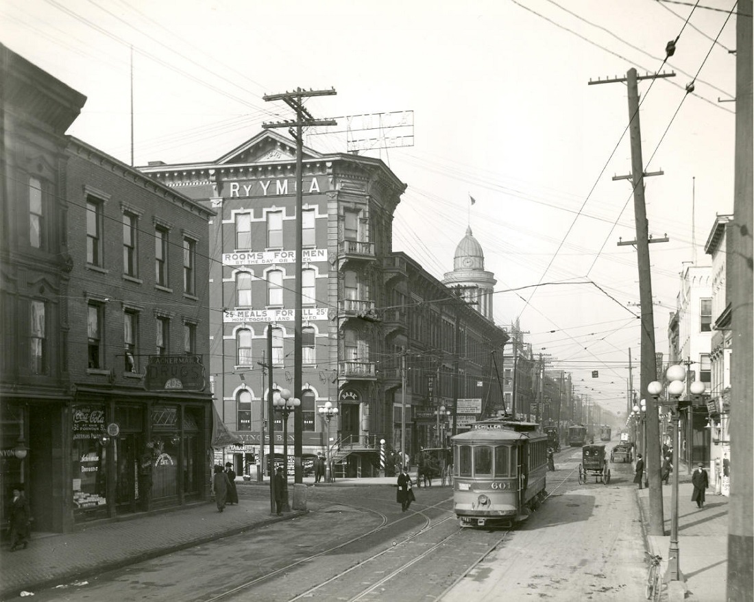
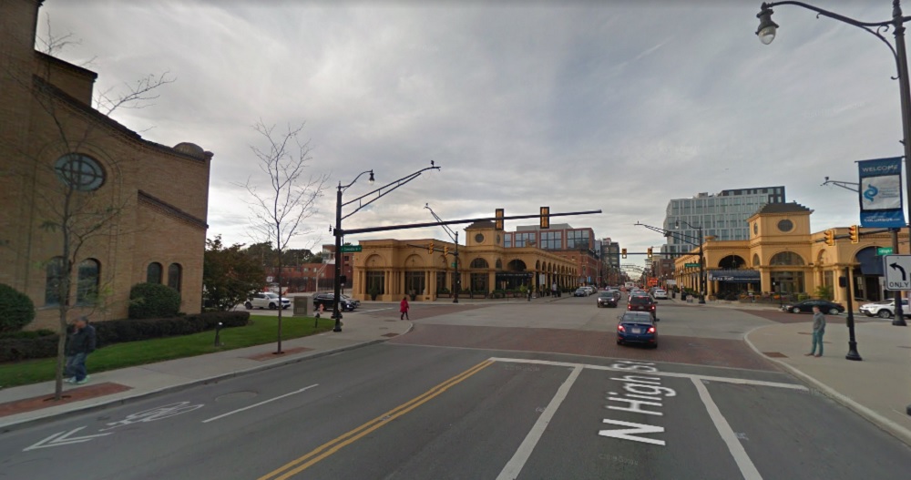
Before: The Columbus Heating and Ventilation Company building at 433 W. Town Street in 1916.
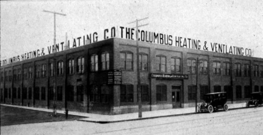
After: 2016

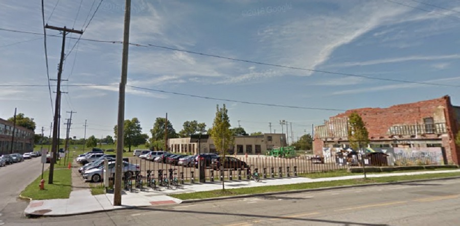
The Columbus Heating and Ventilating Company began in 1903 and still exists in the city, although obviously not at its original location. It later served as factories and parts of the complex were even used to enrich uranium for the Manhattan Project. The old building eventually went into severe disrepair and most of the roof had collapsed by the time it was demolished in 2011 as one of the first steps in the area’s rebirth. Multiple redevelopment plans have come and gone for the site, but so far, nothing has come of them.

Before: Mt. Carmel Hospital, looking southwest on Davis, in 1909.
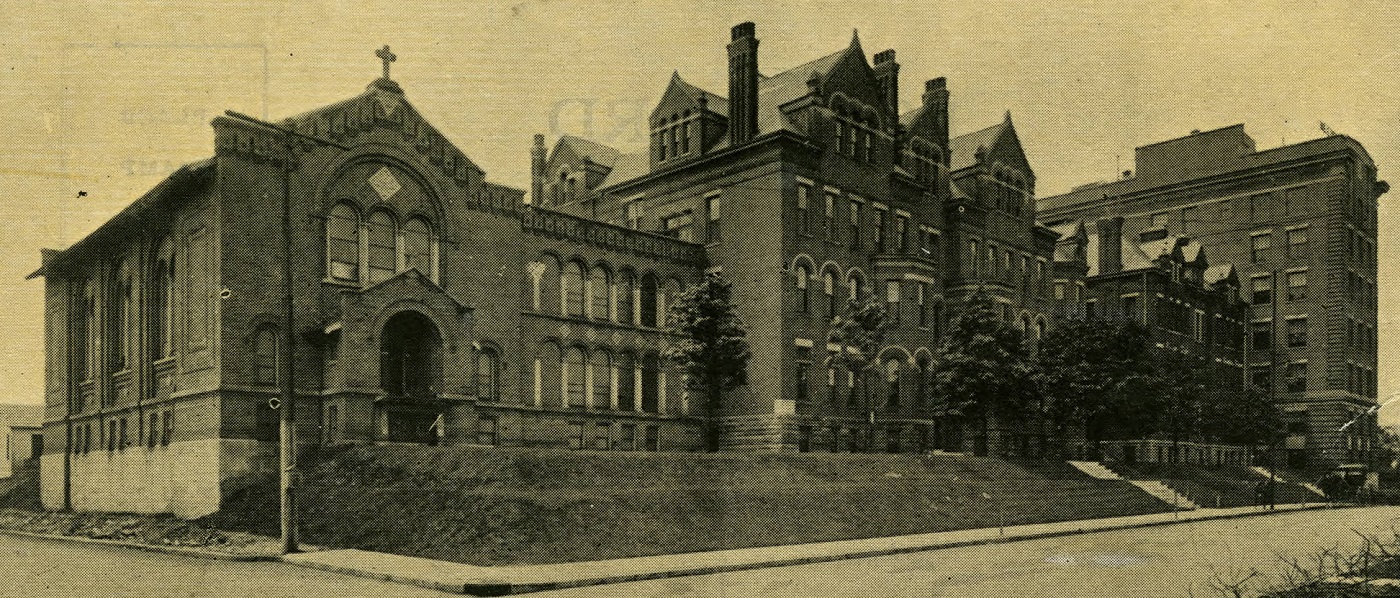
After: 2018

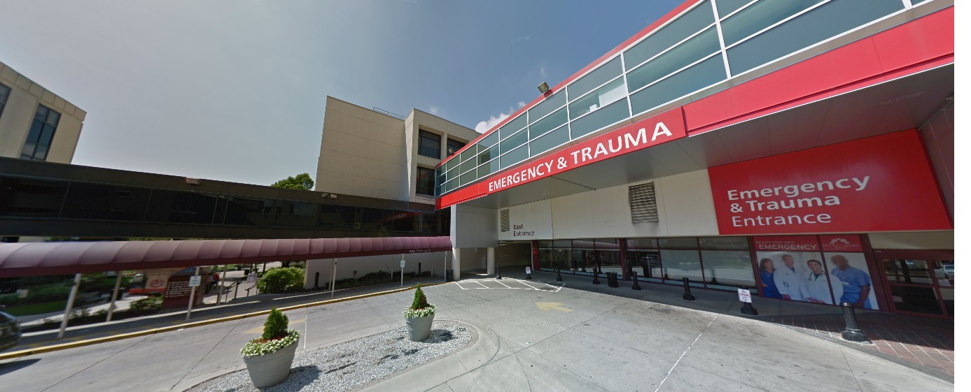
Mt. Carmel was originally known as Hawkes Hospital. The first section was completed in 1886, with later expansions in 1891 and 1908. Eventually, the old structures were deemed outdated for modern hospital purposes, and the entire complex was demolished in the late 1940s. Today, the site is very different, with the current buildings built on top of the old Davis and State Street intersection. The hospital moved most services to a new location in Grove City in recent years, with plans to demolish part of the complex to create a new mixed-use development.

For thousands more before and after photos from all parts of the city, click here:
Historic Building Database


Before and After February 2013


To an urbanist, the following sets of photos are truly disturbing. I’ve heard it said many times over that Columbus is a new city filled with suburban design, and that it never really had a true urban, historic core. The sad thing is that that is dead wrong, and I say it’s sad because so much of it was lost in the name of progress. 99 years ago, Downtown was truly a beautiful, vibrant place, and the present-day shots only serve to make the transformation all that much more awful. You have to wonder what people were thinking in terms of design and the way that they systematically destroyed the environment that made the city what it was.

In any case, the photo set from 1914 was apparently taken by a photographer that walked the length of High Street starting from the intersection of Town Street all the way up to Goodale Avenue at the beginning of the Short North. They are some of the best historic photographs I’ve ever seen of Downtown Columbus. Let’s begin the tour.

Before and After February 2013

Photo taken at High and Town looking north.


The photo above at Town and High shows Lazarus Department Store on the left. It is one of the few buildings that remains today, as shown below.

Town and High in 2016.

The next set is the before and after from Capital Square, just south of the Broad and High intersection. The tall building in the center of the photo is 8 E. Broad and one of the few still standing today.

Capital Square looking north.


Capital Square in 2016.

The next few photographs show the very heart of Downtown, the intersection of Broad and High. A few buildings remain, but most is gone.

Broad and High looking north.


Broad and High in 2018.

Next is High Street just north of Broad and looking north. Notice just how many buildings are gone.

High and Gay Street, looking north.


High and Gay in 2017.


Up next is the intersection of Long and High, just south of the Atlas building (on the right). The Atlas Building still exists and is in the process of renovation. There are also a few buildings across the street that survived. Few others did.

Long and High in 1914.


Long and High in 2018.

For the 2nd to last set, we have the intersection of Spring and High. The old Chittenden Hotel is the large building on the left with the Lyceum Theater behind it. Most of these buildings were torn down to make room for the Nationwide complex in the 1980s. There is literally not a single building from 1914 still standing in this area.

Spring Street and High in 1914.


Spring and High in 2018.

And finally, we have the intersection of Goodale Avenue and High Street. This before and after shows a drastic transformation. Many of the buildings in the photo, including the building with the beautiful domed rotunda, were demolished to clear the right of way for the construction of I-670. Others succumbed due to the Convention Center’s construction or the Greek Orthodox Church’s expansion in the 1980s. There is only one point of reference to know this is the same place. To me, this is the most tragic photo of all. Like so many cities, Columbus had incredible architecture in abundance, and the leaders in the middle part of the 20th century squandered it all away, leaving the current generation trying to rebuild a divided, empty shell of what once was. Much of it, however, can never be restored. Let it be a visible reminder that development has real consequences if not followed through wisely.

Goodale and Avenue in 1914.


Goodale and High in 2018.