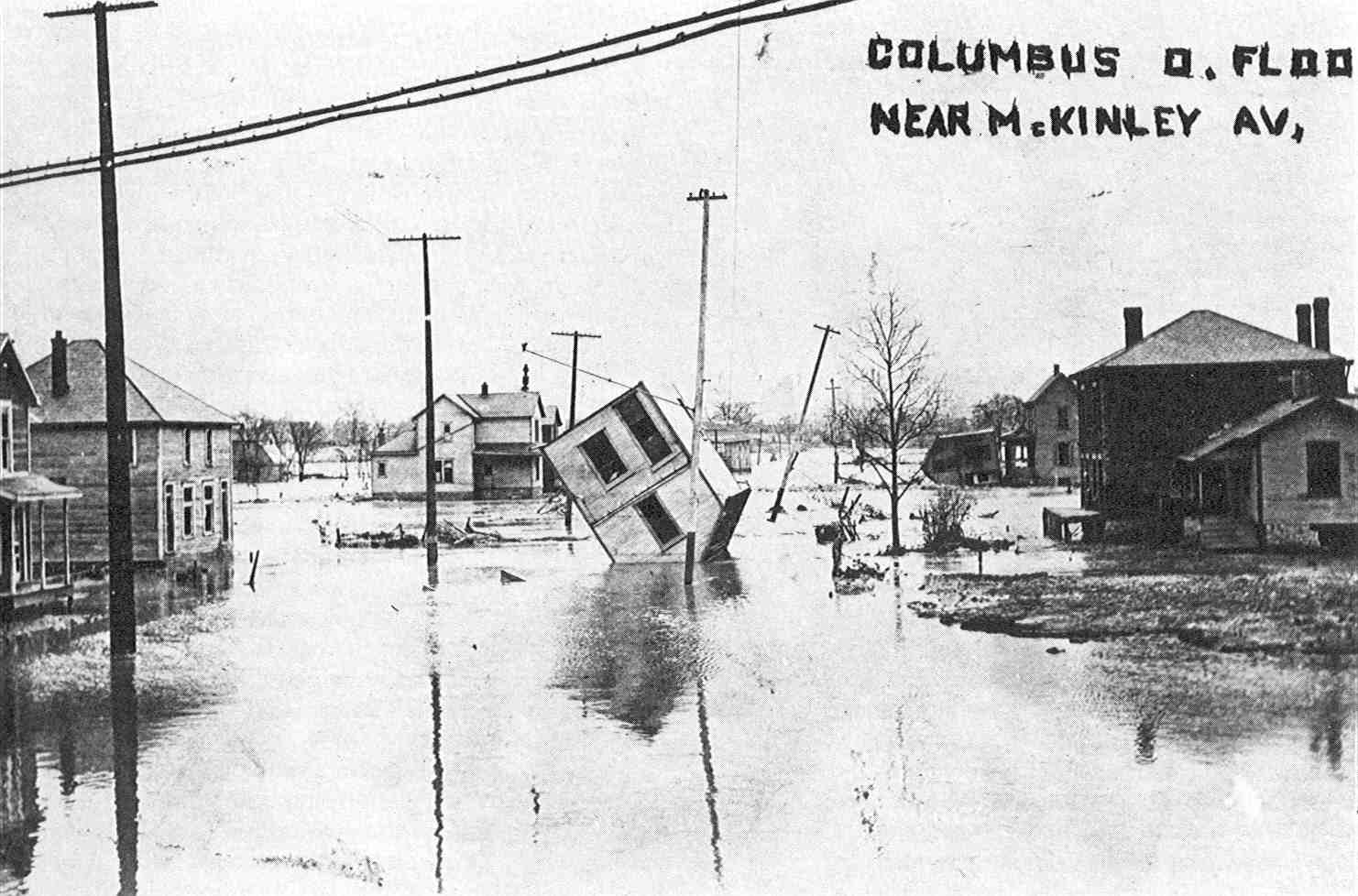
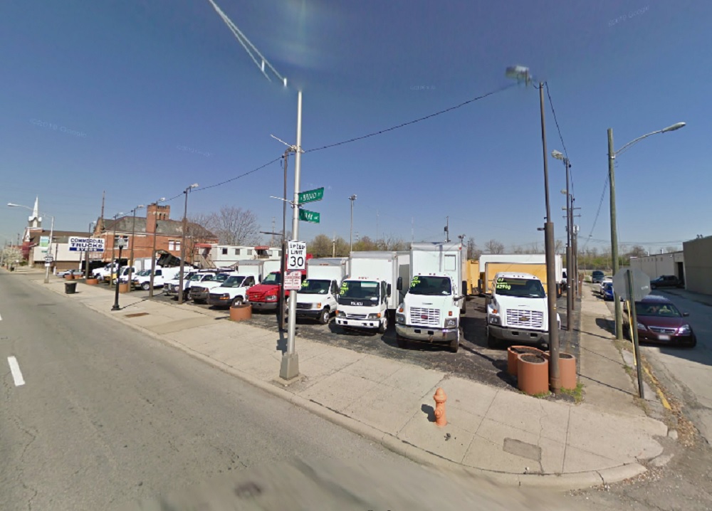
Photo Location: Intersection of McKinley Avenue and North Souder Avenue, looking west. Photo Date: March, 1913 Photo History: The Great Flood of 1913 was the most devastating and deadly flood in Ohio history. 6″-12″ of rain fell between March 23-27, 1913 as two weather systems followed one after the other. Most of the rain fell across the headwaters of major rivers, including the Scioto. The subsequent flood destroyed levees in Columbus and flooded parts of Franklinton- among other areas- with up to 17′ of water with a record crest. The entire riverfront suffered heavy damage with hundreds of buildings damaged or destroyed. 100 people were reportedly killed around the city. Floods like 1913- and later in 1959- eventually led to the federal government limiting new development and investment in Franklinton, which caused it to decline for decades. It wasn’t until 2004 with the completion of the Franklinton floodwall that those limitations were lifted.
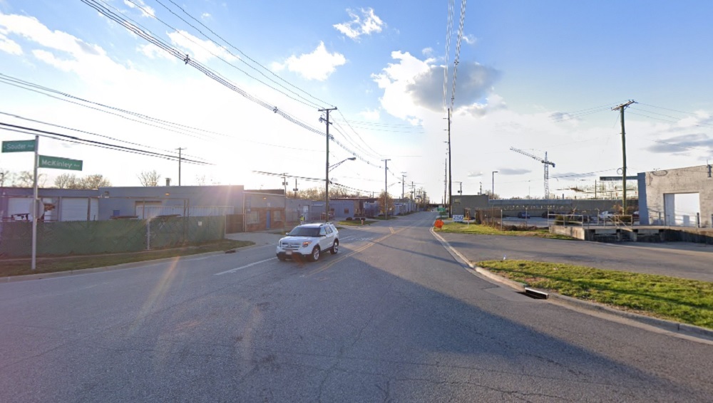
The same view today.
Columbus wasn’t the only victim of this great flood. Virtually every major city saw some significant impact, but Dayton arguably got it much worse than any other.
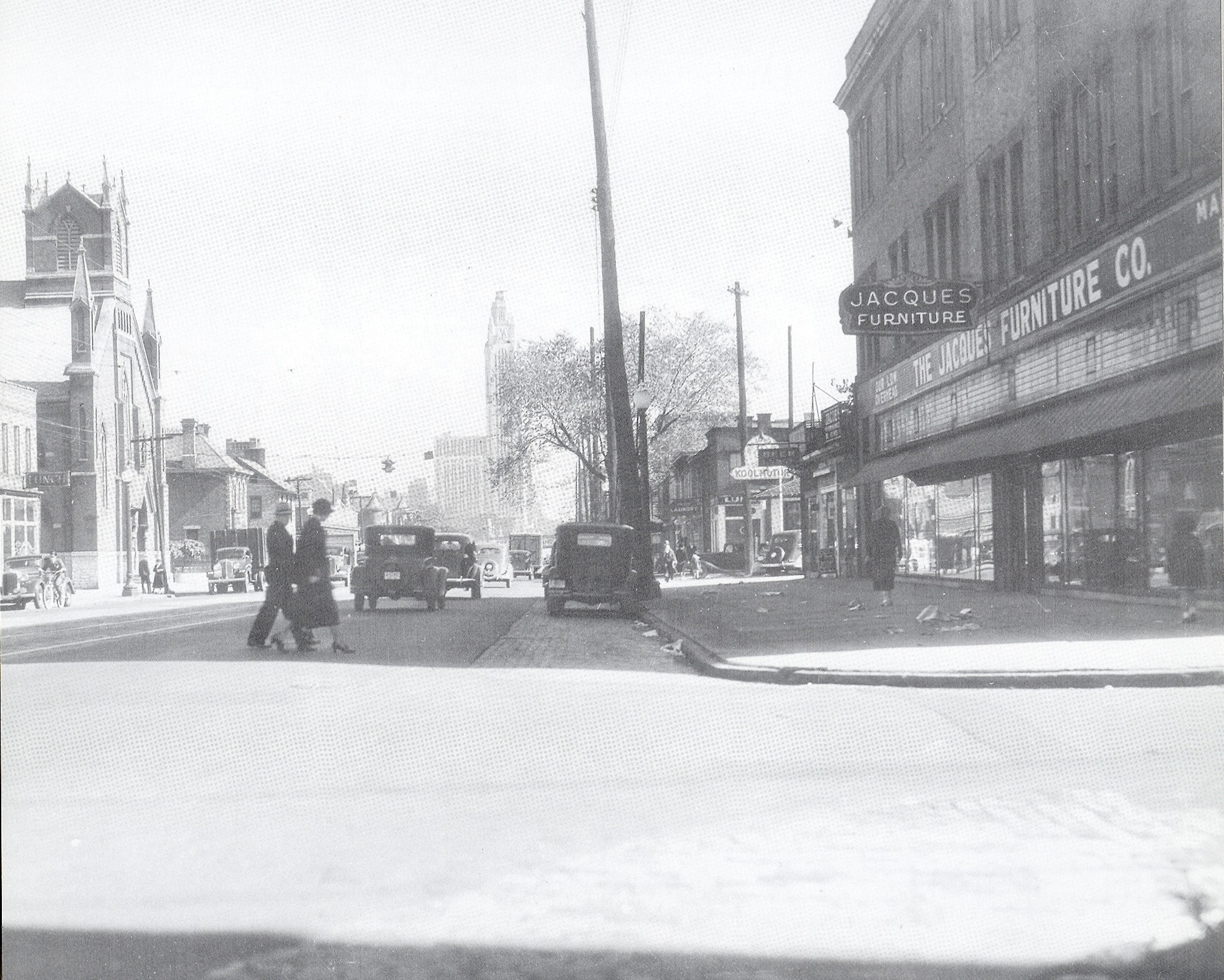
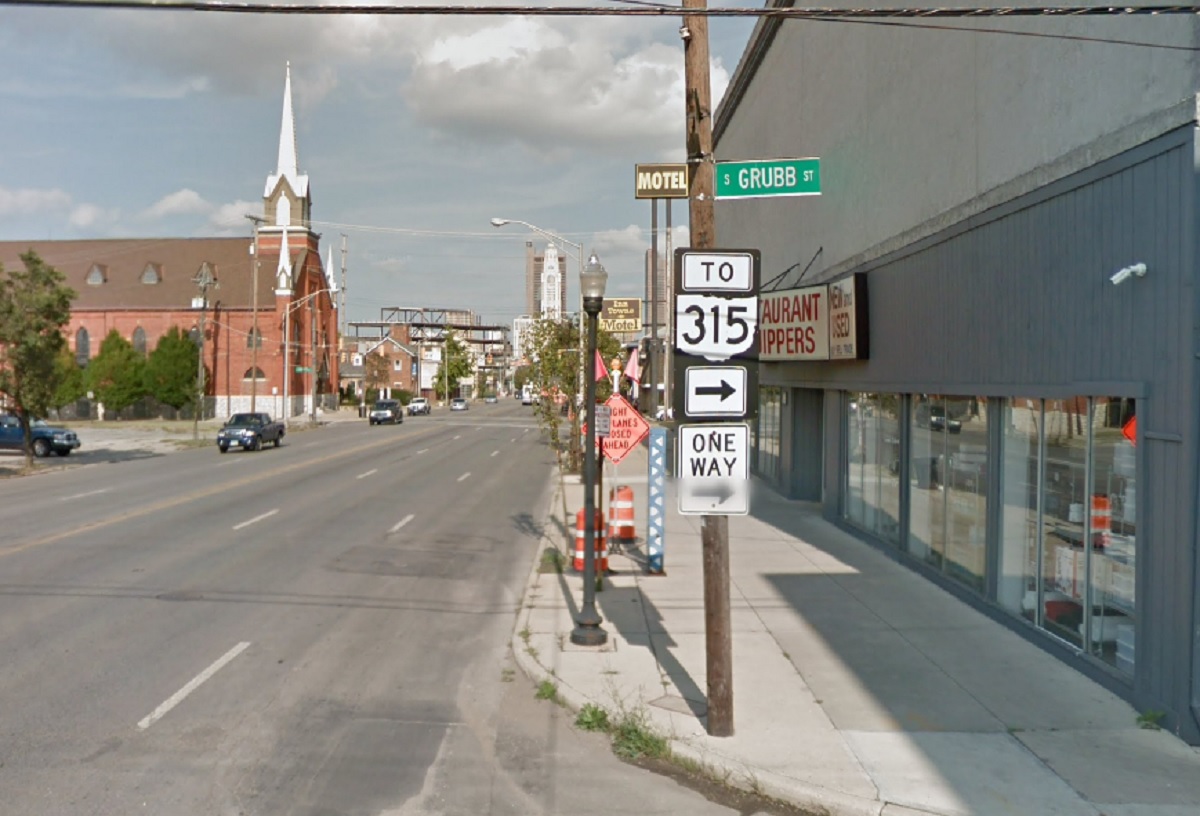
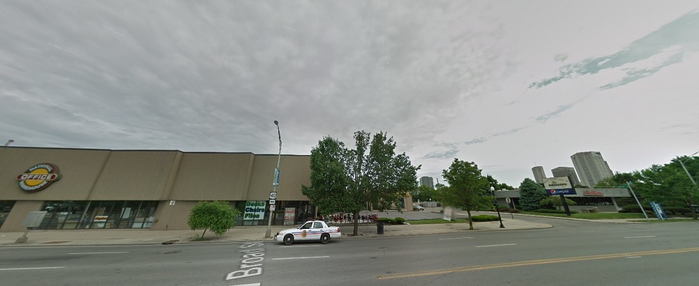
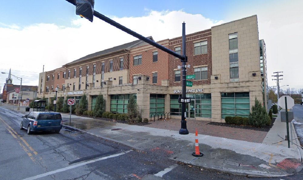
Photo Location: West Broad Street at Grubb Street, looking east. Photo Date: 1937 Photo History: Franklinton was bustling in this pre-WWII era-photo of Broad Street. It had been 24 years since the Great Flood, and the neighborhood was reaching for its historic population high along with the rest of the urban core. Unfortunately, within 2 decades, the neighborhood would be devastated by yet another flood and would be followed by 50 years of stagnation and decline.
Columbus saw a ton of new development proposals the past year, but not all of them have a future. Here are 3 major Columbus proposals that died in 2021.
Harmony Tower Originally announced in the summer of 2020, this proposal called for a 30-story, mixed-use tower to replace a parking lot at 158 N. High Street Downtown. The $100+ million project would’ve included a hotel, 15 floors of condos, office and retail space. After announcing the project, Schiff Capital went silent and the project basically disappeared. There were no updates, no news. In some ways, it was a reminder of the way Arshot had gone silent on the SPARC project years earlier. Sometime over the summer of 2021, plans for the tower were quietly abandoned, though no reason was given as to why. Speculation for its cancellation mostly revolved around Covid and its consequences related to supply chains and rapidly rising costs of construction materials. Sadly, this was not the only skyline-altering proposal that went belly-up this year.
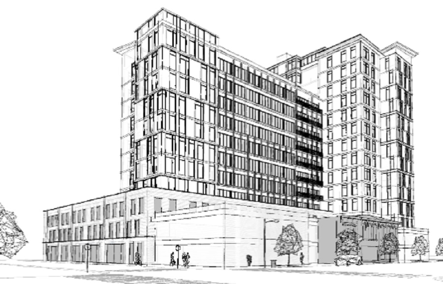
Whittier Peninsula Tower At the end of 2019, a North Carolina company announced a proposal for a significant new development along the railroad tracks just to the east of Scioto-Audubon Metro Park in the Brewery District. The plan called for for the multi-phase development of 10 buildings, including a mixed-use tower that would reach up to 30-stories, with a 7-story and 12-story containing another 400 residential units and retail and office space making up the first phase. The use makeup of the 30-story tower and other buildings had not been determined fully at the time.
Rendering of the original 30-story tower.
As with Harmony tower, after the initial announcement there was radio silence for months. 18 months later, in June of this year, new renderings for the proposal all but confirmed that the project had gone through a serious downsizing. Instead of 10 buildings with heights between 7-30 stories, the update consisted of just 5 6-story apartment and retail buildings. Unfortunately, the scaling down wasn’t finished. In early October of this year, yet another update was released. In it, the 5 6-story buildings had been reduced to to just 3. So the number of buildings had been reduced by 70%, and the top height was now 5x shorter than the original proposal. To me, it seems like a pretty blatant case of the developer never having the necessary resources- or ability to access the necessary resources- required for the original proposal, and by the end of it, the neighborhood development commission was just happy to approve whatever leftovers the developer had really intended to build all along.
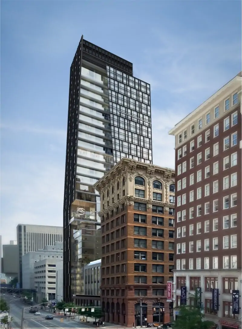
The Mondrian The Mondrian was originally a 13-story tower for 567 W. Broad in Franklinton. It was by far the largest proposal for Franklinton to date in its new revival. The Mondrian would’ve had 80 residential units and ground-floor retail space along Broad Street.
The 15-story Mondrian proposal rendering from Spring 2021.
In April we found out that the proposal had actually increased in height to 15 stories, likely to try to take advantage of new, large-project state tax credits, but otherwise, there was no known movement on this project. We know by now that no news on a big project tends to be bad news, and while there has been no official word that this project has been canceled, the evidence points that it has met an end. It was reported earlier this month that the listed site for the project is now up for sale, indicating that the proposal is likely dead. That said, this project could still have some legs to it and the situation will be monitored until a more definitive answer is known.
Proposals come and go, and in a city growing as fast as Columbus, the more proposals the city gets, the more likely it is that some of them never come to fruition.
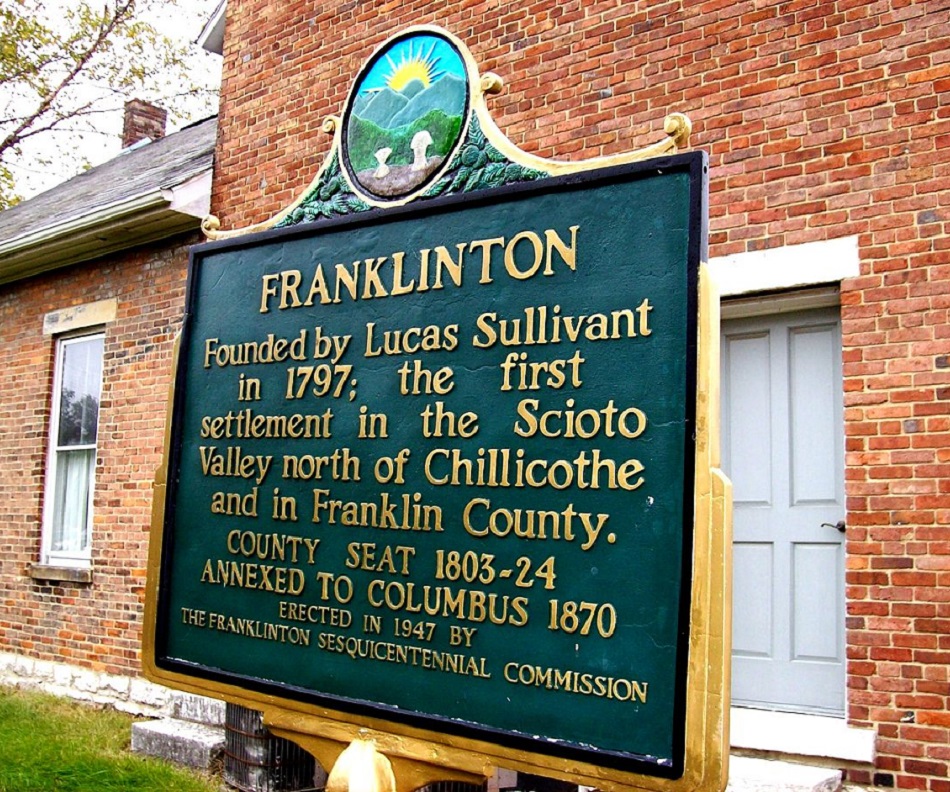
Franklinton has been known as The Bottoms for many years, mainly because the low-lying neighborhood has seen flooding more often than anywhere else in the city. With the completion of the Franklinton Floodwall nearly 20 years ago, the neighborhood has been seeing redevelopment at an ever-increasing pace. This Before and After of the neighborhood only covers some of the changes, and another similar post detailing more changes will most likely be needed.
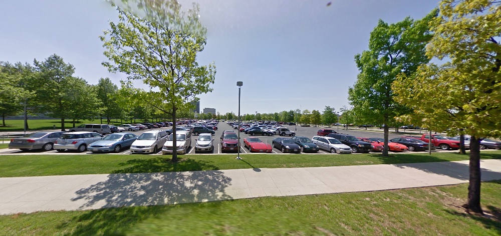
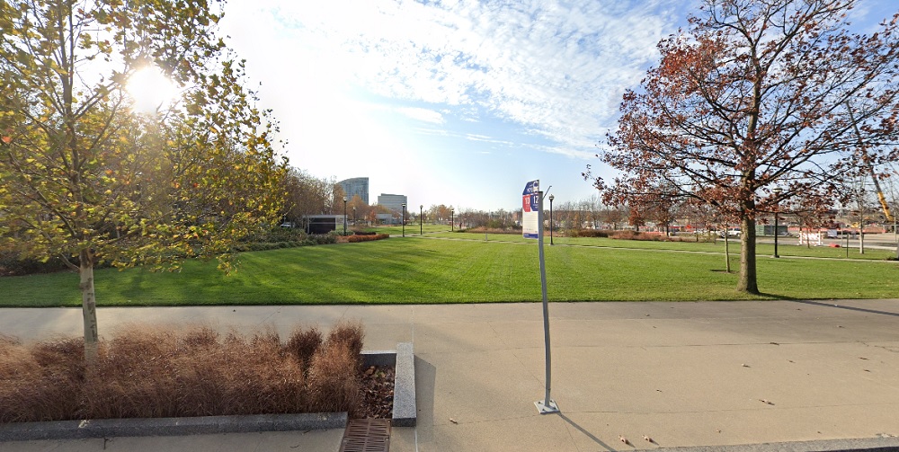
Before: COSI Parking Lot in 2009 This large parking lot had once been part of Central High School’s campus and was originally the site of the schools track and athletic fields. After the school closed in the early 1980s, the area was converted to a large parking lot. It continued its life as parking when COSI moved from Downtown to a new facility in the converted school. When plans for the Scioto Peninsula to be redeveloped emerged, it was decided to turn the parking lot into a brand new park. After: New Park in 2020 The parking was not actually lost, however. An underground garage was constructed beneath the park itself, which is now called Dorian Green. New development, which will include offices, retail and hundreds of new residences, can be seen under construction in the background.
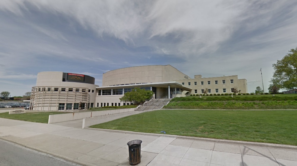
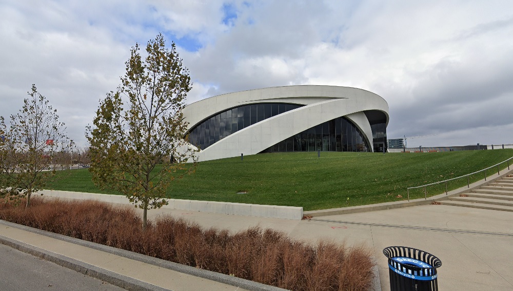
Before: Veterans Memorial in 2011 The old Veterans Memorial was constructed in the mid-1950s. Over the subsequent decades, the building was renovated and expanded multiple times. By the 2000s, the building was considered outdated with a convoluted layout. Despite some objections, it was decided that the complex would be torn down and replaced with a new veterans center. After: National Veterans Memorial and Museum in 2020 The new building had a far more modern, almost futuristic design, like something out of an X-Men movie. The new building was to remain a veterans memorial with office and event space, but also serve as a museum. It was eventually given the status of being the National Veterans Memorial, the only one of its kind in the nation.
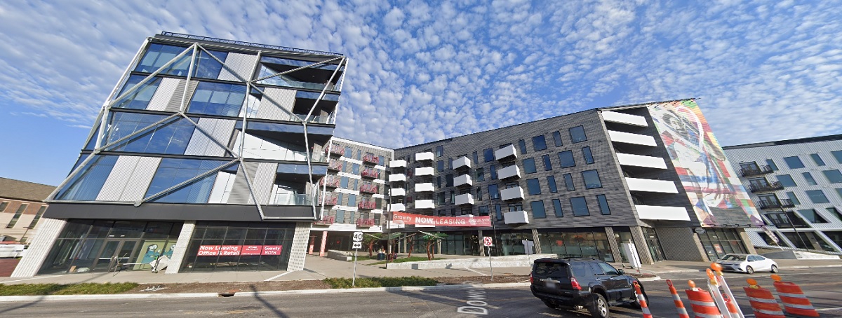
Before: 500 West Broad Street in 2011 Back in 2011, 500 W. Broad was a collection of small businesses, most notably Wasserstrom restaurant supply. This stretch of Broad was unremarkable and a more modern remnant of urban renewal during the mid-20th Century. After: 500 West Broad in 2020 Today, the first phase of the Gravity development occupies the entire stretch. This unique mixed-use development contains, among other things, apartments, retail space, community art and activity space for its residents. Directly across the street, the 2nd- and much larger- phase of Gravity is currently under construction.
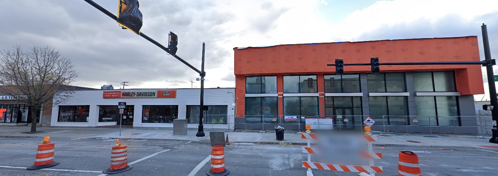
Before: A.D. Farrow Harley Davidson in 2012 A century after the business was established, this Harley Davidson sales shop just down the street from Gravity looked out of date. Half the site was also a parking lot that fronted Broad Street. After: A.D. Farrow Harley Davidson in 2020 In 2020, the business was engaged in a significant remodel and expansion. Local business investments such as this have been on the rise in Franklinton in recent years, especially east of 315.
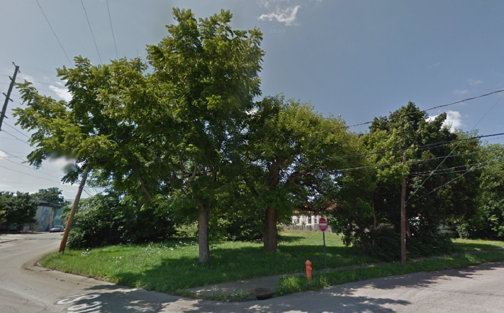
Before: 524 West Broad in 2009 This site had been used as a car lot for some time. The original buildings had been demolished in the early 1960s, replaced with surface parking. After: 524 West Broad in 2020 Today the site is home to Franklinton Station, a lower-income residential complex for seniors.
Before: West Rich Street at the Railroad Crossing, looking west in 2009 This view of West Rich Street shows how the area had been in decline, with abandoned buildings on the right and run-down public housing on the left that had seen little investment since its construction in the early 1960s. After: West Rich Street at the Railroad Crossing, looking west in 2020 Today, this section of Rich Street looks like a completely different place. Buildings have been renovated and old housing has been replaced with the much more dense River & Rich mixed-use development. The new complex contains retail space and residences that retain affordable housing. Another phase of the River & Rich development is in the works that may eventually include a new residential tower.
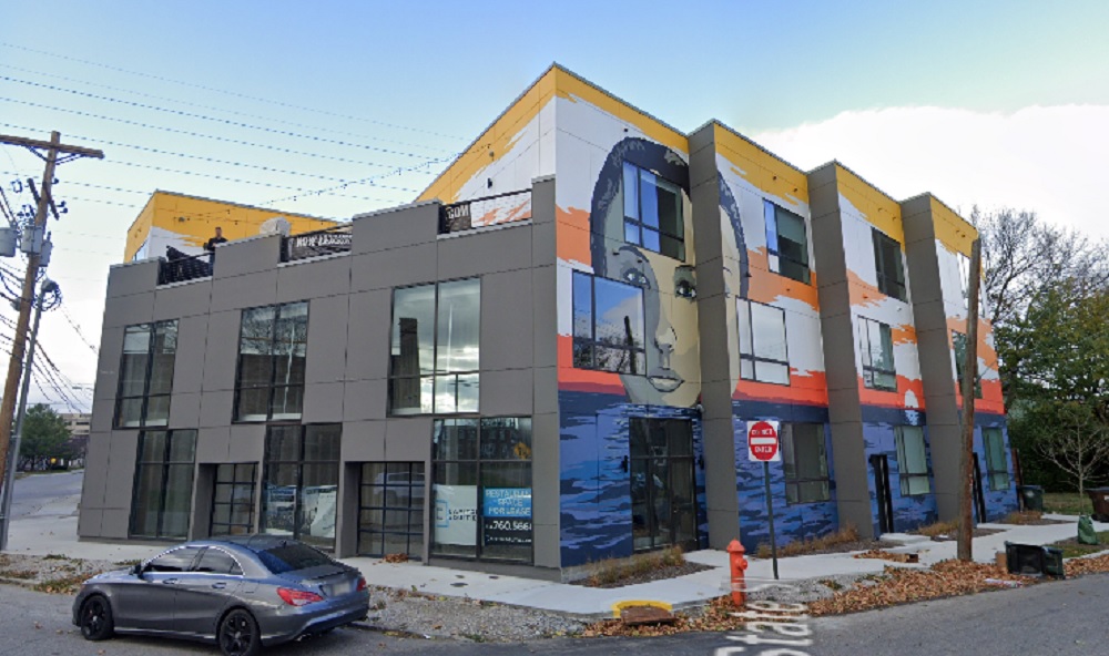
Before: 548 West State Street in 2011 The site at 548 W. State had been vacant for a number of years, with the original development having been demolished. By 2011, it was overgrown with weeds. After: 548 West State Street in 2020 In 2020, the site had a brand new mixed-use building containing 13 apartments and retail space. The mural also contributes to Franklinton becoming more of an arts location as the previous arts destination, the Short North, becomes ever more expensive.
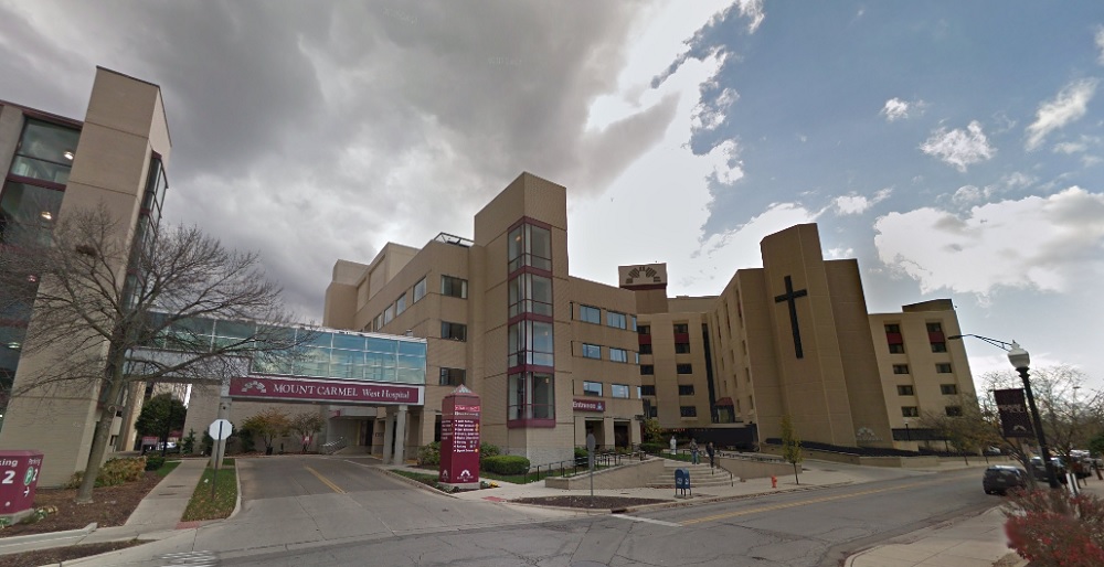
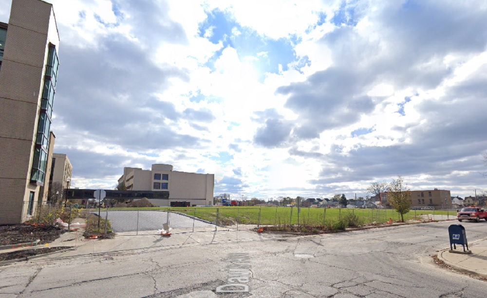
Before: Mount Carmel West in 2015 Mount Carmel West Hospital had been a dominant fixture in Franklinton for more than a century. It was originally known as Hawkes Hospital and constructed in 1886, becoming Mount Carmel in the 20th Century. However, by the 2010s, the location was deemed to be less optimal and so most of the services were moved to a new hospital in Grove City. The fate of the old hospital was sealed and a plan was drawn up to redevelop the entire site. After: Mount Carmel West in 2020 By 2020, the main hospital was no more. The only structures that will remain include the nurse’s college and several parking garages. The site will be redeveloped with mixed-use projects including residential, retail and office space over the next several years.
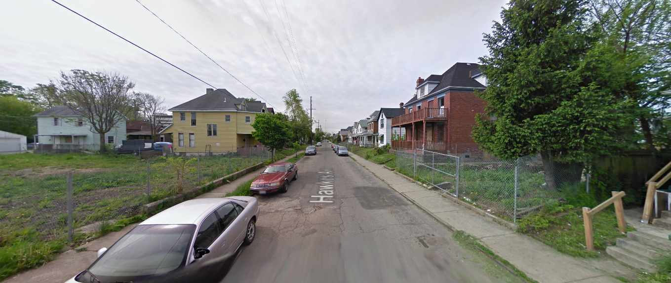
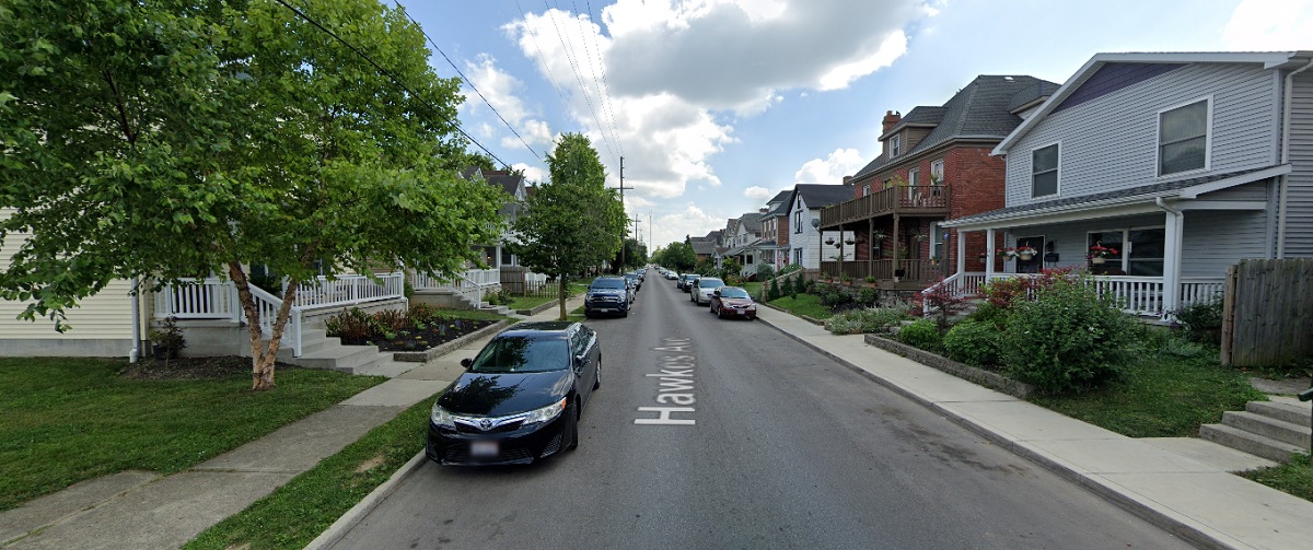
Before: Hawkes Avenue, looking south from Chapel Street in 2009 Hawkes Avenue was a typical Franklinton street by the late 2000s, with its vacant lots, abandoned buildings and poorly-maintained infrastructure. After: Hawkes Avenue, looking south from Chapel Street in 2019 Infill housing has been gradually becoming more common throughout Franklinton, as well as home renovations and general reinvestment in infrastructure by the City. Hawkes Avenue has been a beneficiary, and now looks better than it has in many years.
Franklinton has come a long way in just a few years, and the neighborhood is poised to only continue to change even more drastically in the near future. Many new projects are either under construction or have been recently proposed. Future phases of the Scioto Peninsula redevelopment will only spur additional development and growth westward. Whether Franklinton can revitalize without driving out too many of its existing residents remains somewhat of an open question.
A lot has happened in the past week, so Week in Review 4 is jammed full with site updates.
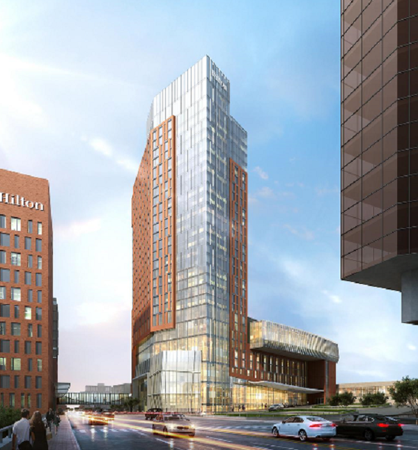
First up, the proposed new Hilton Hotel at the Convention Center continues to get taller, and now stands currently proposed for 28 stories. Construction is not set to begin until possibly next fall, so we have a while to see if any further changes occur.
The latest rendering.
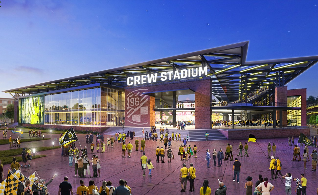
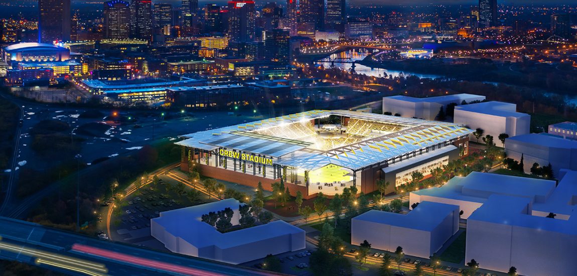
Crew fans got huge news a few months back that a new ownership group was looking to buy the team and keep them in Columbus. This week, it was announced as to what would happen to both Mapfre Stadium, as well as the first renderings and location of a brand new Arena District stadium. The new stadium would be built along with a new mixed-use neighborhood called Confluence Village. It would include offices, restaurant/retail space, 885 apartments and a riverfront park.
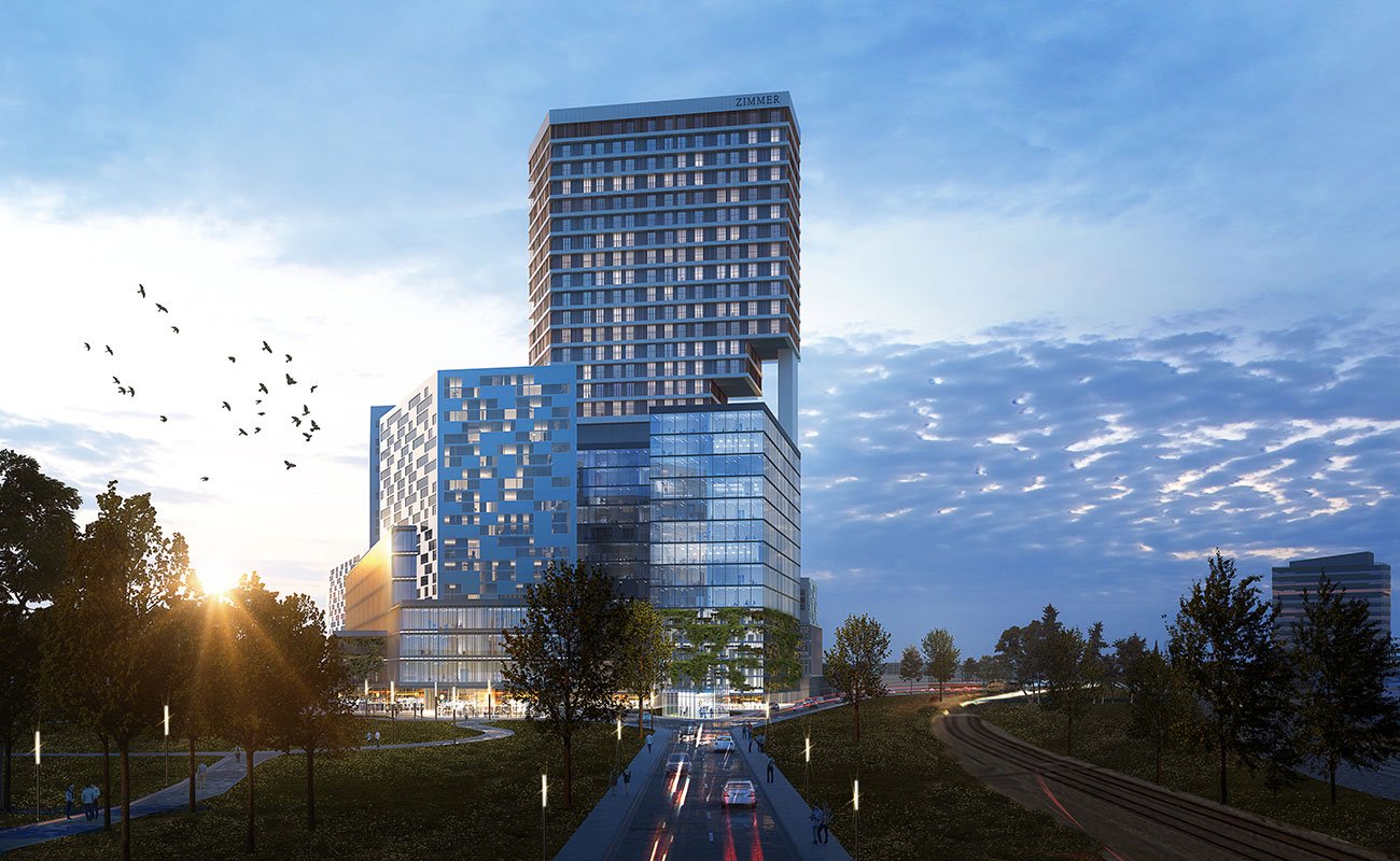
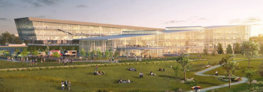
Franklinton continues to move up in the world with the new renderingsof the CoverMyMeds campus. The $240 million project would be one of the largest investment in the neighborhood in perhaps… ever.
Other news… Google may build a $600 million data center in New Albany.
And “Planet Oasis”, the proposed $2 billion entertainment complex in Delaware county, still looks unlikely to happen as the feud between its former development partners continues.
The oldest buildings on Capital Square finally received some funding for the proposal to renovate them into office space. The buildings date to 1869 and 1901.
The former Graham Ford dealership in Franklinton was purchased by Pizzuti Companies. The 7-acre site is to the west of 315, away from where recent development has been concentrated, so the site may remain undeveloped for a while yet. But it indicates where the future of Franklinton overall is headed.