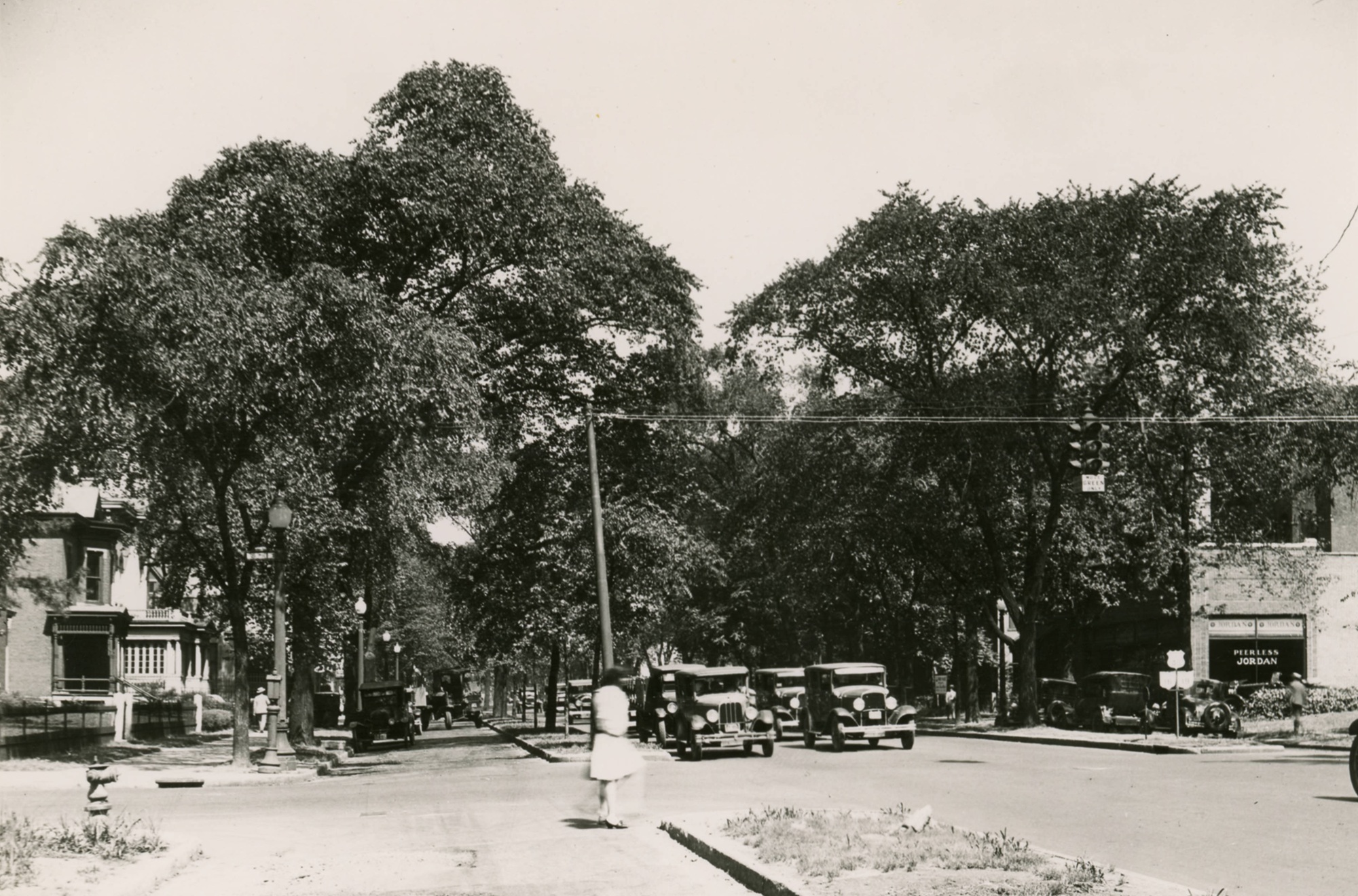
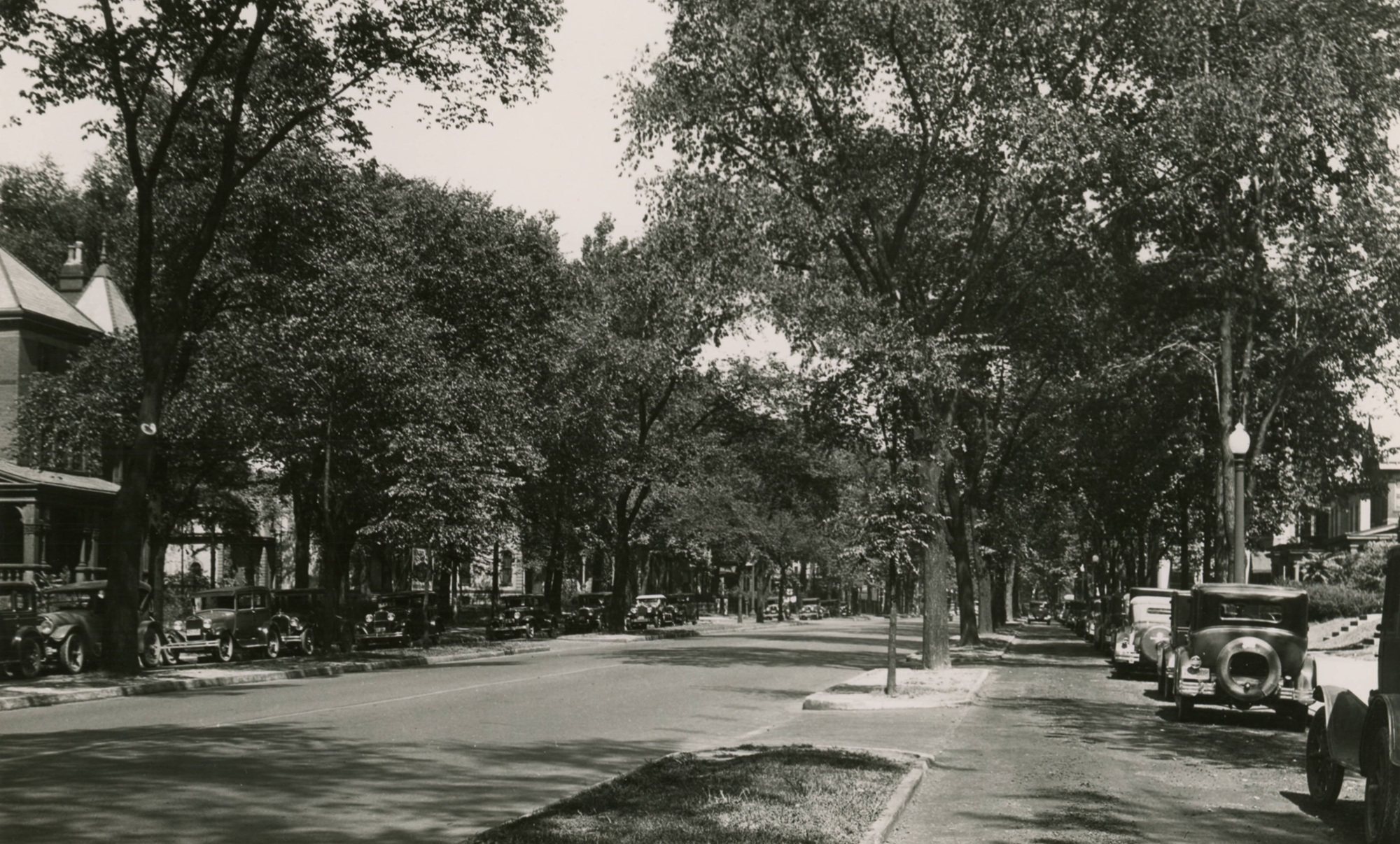
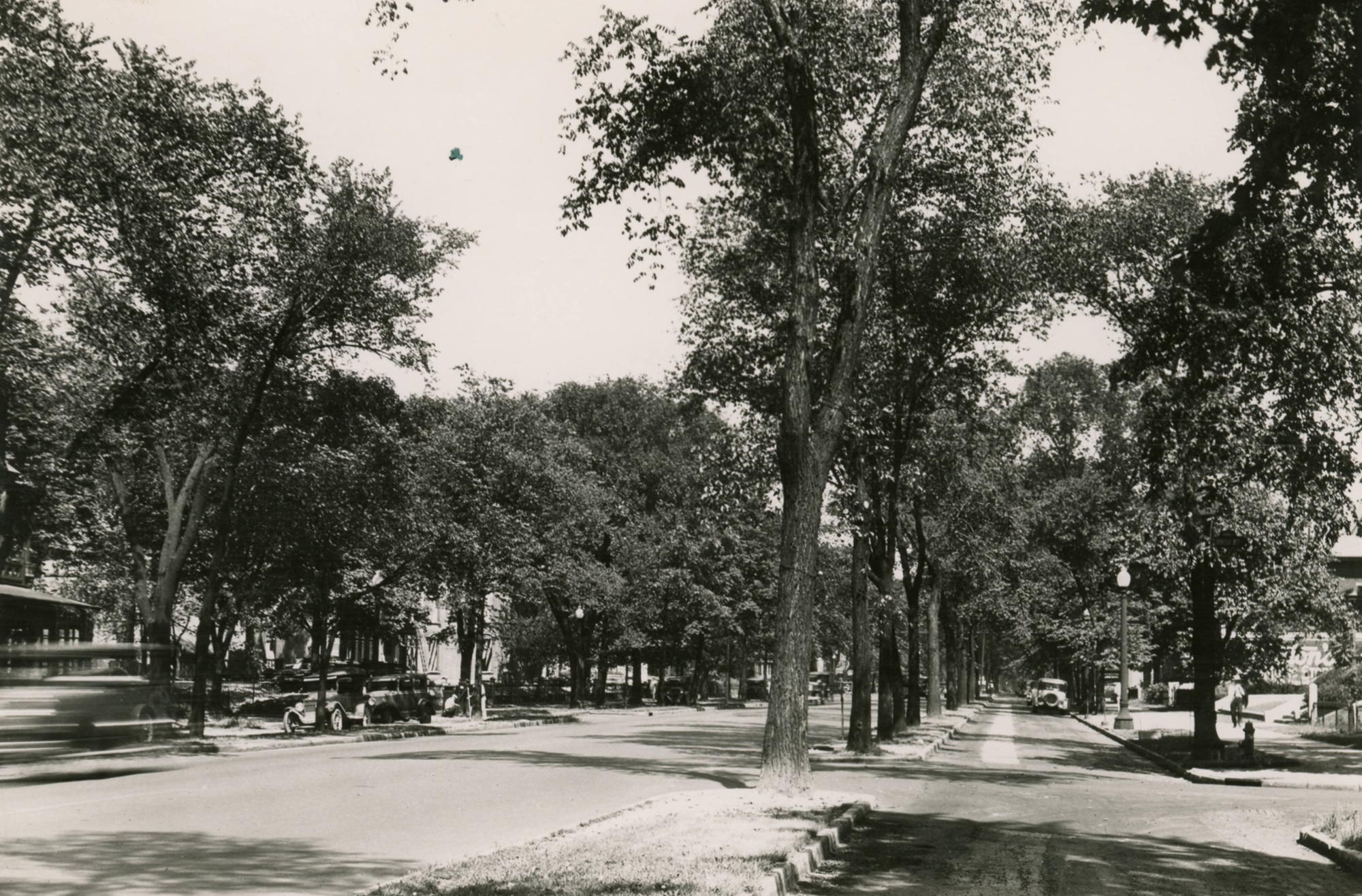
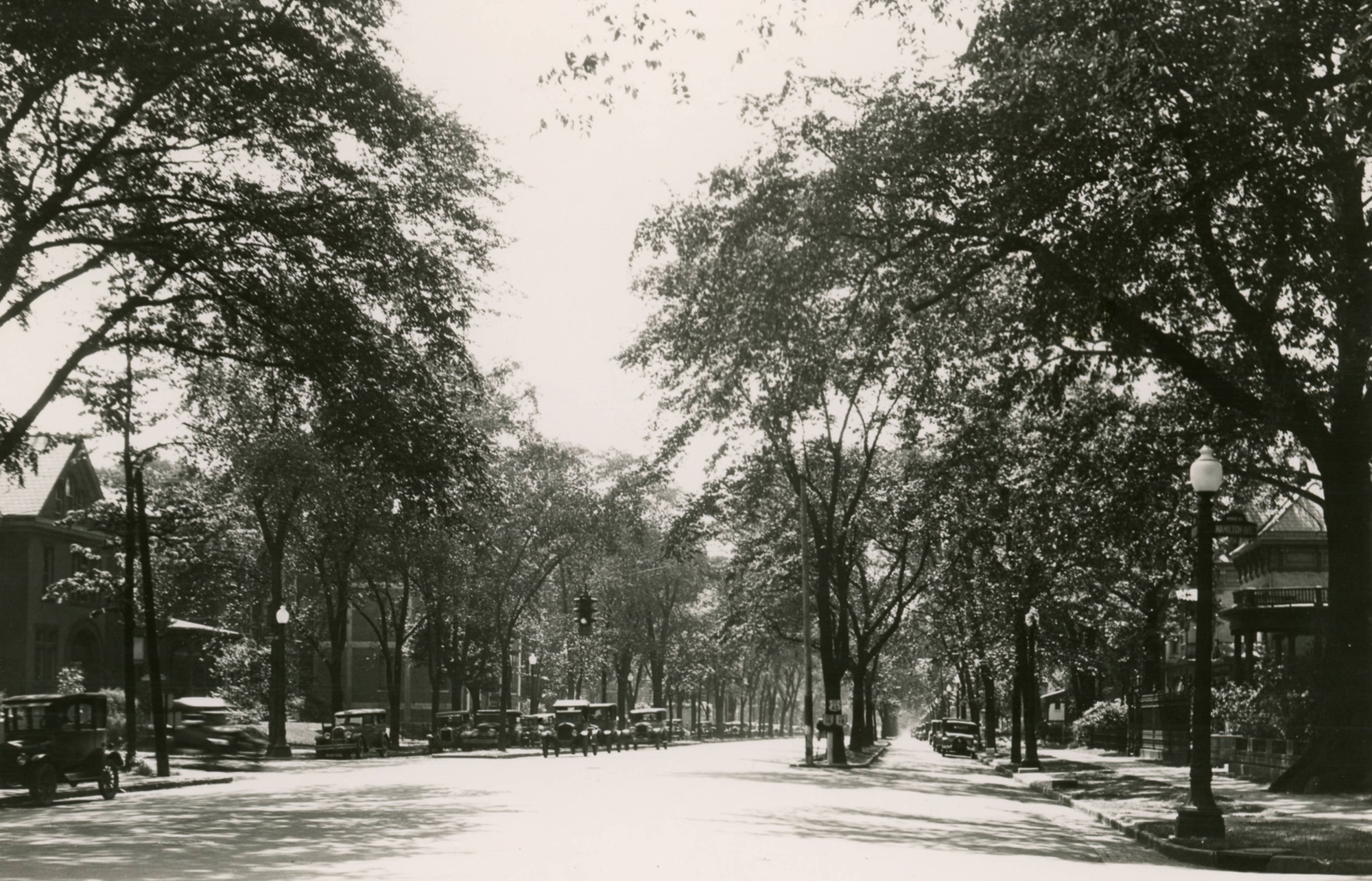
This collection of photos from the 1920s show the East Broad Street Boulevard. Modeled after European cities like Paris, the boulevard featured tree-lined medians that separated parked vehicles and a slower drive lane from the main traffic lanes. The boulevard, also known as the Broad Street Parkway, was in place for many years until it was ultimately removed beginning in 1932. The decision to remove the medians was to widen Broad to facilitate more car traffic.
For today’s Random Columbus Photo 12, we don’t go back too far in history, but the before and after are definitely one of the more dramatic comparisons featured so far. Larger versions of both photos are available if you click on them.
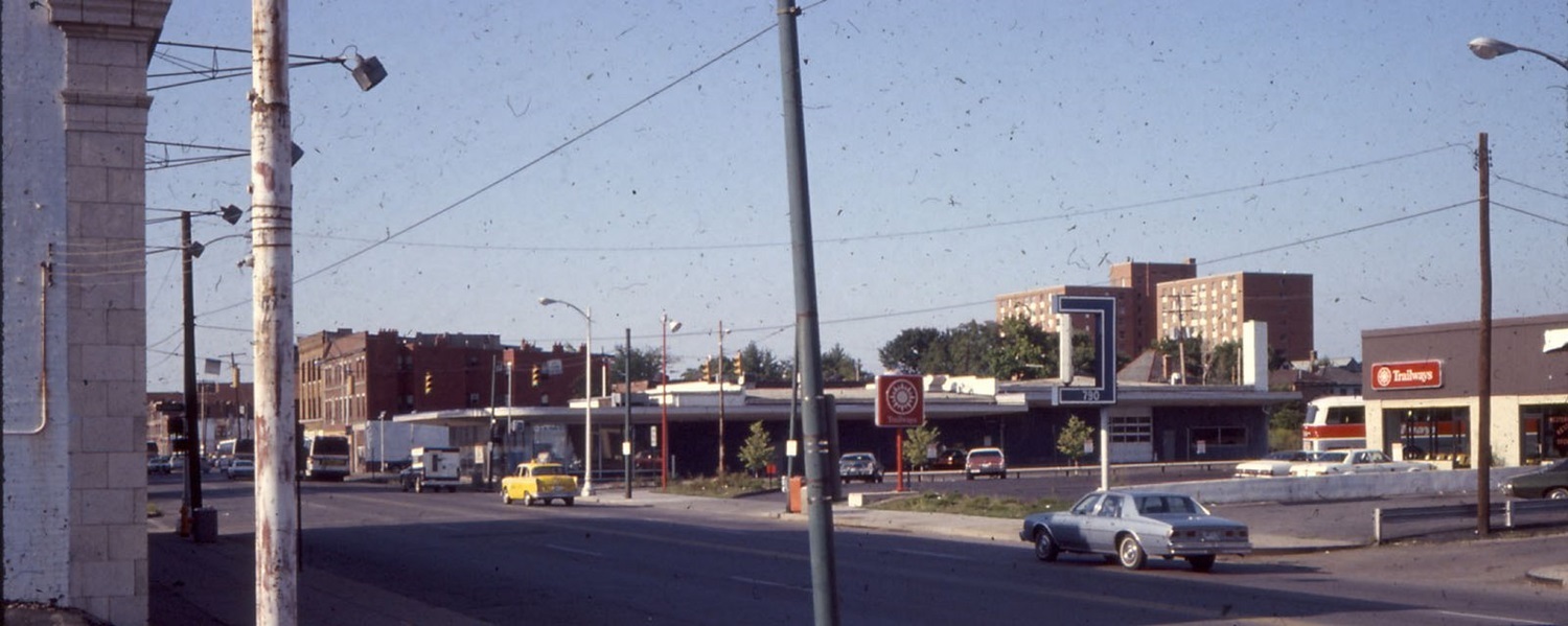
Before: N. High Street at Hubbard Avenue looking northeast, around 1980. The Short North by the 1970s was considered a declined neighborhood with significant crime and prostitution problems. Police were called there often, and history tells that it was the police themselves who coined the name of the neighborhood, since it was an area that was just “short of Downtown”. In the photo, you can see buildings at 790 N. High and beyond. At the time, they were a Trailways bus station and some kind of office building. Trailways was eventually replaced by other businesses and restaurants over the years, the last being the restaurant Haiku until it was all demolished for the current hotel building.
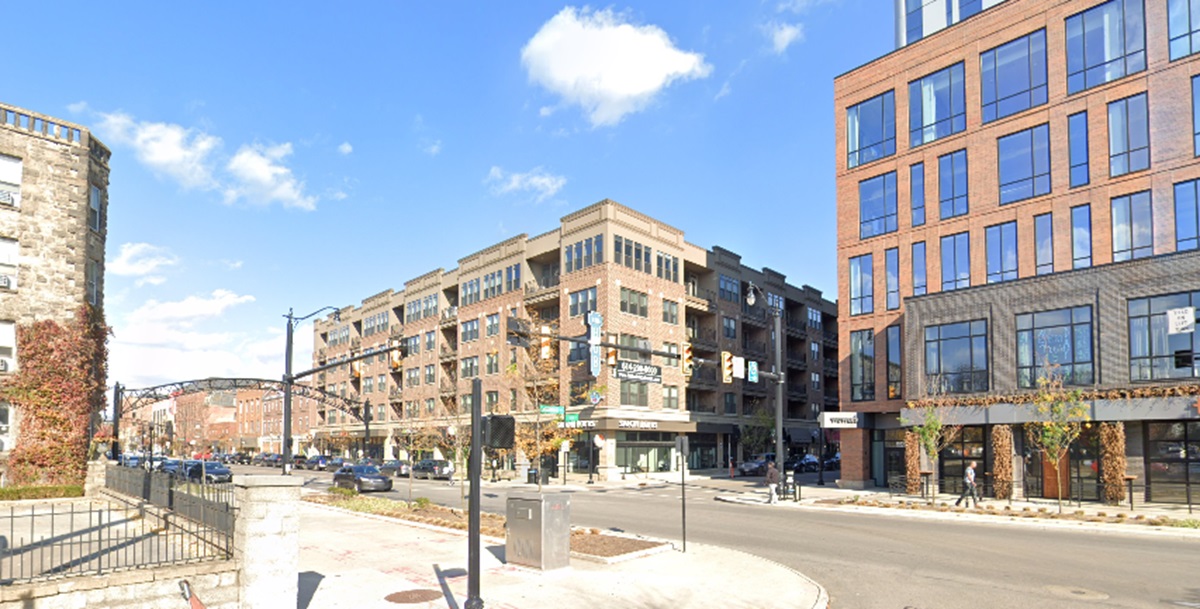
After: The same view in 2024. The picture from 2024 shows a drastically transformed neighborhood. After more than 40 years of renovations, revitalization and construction, the Short North has shed it’s drab and shady past. Crime stubbornly persists despite the improvements, but not nearly to the same degree. The taller apartment building in the older photo was torn down in the 1990s.
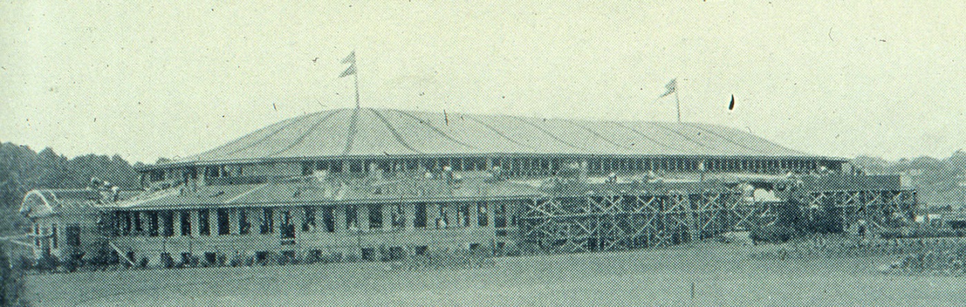
This edition of Before and After Big Bear’s First Store, we look at the chain’s original location. Big Bear grocery stores were founded in November, 1933 in Columbus. The first store in what would eventually become a significant regional chain, was located at 386 W. Lane Avenue. The building was originally built as the “Crystal Slipper” ballroom, which opened in June, 1926. The ballroom was designed to hold 7,000 people and was called “America’s Most Beautiful Ballroom” by the developer, the Stadium Ovals Company. The ballroom itself was open less than a year, and the building was later used for various purposes into the early 1930s.
The Crystal Slipper finishing construction in 1926.
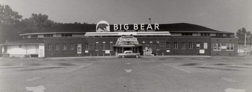
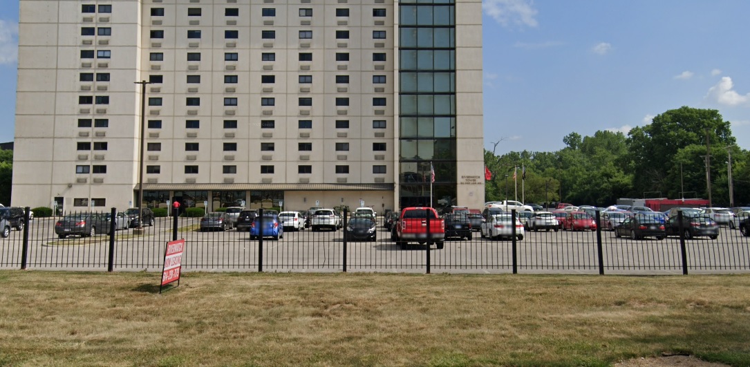
Big Bear would purchase the building and renovate it into a grocery store over the winter of 1933-1934. The location subsequently opened on February 15, 1934. The 47,000 square foot store was said to have attracted 200,000 people on opening day, the success of which allowed the company to open a second store less than a year later. Before: The first Big Bear store sometime in the late 1950s-early 1960s. Big Bear was quite innovative for its time. It was the first self-serve supermarket in the Midwest and the first to use grocery conveyor belts for cashiers, for example. The company eventually grew to include about 100 locations. Ironically, a company that started as innovative ultimately failed because of a lack of innovation and maintenance of quality and service. In 1989, the company was purchased by Penn Traffic, a company that already owned several other chains in the Midwest. Unfortunately, it didn’t exactly have the cash to be buying the chain, and loaded Big Bear with debt. In 1993, newly-appointed CEO Philip Hawkins began cost-cutting measures. These measures included reducing staff and staff hours, and lowering product quality. Store conditions deteriorated and customers began choosing other supermarket chains. By 2003, the company was being run into the ground. Customer volume had dropped to where the company could no longer pay vendors, so shelves were regularly empty of many products. This was the final death spiral. In 2004, Penn Traffic filed for bankruptcy and all remaining Big Bear stores were closed. After: This 2021 image shows the site today. This particular location closed long before the company did- it closed in 1985 and the original building was demolished. Several years later, the current Riverwatch Tower was constructed on site.
These before and after views from Franklinton show a snapshot in time of just how unattractive and people-unfriendly the riverfront once was.
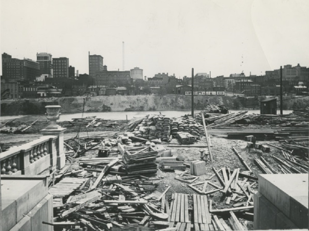
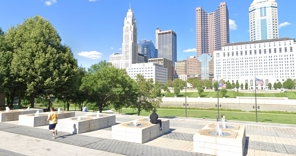
Before: 1923 This view looks east from the Franklinton side of the Scioto River. At the time, Central High School was under construction, which is why the area looks like such a mess of materials. Central High School would be completed in 1924 and open on September 4th of that year. The school would remain open for 60 years before being shut down in the mid-1980s. The building sat empty for more than a decade before being renovated into the new COSI. Beyond the river, a much shorter Downtown skyline can be seen. The image predates LeVeque Tower and most of the government buildings that now line the Scioto’s shores.
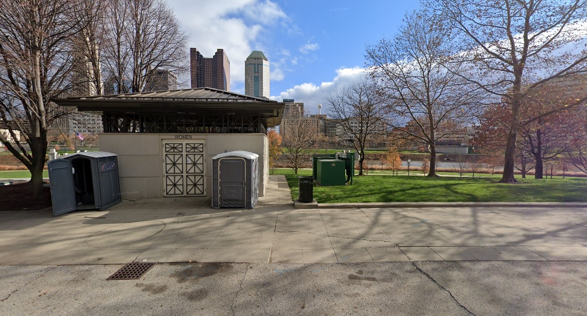
After: 2020 The riverfront looks much different today. With the Scioto Greenways and park space added in more recent years, the view is much more pleasant, the bathroom not included.
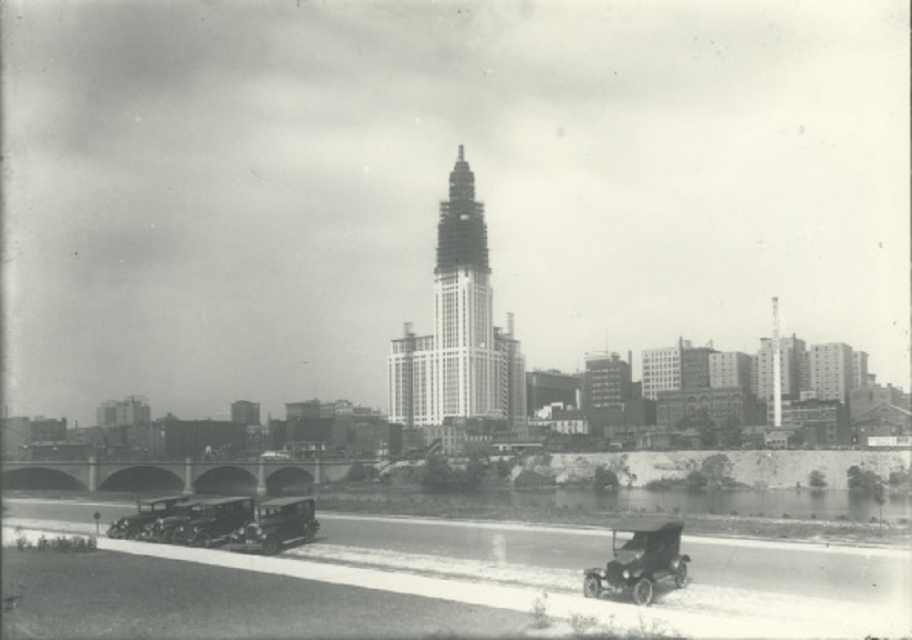
Before: 1926 In an image taken just 3 years after the one above, the Franklinton side of the riverfront looks much better. Additionally, LeVeque Tower is now well under construction. After: 2021 In the modern view, the parking and cars have been replaced with parklands and public space, while LeVeque has become the city’s most iconic skyline addition.
If you enjoy this series, the Historic Building Database page offers thousands of before and after photos of historic buildings and places in and around Columbus.
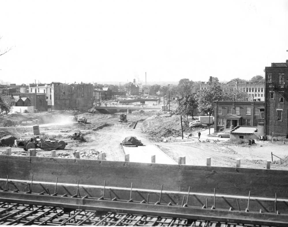
This Before and After Goodale Expressway addition shows a bit of the Columbus highway system’s earliest construction projects.
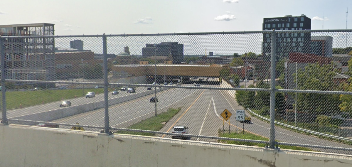
Before: Around 1960 The image above is taken from the then under construction 3rd Street Viaduct overlooking construction of the Goodale Expressway. It is facing west towards High Street, with Italian Village on the right. Although this section did not require significant demolitions due to preexisting railroad tracks, one of the big casualties a bit further west was Flytown, an area along and north of Goodale Avenue west and south of Victorian Village. The Goodale Expressway was one of the first sections of the Columbus highway system constructed, which is somewhat ironic given it would take more than 40 years to fully construct and be the last major highway completed. After decades of controversy, studies and false starts, the final stretch from 71 to the Rt. 62 interchange at 270 was completed in 2003. After: 2021 While an unfortunate fence blocks the view, you can still see how drastically the landscaped has changed after more than 60 years.