These before and after views from Franklinton show a snapshot in time of just how unattractive and people-unfriendly the riverfront once was.
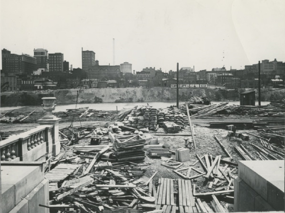
Before: 1923 This view looks east from the Franklinton side of the Scioto River. At the time, Central High School was under construction, which is why the area looks like such a mess of materials. Central High School would be completed in 1924 and open on September 4th of that year. The school would remain open for 60 years before being shut down in the mid-1980s. The building sat empty for more than a decade before being renovated into the new COSI. Beyond the river, a much shorter Downtown skyline can be seen. The image predates LeVeque Tower and most of the government buildings that now line the Scioto’s shores.
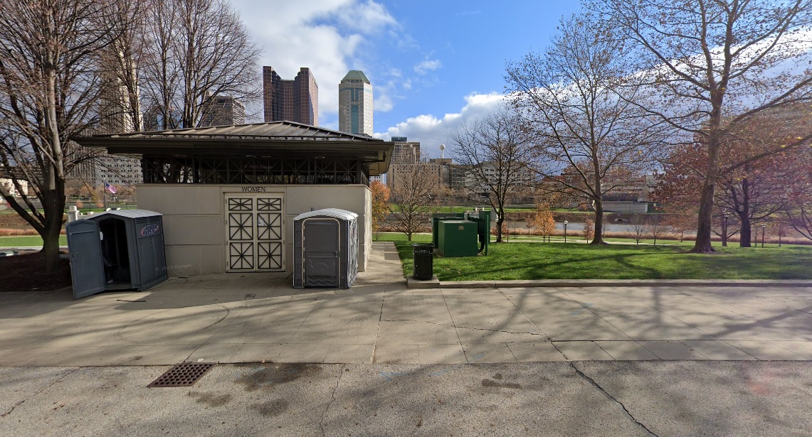
After: 2020 The riverfront looks much different today. With the Scioto Greenways and park space added in more recent years, the view is much more pleasant, the bathroom not included.
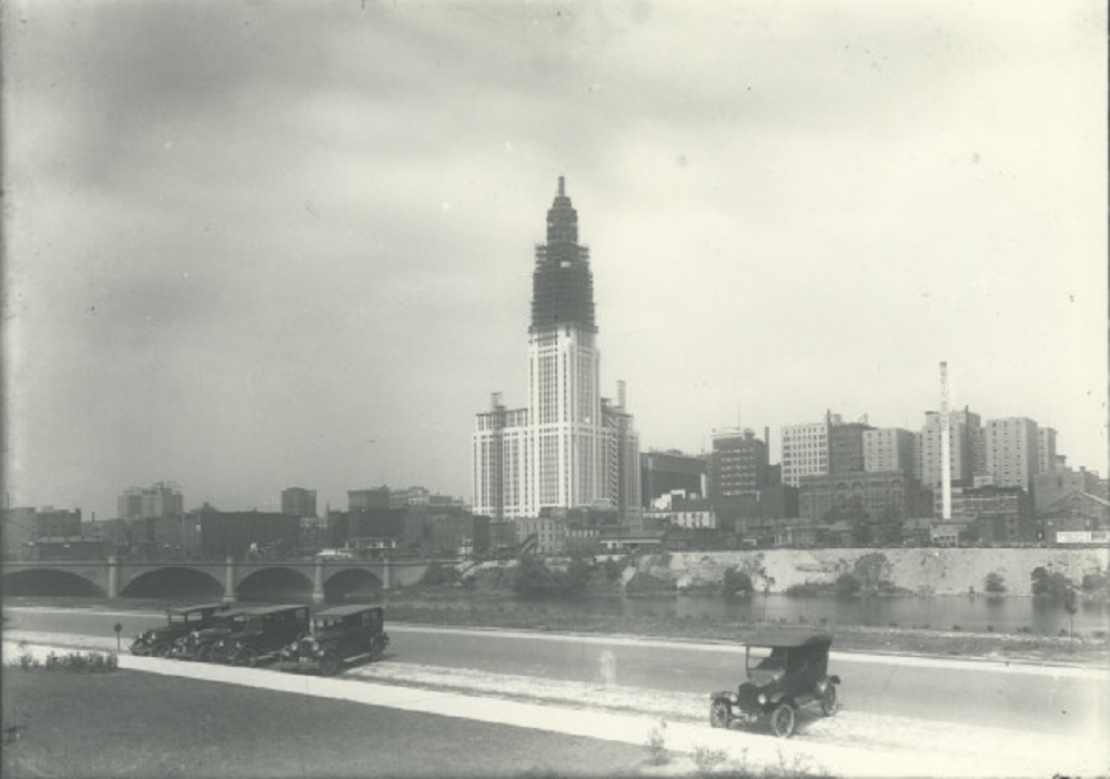
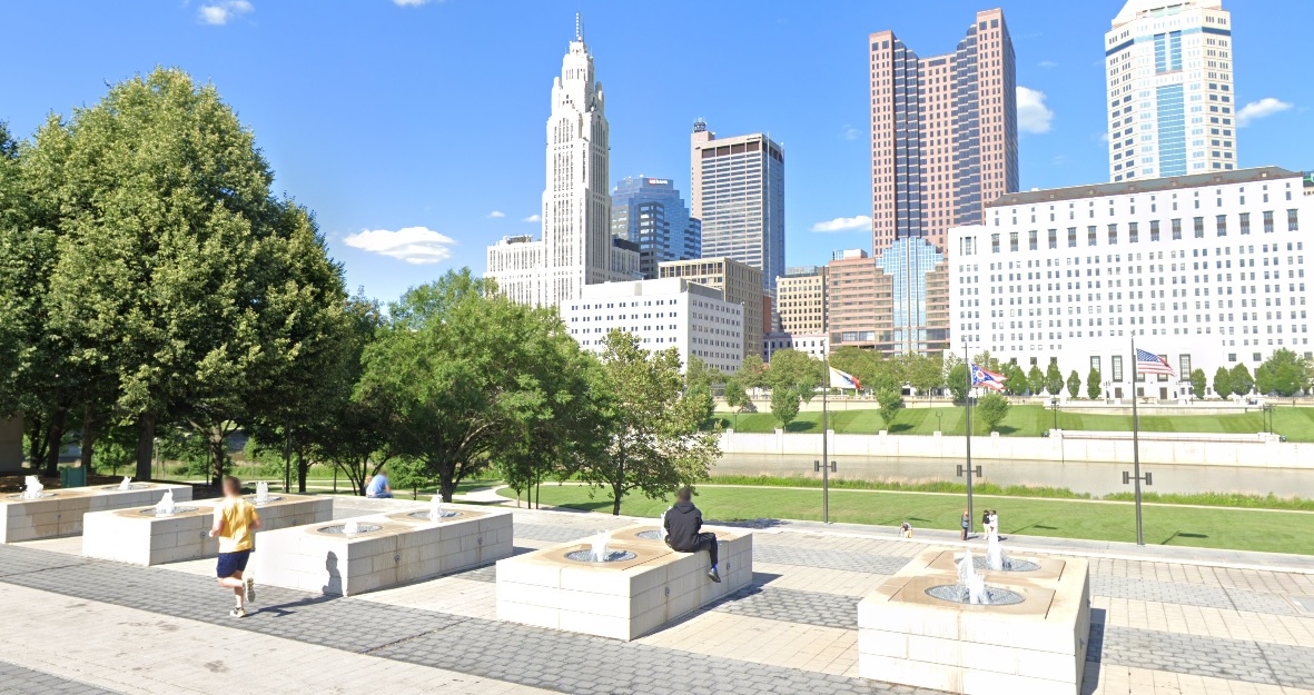
Before: 1926 In an image taken just 3 years after the one above, the Franklinton side of the riverfront looks much better. Additionally, LeVeque Tower is now well under construction. After: 2021 In the modern view, the parking and cars have been replaced with parklands and public space, while LeVeque has become the city’s most iconic skyline addition.
If you enjoy this series, the Historic Building Database page offers thousands of before and after photos of historic buildings and places in and around Columbus.
These Columbus Christmases past photos give a short walk down memory lane of one of the most popular and favorite holidays.
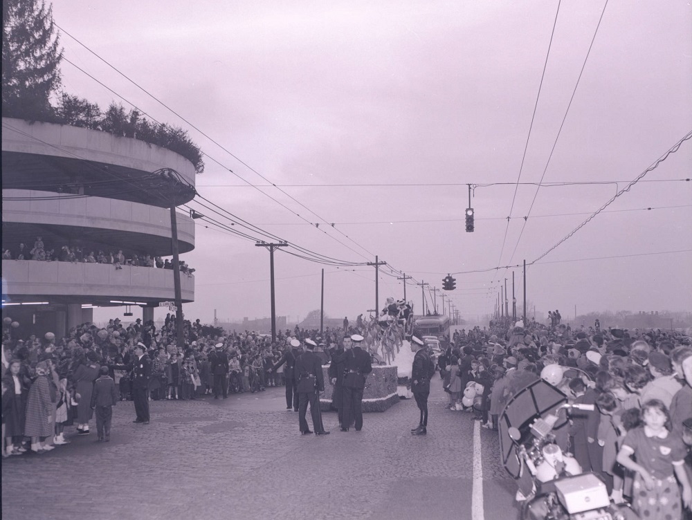
Date: 1952 Location: Corner of W. Town Street and S. Ludlow Street along the Scioto River. Santa and Mrs. Claus ride on a float in the annual Lazarus Christmas parade.
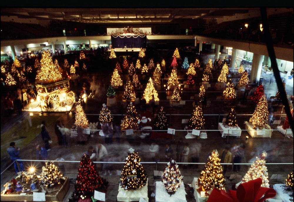
Date: 1980 Location: Ohio Expo Center Multipurpose Building at 717 E. 17th Avenue. The Festival of Trees was an annual event sponsored by Children’s Hospital and Nationwide for charities. In 1980, there were 82 themed Christmas trees on display, which people could buy for at prices up to $1,000 each.
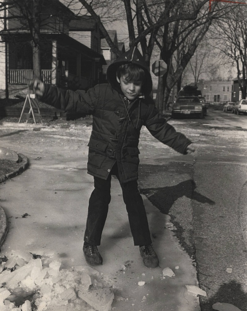
Date: Christmas Day, 1983 Location: Corner of Ebner and Columbus Street, German Village Christmas 1983 was one of the coldest on record, with a high of just 1 degree above zero and an average temperature of -6. The cold caused water mains to burst in several locations, including in German Village, which some children took advantage of for a little fun.
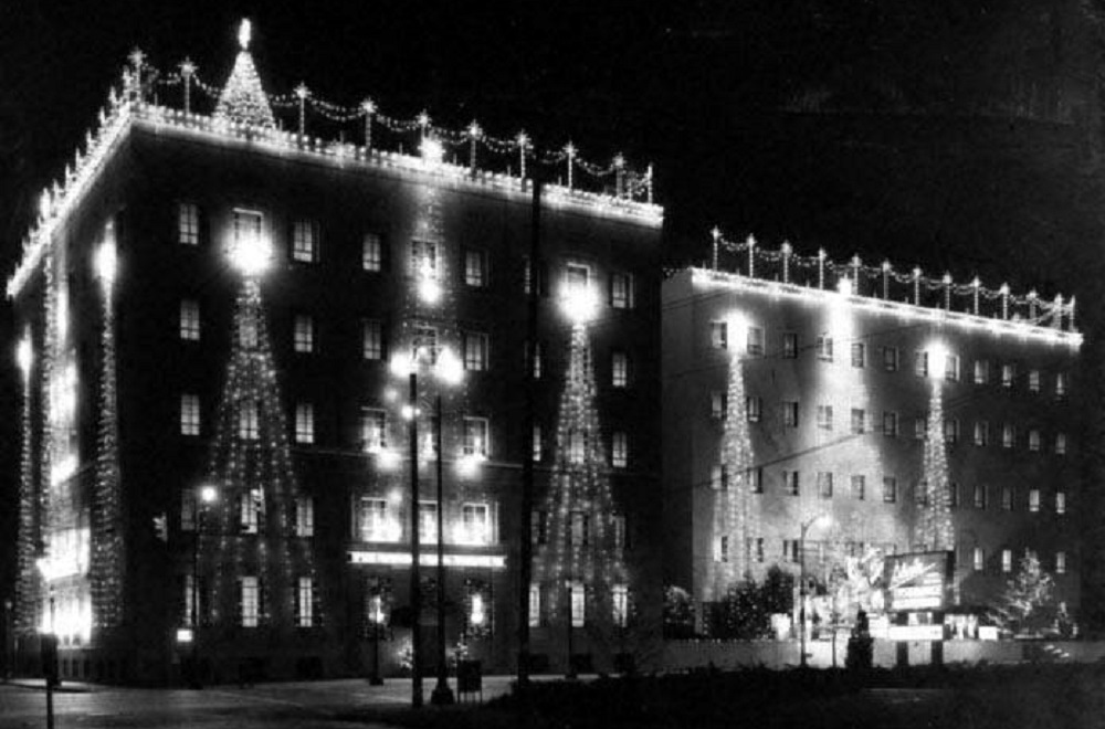
Date: 1965 Location: 518 E. Broad Street State Auto Mutual Insurance began holding a Christmas lighting event every year beginning in 1931.
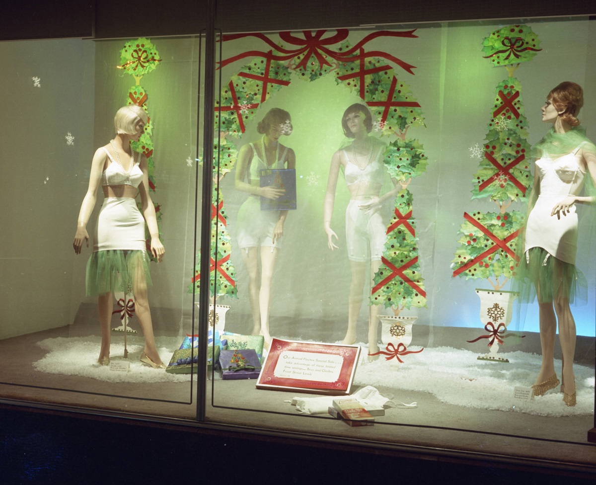
Date: Around 1955 Location: Lazarus Department Store, South High Street Lazarus was famous for its window Christmas displays for well over 100 years, with many being very elaborate. The Christmas displays continued until the 2000s.
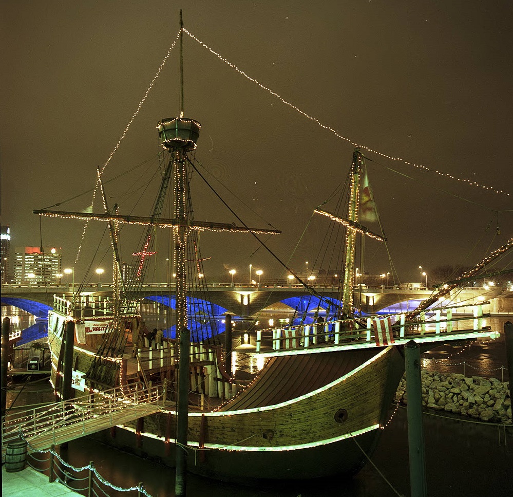
Date: 1992 Location: Scioto Riverfront, Downtown The replica of Christopher Columbus’ Santa Maria, decorated for Christmas in the photo, sat in Battelle Riverfront Park from 1991 until it was permanently dismantled during construction of Scioto Greenways in 2014.
The Random Columbus Photos 4 edition takes a look back at Downtown in the 1980s.
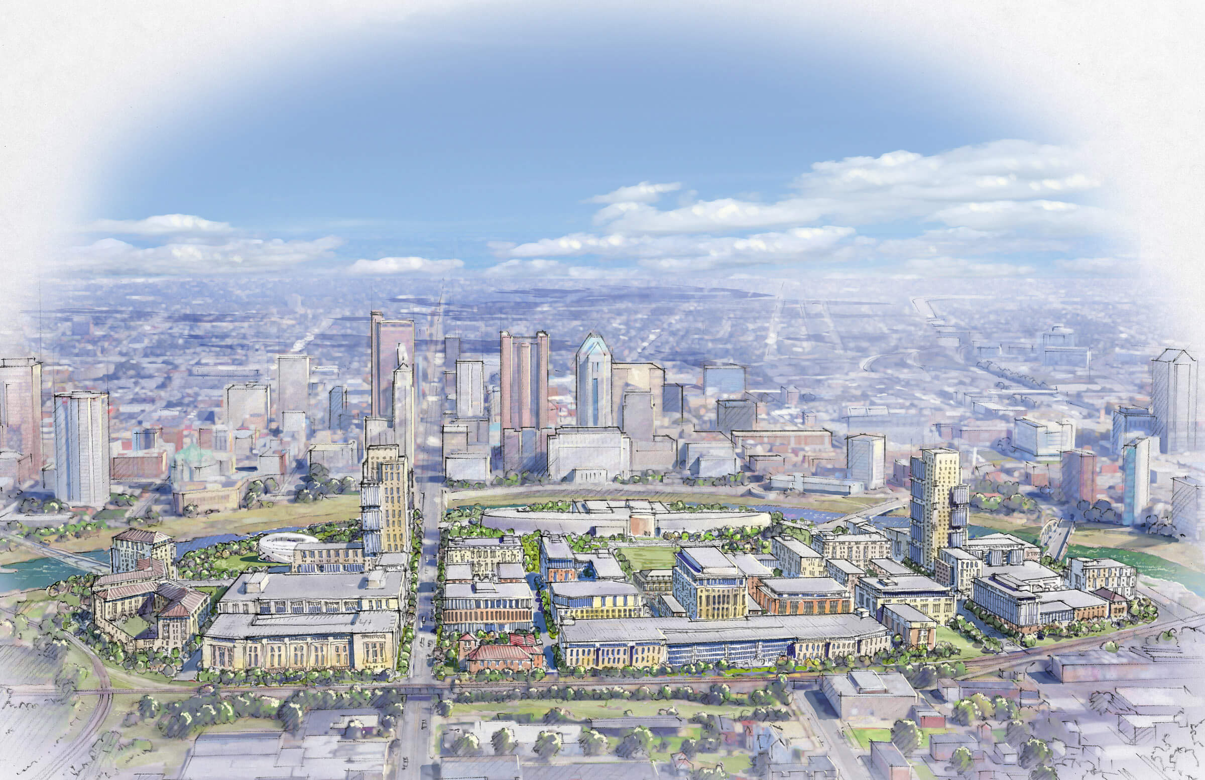
Date Photo Taken: 1989 Photo Location: Looking west on Broad Street from LeVeque Tower. This photo is interesting for a few reasons. First, it shows the beginning of construction to replace the Broad Street Bridge over the Scioto River. After the Great Flood of 1913 destroyed an earlier Broad Street Bridge, the one in the photo was finished in 1921. By the early 1980s, the bridge was rapidly deteriorating and the decision was made to replace it. It’s reconstruction start, however, was delayed until 1988 due to a contract to keep the Columbus 500 auto race going, which used the bridge. The nearly identical new bridge was completed in 1992 at a cost of $13.2 million. Across the bridge is the Scioto Peninsula. On the right is Vets Memorial, built in the 1950s and recently demolished to make way for a new memorial and museum as part of the redevelopment of the peninsula. On the left is the old Central High School, years before it was converted into COSI’s new location. Also of note are warehouse and other buildings that still existed on the peninsula, remnants of when this area was largely manufacturing. These were mostly demolished in the 1990s and early 2000s and were left as vacant lots for well over a decade, some of them becoming parking lots for COSI. These lots will soon become part of a large mixed-use development and park.
The Scioto Peninsula project is an in-planning-stage development that promised to be hugely transformational for both Downtown and all of Franklinton.
The history of the Scioto Peninsula in not really all that positive. Bounded by 315 to the west and on all other sides by the Scioto River directly across from Downtown, this area currently contains Veteran’s Memorial, COSI and not much else. Even as far back as the 1950s, a large chunk of the peninsula, especially around Central High School (which still exists as COSI), was just vacant land. Otherwise, what existed were warehouse buildings and other commercial buildings. What people lived there were mostly confined to a few public housing projects. Being so close to the Scioto River, the area repeatedly flooded over its history, especially in the Great Flood of 1913 and to a lesser extent in 1959. This prevented much development here and in Franklinton in general. Federal standards were actually in place that banned most new construction or even renovations to most types of buildings. This allowed all of Franklinton, including the Peninsula, to stagnate and go through steady decline.
Help was coming, however, in the form of a giant floodwall. Conceived as far back as the 1980s, the Franklinton Floodwall would not be completed until 2004. It took another 4-5 years before people began to seriously look at the area for redevelopment and then for that development to actually start taking place. Eastern Franklinton, so far, has been the focal point of that redevelopment, and a big project to help tie in Downtown with the neighborhood is the planned redevelopment of the Peninsula.
Almost all the buildings that existed in the ’50s are now gone, even the housing projects. COSI uses much of the land for parking, as does Veteran’s Memorial. The rest is grassy lots primed for redevelopment. Some projects have already taken place. The two new Downtown bridges at Main and Rich Streets provide a nice access onto the Peninsula, along with the Broad Street bridge. A 4th, a planned pedestrian bridge, will be located on the north end crossing from Vet’s Memorial to North Bank Park in the Arena District. This bridge is probably still a few years off, as there is another, large project planned. The low-head dams along the Scioto River in the Downtown area are going to be removed, starting sometime next year. This will lower the river level and create a more natural flowing waterway. It will also create acres of new riverfront parkland that new paths and landscaping will be added to. This will create an inviting, park setting to both sides of the river.
The Peninsula has been planned for redevelopment several times in the last 30 years, but there was a lack of momentum for urban projects for decades and no serious plans ever seemed to emerge. That was until the last 10 years, starting in 2002 with the first Downtown development plan by Mayor Coleman and the city. A new version was released in 2010 and contained a dozen projects planned to help Downtown become a destination again. While the Scioto Peninsula was not specifically mentioned, fixing the riverfront was. That’s where Scioto Mile park came from and is now a very popular spot for residents. With all this momentum, the Peninsula needed a serious plan. Right now, meetings are taking place and a development plan is now in the early stages. Some early ideas include a lot of residential, retail and entertainment space, along with a more interactive riverfront and even a transit station for light rail. The first draft of the plan is likely to be released in 2013 and construction could begin as early as 2014.
This project can be found in the Columbus Development links page, which provides a large and regularly-updated list of ongoing and proposed development across the area.