Random Columbus Photos 10


In Random Columbus Photos 10, we look toward the East Side.

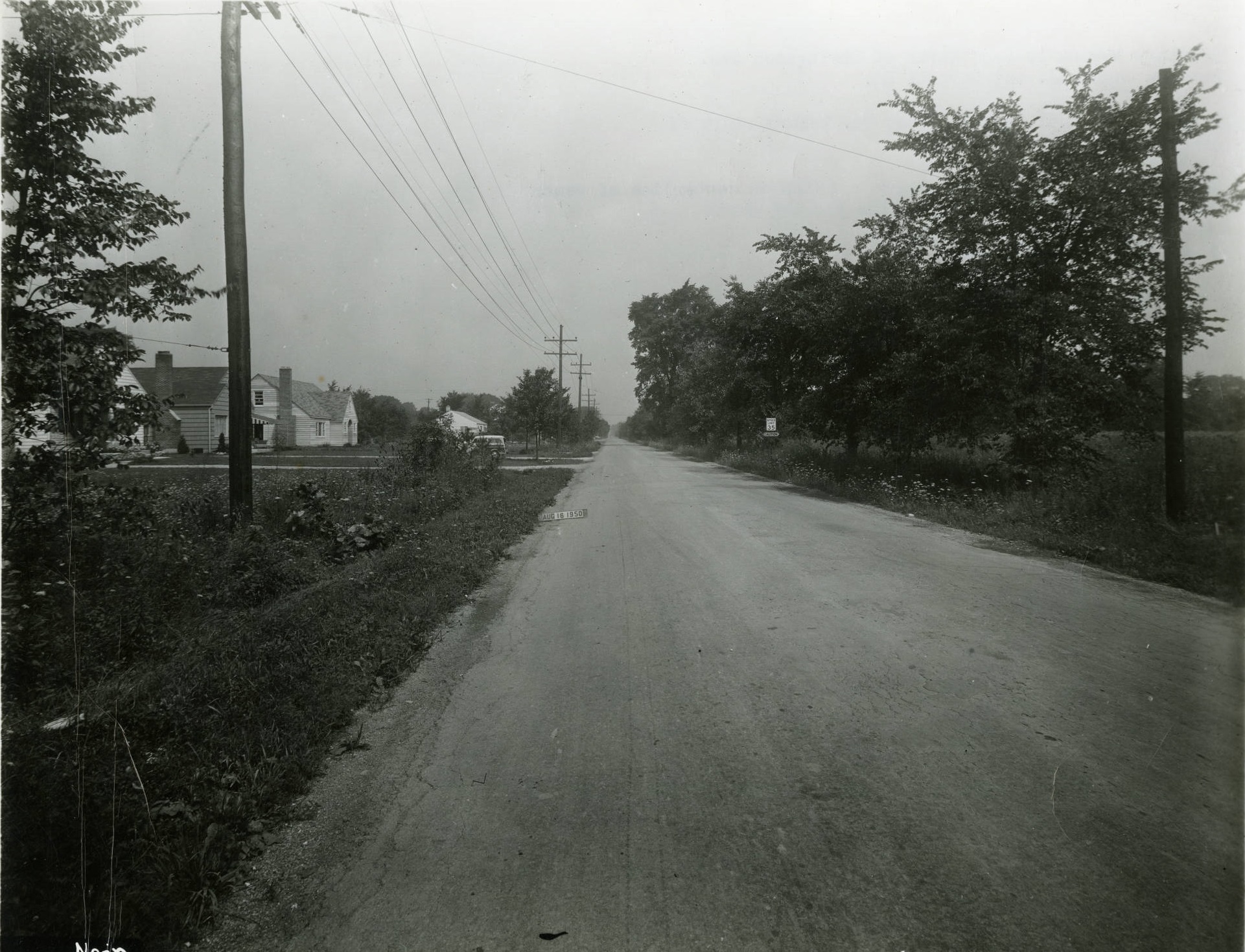
Photo Location: James Road, looking north from Livingston Avenue.
Photo Date: August 16, 1950
Photo History: This photo of a very primitive James Road was taken by the City in preparation for installing a sewer system in the area. There were very few homes and other buildings on James at the time, and the area was still mostly farmland. The homes on the left side of the photo had only just been completed, and were the first of large-scale, small-home subdivisions that now dominate this part of the city and neighboring Whitehall. By 1953, the entire area seen in the photo would be fully developed and unrecognizable.
Random Columbus Photos #10 Columbus, Ohio
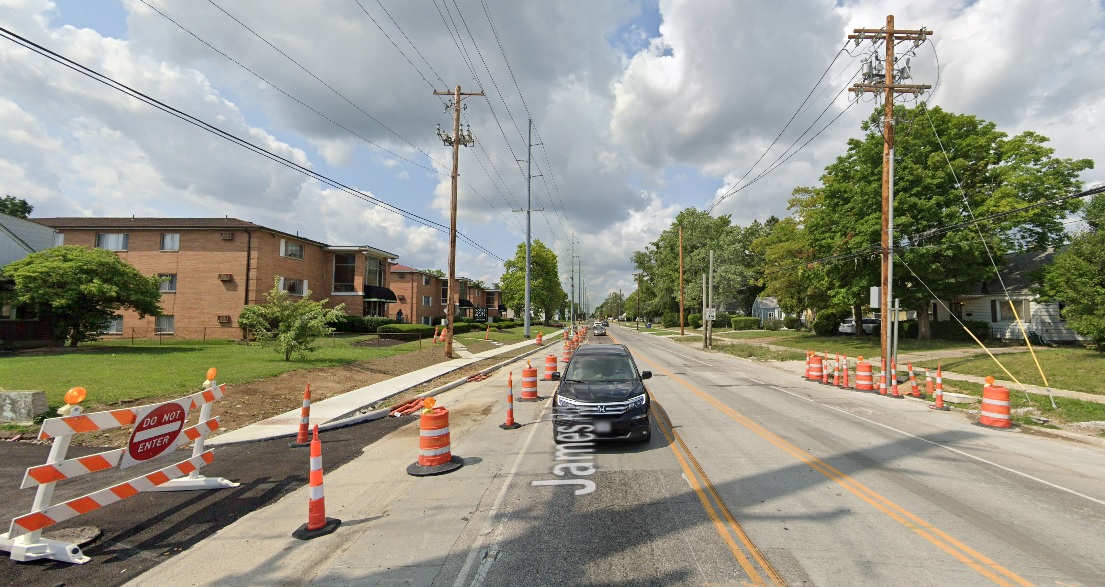
The same view today:
Random Columbus photos #10 Columbus, Ohio

Thousands of historic before and after photos from across the city can be found on the Historic Building Database.

Random Columbus Photos 6


A new Random Columbus Photos after a multi-year absence!

Photo Location: Aerial photo of North High Street between Smith Place and 7th Avenue.
Photo Date: Around 1985
Photo History: Located just north of the Short North and south of the OSU Campus, this part of High Street was often left out of revitalization and development efforts. By the 1980s, much of the urban fabric had already been torn down, leaving mostly parking lots and vacant lots, with only a smattering of buildings.
Random Columbus photos 6 Columbus, Ohio

And the same view today.

The Kroger, while realigned and larger, still retains a large surface parking lot, as does the business across the street, but otherwise, the area is significantly more filled in than it was in the 1980s. That trend will continue with more- and larger- projects planned for the stretch.

Random Columbus Photos 4


The Random Columbus Photos 4 edition takes a look back at Downtown in the 1980s.

Date Photo Taken: 1989
Photo Location: Looking west on Broad Street from LeVeque Tower.
Random Columbus photos 4
This photo is interesting for a few reasons. First, it shows the beginning of construction to replace the Broad Street Bridge over the Scioto River. After the Great Flood of 1913 destroyed an earlier Broad Street Bridge, the one in the photo was finished in 1921. By the early 1980s, the bridge was rapidly deteriorating and the decision was made to replace it. It’s reconstruction start, however, was delayed until 1988 due to a contract to keep the Columbus 500 auto race going, which used the bridge. The nearly identical new bridge was completed in 1992 at a cost of $13.2 million.
Across the bridge is the Scioto Peninsula. On the right is Vets Memorial, built in the 1950s and recently demolished to make way for a new memorial and museum as part of the redevelopment of the peninsula. On the left is the old Central High School, years before it was converted into COSI’s new location. Also of note are warehouse and other buildings that still existed on the peninsula, remnants of when this area was largely manufacturing. These were mostly demolished in the 1990s and early 2000s and were left as vacant lots for well over a decade, some of them becoming parking lots for COSI. These lots will soon become part of a large mixed-use development and park.