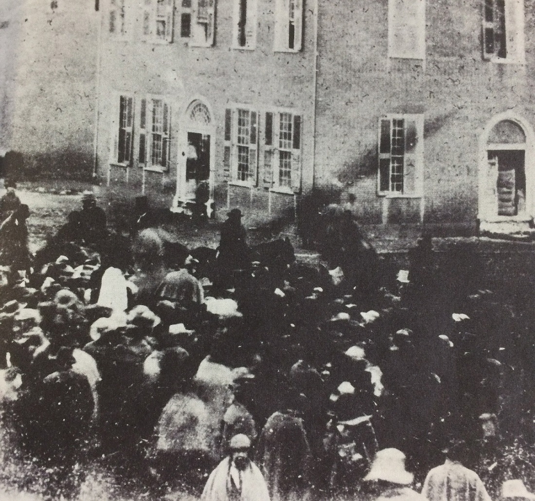
Photo Location: Broad and High Photo Date: Sometime in 1849 Photo History: Random Columbus photo 5 is one of the earliest ever known to have been taken in Columbus, and shows a group of bystanders looking at several people on horseback. The year this was taken, 1849, is significant in that it references the events taking place. 1849, of course, was the year that gold was discovered in California. The men on horseback are 49-ers, getting ready to depart Columbus to join the great California Gold Rush, and the crowd was gathered to see them off.
Click on the image for a better look.
Unfortunately, not much else is known about the photo, who the people were, or in what direction the photo was even taken.
German Village dates back to the early 19th Century, when it was sometimes called called Germantown. Unsurprisingly, by the middle of the 20th Century, the neighborhood had declined significantly, yet still retained the vast majority of its historic buildings. The city of Columbus had it in mind to bulldoze a large part of the neighborhood in the 1950s for public housing, but activists organized against those plans. Instead, in what was one of the first major success stories of Columbus preservation, German Village was saved. The entire area was eventually added onto the National Register of Historic Places in 1975, and today it is still the largest historic district on the registry anywhere in the United States. Here are just a few before and after photos around the neighborhood.
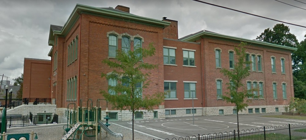
Before: Stewart Avenue Elementary School, looking northeast, in 1920. After: 2017 The school was constructed in 1873 and remains in use today, one of the oldest continuous schools remaining in the city.
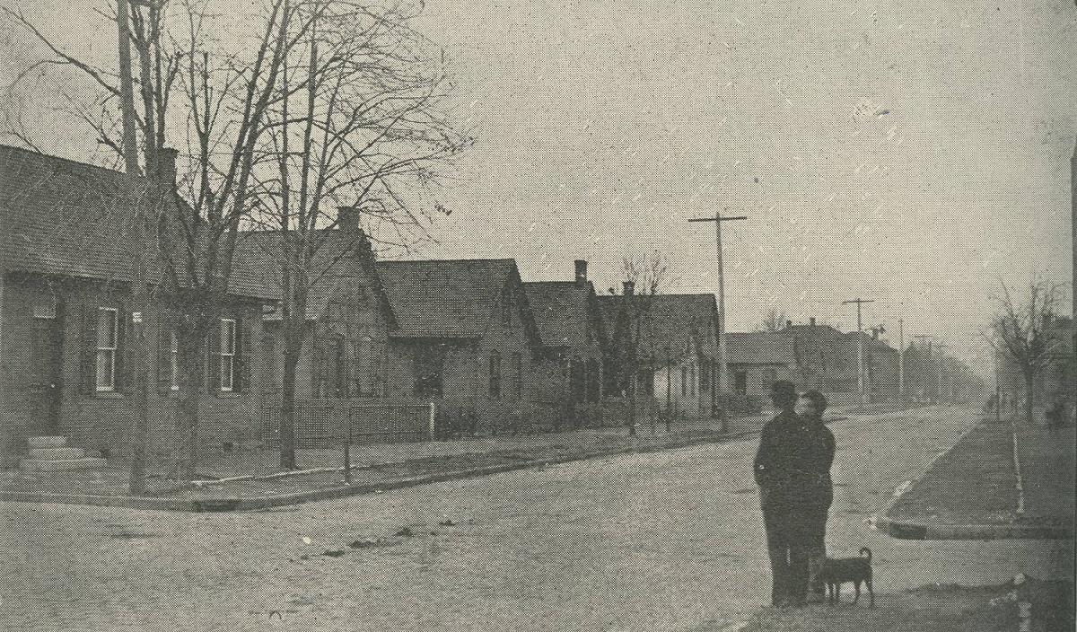
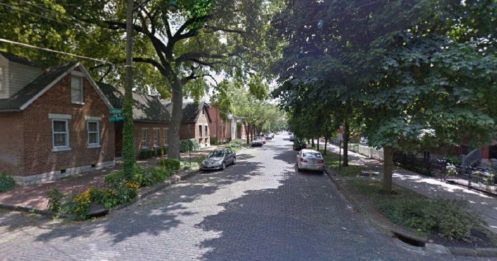
Before: City Park Avenue at Lansing Street, looking south, in 1898. After: 2016
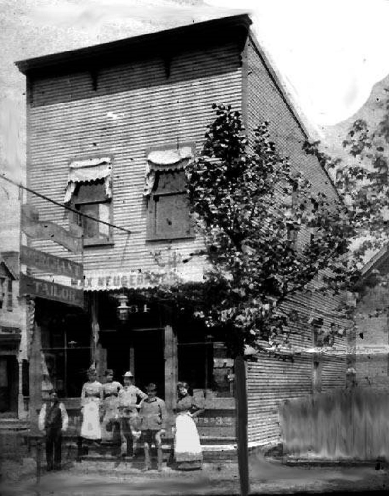
Before: The Max Neugebauer Tailor Shop at 764 Mohawk Street in 1897. After: 2016 Neugebauer arrived in Columbus in 1887, but it’s unclear when he opened this business.
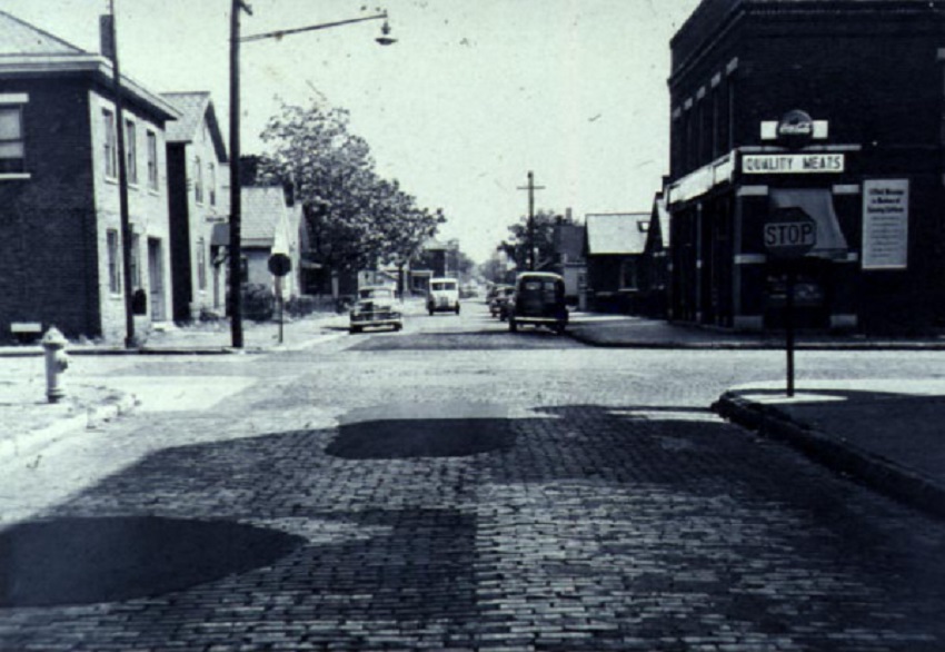
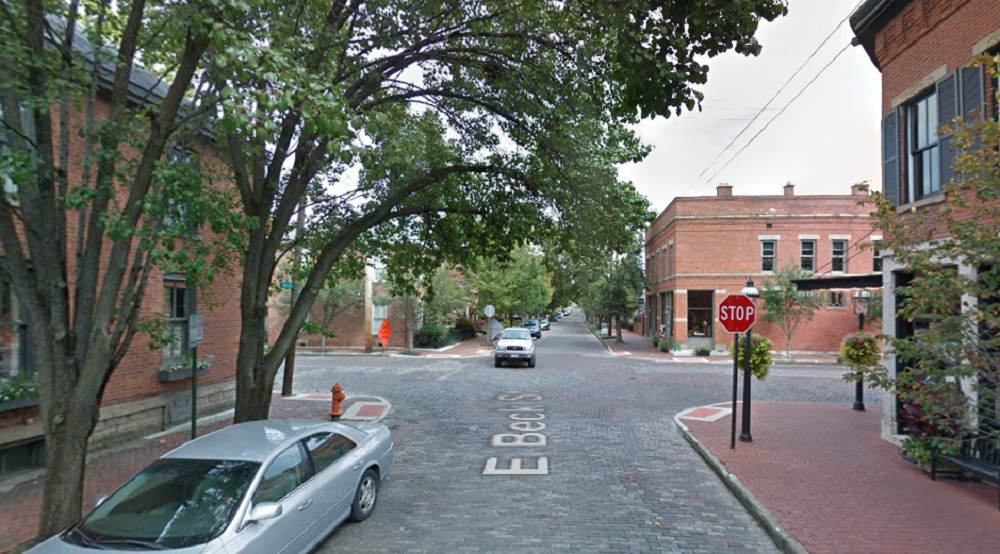
Before: Beck Street and Mohawk, looking east, in 1950. After: 2017 German Village was considered a “slum” by 1950, so the before photo would’ve been around the time of the neighborhood’s low point.
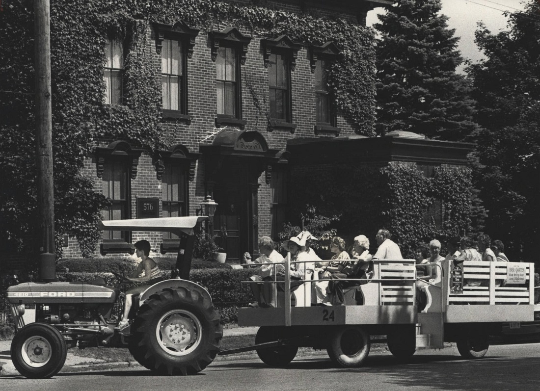
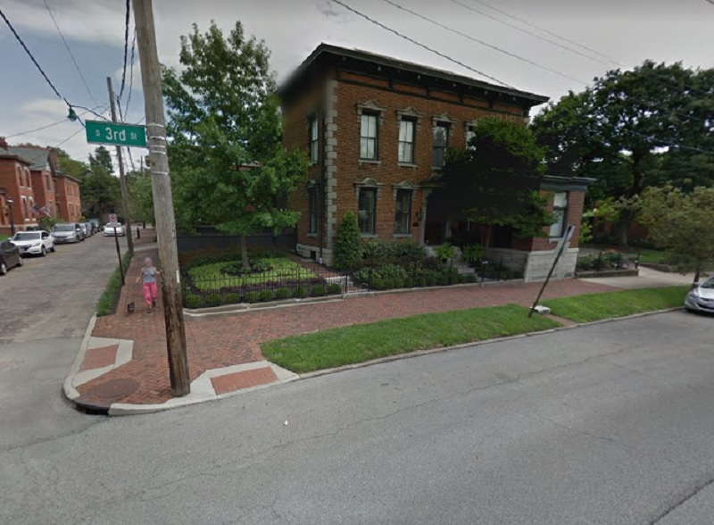
Before: Third Street and Beck, looking east, in 1981. After: 2016 The photo shows a German Village “Haus and Garten Tour” through the neighborhood.
The Random Columbus Photos 4 edition takes a look back at Downtown in the 1980s.
Date Photo Taken: 1989 Photo Location: Looking west on Broad Street from LeVeque Tower. This photo is interesting for a few reasons. First, it shows the beginning of construction to replace the Broad Street Bridge over the Scioto River. After the Great Flood of 1913 destroyed an earlier Broad Street Bridge, the one in the photo was finished in 1921. By the early 1980s, the bridge was rapidly deteriorating and the decision was made to replace it. It’s reconstruction start, however, was delayed until 1988 due to a contract to keep the Columbus 500 auto race going, which used the bridge. The nearly identical new bridge was completed in 1992 at a cost of $13.2 million. Across the bridge is the Scioto Peninsula. On the right is Vets Memorial, built in the 1950s and recently demolished to make way for a new memorial and museum as part of the redevelopment of the peninsula. On the left is the old Central High School, years before it was converted into COSI’s new location. Also of note are warehouse and other buildings that still existed on the peninsula, remnants of when this area was largely manufacturing. These were mostly demolished in the 1990s and early 2000s and were left as vacant lots for well over a decade, some of them becoming parking lots for COSI. These lots will soon become part of a large mixed-use development and park.
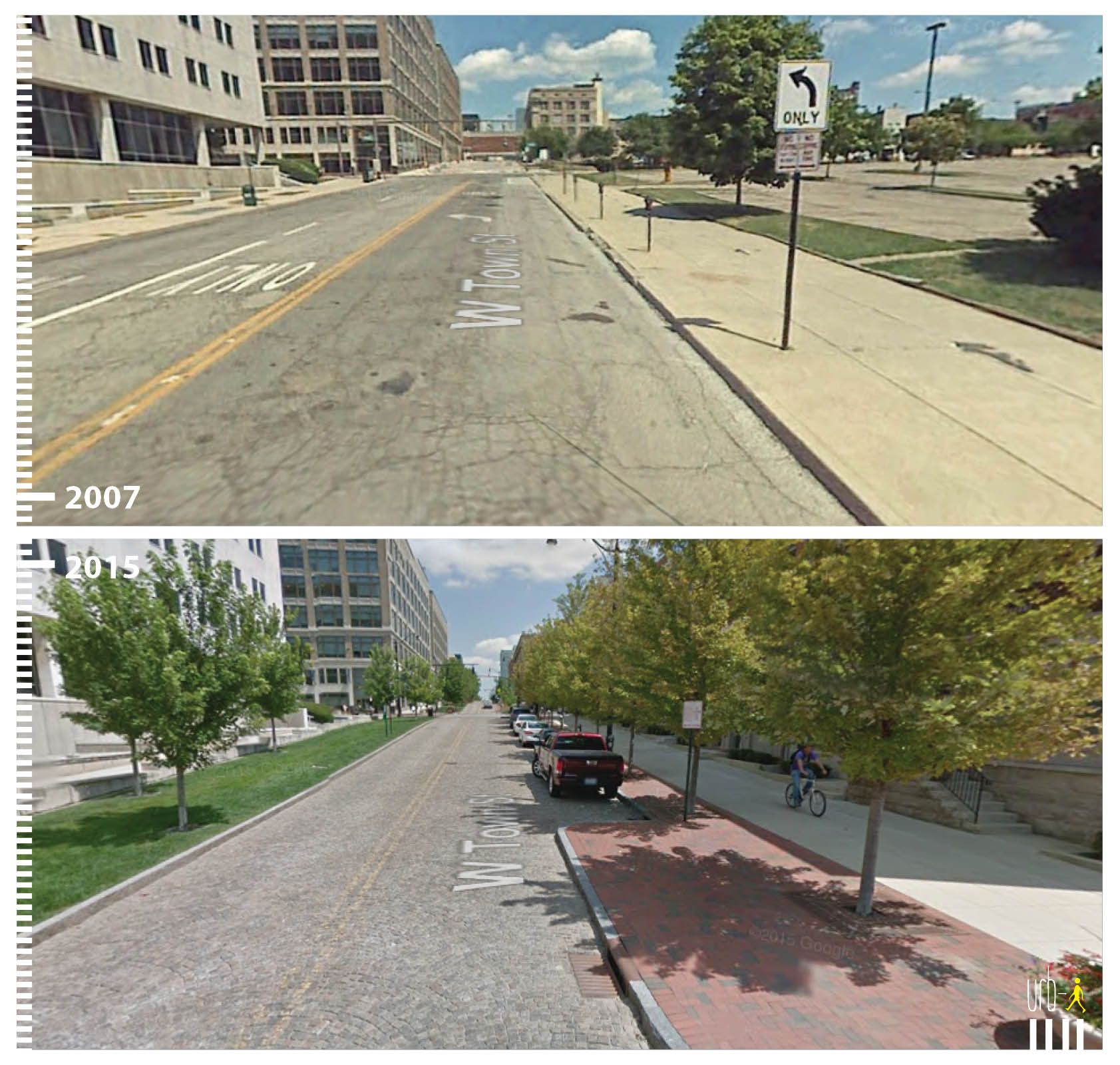
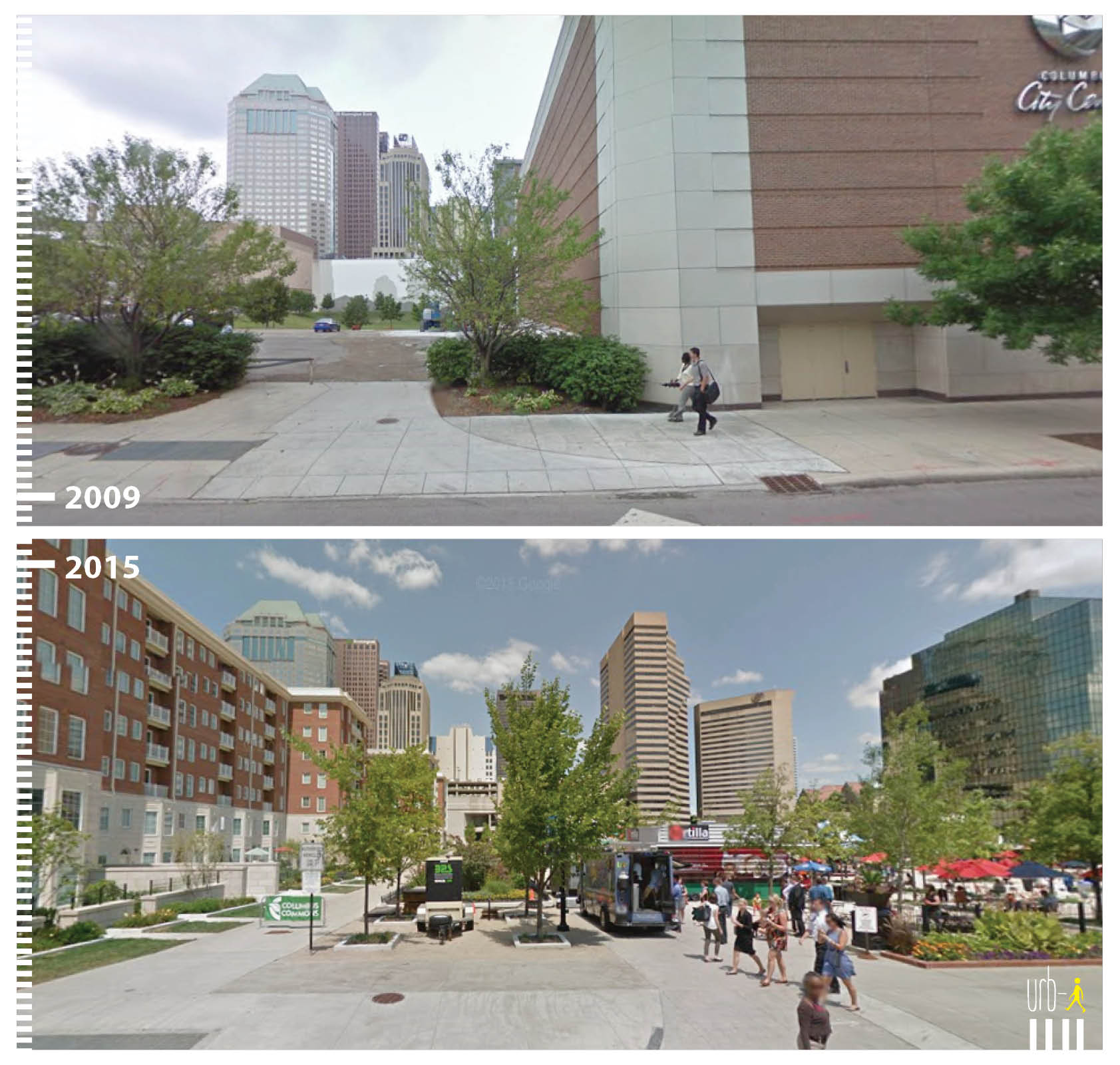
I saw this site mentioned on the CityLab site awhile back and thought it was a very cool idea. The site highlights how cities are transforming public spaces and making car-centric areas much more pedestrian, bike and transit friendly. Since I found the site, I have been lucky enough to become a regular contributor working to help make the site even better. The great thing is that anyone can send in before and after photos from their own cities of public space transformations. Take a look: http://www.urb-i.com/ The site covers cities across the world.
Columbus has several examples that I have added, but the photos are not yet updated on the site’s map. Until they are, here is a sneak peek:
This Random Columbus Photos 3 edition looks at a Downtown icon, the Columbus Athletic Club..
Photo Date: November 1, 1914 Location: 136 E. Broad Street
The photo shows the ongoing excavation of the Columbus Athletic Club. It was conceived a few years prior as a social club by a group of wealthy Columbus businessmen in 1912. The organization was originally housed in the Atlas Building at Gay and High, but the club wanted their own building. Construction began in early 1914, and the 6-story building was dedicated in 1915. The 100-year-old institution, now on the National Register of Historic Places, looks pretty much the same as it did when it was first built, and it remains a private club to this day. Over the years, the club has had many prominent members, including politicians and even a president, Warren G. Harding.