For today’s Random Columbus Photo 12, we don’t go back too far in history, but the before and after are definitely one of the more dramatic comparisons featured so far. Larger versions of both photos are available if you click on them.
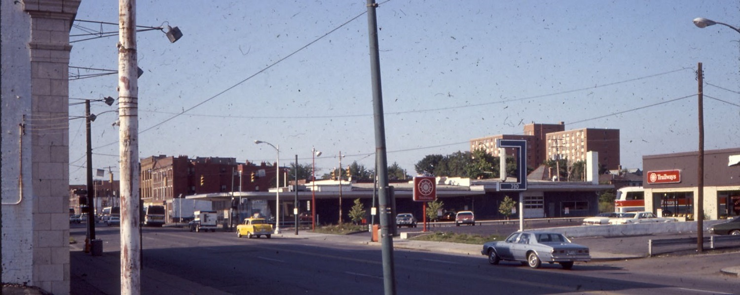
Before: N. High Street at Hubbard Avenue looking northeast, around 1980. The Short North by the 1970s was considered a declined neighborhood with significant crime and prostitution problems. Police were called there often, and history tells that it was the police themselves who coined the name of the neighborhood, since it was an area that was just “short of Downtown”. In the photo, you can see buildings at 790 N. High and beyond. At the time, they were a Trailways bus station and some kind of office building. Trailways was eventually replaced by other businesses and restaurants over the years, the last being the restaurant Haiku until it was all demolished for the current hotel building.
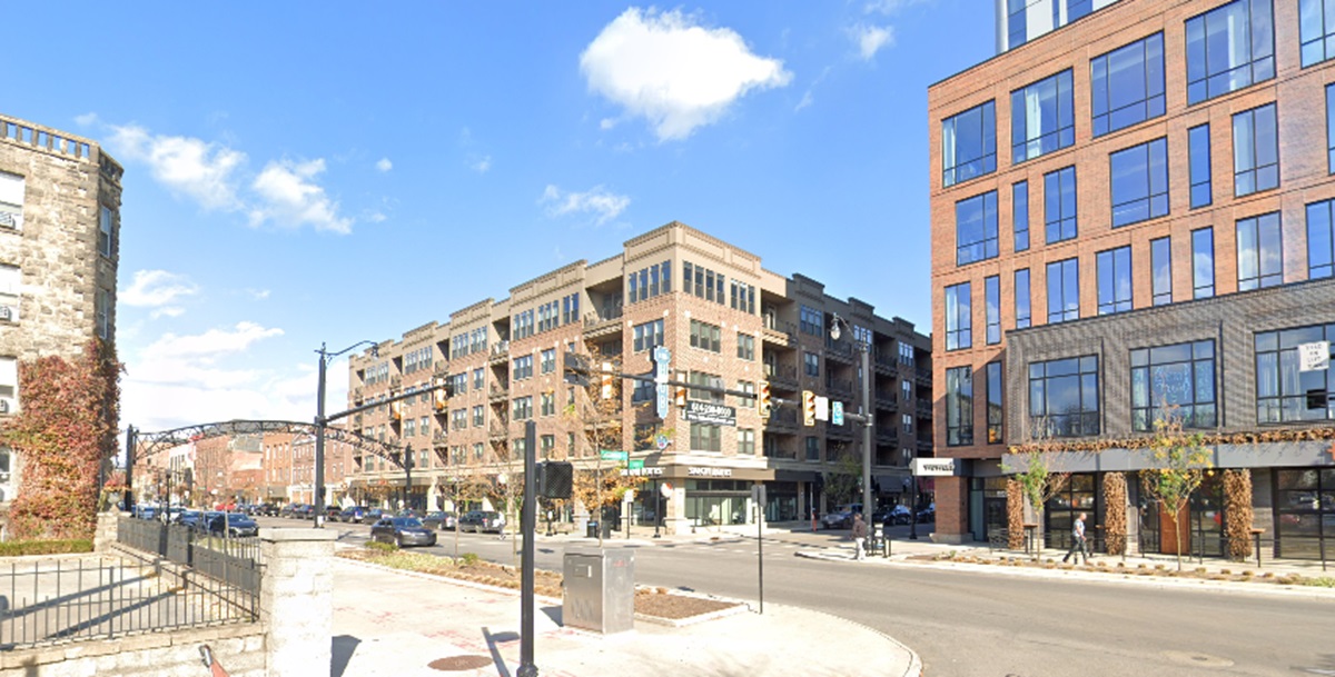
After: The same view in 2024. The picture from 2024 shows a drastically transformed neighborhood. After more than 40 years of renovations, revitalization and construction, the Short North has shed it’s drab and shady past. Crime stubbornly persists despite the improvements, but not nearly to the same degree. The taller apartment building in the older photo was torn down in the 1990s.
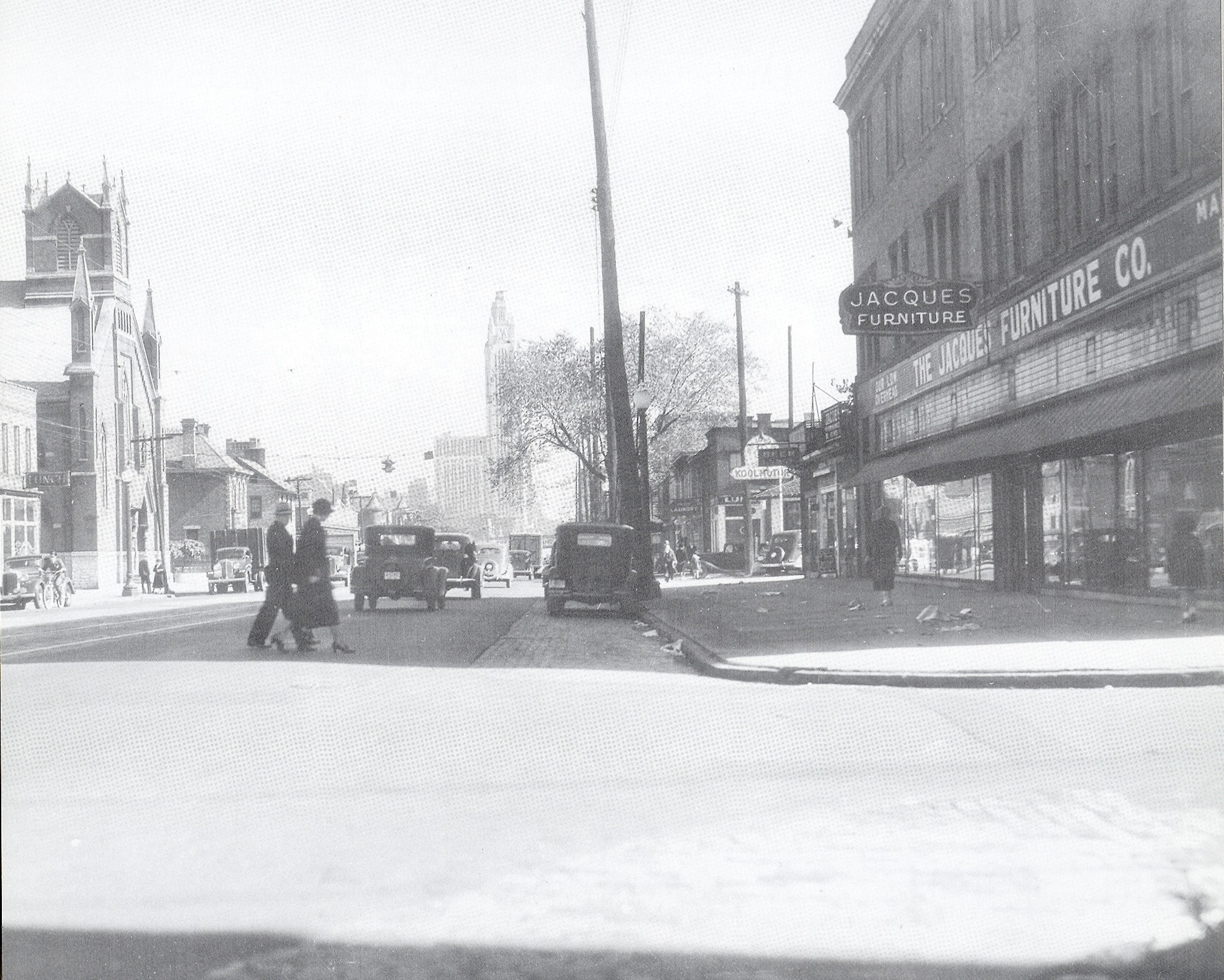
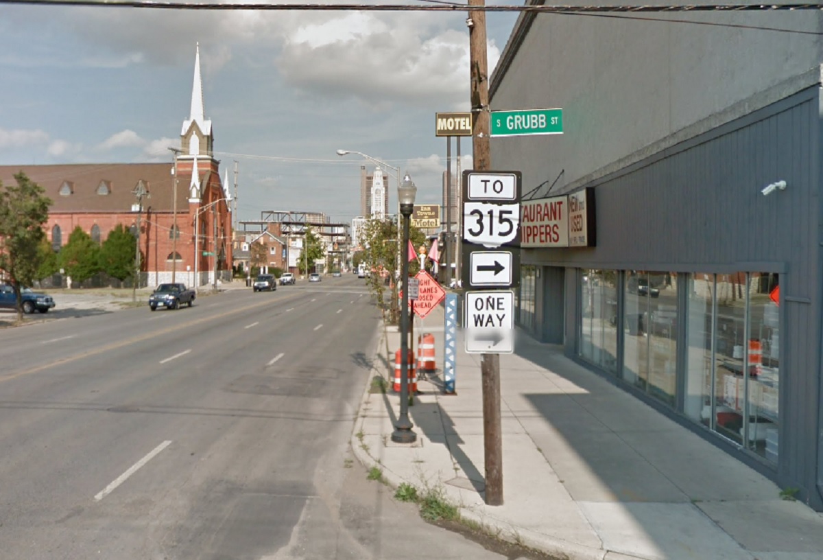
Photo Location: West Broad Street at Grubb Street, looking east. Photo Date: 1937 Photo History: Franklinton was bustling in this pre-WWII era-photo of Broad Street. It had been 24 years since the Great Flood, and the neighborhood was reaching for its historic population high along with the rest of the urban core. Unfortunately, within 2 decades, the neighborhood would be devastated by yet another flood and would be followed by 50 years of stagnation and decline.
A new Random Columbus Photos after a multi-year absence!
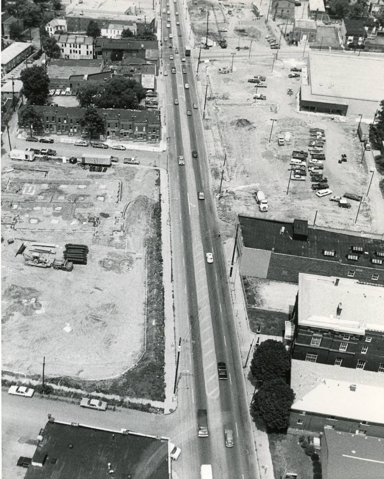
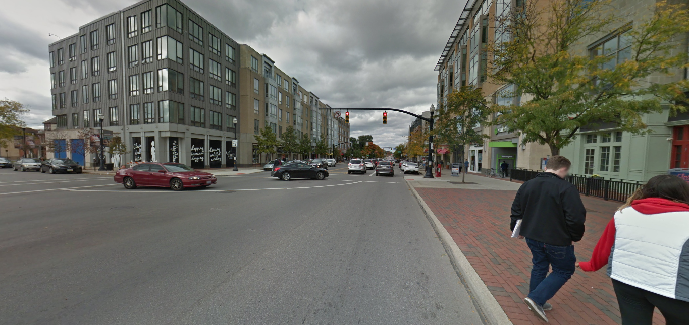
Photo Location: Aerial photo of North High Street between Smith Place and 7th Avenue. Photo Date: Around 1985 Photo History: Located just north of the Short North and south of the OSU Campus, this part of High Street was often left out of revitalization and development efforts. By the 1980s, much of the urban fabric had already been torn down, leaving mostly parking lots and vacant lots, with only a smattering of buildings.
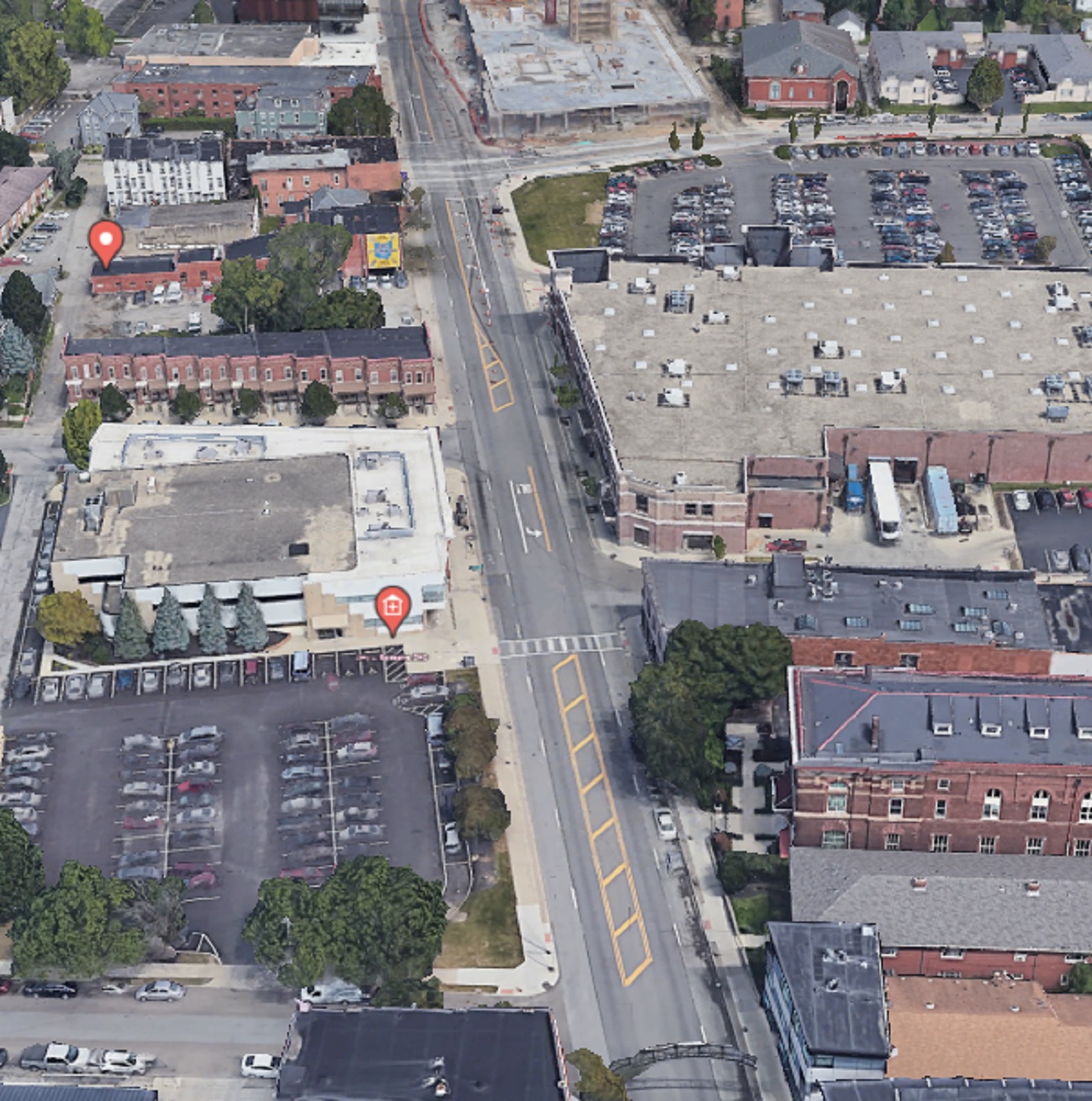
And the same view today. The Kroger, while realigned and larger, still retains a large surface parking lot, as does the business across the street, but otherwise, the area is significantly more filled in than it was in the 1980s. That trend will continue with more- and larger- projects planned for the stretch.
German Village dates back to the early 19th Century, when it was sometimes called called Germantown. Unsurprisingly, by the middle of the 20th Century, the neighborhood had declined significantly, yet still retained the vast majority of its historic buildings. The city of Columbus had it in mind to bulldoze a large part of the neighborhood in the 1950s for public housing, but activists organized against those plans. Instead, in what was one of the first major success stories of Columbus preservation, German Village was saved. The entire area was eventually added onto the National Register of Historic Places in 1975, and today it is still the largest historic district on the registry anywhere in the United States. Here are just a few before and after photos around the neighborhood.
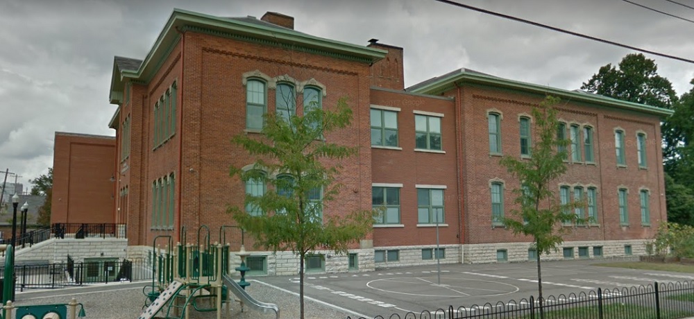
Before: Stewart Avenue Elementary School, looking northeast, in 1920. After: 2017 The school was constructed in 1873 and remains in use today, one of the oldest continuous schools remaining in the city.
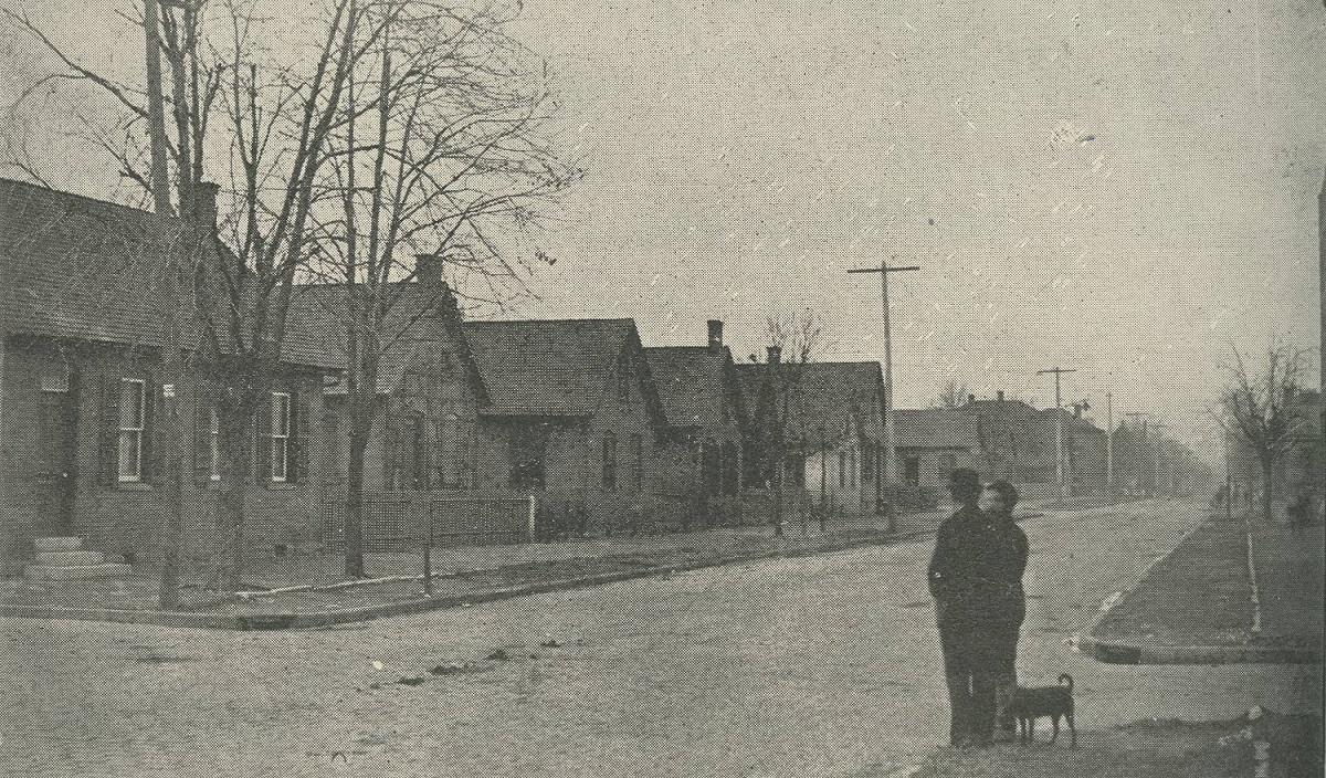
Before: City Park Avenue at Lansing Street, looking south, in 1898. After: 2016
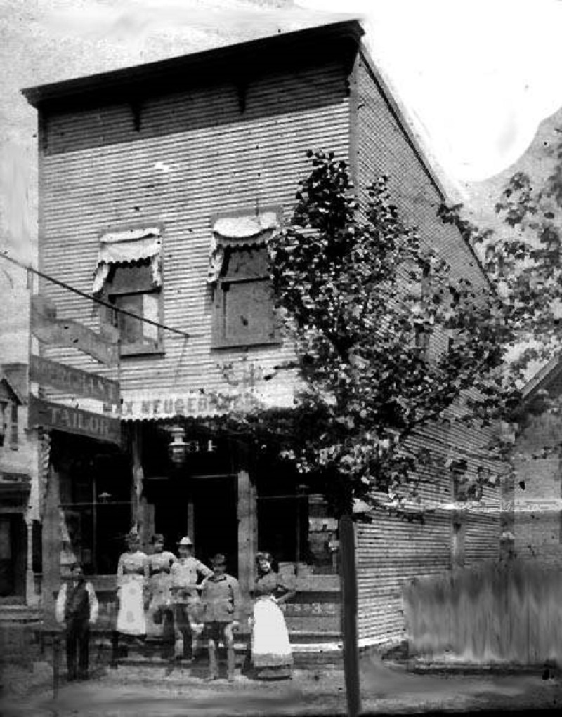
Before: The Max Neugebauer Tailor Shop at 764 Mohawk Street in 1897. After: 2016 Neugebauer arrived in Columbus in 1887, but it’s unclear when he opened this business.
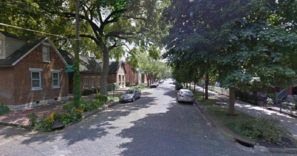
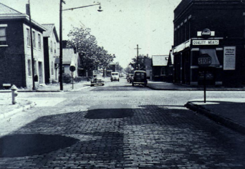
Before: Beck Street and Mohawk, looking east, in 1950. After: 2017 German Village was considered a “slum” by 1950, so the before photo would’ve been around the time of the neighborhood’s low point.
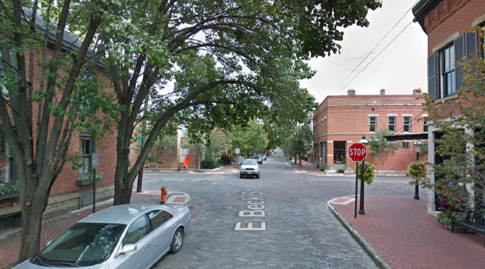
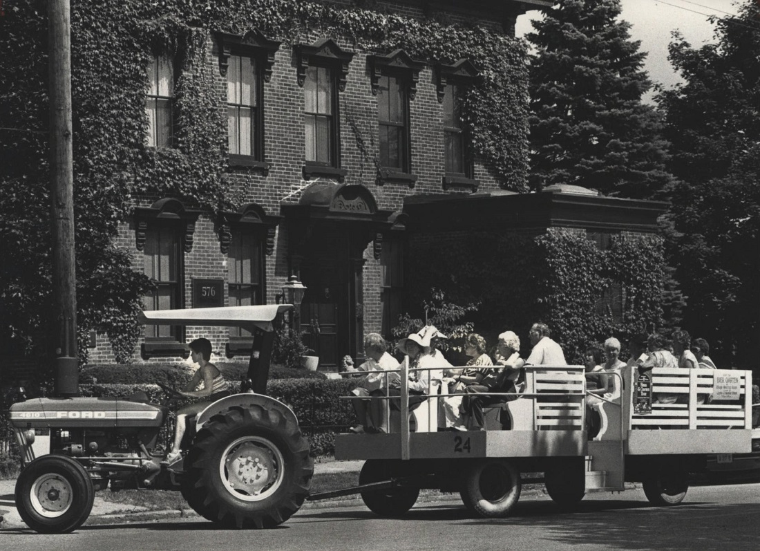
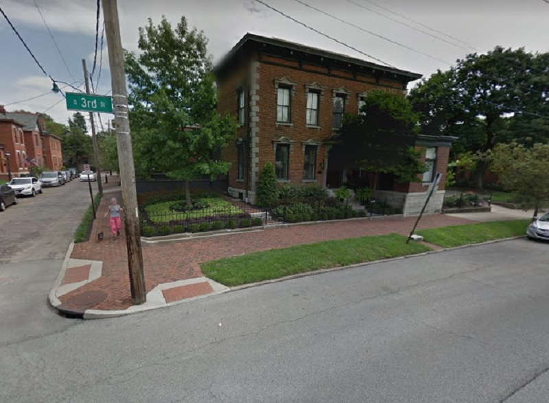
Before: Third Street and Beck, looking east, in 1981. After: 2016 The photo shows a German Village “Haus and Garten Tour” through the neighborhood.
I haven’t done a Before and After installment for a while. This time around, I chose to not focus on any single neighborhood.
First up is a photo of the construction of the Columbus Interurban Terminal, looking northwest from 3rd. The photo was taken on October 5, 1911, about 3 months before the building opened. The interurban system was relatively short-lived in the city, and the terminal closed after only 26 years in 1938. The building survived as a grocery store through the mid-1960s before the building was demolished in 1967 as part of the construction of the Greyhound Bus Terminal across the street. The actual location of the building was not on the Greyhound site, but was used as an overflow parking lot. It remained a parking lot until the mid-1980s, when it became part of the City Centre Mall site. Today, plans are for the site to become the location for the 12-story, 80 on the Commons mixed-use project.
October, 1911.
Here is the same place in October, 2018.
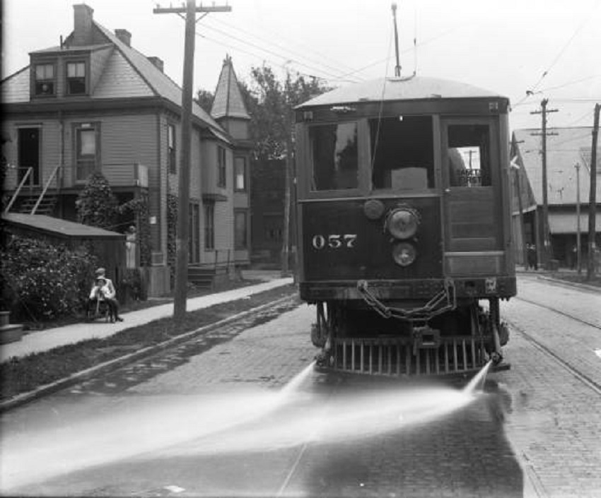
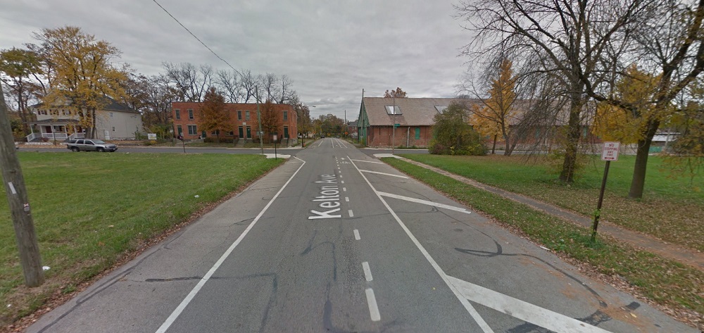
The second historic photo is of the #57 streetcar on Kelton Avenue just south of the Oak Street intersection. The photo, which looks north, was taken on June 30, 1915 and includes 3 separate visible buildings as well. The house on the left actually survived until 1977, when it and the rest of the east half of the block was demolished. The building visible on the right is the surviving streetcar barn. Today, it is in bad shape, and while many would like to see it renovated and saved, time seems to be running out. The other surviving building, barely visible in the 1915 photo, is the tenement building on the northwest corner of Oak and Kelton. And in 2015:
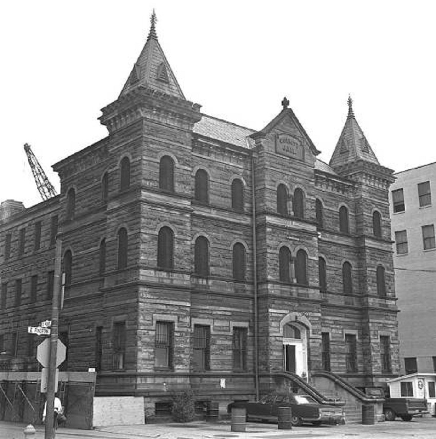
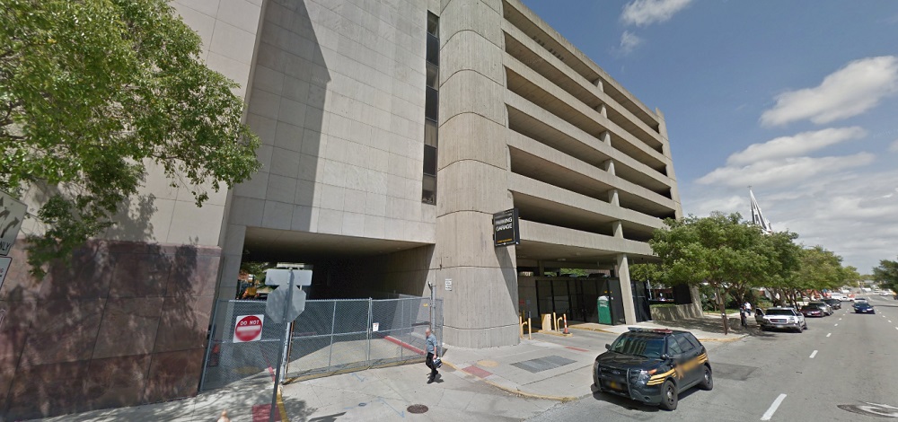
Third in this list is a photo of the demolition of the old Franklin County Jail, once located at 36 E. Fulton Street in Downtown. Built in 1889, the structure survived until the fall of 1971, when the building, which by then had become outdated for its intended purpose, was torn down to make way for- what else- a parking garage. The parking garage remains to the present day. Columbus leaders at the time should’ve been flogged for such short-sighted thinking, something that was repeated over and over and over again during that era. Today, such a very cool, unique building would’ve made an excellent candidate for mixed-use conversion. And in August, 2016:
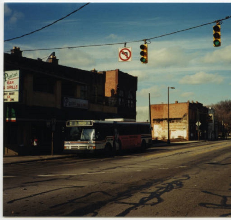
Finally, this next photo isn’t really historic. It was taken a mere 15 years ago in February, 2002, looking northwest from the corner of N. High Street and 10th Avenue. At the time, this area had been made up of low-rise historic buildings that had long held bars for OSU students. All these buildings in the photo, and many more, were demolished not long after the photo was taken in order to make room for the South Campus Gateway, now more or less just called the Gateway. Similar large-scale demolitions are taking place to the north and south as the entirety of the High Street corridor around Campus is transformed. Whether that is good or bad depends on who you ask. What can be agreed upon, however, is that the corridor will be almost unrecognizable in the end. And in October, 2016: