Redeveloping Westland Mall


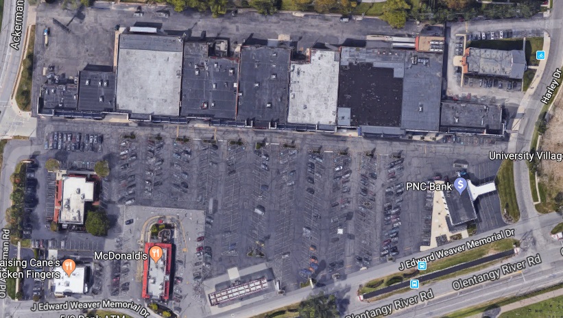
Years ago- originally in 2013 and later reposted in 2016- I made a rather crude map of how I thought the Westland Mall site should be redeveloped.. It seems that the mall may finally be torn down soon after a long period of deterioration, so I figured it was time to revisit this map once more, but this time update it in detail and give a much clearer sense of how redeveloping Westland Mall would drastically change the entire West Side.

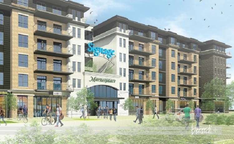
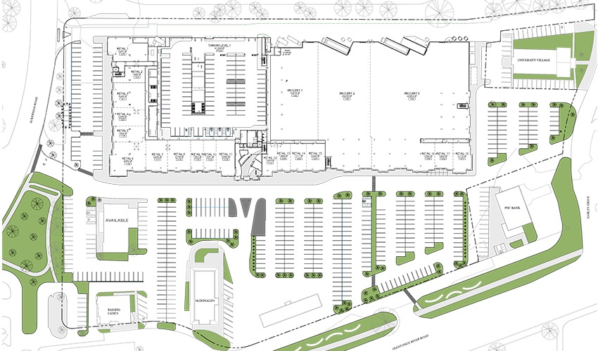
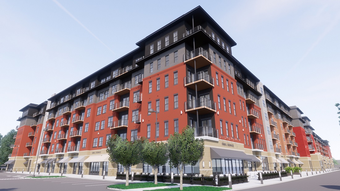
One of the problems with the original map was that it really didn’t take into account the massive size of the entire site and how many decent-sized buildings could truly fit within it. While on the old map I used single, general boxes to convey multiple buildings, this time I actually laid out nearly 50 of them. These mixed-use buildings are all a minimum of 4 stories and contain residential, office, hotel and retail/restaurant space.
Each of these buildings could hold 100 or more residential units, so there could easily be several thousand new residents in this neighborhood.
3 parking garages of various sizes are also included, with enough combined space for thousands of parking spaces. The garages would mostly be covered by new walk-up condo or apartment units. A new park avenue street grid connects these garages and all other buildings, with a central roundabout plaza flanked by retail and restaurant locations. Between the streets, a series of pedestrian-only alleyways provide convenient places for outdoor patio seating for any restaurants and retail locations.
One of the biggest changes on the new map is that the park space has become significantly larger, almost doubling in size to more than 18 acres. This would be a significant new park for the West Side, something this part of the city doesn’t have much of. The closest park is also fairly new- Wilson Road Park- which opened in 2017, but its out-of-the-way location makes it somewhat underused. The new Westland park would be lined with retail and restaurant space overlooking it, and a new outdoor market would sit on the northern end- perhaps another extension of North Market similar to what Bridge Park received?
There are also new connections to the park and overall development. Multi-use path connections could be built on the eastern end along the old Shopper’s Lane, a western connection that travels under or over I-270 to the large residential area south of Lincoln Village, and a southern path would connect directly to the Camp Chase Trail. The old Lincoln Park West apartment complex would also have adjacent access.
A rapid-transit station could go on West Broad Street in front of the entire complex as part of the LinkUS plan.
Finally, another big difference between this and the old map is that I tried to be a bit less Sim City about it, meaning that I largely stuck with the existing Westland site and didn’t go beyond it. However, the light yellow areas are all potential future redevelopment locations. These areas are mostly low-density retail strip centers or big box stores with large parking lots. Over time, these areas could be redeveloped to create an enormous, 160-acre redevelopment of the Westland area.
For comparison, Dublin’s Bridge Park is only about 40 acres and Jeffrey Park in Italian Village is about 42 acres, with both developments being good examples of what could be done on the Westland site. In fact, Easton is the only comparable area. The potential is incredible and would finally give West Siders the destination and transformative development they’ve been asking for.

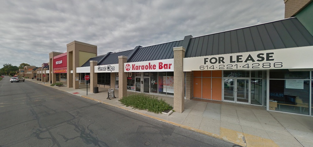
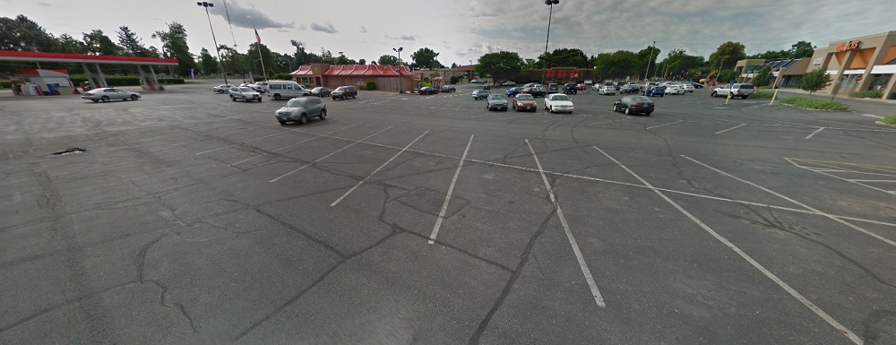
To date, there have been no solid plans released about the future of the Westland site by its owners. However, given that they’ve already sold off a small part of the site on Broad Street for a gas station, the chances that they have any significant, urban vision for it seem to be very slim. In reality, I would expect a suburban-style apartment development with fast-food outlets and another strip retail center, adding to the car-dominated stroad hellscape that already exists on West Broad Street now. The only way to avoid that outcome is for residents to demand better.


Random Columbus Photos 10


In Random Columbus Photos 10, we look toward the East Side.

Photo Location: James Road, looking north from Livingston Avenue.
Photo Date: August 16, 1950
Photo History: This photo of a very primitive James Road was taken by the City in preparation for installing a sewer system in the area. There were very few homes and other buildings on James at the time, and the area was still mostly farmland. The homes on the left side of the photo had only just been completed, and were the first of large-scale, small-home subdivisions that now dominate this part of the city and neighboring Whitehall. By 1953, the entire area seen in the photo would be fully developed and unrecognizable.
Random Columbus Photos #10 Columbus, Ohio
The same view today:
Random Columbus photos #10 Columbus, Ohio

Thousands of historic before and after photos from across the city can be found on the Historic Building Database.

More Historic Building Preservation Results


More historic building preservation results

A few years back, I wrote about the outcomes of Columbus Landmarks’ historic buildings under threat from development or demolition. A few of the buildings had already been lost, a few had been saved, but several had no resolution. Since then, however, the list has seen more historic building preservation results arrive.
Additionally, other buildings that were not on the Columbus Landmarks list of endangered buildings have recently come under threat.

Columbus Landmarks List Buildings

Indianola Junior High School
Address: 420 E. 19th Avenue
Built: 1929
Status as of April 2022: Existing, with a Renovation Plan

Indianola in 2015.

Some good news for the very first Junior High building in the United States. An independent STEM school chain, Metro Schools, announced in May of last year that they will be renovating the old school for grades 6-12. Through April of this year, renovation does not appear to have started, however.

Bellows Avenue Elementary
Address: 725 Bellows Avenue
Built: 1905
Status as of April 2022: Existing, with a Renovation Plan


In November of 2021, Columbus City Council approved redevelopment plans that would renovate the school into a mix of office space and apartments. Additionally, the remaining school site land would be filled with new townhomes. Work has yet to begin on this project, however.

Near East Trolley Barn Complex
Address: 1600 Oak Street
Built: 1880-1900
Status as of April 2022: Renovated

The main trolley barn and grounds in 2019.

The old trolley barn as of April 2022.

A renovation to turn the trolley barn into East Market has more or less been completed, and the surrounding grounds have also been rebuilt.

Kessler’s Corner Grocery
Address: 553-555 W. Town Street
Built: 1884
Status as of April 2022: Existing, but to be Demolished

Kessler’s in 2019.

The building had been vacant for more than 30 years, with a slew of owners not spending a dime on maintaining the structure- and apparently the city doing nothing about it. Ironically, the current owner has some history with restoring buildings like this, but claim the building is too far gone to save. The reality, however, is that only very rarely can a building not be saved. It largely comes down to the cost-return analysis, meaning that restoring this building would likely cost more than the return the owner wants to get out of it. They will say it’s beyond saving, but really it’s just beyond what they want to spend. And so, another piece of Columbus history is lost.

The Main Bar
Address: 16 W. Main Street
Built: 1880s
Status as of April 2022: Demolished

The Main Bar building in 2016.

This one really irks me. The Main Bar building was a small, historic building that was in great condition. It was demolished in 2021 not because of a proposed development project or because it was unsafe or in poor condition. Nope, it was torn down… for parking. The Downtown Commission allowed the demolition despite the fact that their own development standards forbid demolition without a replacement project planned, and also forbids it solely for surface parking space. Yet it happened, anyway. Why? At this point, who knows. Downtown development standards are rarely enforced by the Downtown Commission. Half the recently-built projects along High Street shouldn’t have been allowed as built, so the fact that they weren’t followed here, either, is no surprise. The owner promised that there would eventually be a development proposal for the site, but they didn’t have one at the time of demolition and still don’t.

Macon Hotel Building
Address: 366 N. 20th Street
Built: 1888
Status as of April 2022: Existing, with a Renovation Plan

The Macon in 2019.

This old building, famous for its jazz history, has been vacant for decades. Various redevelopment and renovations proposals have come and gone. A new one from the summer of 2021, and hopefully one that we see finally come to fruition, wants to renovate the structure back into a hotel with first-floor retail and restaurant space. No movement, however, has occurred on this project.

Kroger Bakery Building
Address: 457 Cleveland Avenue
Built: 1914
Status as of April 2022: Existing, with a Renovation Plan


A proposal from last spring seeks to renovate the structures into a mix of uses with apartments and retail, with more apartment buildings proposed around the historic bakery buildings. This project has been approved, but work has yet to begin.

Threatened Buildings Not on the Columbus Landmarks List

South Dormitory
Address: 240 Parsons Avenue
Built: 1935
Status as of April 2022: Existing, likely to be Saved

The South Dormitory in 2021.

This building was one of the dormitory buildings that were part of the old Institution for the Blind building that is now used by the City of Columbus. The City had been using it for offices, but claimed that it no longer functioned well for their purposes, so they proposed tearing it down for expanded parking space. Ironically, the complex already has a very large parking lot and garage that could be expanded upwards without requiring any demolition. Because the building itself is in good condition and because of the reason for the proposed demolition, there was immediate and heavy criticism of the plan. So much so that funding was pulled. While a new parking proposal hasn’t been released publicly, given the outcry, it seems unlikely that the City will move forward with the demolition itself.

South Side Learning Center
Address: 255 Reeb Avenue
Built: 1927
Status as of April 2022: Existing, but with Demolition Plan

255 Reeb in 2019.

The former South Side Learning Center is being proposed to be demolished as part of Nationwide Realty’s Healthy Homes affordable housing company. The existing building is in good condition, but Healthy Homes says that it can be best renovated only into 1 bedroom units and efficiencies, but they prefer to build 2-3 bedroom units. That’s it… that’s the reasoning. So as with the Main Bar, there is nothing really wrong with the historic building other than that it can’t accommodate the specific desired unit size. If Healthy Homes only owned this specific lot, I could see how that may be an issue. However, they also own the few vacant lots to the west along Reeb and the land back to the rear alley. The overall site is more than large enough to build 3-4 multi-unit new buildings each with 2-3 bedroom units in addition to renovating the existing structure into 1-bedroom units, creating a dense pocket of necessary housing for all potential parties. In fact, such a proposal could potentially more than double the units actually proposed. Yet for some inexplicable reason, Healthy Homes doesn’t want to do that despite the claim that they need more housing.

Jersey Farm Bakery Building
Address: 1826 E. Livingston Avenue
Built: 1949
Status as of April 2022: Existing, but with Demolition Plan

The bakery building in 2021.

While not as old as some of the other buildings on this list, this large art-deco style factory building still has some architectural interest and history attached. Woda Companies initially planned to renovate the building into residences, but now want to tear it down and replace it with a 4-story affordable housing complex with some retail space. Unfortunately, the latest proposal is fairly generic and somewhat garish with the choice of colors. A project that would’ve at least incorporated the Livingston-facing part of the building would’ve gone a long way to make this project more interesting. The overall site is very large at nearly 3.3 acres, so there was plenty of space to do something unique here. This seems like a huge missed opportunity.

Columbus and the greater region are set to change significantly in the coming years, with its trajectory of population growth only meaning greater pressure to build. But as those projects come, more and more old buildings could be lost if forward thinking fails.

To explore other proposals around Columbus, the best place is here.


3 Major Columbus Proposals that Died in 2021


Columbus saw a ton of new development proposals the past year, but not all of them have a future. Here are 3 major Columbus proposals that died in 2021.

Harmony Tower
Originally announced in the summer of 2020, this proposal called for a 30-story, mixed-use tower to replace a parking lot at 158 N. High Street Downtown. The $100+ million project would’ve included a hotel, 15 floors of condos, office and retail space.
After announcing the project, Schiff Capital went silent and the project basically disappeared. There were no updates, no news. In some ways, it was a reminder of the way Arshot had gone silent on the SPARC project years earlier.

Sometime over the summer of 2021, plans for the tower were quietly abandoned, though no reason was given as to why. Speculation for its cancellation mostly revolved around Covid and its consequences related to supply chains and rapidly rising costs of construction materials.
Sadly, this was not the only skyline-altering proposal that went belly-up this year.

Whittier Peninsula Tower
At the end of 2019, a North Carolina company announced a proposal for a significant new development along the railroad tracks just to the east of Scioto-Audubon Metro Park in the Brewery District. The plan called for for the multi-phase development of 10 buildings, including a mixed-use tower that would reach up to 30-stories, with a 7-story and 12-story containing another 400 residential units and retail and office space making up the first phase. The use makeup of the 30-story tower and other buildings had not been determined fully at the time.

Rendering of the original 30-story tower.


As with Harmony tower, after the initial announcement there was radio silence for months. 18 months later, in June of this year, new renderings for the proposal all but confirmed that the project had gone through a serious downsizing. Instead of 10 buildings with heights between 7-30 stories, the update consisted of just 5 6-story apartment and retail buildings.
Unfortunately, the scaling down wasn’t finished. In early October of this year, yet another update was released. In it, the 5 6-story buildings had been reduced to to just 3. So the number of buildings had been reduced by 70%, and the top height was now 5x shorter than the original proposal. To me, it seems like a pretty blatant case of the developer never having the necessary resources- or ability to access the necessary resources- required for the original proposal, and by the end of it, the neighborhood development commission was just happy to approve whatever leftovers the developer had really intended to build all along.

The Mondrian
The Mondrian was originally a 13-story tower for 567 W. Broad in Franklinton. It was by far the largest proposal for Franklinton to date in its new revival. The Mondrian would’ve had 80 residential units and ground-floor retail space along Broad Street.

The 15-story Mondrian proposal rendering from Spring 2021.


In April we found out that the proposal had actually increased in height to 15 stories, likely to try to take advantage of new, large-project state tax credits, but otherwise, there was no known movement on this project.
We know by now that no news on a big project tends to be bad news, and while there has been no official word that this project has been canceled, the evidence points that it has met an end. It was reported earlier this month that the listed site for the project is now up for sale, indicating that the proposal is likely dead.
That said, this project could still have some legs to it and the situation will be monitored until a more definitive answer is known.

Proposals come and go, and in a city growing as fast as Columbus, the more proposals the city gets, the more likely it is that some of them never come to fruition.


June’s Missed Opportunity of the Month


Columbus, as recent estimates show, is clearly becoming a real player on the national stage in terms of its rapid growth and increasing name recognition. There’s a lot to be proud of for a city located in what many people think is just the Rust Belt. But as with every city, Columbus doesn’t get it all right all the time. A while back, I wrote how Columbus could sometimes be a city of missed opportunities when it came to development, and that remains true. For every great project in the Short North, there’s an equally terrible development going up somewhere else. In what I want to be a semi-regular series, I’m going to highlight some projects that simply miss the boat in terms of good urban development. Some are merely not reaching their potential, and then some, like June’s missed opportunity of the month, is an out of left field example that seems to be trying so hard, only to fail equally so.

That project is the redevelopment of the University City strip mall off of Olentangy River Road.

Aerial photo.

As you can see from the aerial, the site is your typical strip mall. Built in 1961 when such developments were seen as community shopping destinations rather than the dying suburban sprawl they have become, University City is completely nondescript and looks no different than hundreds of others dotting the landscape. Anchored by a Kroger, the strip mall held other stereotypical establishments- a salon, bars, a Chinese restaurant, etc. A handful of out lots contain a McDonald’s, gas station and a bank.


Most of the site, of course, is taken up by enormous amounts of surface parking, most of which sits empty more often than not.

Olentangy River Road is not exactly an urban street. Most of it is lined with hotels, restaurants and offices, all set well back from the road and in a generally unfavorable configuration to encourage walkability. So when it was announced in June of last year that the strip mall would be redeveloped, hope for something substantially different seemed possible. The initial renderings showed a 6-story mixed-use building on the site instead of the strip mall.

MUCH better, right? Of course, saying it’s much better is a low bar compared to the current situation, but a 6-story, mixed-use project is truly urban, and one of the first of its kind on Olentangy River Road. So why, one might ask, is this a missed opportunity?
To answer that, we have to look at the proposed layout of the entire site.

Comparing the proposed layout to the current one is a little confusing, because they look extremely similar. It seems that the 6-story project will only replace the current strip center, but most of the parking and all of the out lots will remain intact. It’s a Frankenstein’s monster of suburban and urban elements that just looks really weird. There is no interaction with any of the nearby roads, and not even a resident pathway from the main building to the multi-use path that was built a few years ago along Olentangy. It’s all still catering to cars.
In the most recent rendering of the main building, seen below, there appears to be only 1 patio space for what is clearly a very large project. The view for customers from there, of course, is still just the parking lot, with its noise, pollution and lack of any shade. In fact that’s basically the view out of every window in the building- parking lots.

I suppose that some surface lots and outbuildings could eventually be redeveloped at some point, but as it stands now, there’s a lot to be desired. The main building is decent, but the overall layout and connections are terrible and it makes the whole project just look like a much larger version of the strip mall that’s already there. Maybe that’s a harsh assessment, but I don’t think it’s an unfair one. Casto, the developer, basically invented the strip mall, so they’re clearly playing to their strengths here. They’ve done some really good projects at times, like the renovation of the Julian building on South Front Street in Downtown, and I applaud the effort to go more urban in this location, but I think so much could’ve been done better in this case. No doubt that this development will have no trouble finding tenants to rent the apartments, just due to the lack of housing anywhere in the core, but I question just what this development offers that better ones don’t.

In the end, it is a good example of how Columbus needs more true urban developers that are comfortable and willing to push the envelope on this style of development. Trying to have it both ways, where suburbia reigns in an urban location, gets us nowhere.