In this Columbus Retail History Shopping Centers edition, we look back at how the city and retail innovation have been together for a long time, and there is a strong argument that the city has had such innovation before anywhere else in America. Even today, retail is a powerful player in the city’s economic and social picture. How did it all get started? Columbus Retail History: Shopping Centers, the second in the series, seeks to answer that.
As the automobile began to grow in use and importance, the concept of shopping changed. Previously, stores had been set up right against the sidewalk or street and customers would walk or find some other way to reach it. When the automobile came about, on-street parking was added. This was soon deemed insufficient for the steadily growing number of drivers, and developers and engineers began to think of new shopping experiences to adapt to this changing environment.
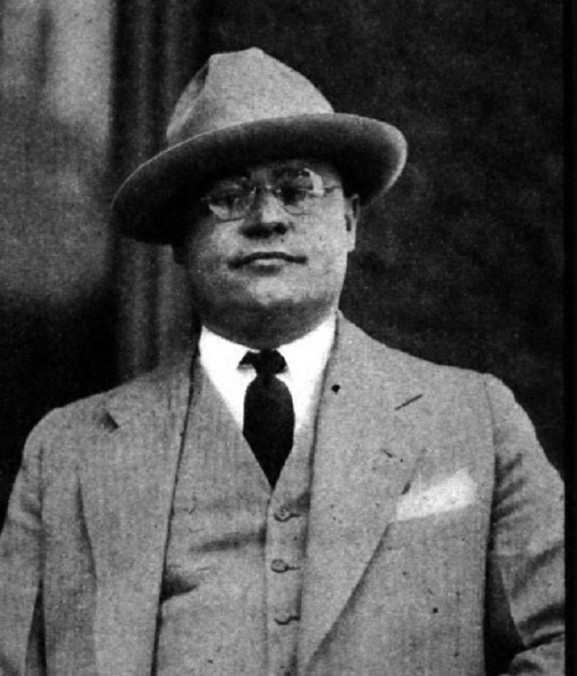
Don Casto Sr. in 1928.
One of the first major changes to come about was the strip center. Prolific in every suburb in America today, the strip center got its start in Columbus. The first one was developed in Grandview Heights and named the Grandview Avenue Shopping Center (also known as the Grandview Avenue Bank Block). Opening in 1928, the center included 30 shops and incorporated parking spaces for up to 400 cars, one of the first major retail developments to design for cars. It was also the first regional shopping center and the first to have more than one national grocer (it had 4). The opening was a big deal at the time. There was a parade that featured child actors from the “Our Gang” films (Alfalfa, Spanky, etc), a street fair and musical acts. It was, of course, an instant success, and copies began to sprout around the city, and eventually, the nation. The center was built by Don Casto Sr., and Casto Construction still is a Columbus entity, recently announcing a local HQ move to the Bicentennial Plaza building Downtown. The Bank Block also still exists, and although not functioning today exclusively as it was designed (it is now mixed-use), it is on the National Historic Register and continues to be a part of the Grandview Heights landscape.
The 1929 Bank Block at 1269 Grandview Avenue.
During the 1930s and 1940s, as suburban strip centers expanded and prospered, another idea began to emerge: The suburban shopping center. They were to be larger in scale than any strip center so far, with many stores, abundant parking and perhaps entertainment venues. Don Casto Sr., once again, took the lead. He proposed a new center at 3772 E. Broad Street, ironically, in order to relieve traffic congestion of shoppers in the Downtown area. Town & Country Shopping Center in Whitehall, was the result, opening in 1949. It was still strip-style, but much larger and with the parking lot set in front of the buildings. This became the dominant layout of all strip centers (and all retail development of any kind) for much of the next 60 years. Today, Town & Country has been renovated and reworked several times over, and shows little sign of its age.
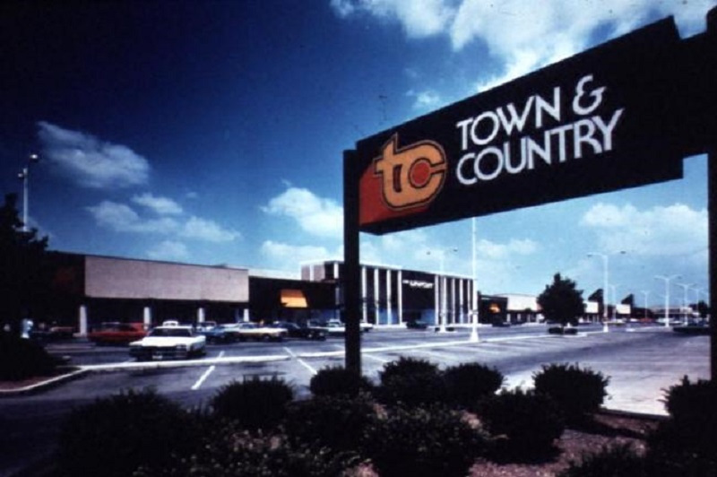
Photo taken in 1976.
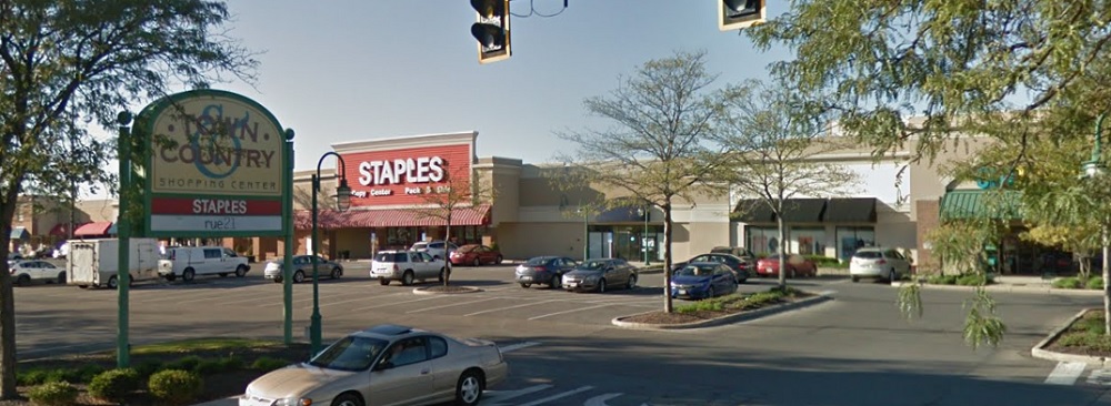
Town & Country in 2018.
Casto followed up Town & Country with a string of new strip shopping centers that included Northern Lights Shopping Center on the North Side (1954), Great Western in Hilltop (1955), Graceland Shopping Center at 5155 N. High Street (1955) and Great Southern Shopper’s City on S. High Street (1957). Most of these new centers also featured some type of local attraction. At Great Southern, there was a Pan American flag display, while at Great Western, there was the famous Walk O’ Wonders, where a large section of the parking lot featured scale models of the world’s major architectural and natural wonders, such as the Great Pyramids of Giza and Niagara Falls. Today, all of these centers still exist, though none of them are particularly popular. Most of them now have low-end retail or non-retail establishments, victims of the shopping mall.
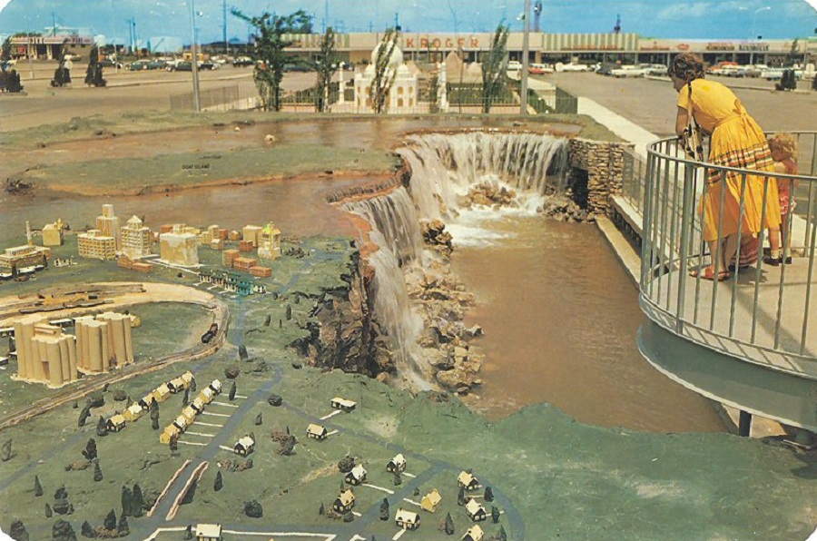
Niagara Falls at the Walk O’ Wonders at Great Western C. 1960. The attraction lasted about a decade.
By the 1960s, the regional shopping mall was the next big idea in retail, and malls were sprouting up all over the country. Columbus was no exception to this trend. Columbus’ first major mall was Northland, which opened on August 13, 1964. Built for a modest $11 million, the enclosed mall featured 43 stores and 4,500 parking spaces. It was soon to be followed by Eastland Mall in February 1968 and Westland Mall in February 1969. The Westland Mall site was already a retail destination, having the first Lazarus branch store in the nation, opening in 1962. The mall was also built as an open-air shopping plaza, a very early version of the Easton Town Center concept, but the design proved unpopular, especially in bad weather months, and the mall was enclosed in 1982. The last retail destination was The Continent. Opening in 1973, The Continent was an open-air shopping center that featured European-style architecture and walkways that resembled the cobblestone alleys of Europe. As of today, only Eastland still functions as a full mall. Northland closed in 2002 and was demolished in 2004. The site is being redeveloped into a mixed-use site with offices, restaurants and small-scale retail. Westland still has a few stores, but the main mall section is now closed. The new Hollywood Casino opened in October 2012 across the street, and plans for the mall’s redevelopment are in the works. These plans are expected to be announced sometime this year, perhaps in the spring, although the owners have said it will likely not be a mall any longer and that the building itself may not remain. As far as The Continent goes, many of the stores began to move out in the 1980s and today the area is a collection of motels, low-end retail and not much else.
The Continent in 1976.
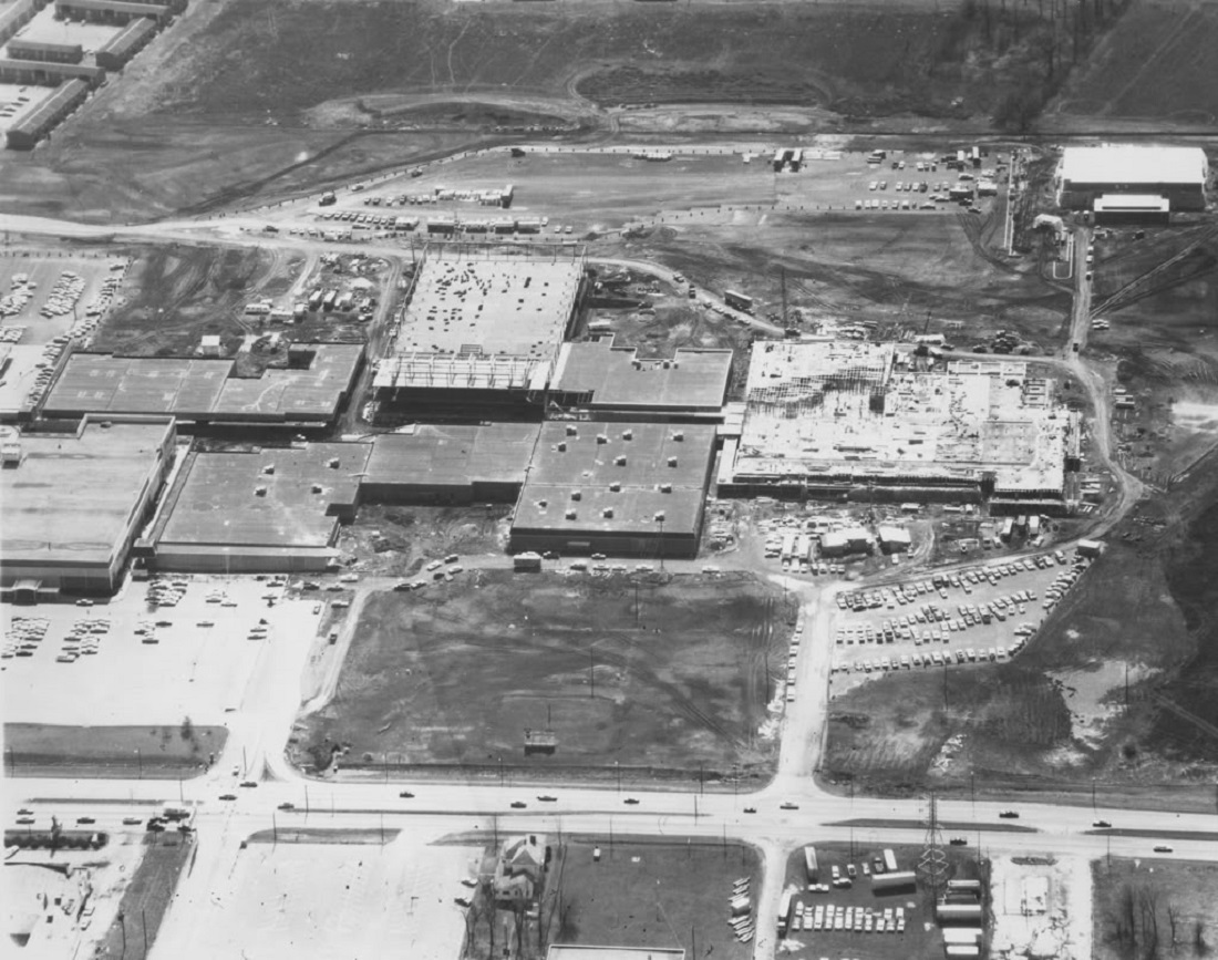
Westland Mall under construction in 1968 as an open-air concept.
Why did these malls fail? Pretty simple really… too much competition. This brings us to the the later arrivals on the retail scene. First up, was City Center. This mall was conceived as the savior of Downtown, to pull in shoppers from the suburbs and bring back traffic to the area. This $100 million, 100+ store enclosed mall was completed in 1989. For awhile, it did function as a destination mall, but also pulled business from Northland, Westland and Eastland malls, though it did not kill them.
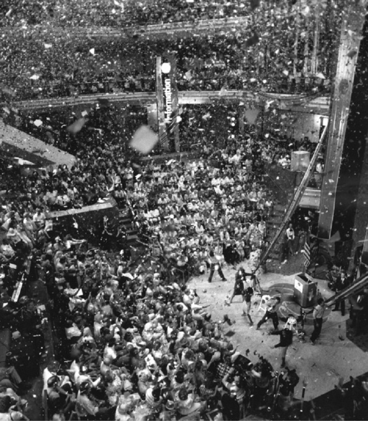
August 18, 1989 — BLACK & WHITE — File photo of Columbus City Center grand opening celebration. City Center is the three-level shopping mall in downtown Columbus. (Ran in the paper on August 19, 1989.) The mall marked a turning point in Downtown redevelopment.
Three new suburban shopping malls opened between 1997 and 2001: Tuttle Crossing, Easton Town Center and Polaris Fashion Place. Each was a bigger blow to the traffic at the older malls, and one by one most of them perished. Eastland was the only survivor, and only because it was the furthest away from the new destinations.
Tuttle Crossing was completed in 1997 with 150 stores. A traditional enclosed mall, this 2-floor building has been largely successful and has remained busy through its lifespan so far. The future of the enclosed mall, however, is not as bright.
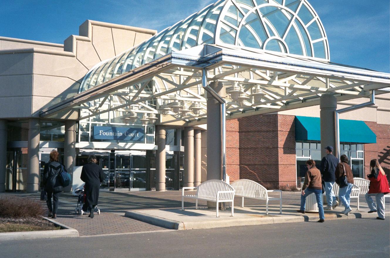
Tuttle Crossing’s main entrance.
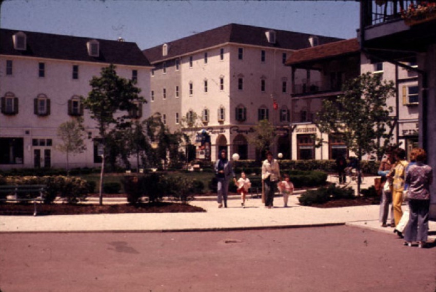
Easton Town Center opened in 1999. The nearly $1 billion retail center brought back the open-air concept that had been absent in Columbus since the 1980s. However, instead of just lines of stores, the center was built as a small town, complete with streets, public plazas, landscaping and other amenities. Easton proved to be extremely popular, adding a second phase in 2001 and is currently planning a 3rd phase, perhaps for completion by 2014. As it stands now, there are already over 200 stores, a 30-screen movie theater and dozens of restaurants. Easton’s design was hailed as innovative and revolutionary to the mall concept, and has since been copied around the nation, much like Don Casto’s early strip centers.
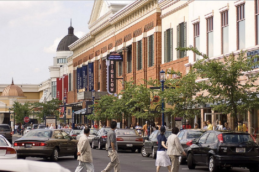
Easton Town Center’s street scenes.
Polaris Fashion Place was the last major retail center to be built in Columbus, a $200 million 200-store enclosed mall in the southern part of Delaware County just west of I-71. It was the largest mall in Central Ohio and one of the largest in the state. It introduced the Columbus market to new stores like Lord & Taylor and Sak’s Fifth Avenue, and Polaris was considered to be the high end fashion destination for the area at the time. Development around the mall has since exploded, requiring the construction of two exits to be built off of 71 to handle the traffic levels.
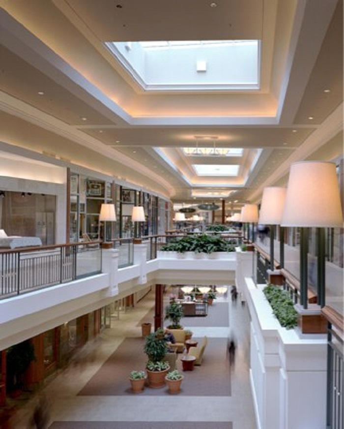
Polaris Fashion Place interior.
So what is the future of these most recent places? City Center is, of course, gone. The mall was demolished in 2010 and the site converted to Columbus Commons Park. Tuttle Crossing and Polaris are still popular, but enclosed malls are increasingly falling out of favor and both are showing signs of this. No new ones have been built in the US since 2006, and there may not be another built anywhere for a long time to come. Retail has evolved from just mere shopping to an overall experience. In that sense, Easton looks to have the brightest future of the bunch, so long as it can keep updating itself in the way it has for the past 14 years. Polaris may be the most in trouble of the bunch. A recent proposal by the Ohio Department of Transportation is to rebuild the 36/37 interchange in Delaware County. Along with this rebuild, retail is being proposed for the site. This retail may include one, or perhaps two, outlet malls similar to the one in Jeffersonville, about an hour southwest of Columbus. If these get built, the cycle that killed off Westland, Northland and City Center may be repeated. Customers are likely to get pulled from Polaris to this new development unless Polaris can update itself in the way Easton has. It remains to be seen. Studies have suggested that Columbus cannot absorb much more retail, even as a growing city, so the construction of more large-scale retail is bound to have ripple effects across the metro area. In future posts, I want to highlight some of these retail places a bit more, especially City Center and its ultimate demise. Until then, happy shopping!