Before and After Big Bear’s First Store

This edition of Before and After Big Bear’s First Store, we look at the chain’s original location. Big Bear grocery stores were founded in November, 1933 in Columbus. The first store in what would eventually become a significant regional chain, was located at 386 W. Lane Avenue.
The building was originally built as the “Crystal Slipper” ballroom, which opened in June, 1926. The ballroom was designed to hold 7,000 people and was called “America’s Most Beautiful Ballroom” by the developer, the Stadium Ovals Company. The ballroom itself was open less than a year, and the building was later used for various purposes into the early 1930s.
Before and After Big Bear's First Store The Crystal Slipper

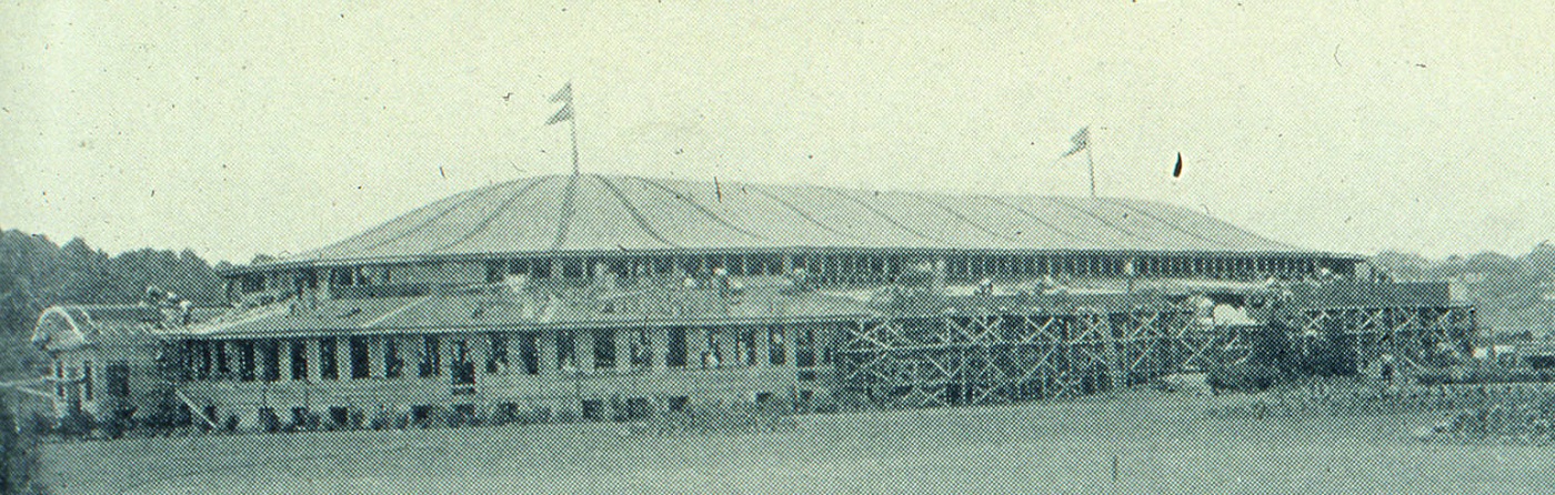
The Crystal Slipper finishing construction in 1926.


Big Bear would purchase the building and renovate it into a grocery store over the winter of 1933-1934. The location subsequently opened on February 15, 1934. The 47,000 square foot store was said to have attracted 200,000 people on opening day, the success of which allowed the company to open a second store less than a year later.
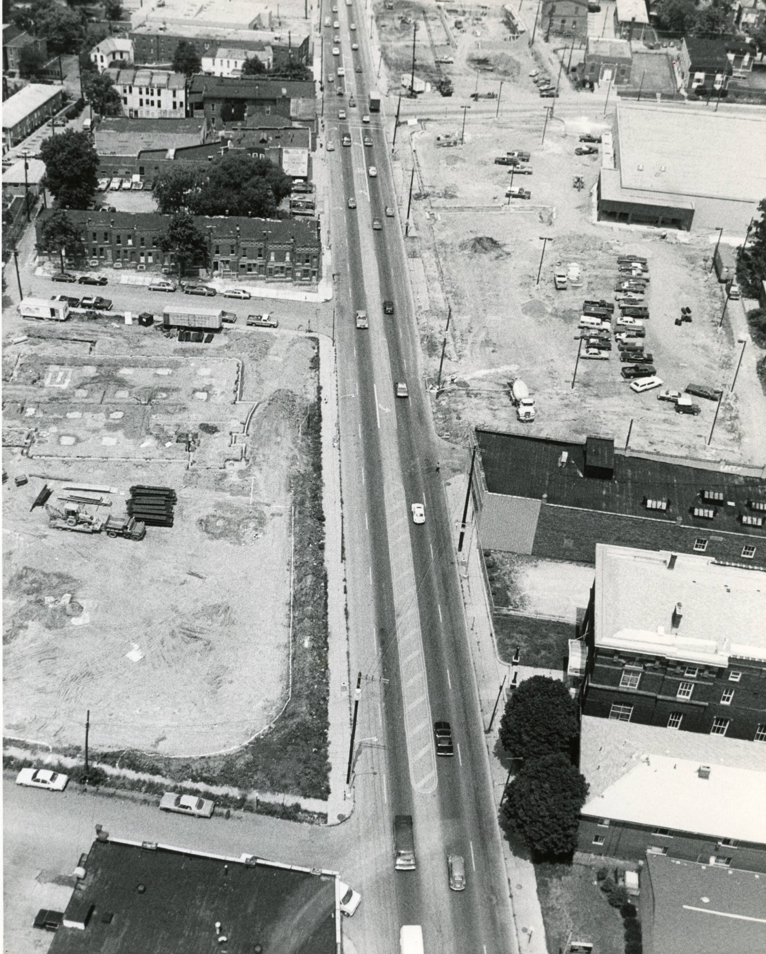
Before: The first Big Bear store sometime in the late 1950s-early 1960s.
Before and After Big Bear's First Store
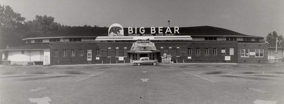
Big Bear was quite innovative for its time. It was the first self-serve supermarket in the Midwest and the first to use grocery conveyor belts for cashiers, for example.
The company eventually grew to include about 100 locations.
Ironically, a company that started as innovative ultimately failed because of a lack of innovation and maintenance of quality and service. In 1989, the company was purchased by Penn Traffic, a company that already owned several other chains in the Midwest. Unfortunately, it didn’t exactly have the cash to be buying the chain, and loaded Big Bear with debt. In 1993, newly-appointed CEO Philip Hawkins began cost-cutting measures. These measures included reducing staff and staff hours, and lowering product quality. Store conditions deteriorated and customers began choosing other supermarket chains.
By 2003, the company was being run into the ground. Customer volume had dropped to where the company could no longer pay vendors, so shelves were regularly empty of many products. This was the final death spiral. In 2004, Penn Traffic filed for bankruptcy and all remaining Big Bear stores were closed.
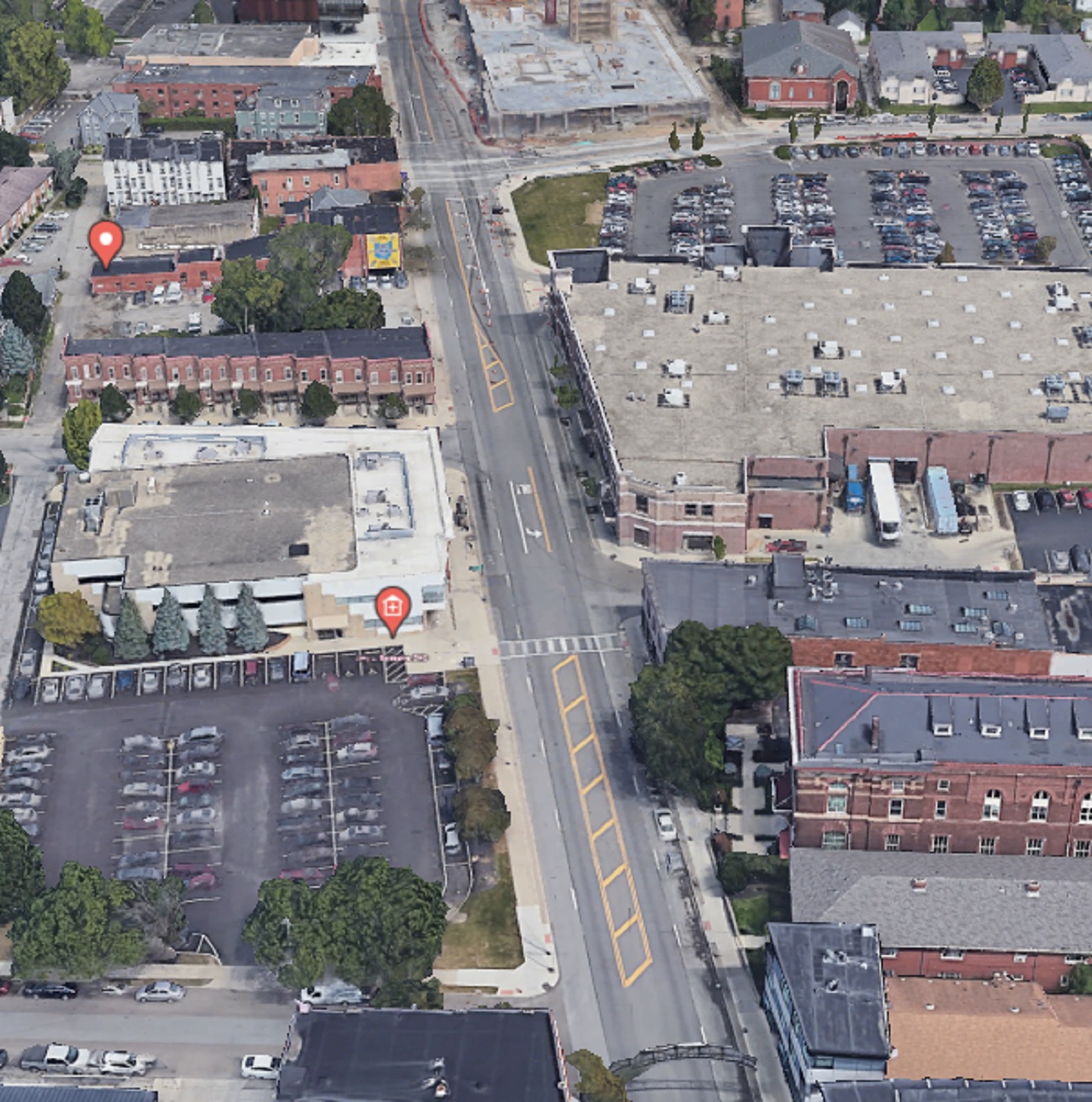
After: This 2021 image shows the site today.
Before and After Big Bear's First Store the location today
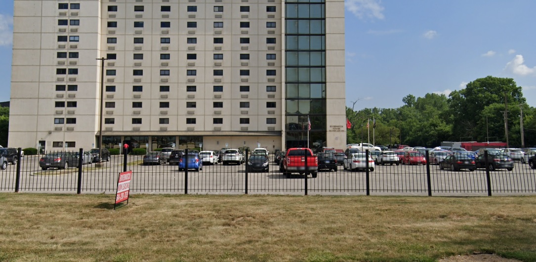
This particular location closed long before the company did- it closed in 1985 and the original building was demolished. Several years later, the current Riverwatch Tower was constructed on site.


Before and After Views from Franklinton


These before and after views from Franklinton show a snapshot in time of just how unattractive and people-unfriendly the riverfront once was.

Before: 1923
Before and after views from Franklinton in 1923
This view looks east from the Franklinton side of the Scioto River. At the time, Central High School was under construction, which is why the area looks like such a mess of materials. Central High School would be completed in 1924 and open on September 4th of that year. The school would remain open for 60 years before being shut down in the mid-1980s. The building sat empty for more than a decade before being renovated into the new COSI.
Beyond the river, a much shorter Downtown skyline can be seen. The image predates LeVeque Tower and most of the government buildings that now line the Scioto’s shores.

After: 2020
Before and after views from Franklinton in 2020.
The riverfront looks much different today. With the Scioto Greenways and park space added in more recent years, the view is much more pleasant, the bathroom not included.

Before: 1926
Before and after view from Franklinton in 1926.
In an image taken just 3 years after the one above, the Franklinton side of the riverfront looks much better. Additionally, LeVeque Tower is now well under construction.
After: 2021
before and after view from Franklinton in 2021
In the modern view, the parking and cars have been replaced with parklands and public space, while LeVeque has become the city’s most iconic skyline addition.

If you enjoy this series, the Historic Building Database page offers thousands of before and after photos of historic buildings and places in and around Columbus.

Random Columbus Photos 6


A new Random Columbus Photos after a multi-year absence!

Photo Location: Aerial photo of North High Street between Smith Place and 7th Avenue.
Photo Date: Around 1985
Photo History: Located just north of the Short North and south of the OSU Campus, this part of High Street was often left out of revitalization and development efforts. By the 1980s, much of the urban fabric had already been torn down, leaving mostly parking lots and vacant lots, with only a smattering of buildings.
Random Columbus photos 6 Columbus, Ohio

And the same view today.

The Kroger, while realigned and larger, still retains a large surface parking lot, as does the business across the street, but otherwise, the area is significantly more filled in than it was in the 1980s. That trend will continue with more- and larger- projects planned for the stretch.

Before and After Iuka Ravine


Iuka Ravine, much like Glen Echo Ravine to its north, is a hidden gem in the heart of the city. Columbus isn’t exactly known for its interesting topography, so such features offer welcome variety from the otherwise endless flatness of Central Ohio. That the feature sits in the middle of the Campus area makes it even more special.

Iuka Ravine was named by Robert Neil when he returned home from the Civil War and built a home along it. Neil gave names to many local streets in the area, all based on his time in the Union Army and the places he had visited. He named the ravine after the Battle of Iuka, and Indianola Avenue was named after the location of that battle, Indianola, Mississippi.

The ravine went largely untouched until the early part of the 20th Century. Large homes sprung up along its edges beginning in the early 1900s, built to take advantage of the natural scenery. Iuka Avenue seems to have been built around 1905 given references for it don’t appear in any media before then. In 1912, Iuka Avenue was improved and the viaducts were built over the ravine at Indianola and Summit.

Before
before and after Iuka Ravine Columbus, Ohio
The before photo shows the Indianola viaduct over Iuka Avenue in 1916. Strangely enough, the ravine appears rather treeless, most likely due to construction of the viaducts and improvements 4 years prior to the time of the photo. A large building behind the bridge to the right was home to the Chi Phi fraternity at 2000 Indianola Avenue.

After

In the 2020 image, Iuka Ravine is now filled with trees- and, unfortunately, many cars- but otherwise remains remarkably untouched. Even the old Chi Phi house can still be seen peeking above the viaduct.

Over the years, Iuka has been threatened by development, but is now on the National Register of Historic Places. This popular running road and adjacent Iuka Park will likely continue to offer a bit of nature in the growing city for generations to come.

The Battle of Iuka was not a huge battle overall in comparison to other Civil War events, but over 400 soldiers still lost their lives during the fighting.


Before and After: Ohio State Campus Aerials


It’s hard to imagine Columbus without its flagship university. While today Ohio State is one of the nation’s largest universities and a powerful influence in and out of Columbus in many ways, it got its start as just a humble agricultural college in 1870. Let’s go back to a time and look at these Ohio State campus aerials from 1919, and compare them to the same views today.

Before

Ohio State campus aerials

Photo taken in 1919.

This 1919 photo of the Oval and the surrounding neighborhood shows just how small the campus was back then. Residential areas began just to the north of of the Oval. Over the years, almost every single building in this photo would be demolished in OSU’s never-ending quest to expand and modernize.
After

Photo taken in 2019.

The residential neighborhood is long gone, replaced with new student residences, offices and educational buildings. Almost nothing remains the same- even the street grid itself has been dramatically altered.
Before

Photo taken in 1919.

This photo of Campus further east show the famous castle-looking Armory, along with an athletic field and part of High Street.
After

Some buildings remain recognizable, but not many. The athletic field disappeared by the 1930s, and the Armory burned down in disastrous fire in the early 1950s. It iconic castle towers were recreated somewhat in the Wexner Center for the Arts, which occupies the former Armory location.

Clearly, Ohio State’s campus has changed drastically over the last century. No doubt a century from now, it will be equally as unrecognizable to us as the current iteration would be to students from long ago.