These before and after views from Franklinton show a snapshot in time of just how unattractive and people-unfriendly the riverfront once was.
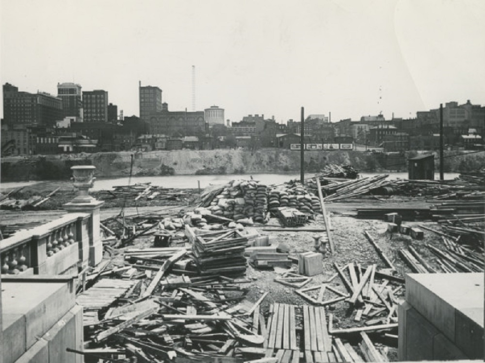
Before: 1923 This view looks east from the Franklinton side of the Scioto River. At the time, Central High School was under construction, which is why the area looks like such a mess of materials. Central High School would be completed in 1924 and open on September 4th of that year. The school would remain open for 60 years before being shut down in the mid-1980s. The building sat empty for more than a decade before being renovated into the new COSI. Beyond the river, a much shorter Downtown skyline can be seen. The image predates LeVeque Tower and most of the government buildings that now line the Scioto’s shores.
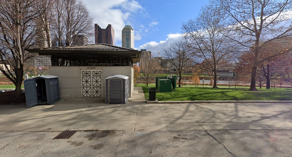
After: 2020 The riverfront looks much different today. With the Scioto Greenways and park space added in more recent years, the view is much more pleasant, the bathroom not included.
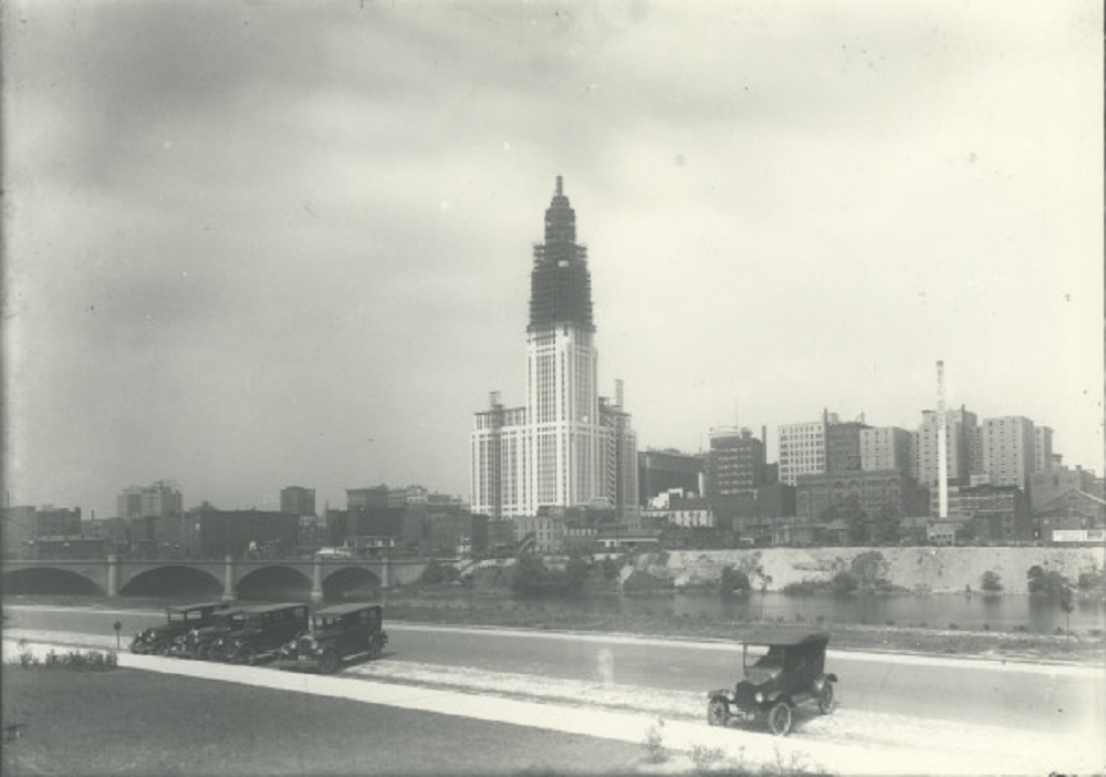
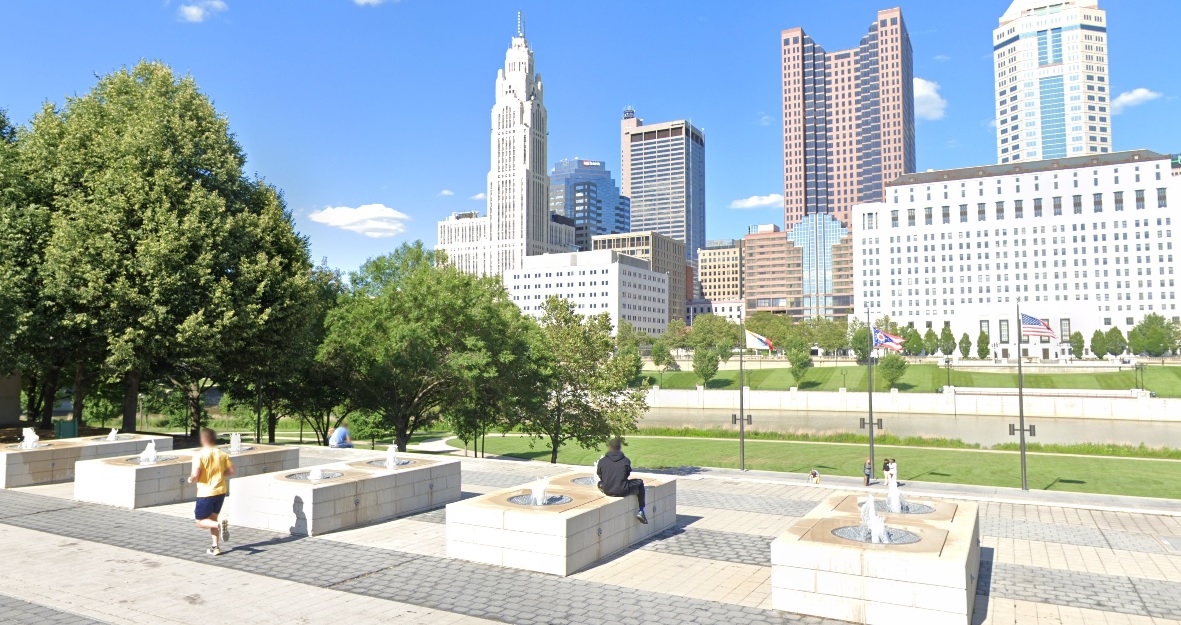
Before: 1926 In an image taken just 3 years after the one above, the Franklinton side of the riverfront looks much better. Additionally, LeVeque Tower is now well under construction. After: 2021 In the modern view, the parking and cars have been replaced with parklands and public space, while LeVeque has become the city’s most iconic skyline addition.
If you enjoy this series, the Historic Building Database page offers thousands of before and after photos of historic buildings and places in and around Columbus.
For the Random Columbus Photos 9 edition, we take a not-so-distant look back for a change.
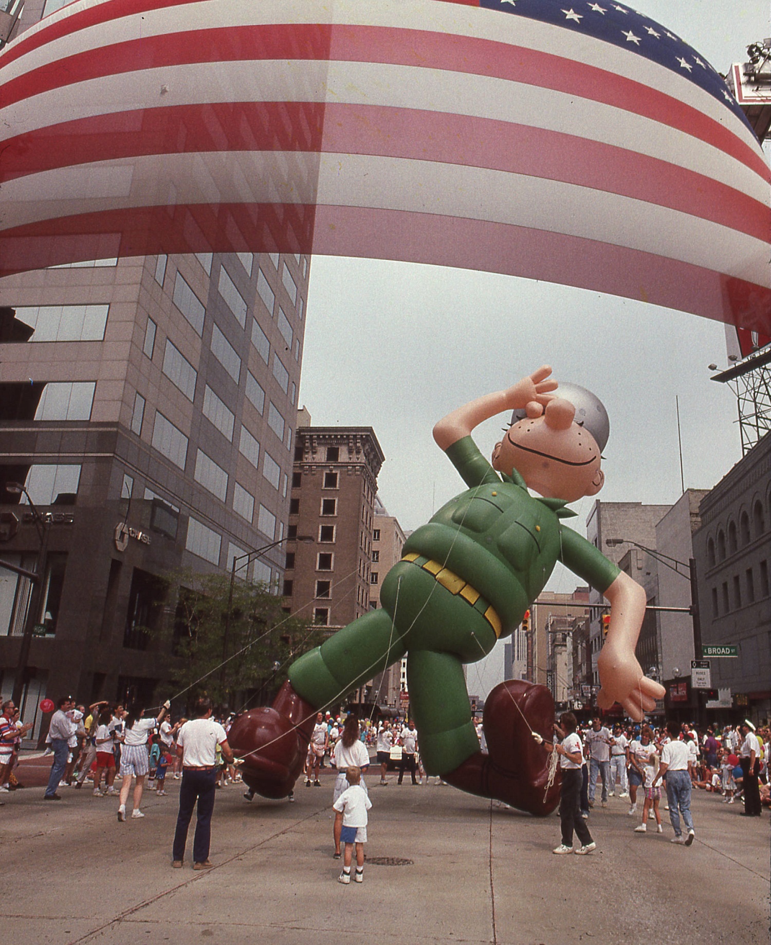
Photo Location: High and Broad intersection, looking north. Photo Date: August 31, 1991 Photo History: The Celebrate Them Home Columbus parade occurred as an event to honor returning Gulf War and Operation Desert Storm veterans, as well as veterans of previous wars. The event was held only one time. National patriotism was unusually high during this short war, and helped to revive Lee Greenwood’s 1984 song “God Bless the USA”, which often played on the radio during the conflict. Contrary to what may be popular belief, the Beetle Bailey character represented in the balloon does not date back to WWII. Instead, he first appeared in comic strips in 1950 and continues to run today.
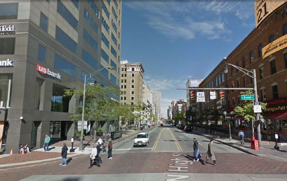
The same view today. Not much has changed since the 1991 photo. A few buildings have been renovated and the streetscape has seen improvements, but otherwise, the view is largely the same.
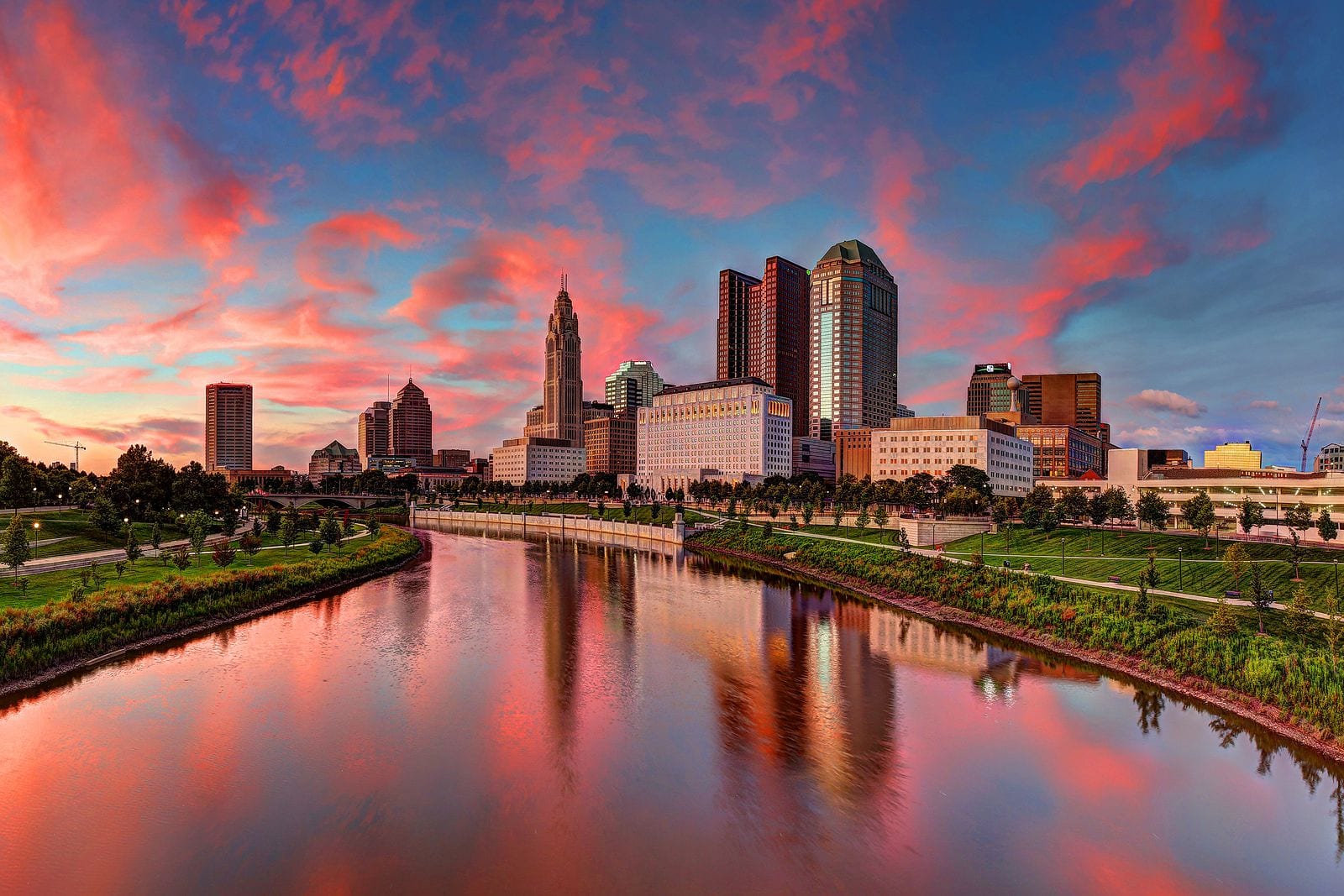
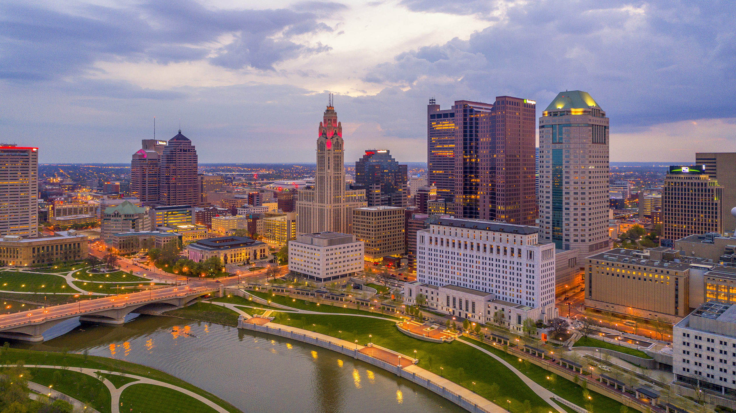
Capital Crossroads has released its latest report for the state of Downtown. The annual report includes population estimates, information on construction and more.
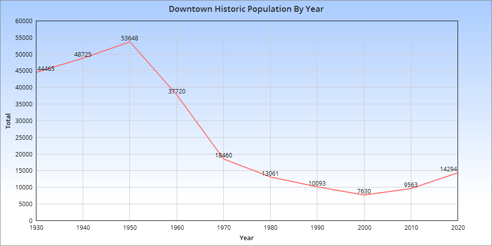
For 2021, Downtown’s population reached 11,200, and is expected to rise to around 15,000 over the next 3 years.
With the latest US Census data for 2020, we can once again take a closer look at how the Downtown area is doing.
Looking at the graph above, we can see that the Downtown population peaked in 1950 and declined through 2000. The last 20 years have seen accelerating growth and the population was the highest in 2020 since 1970. One caveat with this is that the census tract boundaries that are used to make up this graph have changed some over the years. They haven’t changed significantly, but the area that’s being covered in 2020 is slightly different than it was in 1950. As such, it’s more of an approximation per year rather than exact figures based on the exact same area. Still, the rapid decline after 1950 is well-documented. Highways were either being planned or already under construction through the neighborhood during the 1950s, and this also helped the beginning stages of the suburban flight from the urban core.
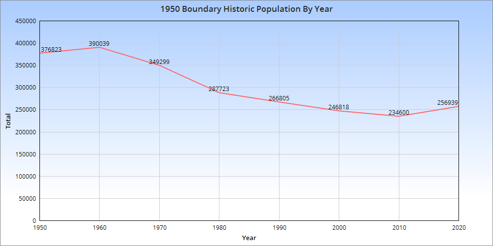
The urban core of the city overall reached its population peak in 1950, and the 1950 boundaries represent the oldest, arguably most urban part of the city today. Let’s examine how the population within that boundary changed over the same time. The 1950 boundary peaked in 1960 and then declined through 2010. Between 2010-2020, the 1950 boundary area gained more than 22,000 new residents, a significant increase which puts the area back to where it was around 1995.
So in both cases, the urban core of Columbus is in recovery, though it is unlikely to ever regain its 1950 population. Average household size is much smaller now than it was 70 years ago, so it would require a massive amount of infill that would be far denser than much of what is getting built in recent years. Outdated zoning codes, among other reasons, have been limiting many projects in the urban core from reaching their potential.
Breaking things down a bit further, let’s look at the census tracts that made up the 1950 boundary in 2020 and rank them for population and growth.
Top 10 Fastest-Growing 1950 Boundary Census Tracts by Total 2010-2020 1. 1121: +4,831 The tract is the main OSU Campus. The explosive growth is mostly due to the recent requirement that sophomores also have to now live on Campus, prompting thousands of students to move to the tract from nearby neighborhoods. 2. 4002: +2,592 This new tract was split off of Tract 40 and includes the southwest area of Downtown, including RiverSouth. 3. 22: +2,428 This tract is the heart of Italian Village and includes the large, new Jeffrey Park development. 4. 1901: +2,028 Includes the 5th Avenue corridor to just east of 5thxNW. 5. 32: +1,353 This tract covers the southern part of Victorian Village/Harrison West, as well as the far western sections of the Arena District where the new White Castle HQ complex is. 6. 17: +1,290 Western Weinland Park, which has seen rapid revitalization in recent years. 7. 30: +1,084 This area includes all of the norther half of Downtown north of Broad Street and west to Neil Avenue in the Arena District. 8. 16: +717 Eastern Weinland Park, which has seen hundreds of new housing units constructed along and near Grant Avenue. 9. 1902: +653 Includes the 5th Avenue corridor through 5thxNW. 10. 21: +648 The heart of the High Street strip in the Short North continued to add people. It reached its highest population in 60 years.
Top 10 Tracts with the Highest Population Densities in 2020 1. 1121: 34,888.8 2. 1810: 28,351.1 3. 1302: 24,740.7 4. 1301: 20,549.1 5. 17: 20,158.6 6. 12: 20,069.6 7. 1110: 18,353.2 8. 10: 16,260.2 9. 16: 12,675.6 10. 21: 12,196.7 All of these tracts are either in the Short North or surrounding Ohio State’s campus. They include the highest densities anywhere in Ohio.
So there you have it. The urban core of Columbus is clearly on a positive path. So long as infill development continues, population growth should also continue to increase. Perhaps someday, this increasing population and density may facilitate the construction of more amenities, including rail lines, BRT and more biking infrastructure, all of which lags in the area. To see Census Tract data in map form, the Census Tract Maps page provides it.
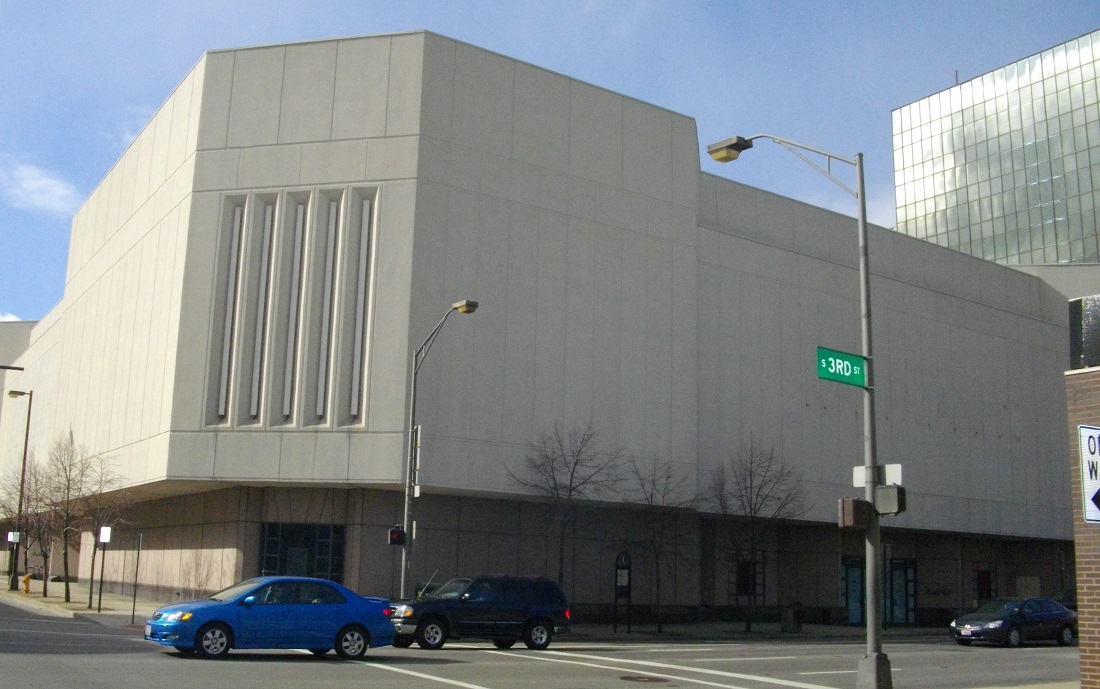
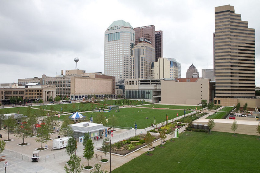
The RiverSouth area of Downtown was, not that long ago, the epitome of the disastrous Urban Renewal policy so popular during much of the mid-latter part of the 20th century. Bounded to the east by High Street, north by State Street, west by the Scioto River and south by I-70, this area, by the mid-1990s, had become a sea of surface parking lots, old storage warehouses, underutilized or empty storefronts and ugly infrastructure. The construction of City Center Mall in 1989, with its location directly across High Street, was supposed to help bring this neighborhood back with new development. Instead, as the mall did with the rest of Downtown, it helped suck the life out what retail and business existed there. Worse, the concrete, prison-like exterior of the mall lacked any type of street-level connection, so it functioned to keep people off the sidewalks and the streets were as abandoned as ever even as thousands of shoppers flooded the new mall every weekend.
The imposing structure of City Center.
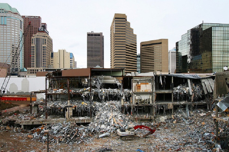
As newer suburban competition gradually killed City Center itself, the city was left with the task of figuring out what to do with its hulking core. Proposals were put for from everything to government buildings to redesigning the building itself into an Easton-like outdoor shopping town center. However, the money and interest for such proposals just weren’t there, and so the city came up with another, much different plan. The 10-15 year development plan called for the complete demolition of the mall complex, replacing it with a new city park complete with an entertainment stage, carousel and eateries.
City Center being demolished in 2010.
The mall was closed in 2009 and demolished the following year. This event seems to have marked the true beginning of the rise of RiverSouth. Columbus Commons and its 9 acres opened to the public in 2011. Despite a hugely negative expectation by some that the park would see little use and become a new place for vagrants and criminals, CC was an almost instant success. Hundreds of events were held there during its first year, and those numbers have grown every year since. Picnic with the Pops moved to the new park during the 2012 season, and the Columbus Food Truck Festival has attracted tens of thousands each of the last 2 years. The carousel, outdoor library and other events have been popular with kids and families. The park, with all its success, helped to bring about another important change to the area. It attracted development.
Columbus Commons before any development.
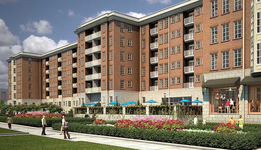
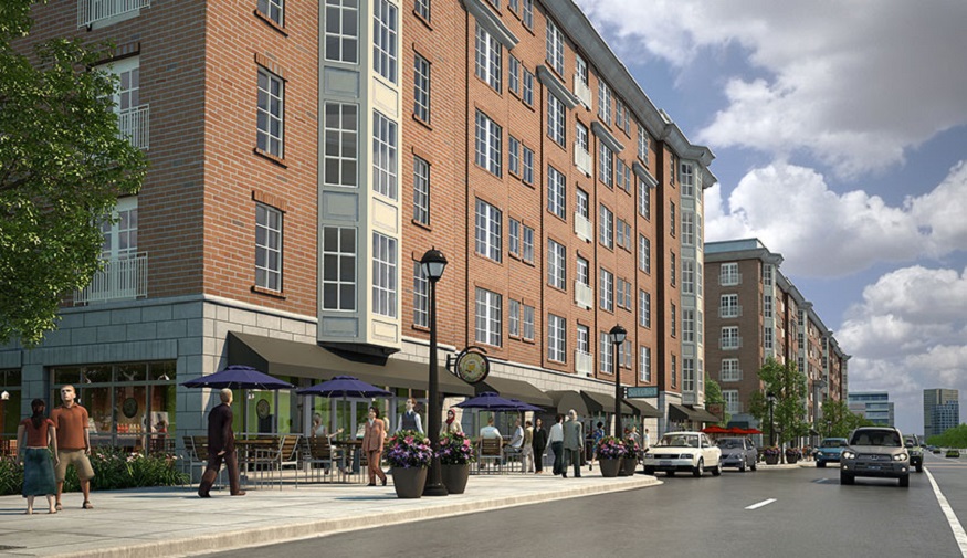
Originally, the park’s long-term plan was to have the grassy areas along High Street developed, but no one expected that to happen within a decade. Instead, a developer came forward less than a year after the park opened. High Point was that project, a pair of 6-story mixed-used buildings that would line the entire west side of the park from the corner of Rich and High. 302 new apartments, a handful of restaurants and ground floor retail lining High were all part of the project. Still under construction, this project should be complete in early 2014. Unfortunately, as the below pictures show (and the most flattering ones I could find at that) that the architecture is pretty horrendous. Despite that, the buildings will help fill in the gaps on High Street and bring hundreds of new residents, so the positives outweigh the negatives here.
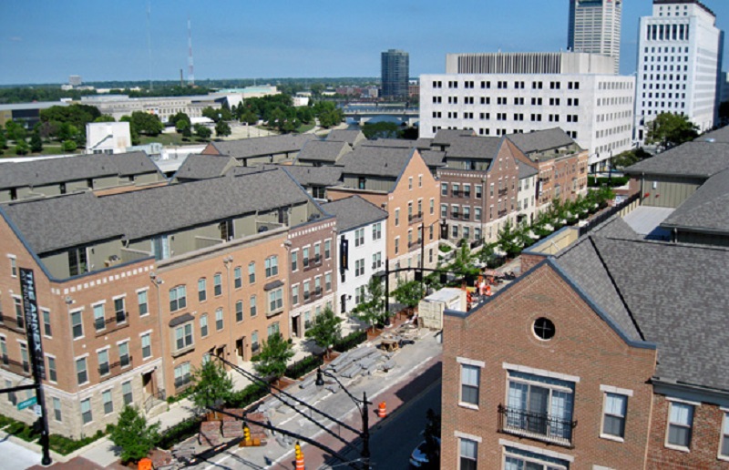
Since the announcement of City Center’s demise, other projects have come about over the last few years that have helped raise the profile of RiverSouth. -The Annex at RiverSouth replaced several surface parking lots along S. Front Street. This 214-unit, 4-story residential complex was originally planned to be a mix of condos and apartments, but became mostly apartments when the condo market died off. The complex was completed in 2010.
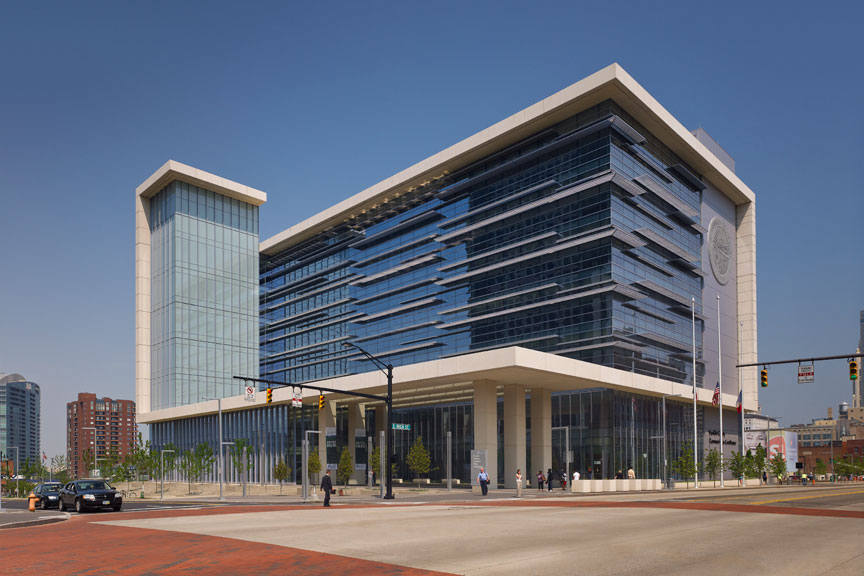
-The new Franklin County Courthouse, a $106 million, 7-story complex was completed in 2011 at the southwest corner of W. Main and S. High Streets.
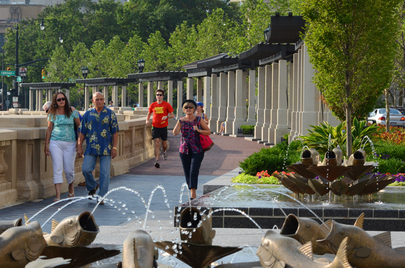
-The Scioto Mile, the $44 million riverfront park, was completed in 2011 complete with fountains, a restaurant, paths and an entertainment stage.
Scioto Mile
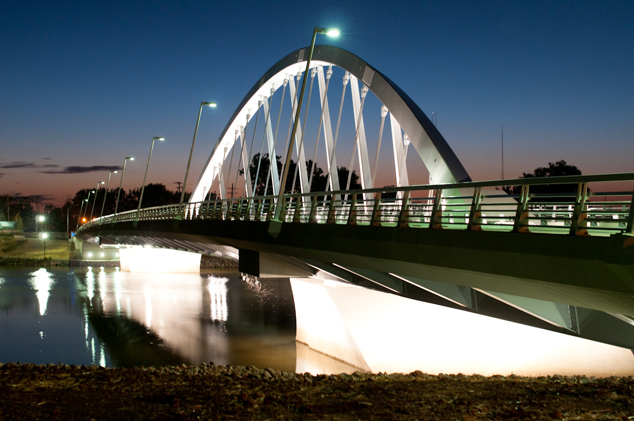
-Main Street Bridge was replaced with a signature, $60 million arched span in 2011.
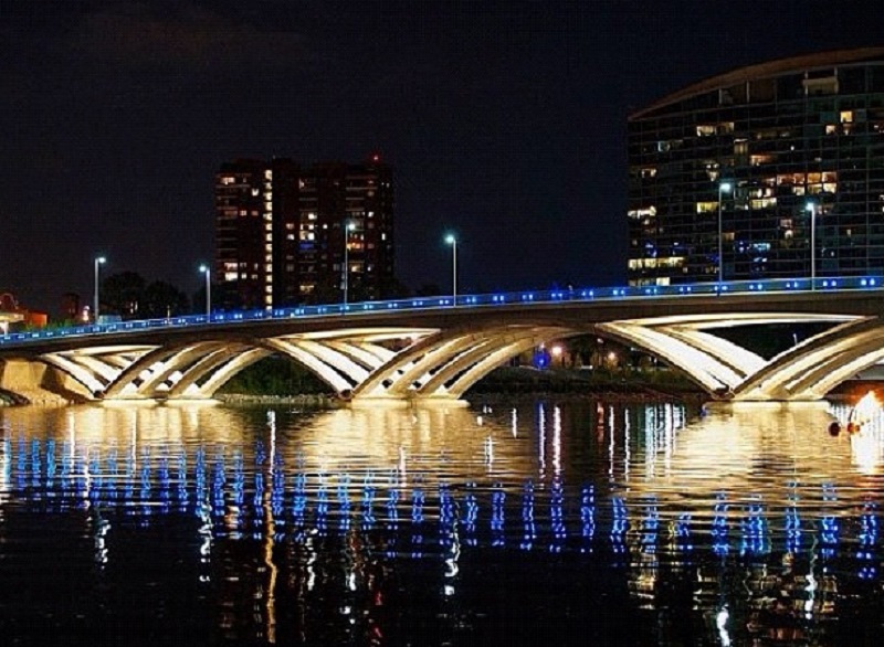
-The Rich Street Bridge was also replaced in 2012 with a new $26 million open span.
-The old Lazarus building, once connected to City Center by a massive skywalk, received a $60 million renovation in 2010 that converted the former retail building into an LEED green office building for the Ohio EPA and other organizations.
-Many of the streets in the area have been rebuilt with brick crossing and new landscaping.
So a lot has been done over the past few years, but what’s coming next? Beyond the High Point project, 3 more projects have recently been announced.
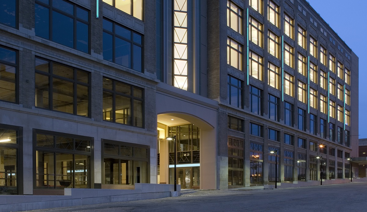
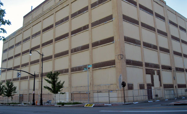
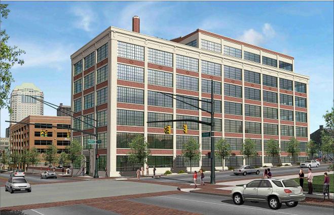
-The first is the conversion of the Secur-It warehouse building at the northeast corner of S. Front and W. Main Street. The century-old building was once used as a shoe factory, but was bricked over and used as a storage facility for many years. The current plan by Casto is to turn the building into about 90 residential units. The old warehouse windows will be restored, as well as the façade and interiors. The project should get started in the spring of 2014.
The current Secure-It building.
Proposed rendering for the Secure-It building.
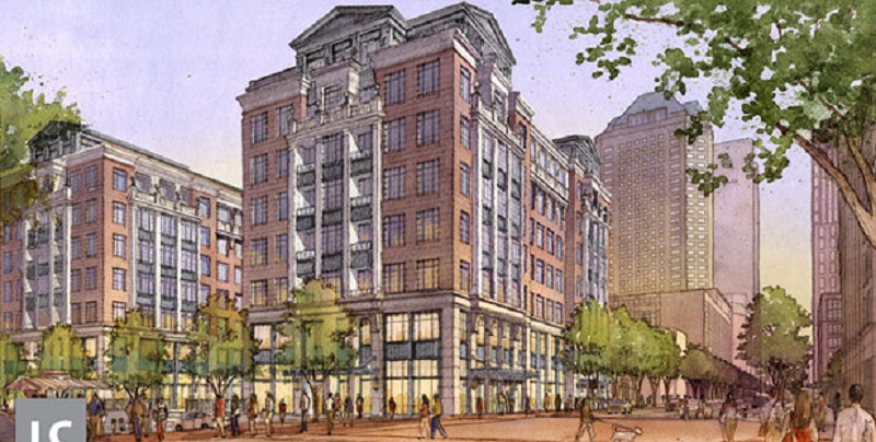
-Second, we have Lifestyle Communities LC at RiverSouth project. This 8-story, 102-unit residential building will occupy the northwest corner of S. High and W. Rich Streets, directly across from Columbus Commons. Construction should begin this fall and complete in early 2015.
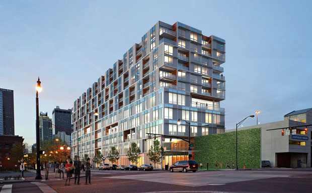
-And finally, we have the recently announced 250 High project. This $50 million, 12-story mixed-use tower would have ground floor retail, 4 floors of offices and 7 floors of residential totaling 156 units. This project will be built on the surface lot adjacent to the old City Center parking garage at 250 S. High Street. Construction on this project should also begin in the fall and complete sometime in early 2015.
These projects will no doubt spur others in the near future. Several surface lots still exist in RiverSouth, and a few of them are still along S. High Street just north of the new courthouse. Given the momentum of the neighborhood, expect to see development announcements on at least a few of these lots sooner than you think.