Is the Short North Dangerous Now?


Is the Short North dangerous?

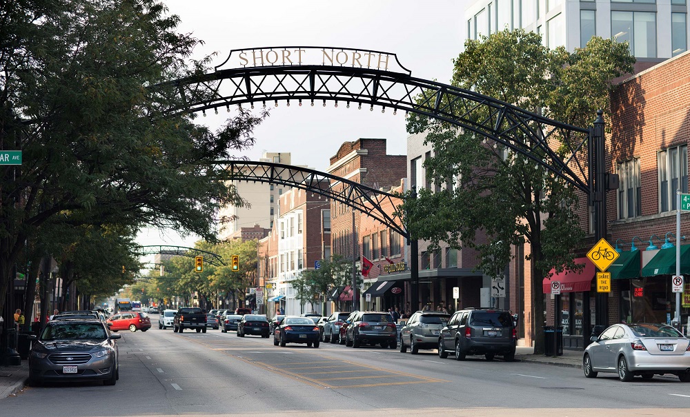
There’s been a lot of media attention to recent shootings in the Short North this year. It’s supposedly gotten so bad, that Mayor Ginther has asked local businesses in the neighborhood to close by Midnight.
But has the violence really spiraled out of control, especially compared to other areas in the city. Is the Short North dangerous now? Or is the area just getting more attention due to its status as a hot neighborhood popular with locals and tourists alike?

First, let’s take a look at homicides and homicide rates across Franklin County by Census Tract. The numbers are through May 17th and the rates are total homicides divided by the 100K people per tract.

The first thing that sticks out is that the map has a whole lot of white areas, meaning most of the county and most of Columbus have seen zero homicides so far this year. The areas that have seen them do not appear to be much different than previous years- Hilltop, the Far West, the Near South, parts of Linden, and Northland. The Short North has had 1 homicide this year, which is certainly more than normal, but arguably not an epidemic even if gun violence overall is up. The other thing that sticks out is that most homicides are occurring in relatively small areas, and are often tied to certain streets or even certain businesses or residential complexes.

Using this map, we’ll next take a look at the overall homicide rates of specific neighborhoods and areas in and around Columbus to see where the whole of the Short North really ranks.

The ranking gives the neighborhood, how many tracts make it up, the 2020 population, total homicides and the homicide rate per 100,000 people.
1. Franklinton- 3 Tracts- 6,482- 3 Homicides- 46.28
Franklinton is still the most dangerous part of Columbus, and it’s really not even close. This is despite significant redevelopment in the neighborhood.
2. Near South- 13 Tracts- 35,026- 7 Homicides- 19.99
The Near South comes in a distant 2nd place. It includes a much larger area than Franklinton, but about half of the homicides occurred in the 3 tracts to the southeast of Nationwide Children’s Hospital. Places like German and Merion Village have had none.
3. Weinland Park- 2 Tracts- 6,393- 1 Homicide- 15.64
It seems a little unfair to rank Weinland Park 3rd when it’s only had a single homicide, but that’s just how the math works out. The single homicide has been lumped in with the Short North by some media, but it occurred well north across from Campus.
4. Near East- 9 Tracts- 21,841- 3 Homicides- 13.74
The Near East Side ranks 4th for the year so far. It’s been somewhat quieter than normal in this part of the city.
5. Linden- 14 Tracts- 41,627- 5 Homicides- 12.01
Similar to the Near East, Linden has been a bit more quiet than normal despite the relatively bad year Columbus is having.
5. Hilltop- 16 Tracts- 68,045- 8 Homicides- 11.76
Hilltop has had the 2nd most homicides of any of the neighborhoods looked at, but it’s also one of the largest and highest-populated as well, so the rate was lower than those above.
6. Northland- 18 Tracts- 89,165- 9 Homicides- 10.09
Northland has had the most homicides so far of any area of the city or county. Like Hilltop, however, its higher population means its rate is still relatively lower.
7. Short North- 4 Tracts- 12,472- 1 Homicide: 8.07
The Short North’s single homicide puts the neighborhood in 7th place overall. The rate itself is only slightly above that of the entirety of Columbus, so it doesn’t seem to be much of an outlier.
8. Far West- 11 Tracts- 51,308- 3 Homicides- 5.85
The Far West is the only neighborhood looked at that is entirely outside of I-270. It’s rate is only about 60% of the overall Columbus rate at this point in the year.
9. OSU Campus- 12 Tracts- 55,281- 2 Homicides- 3.62
Another large and heavily-populated area, the Campus neighborhood has been fairly safe so far this year.
10. Downtown- 5 Tracts- 12,297- 0 Homicides- 0.0
Downtown has had no homicides so far this year, a departure from last year in which it had already seen 1 at this point on its way to a total of 4 for 2022.
11. Whitehall- 8 Tracts- 23,054- 0 Homicides- 0.0
Another area I think that has had a somewhat negative reputation for crime is Whitehall, the only non-Columbus area looked at. It’s also had no homicides so far this year.

Overall, the neighborhoods above have accounted for 42 of the 65 total homicides so far this year, or about 65%. Most of the rest were very scattered.

So is the Short North dangerous? Not in terms of homicides, no, but that doesn’t mean that recent crime trends should be ignored. That said, it’s pretty clear other neighborhoods are much more deserving of attention in this regard, but may not have the economic or social clout to demand it.
Of course, it also needs to be said that homicides are just a single type of crime. An examination of other types of crime may show a completely different story, but those other types rarely get the kind of breathless, hyperbolic reporting that homicides do.


Winter 2022-2023 Review


Winter 2022-2023 Review

A scene largely absent from the 2022-2023 winter.

The Winter 2022-2023 Review shows that the season was one of the warmest ever recorded for Columbus, with near consistent above average- and sometimes record-breaking temperatures. Snow, as a consequence, was well below average.

The rankings below are good through the 2022-2023 season.

December-February Only
Average High: 45.8 4th Warmest
Average Low: 29.4 7th Warmest
Mean: 37.6 5th Warmest
Precipitation: 7.80″ 62nd Wettest
Snowfall: 11.2″ 30th Least Snowy
Average Daily Snow Depth: 0.3″ Tied for 4th Lowest
Largest Snowstorm: 4.9″ on 12/23/2022
# of 32 or Below Highs: 10 5th Fewest
# of 32 or Below Lows: 51 Tied for 4th Fewest
# of Measurable Precipitation Days: 40 Tied for 13th Most
# of Measurable Snowfall Days: 10 Tied for 6th Fewest
Highest Average Daily Wind Speed in MPH: 23.3 on 12/23/2022
Highest Wind Gust in MPH: 54 on 1/19/2023
# of Clear Days: 6 6.67%
# of Partly Cloudy Days: 38 42.22%
# of Cloudy Days: 46 51.11%

Early winter ended up being the coldest and snowiest part of the season, with every subsequent month getting warmer. There were very few freezing days during the heart of the winter, and despite a somewhat stormy pattern with seemingly endless windy days, there was relatively little precipitation.

The biggest snowstorm was on December 23rd, when a very strong low pressure system and cold front brought heavy snow and very cold temperatures, making for one of the coldest Christmas Eves and Days in many years.

Entire Cold Season: October-April
Average High: 53.8 3rd Warmest
Average Low: 34.5 Tied for 14th Warmest
Mean: 44.1 Tied for 6th Warmest
Precipitation: 19.13″ 63rd Driest
Snowfall: 14.5″ Tied for 21st Least Snowy
Average Snow Depth: 0.1″ Tied for 2nd Lowest
Largest Snowstorm: 4.9″ on 12/23/2022
# of 32 or Below Highs: 11 Tied for 2nd Fewest
# of 32 or Below Lows: 83 6th Fewest
# of Measurable Precipitation Days: 79 Tied for 14th Fewest
# of Measurable Snowfall Days: 15 Tied for 6th Fewest
Highest Average Daily Wind Speed in MPH: 23.3 on 12/23/2022
Highest Wind Gust in MPH: 59 on 3/3/2023
# of Clear Days: 30 14.15%
# of Partly Cloudy Days: 95 44.81%
# of Cloudy Days: 87 41.04%

The entire cold season didn’t really live up to its name. All months except October ended up above normal. Now let’s break down those months individually.

Average High By Month
October 2022: 65.6 44th Warmest
November 2022: 54.6 Tied for 19th Warmest
December 2022: 41.8 Tied for 36th Warmest
January 2023: 43.8 13th Warmest
February 2023: 52.3 1st Warmest
March 2023: 52.6 33rd Warmest
April 2023: 65.7 20th Warmest

February, 2023 had the warmest average high mean on record, beating the next closest year- 2017- by 0.5 degrees.

Average Low By Month
October 2022: 42.7 Tied for 28th Coldest
November 2022: 36.0 29th Warmest
December 2022: 27.4 Tied for 40th Warmest
January 2023: 31.0 6th Warmest
February 2023: 30.0 10th Warmest
March 2023: 32.1 Tied for 45th Warmest
April 2023: 42.0 Tied for 35th Warmest

Mean By Month
October 2022: 54.1 Tied for 33rd Coldest
November 2022: 45.3 Tied for 18th Warmest
December 2022: 34.6 Tied for 37th Warmest
January 2023: 37.4 10th Warmest
February 2023: 41.1 3rd Warmest
March 2023: 42.4 Tied for 40th Warmest
April 2023: 53.9 Tied for 23rd Warmest

Precipitation By Month
October 2022: 0.60″ 11th Driest
November 2022: 2.34″ 58th Driest
December 2022: 2.02″ 39th Driest
January 2023: 4.16″ 28th Wettest
February 2023: 1.62″ Tied for 41st Driest
March 2023: 5.22″ 17th Wettest
April 2023: 3.17″ Tied for 64th Wettest

Snowfall By Month
October 2022: Trace Tied for 2nd Least Snowy
November 2022: 0.3″ Tied for 5th Least Snowy
December 2022: 5.8″ 38th Snowiest
January 2023: 5.4″ Tied for 39th Least Snowy
February 2023: Trace 1st Least Snowy
March 2023: 1.0″ Tied for 10th Least Snowy
April 2023: Trace Tied for 2nd Least Snowy

February’s Trace was the lowest ever recorded for the month.

Average Snow Depth By Month
October 2022: 0.0″
November 2022: 0.0″
December 2022: 0.7″
January 2023: 0.1″
February 2023: 0.0″
March 2023: 0.0″
April 2023: 0.0″


Maximum High By Month
October 2022: 77 on the 6th, 23rd and 24th
November 2022: 77 on the 5th
December 2022: 65 on the 30th
January 2023: 62 on the 3rd
February 2023: 73 on the 23rd
March 2023: 75 on the 1st
April 2023: 84 on the 20th

Maximum High Records
-The 77 on November 5th was a record for the date, beating the old record of 76 set in 1977.
– The 65 on December 30th was a record for the date, beating the old record of 63 set in 1964.
-The 72 on February 9th was a record for the date, beating the old record of 66 set in 2001.
-The 72 on February 15th was a record for the date, beating the old record of 70 set in 1954.
-The 73 on February 23rd was a record for the date, beating the old record of 72 set in 2017.
-The 75 on March 1st was a record for the date, beating the old record of 65 set in 1972 and 1997.

Minimum High By Month
October 2022: 45 on the 18th
November 2022: 30 on the 20th
December 2022: 14 on the 24th
January 2023: 26 on the 31st
February 2023: 30 on the 1st
March 2023: 33 on the 14th
April 2023: 46 on the 2nd and 17th

Maximum Low By Month
October 2022: 57 on the 31st
November 2022: 62 on the 5th
December 2022: 54 on the 30th
January 2023: 56 on the 3rd
February 2023: 47 on the 15th
March 2023: 47 on the 23rd
April 2023: 60 on the 5th

Maximum Low Records
-The 62 on November 6th was a record for the date, beating the old record of 61 set in 1977.
-The 49 on January 2nd tied the record for the date, matching 1997, 2000 and 2005.
-The 56 on January 3rd was a record for the date, beating the old record of 55 set in 1997.

Minimum Low By Month
October 2022: 32 on the 20th
November 2022: 17 on the 20th
December 2022: -7 on the 23rd
January 2023: 16 on the 15th
February 2023: 12 on the 4th
March 2023: 18 on the 19th
April 2023: 29 on the 25th

Highest Daily Precipitation by Month
October 2022: 0.15″ on the 12th and 30th
November 2022: 1.14″ on the 11th
December 2022: 0.44″ on the 15th
January 2023: 0.73″ on the 12th
February 2023: 0.73″ on the 27th
March 2023: 1.6″ on the 3rd
April 2023: 0.91″ on the 5th

Precipitation Records
-The 1.14″ on November 11th set a record for the date, beating the old record of 1.03″ set in 1995.
-The 1.60″ on March 3rd set a record for the date, beating the old record of 1.31″ set in 2020.

Highest Daily Snowfall By Month
October 2022: Trace on the 18th
November 2022: 0.2″ on the 12th
December 2022: 4.9″ on the 23rd
January 2023: 3.0″ on the 22nd
February 2023: Trace on the 3rd and 17th
March 2023: 0.4″ on the 12th and 13th
April 2023: Trace on the 17th

Deepest Snow Depth By Month
October 2022: 0.0″
November 2022: Trace on the 13th
December 2022: 4″ on the 23rd, 24th, 25th and 27th
January 2023: 2″ on the 23rd
February 2023: Trace on the 1st
March 2023: 1″ on the 14th
April 2023: 0.0″

Average Daily Wind Speed by Month in MPH
October 2022: 7.9
November 2022: 8.2
December 2022: 8.0
January 2023: 8.4
February 2023: 9.7
March 2023: 10.0
April 2023: 8.1

Highest Wind Gust by Month in MPH
October 2022: 38 on the 26th
November 2022: 44 on the 27th and 30th
December 2022: 46 on the 23rd
January 2023: 54 on the 19th
February 2023: 49 on the 9th
March 2023: 59 on the 3rd
April 2023: 50 on the 1st

Clear Days by Month
October 2022: 8 25.81%
November 2022: 6 20.0%
December 2022: 2 6.45%
January 2023: 0 0.0%
February 2023: 4 14.29%
March 2023: 5 16.13%
April 2023: 5 16.67%

Partly Cloudy Days by Month
October 2022: 17 54.84%
November 2022: 13 43.33%
December 2022: 10 32.26%
January 2023: 13 41.94%
February 2023: 15 53.57%
March 2023: 15 48.39%
April 2023: 12 40.0%

Cloudy Days by Month
October 2022: 6 19.35%
November 2022: 11 36.67%
December 2022: 19 61.29%
January 2023: 18 58.06%
February 2023: 9 32.14%
March 2023: 11 35.48%
April 2023: 13 43.33%


Redeveloping Westland Mall


Years ago- originally in 2013 and later reposted in 2016- I made a rather crude map of how I thought the Westland Mall site should be redeveloped.. It seems that the mall may finally be torn down soon after a long period of deterioration, so I figured it was time to revisit this map once more, but this time update it in detail and give a much clearer sense of how redeveloping Westland Mall would drastically change the entire West Side.

One of the problems with the original map was that it really didn’t take into account the massive size of the entire site and how many decent-sized buildings could truly fit within it. While on the old map I used single, general boxes to convey multiple buildings, this time I actually laid out nearly 50 of them. These mixed-use buildings are all a minimum of 4 stories and contain residential, office, hotel and retail/restaurant space.
Each of these buildings could hold 100 or more residential units, so there could easily be several thousand new residents in this neighborhood.
3 parking garages of various sizes are also included, with enough combined space for thousands of parking spaces. The garages would mostly be covered by new walk-up condo or apartment units. A new park avenue street grid connects these garages and all other buildings, with a central roundabout plaza flanked by retail and restaurant locations. Between the streets, a series of pedestrian-only alleyways provide convenient places for outdoor patio seating for any restaurants and retail locations.
One of the biggest changes on the new map is that the park space has become significantly larger, almost doubling in size to more than 18 acres. This would be a significant new park for the West Side, something this part of the city doesn’t have much of. The closest park is also fairly new- Wilson Road Park- which opened in 2017, but its out-of-the-way location makes it somewhat underused. The new Westland park would be lined with retail and restaurant space overlooking it, and a new outdoor market would sit on the northern end- perhaps another extension of North Market similar to what Bridge Park received?
There are also new connections to the park and overall development. Multi-use path connections could be built on the eastern end along the old Shopper’s Lane, a western connection that travels under or over I-270 to the large residential area south of Lincoln Village, and a southern path would connect directly to the Camp Chase Trail. The old Lincoln Park West apartment complex would also have adjacent access.
A rapid-transit station could go on West Broad Street in front of the entire complex as part of the LinkUS plan.
Finally, another big difference between this and the old map is that I tried to be a bit less Sim City about it, meaning that I largely stuck with the existing Westland site and didn’t go beyond it. However, the light yellow areas are all potential future redevelopment locations. These areas are mostly low-density retail strip centers or big box stores with large parking lots. Over time, these areas could be redeveloped to create an enormous, 160-acre redevelopment of the Westland area.
For comparison, Dublin’s Bridge Park is only about 40 acres and Jeffrey Park in Italian Village is about 42 acres, with both developments being good examples of what could be done on the Westland site. In fact, Easton is the only comparable area. The potential is incredible and would finally give West Siders the destination and transformative development they’ve been asking for.

To date, there have been no solid plans released about the future of the Westland site by its owners. However, given that they’ve already sold off a small part of the site on Broad Street for a gas station, the chances that they have any significant, urban vision for it seem to be very slim. In reality, I would expect a suburban-style apartment development with fast-food outlets and another strip retail center, adding to the car-dominated stroad hellscape that already exists on West Broad Street now. The only way to avoid that outcome is for residents to demand better.


Unimaginative Developers Creating Poor Projects


Columbus continues to develop rapidly as the population grows. Demand is high and homes have been in short supply for years. Unimaginative developers creating poor projects and proposals seems to be the norm, however. Some of these proposals sacrifice historic buildings, others promote an entirely car-centric environment unfriendly to transit, bikes and pedestrians, while still others are a massive waste of site space.

Here are just a few recent examples of proposed projects that are baffling in their lack of creativity, access, accommodation and site potential.

167-191 S. High Street
Destroying Columbus history 167-189 S. High Street
The Plan
The 3 buildings pictured on this Downtown block of High Street are all in imminent danger. In a recent Columbus Business First article, it was reported that the 3 buildings were purchased by Cleveland-based Harsax Management Company, a construction and development firm. While the 1914 Ohio National Bank building at 167 S. High is supposedly the most likely to stay, the other two early 1910s buildings at 171-177 and 181-191 S. High are already likely to be demolished according to the company’s CEO.
No specific reason is given for the demolition proposal, only that the company plans to develop the site at some point afterwards. So the suggestion is that these buildings may be demolished without any actual plan in place to replace them, so they’d end up- at least for a short time- as an empty lot or parking.
The Problem
Not incorporating the southern two buildings into a new development is an entirely unnecessary wasted opportunity, and High Street and Downtown lose at least 2 more of of their old streetscape for no good reason. While the prospect of new development is exciting, the fact of the matter is that preservation can take place while still getting a new dense, mixed-use project for the site even if most or all of the existing buildings are saved.

Destroying Columbus history 181-191 S. High

The Walnut side of 181-191 S. High Street, showing its old stone foundation and other architectural features.


A Few Potential Solutions
The site is more than large enough to accommodate the existing buildings with new development, and there are 3 potential configurations that show this.
Option 1- The Least Destructive

The red area in the above map shows the best possible option. The main part of 171-177 is saved, along with the entirety of 181-189. The small parking lot, the skinny section of 171-177, and the later, smaller addition behind 181-189 would all be replaced with a new development. The area would encompass about 1/3 of an acre, plenty of space to build something fairly significant on. With the renovations of the existing buildings and the new, taller development in back, it would be a potentially spectacular addition to the RiverSouth part of Downtown.
In fact, a new project and renovation could incorporate the adjacent dead-end Walnut Alley into the plan, turning it into a market space, restaurant/bar patio, or both. It would be a shame to lose the addition as it is a cool little building itself, but if it allowed the other main buildings to be saved, it would ultimately be worth it.
Option 2- The Compromise

The second option would fully replace 171-177 S. High and the rear parking lot with a new build. The site would offer just under 1/3rd an acre, so it would be the smallest available option, but would still allow a taller, dense, mixed-use project with High Street frontage. It would also allow both 181-189 and its rear addition to be saved and renovated, which are arguably more important.
Option 3- The Greatest Sacrifice

Option 3 would require the demolition of 171-177 and the rear addition. This would allow the developer to build an L-shaped project with the new building having direct High Street frontage. It would be a greater loss than Options 1 and 2, for sure, but still a potential compromise versus full demolition. Furthermore, the new building could maintain 171-177’s facade so that the old streetscape look is still maintained. This would be similar to what was done with this hotel project on Park Street.

The fact that the developer either hasn’t considered such options, or isn’t interested in them, is unfortunate. Given its prime location, the potential for this site is extremely high, both in terms of a new build and preservation. It would be incredibly short-sighted of the Downtown Commission to allow full demolition of the site to take place, even if the developer ultimately proposes something significant for the site.

45 W. Barthman Avenue
Developers creating poor projects 45 W. Barthman
The Plan
This 8.2-acre South Side site is a former industrial area that has been mostly vacant and abandoned for many years. The NRP Group, another Cleveland-based development company, wants to turn this site into a residential complex with 200 apartments in 3 buildings.

The site as it exists now.


The proposed site layout.


The Problem
The 8.2-acre site is one of the largest single development sites available anywhere on the South Side. 200 units is an insultingly low density for the space. Furthermore, the layout is absolutely awful. The 3 proposed buildings are completely surrounded by surface parking lots, and the positioning of the buildings make it virtually impossible to ever add additional housing on the site later on. It’s also entirely unfriendly to pedestrians, as the site plan shows no sidewalks or pathways along Wall Street and no connections across it. There are only small sections of sidewalk between the buildings and the parking lots, but they do not connect with each other between the 3 buildings. This is about as poor of a plan as it gets.
A Potential Solution

A new layout is desperately needed for the site. In 5 minutes, I created this potential one. The blue box is a large parking garage- or surface lot alone if any of the buildings have parking underneath- that could easily accommodate hundreds or 1000+ cars. The black lines are new streets, including extensions of Reeb and Barthman Avenues. The yellow line is a new sidewalk along the entire site on Wall Street, and each new street would have connecting sidewalks. The orange boxes are potential buildings, each between 1/2-1.2 acres in size. For comparison, the entire HighPoint project on High Street Downtown is about 1.3 acres. That’s more than large enough to accommodate 100-300 units each depending on the number of floors. That means the 6 buildings could potentially provide 6x-9x the housing units that the original proposal provides, even with just 3 or 4-story buildings.
Furthermore, any of the buildings could incorporate retail/restaurant space, something this part of the South Side really doesn’t have outside of strip centers. Those spaces would be particularly attractive facing the 1.5-acre park carved out in the center of the site. I noticed in the original plan that they have retention ponds. If they are necessary, a central retention pond could be the key feature of this pocket park and event space.
You might say, however, that the developer might not have the financing to build all of this, and that’s true. However, just like Jeffrey Park in Italian Village, building one or 2 buildings at a time, letting them fill up and then building more over several years would not be out of the question. The site doesn’t have to be developed all at once. The developer can build the 3 buildings originally planned and then fill out the rest of the site over time. The point is to do it right, not fast.

329 Loeffler Avenue

329 Loeffler Avenue.


The Plan
Another proposal that seeks to demolish a part of old Columbus is the 7-townhome proposal from, it seems, an R and R Construction. Most of the land for the proposal is vacant and has been for years, but there is a lone brick house at the corner of Loeffler and Carrie Avenue that the company wants to demolish for the project. The house dates back to between 1890-1905.
The Problem
There is, quite plainly, no reason the house needs to be demolished. While it is vacant, auditor records list the house in fair condition, so it’s hardly beyond saving. It can be renovated. Furthermore, the location on the corner means that it is not actually in the way of the project overall. The proposed layout below shows the location of the house in the red box.

The Solution
There is no reason that the new building on Loeffler needs to extend to the corner. It could just be a 3-unit building on that section instead of 4, with the house being renovated on the corner. It’s location does not interfere with the other 3 units facing the back alley whatsoever and the overall number of units for the project would still be 7. The house is a part of the neighborhood’s history. Regardless of how it may look at the moment, it’s condition means that it is not structurally deficient, so it can remain and should. Brick homes like this are being lost for all sorts of reasons- neglect, arson, new development- but this is a perfect example where location makes it a great candidate for saving.

While these are recent, the fact is that such poor project proposals come out almost every month, and there is often little to no pushback from neighborhood commissions or the city to do better. While solutions and better options exist, we’re missing out on creating better, richer neighborhoods that both embrace new development while encouraging preservation and higher standards for residents. I encourage anyone who can to contact these companies, the city and neighborhood commissions to speak out. Even if you disagree with my particular take on these proposals, collectively more voices should be heard in the direction that development in Columbus takes.


Housing Market Update January 2023


Housing market update January 2023

The Housing Market Update January 2023 data, the first of the new year, from Columbus Realtors showed that home sales and overall supply continued to decline, helping to ensure most areas saw continued increases in median prices.

Note: LSD= Local School District, CSD= City School District. In both cases, school district boundaries differ from city boundaries.

Housing Market Update January 2023 county closed sales
Housing market update January 2023 county closed sales % change
Closed sales are those sales that were completed during the month. 7 of the 10 metro counties saw declines in January
Housing market update January 2023 best closed sales
Housing market update January 2023 worst closed sales
Only 9 of more than 40 local markets were up year-over-year.
Housing market update January 2023 county median price
Housing market update January 2023 county median price change
Housing market update January 2023 median price % change
Not sure what was going on in Union County in January, but it was well above all other counties for the month. The market overall continued to be up on price year-over-year, except in Pickaway County.
Overall Market Median Sales Price in January 2023: $307,289
Based on the 10 Columbus Metro Area counties, the metro price saw a more than $39,000 increase over January, 2022.
Overall Market Median Sales Price % Change in January, 2023 vs. January, 2022: +14.6%
Continuing home sale declines had relatively little impact on home prices overall, which saw a strong increase over the year.
Housing market update January 2023 least expensive markets
Housing market update January 2023 most expensive markets
Housing market update January 2023 lowest market price change
Housing market update January 2023 highest market price change
It seems the Intel project’s impact may finally be making an appearance in housing numbers, with the Johnstown district seeing a huge increase in median home prices versus January 2022, 2 months before the project became official. That said, New Albany had one of the areas largest declines, but that could be due to it generally being one of the most expensive markets last year.
Housing market update January 2023 new listings by county
Housing market update January 2023 new listings change
New listings across most of the metro area were down, accounting for most of the median price increase as demand remains strong in the region. Most of the decrease came from Franklin County.
Total Metro New Listings in January, 2023: 1,612
Total Metro New Listings Change from January, 2022 to January, 2023: -316
Housing market update January 2023 most market listings
Housing market update January 2023 fewest market listings
Housing market update January 2023 county days on market
Housing market update January 2023 days on market change
Average # of Days Homes Remain on the Market Before Sale for the Metro Overall in January, 2023: 34.0
# of Days Homes Remain on the Market Before Sale for the Metro January, 2022 to January, 2023: +8.8

Homes continued to sell more slowly than they did a year ago, now more than a week more slowly on average.
Housing market update January 2023 fastest selling markets
Housing market update January 2023 slowest selling markets
Housing market update January 2023 market sale days increase
Housing market update January 2023 market sale days decline