Before and After: The Near East Side Transformation


Given the popularity of the Weinland Park Before and After, I am finally getting around to posting this one for the Near East Side, which is a combination of Olde Towne East and King-Lincoln. Like Weinland Park, the NES has seen its fair share of struggles over the years, but unlike Weinland Park, its revitalization has been decades in the making. It has seen steady house-to-house renovations since at least the 1980s, and is now at the point where the pace of larger scale redevelopment is picking up. There are currently at least a dozen infill projects in the works, with even more renovations.
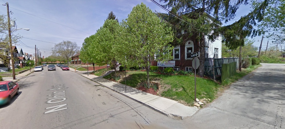
North Ohio Avenue
Before: 2009 North Ohio Avenue looking north.

After: 2017

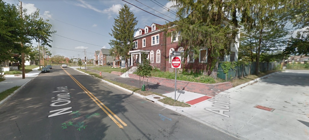
These photos don’t represent all that big a change, but it shows some of the infrastructure improvements going on around the neighborhood. This picture is just south of the Poindexter Place development on North Ohio Avenue. The photos show the addition of a multi-use path, new sidewalks and pavement. Bike lanes, which aren’t shown in the Google image, were also striped.

Poindexter Village
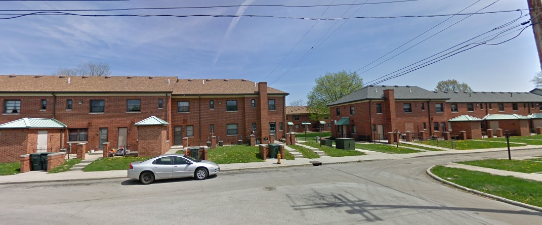
Before: 2009 North Ohio and Hawthorne, looking east.

After: 2017

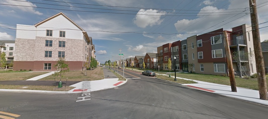
Poindexter Village was the first large-scale public housing complex in Columbus, built back in the 1940s. All but 2 of the original buildings were torn down to make room for a redevelopment, called Poindexter Place. The last 2 buildings will become a museum. The change from 2009 to 2017 is drastic.
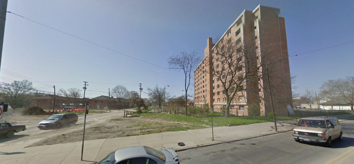
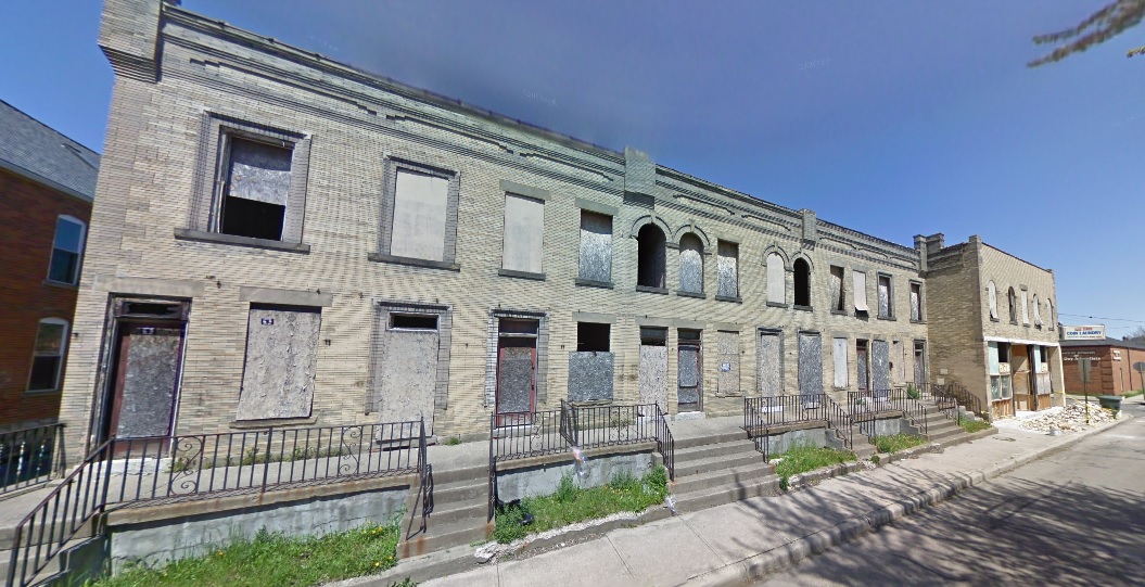
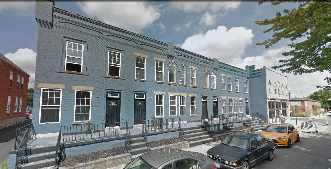
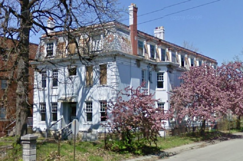
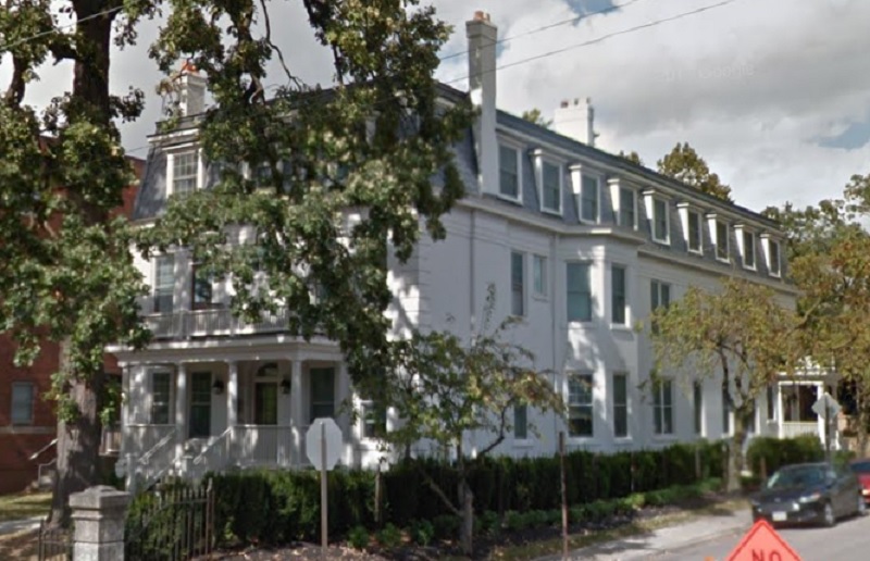
Before: 2009 Champion and Mt. Vernon, looking southeast.
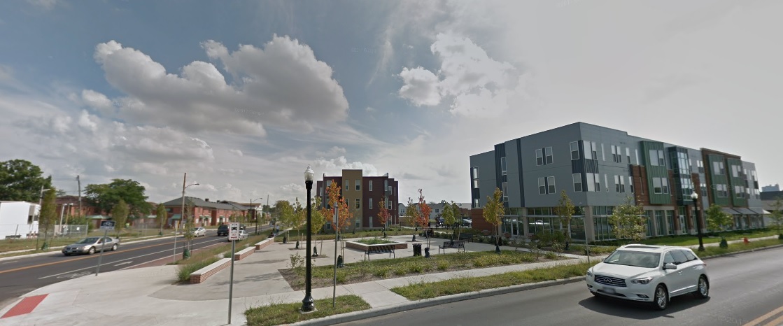
After: 2017

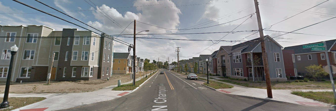
Before: 2011 Champion Avenue and Hawthorne Avenue looking south.
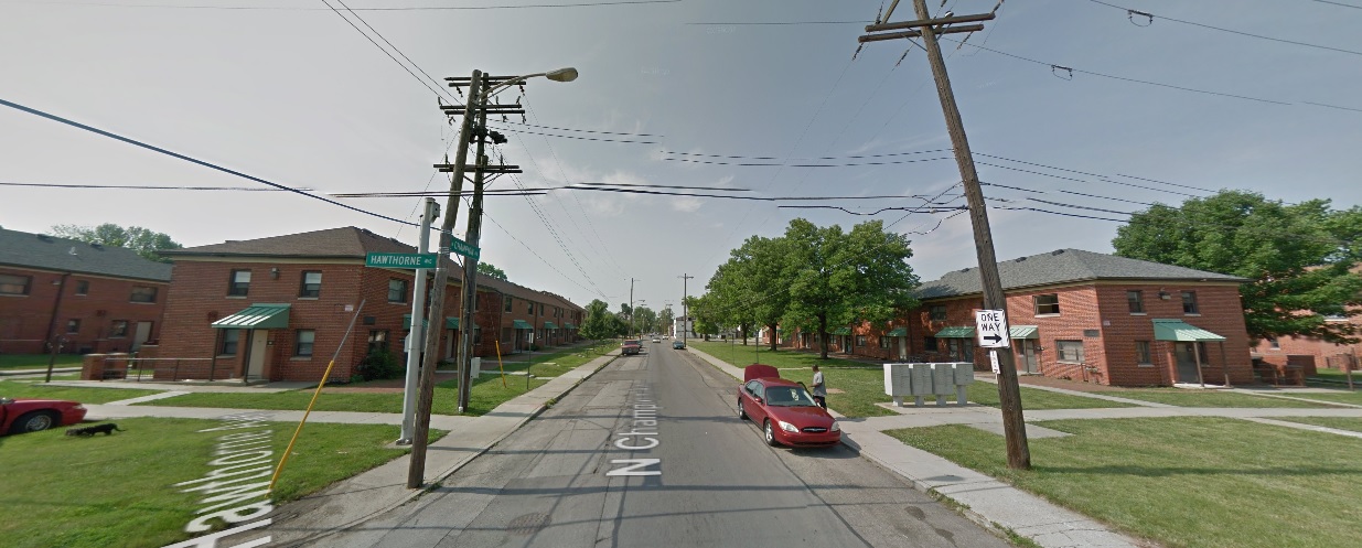
After: 2017

Oak Street
Before: 2009 Oak and 18th looking northeast.

After: 2017

Long Street
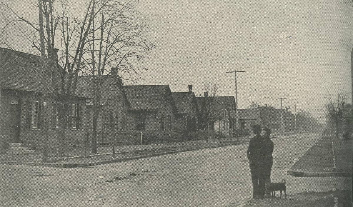
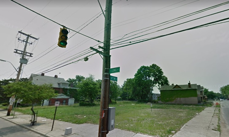
Before: 2011 Long and 17th, looking southeast.
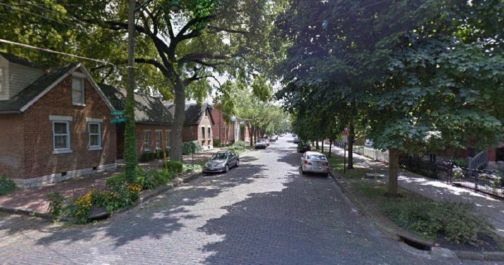
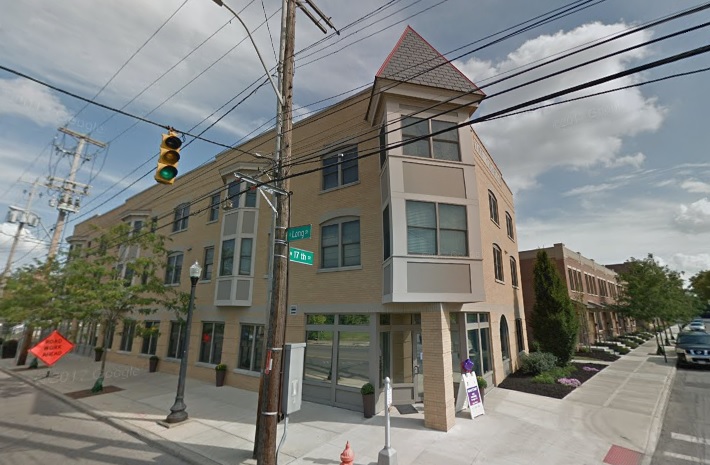

After: 2017

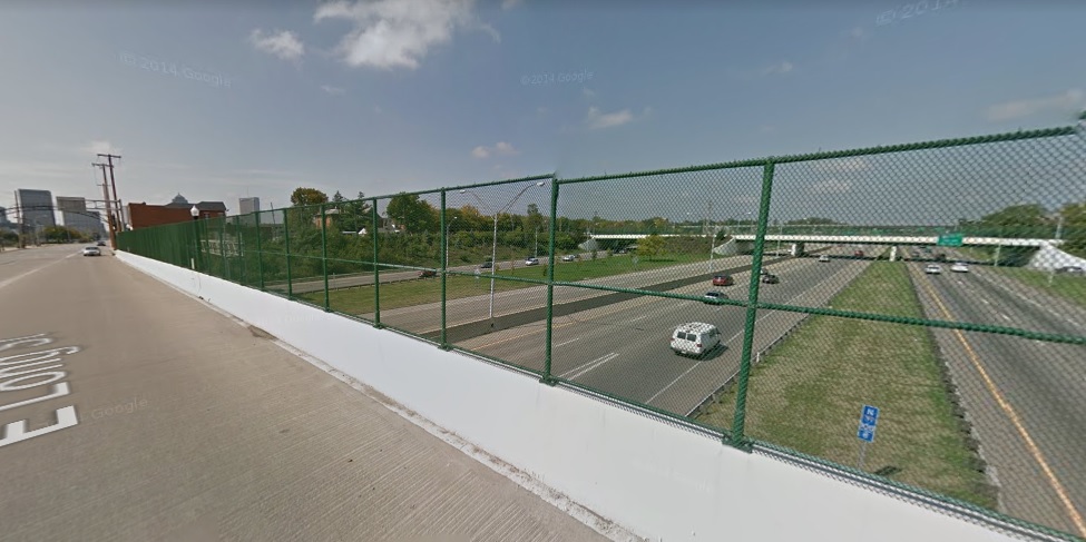
Before: 2011 Long Street and I-71 looking northwest.
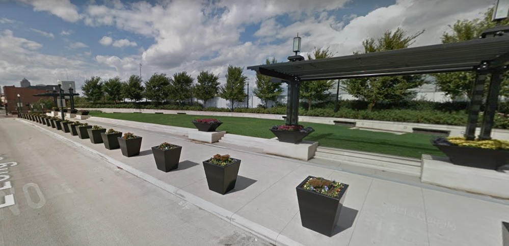
After: 2017

Bryden Road
Before: 2009 Bryden and Garfield looking northwest.


After: 2017

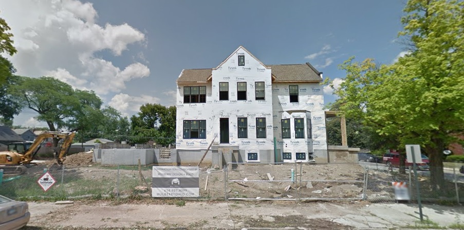
Before: 2015 Bryden and Ohio Avenue looking north.

After: 2018


Before and After German Village


German Village dates back to the early 19th Century, when it was sometimes called called Germantown. Unsurprisingly, by the middle of the 20th Century, the neighborhood had declined significantly, yet still retained the vast majority of its historic buildings. The city of Columbus had it in mind to bulldoze a large part of the neighborhood in the 1950s for public housing, but activists organized against those plans. Instead, in what was one of the first major success stories of Columbus preservation, German Village was saved. The entire area was eventually added onto the National Register of Historic Places in 1975, and today it is still the largest historic district on the registry anywhere in the United States. Here are just a few before and after photos around the neighborhood.

Before: Stewart Avenue Elementary School, looking northeast, in 1920.
before and after German Village
After: 2017

The school was constructed in 1873 and remains in use today, one of the oldest continuous schools remaining in the city.

Before: City Park Avenue at Lansing Street, looking south, in 1898.

After: 2016

Before: The Max Neugebauer Tailor Shop at 764 Mohawk Street in 1897.

After: 2016

Neugebauer arrived in Columbus in 1887, but it’s unclear when he opened this business.

Before: Beck Street and Mohawk, looking east, in 1950.

After: 2017

German Village was considered a “slum” by 1950, so the before photo would’ve been around the time of the neighborhood’s low point.

Before: Third Street and Beck, looking east, in 1981.

After: 2016

The photo shows a German Village “Haus and Garten Tour” through the neighborhood.


Before and After April 2017


**Note: Some photos have been updated for 2018.

I haven’t done a Before and After installment for a while. This time around, I chose to not focus on any single neighborhood.

First up is a photo of the construction of the Columbus Interurban Terminal, looking northwest from 3rd. The photo was taken on October 5, 1911, about 3 months before the building opened. The interurban system was relatively short-lived in the city, and the terminal closed after only 26 years in 1938. The building survived as a grocery store through the mid-1960s before the building was demolished in 1967 as part of the construction of the Greyhound Bus Terminal across the street. The actual location of the building was not on the Greyhound site, but was used as an overflow parking lot. It remained a parking lot until the mid-1980s, when it became part of the City Centre Mall site. Today, plans are for the site to become the location for the 12-story, 80 on the Commons mixed-use project.

Before and after April 2017

October, 1911.

Here is the same place in October, 2018.

The second historic photo is of the #57 streetcar on Kelton Avenue just south of the Oak Street intersection. The photo, which looks north, was taken on June 30, 1915 and includes 3 separate visible buildings as well. The house on the left actually survived until 1977, when it and the rest of the east half of the block was demolished. The building visible on the right is the surviving streetcar barn. Today, it is in bad shape, and while many would like to see it renovated and saved, time seems to be running out. The other surviving building, barely visible in the 1915 photo, is the tenement building on the northwest corner of Oak and Kelton.

And in 2015:

Third in this list is a photo of the demolition of the old Franklin County Jail, once located at 36 E. Fulton Street in Downtown. Built in 1889, the structure survived until the fall of 1971, when the building, which by then had become outdated for its intended purpose, was torn down to make way for- what else- a parking garage. The parking garage remains to the present day. Columbus leaders at the time should’ve been flogged for such short-sighted thinking, something that was repeated over and over and over again during that era. Today, such a very cool, unique building would’ve made an excellent candidate for mixed-use conversion.

And in August, 2016:

Finally, this next photo isn’t really historic. It was taken a mere 15 years ago in February, 2002, looking northwest from the corner of N. High Street and 10th Avenue. At the time, this area had been made up of low-rise historic buildings that had long held bars for OSU students. All these buildings in the photo, and many more, were demolished not long after the photo was taken in order to make room for the South Campus Gateway, now more or less just called the Gateway. Similar large-scale demolitions are taking place to the north and south as the entirety of the High Street corridor around Campus is transformed. Whether that is good or bad depends on who you ask. What can be agreed upon, however, is that the corridor will be almost unrecognizable in the end.

And in October, 2016:


Cool Link of the Day: Urb-I Urban Ideas

I saw this site mentioned on the CityLab site awhile back and thought it was a very cool idea. The site highlights how cities are transforming public spaces and making car-centric areas much more pedestrian, bike and transit friendly. Since I found the site, I have been lucky enough to become a regular contributor working to help make the site even better. The great thing is that anyone can send in before and after photos from their own cities of public space transformations. Take a look: http://www.urb-i.com/ The site covers cities across the world.

Columbus has several examples that I have added, but the photos are not yet updated on the site’s map. Until they are, here is a sneak peek:

Civic Center Drive
Urb-I Urban Ideas

West Town Street

Columbus Commons


Cool Link Before and After Worldwide


Similar to other posts that show how Columbus has been changing, the link below from the site Urb-I has hundreds of before and after worldwide photos of streetscape changes. Columbus itself is not included, but perhaps that can be changed as the site allows anyone to submit images.

http://www.urb-i.com/#!before-after/ceh8