How We Should Develop Around Intel


how we should develop around Intel Columbus, Ohio

Intel’s big project northeast of New Albany is now well-known. People are both excited and cynical about all the potential impacts that will come with it. But what is not discussed nearly as much- and is arguably just as important long-term- is what happens to all the land around it.
Rumors are already flying about developers scrambling to snatch up as much land as they can for housing, and that is no doubt true. The land is largely a blank slate, so what happens to it from this point is entirely up to the cities, towns and townships that the land sits within. Without a coordinated effort and plan, the area will almost certainly become a nightmarish cluster**** of low-density sprawl and endless traffic, which would be to the detriment of all.

So what can be done? How we should develop around Intel is not really the open question some might think. The answer, it seems, is pretty obvious once you get into the details of what types of development provide the most economic and social benefits.

The Area Today
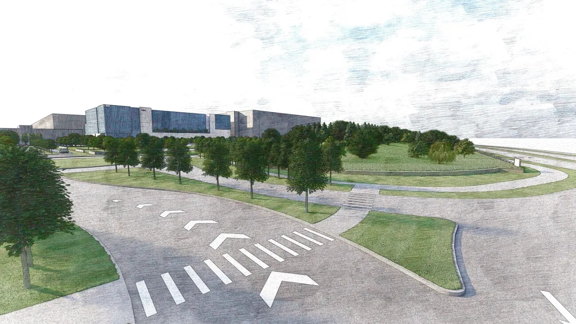
The main Intel site is bounded by Green Chapel Road, Mink Street, Miller Road and Clover Valley Road, encompassing about 1,000 acres, but a larger expansion area is about 3x that size, as shown by the map below.
This area is largely rural and almost entirely made up of farms. There is very little organized development between New Albany and Johnstown, which this site sits between. 2-lane Rt. 62, otherwise known as Johnstown-Utica Road, is the main connection between the two and runs just north of the Intel site.

How we should develop around Intel

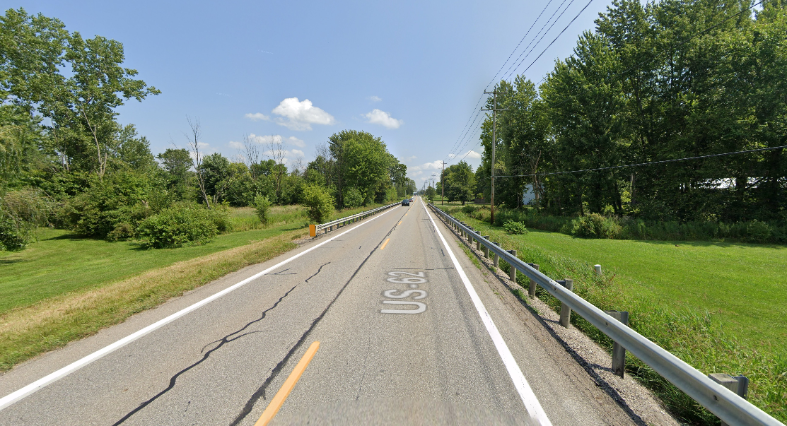
How Rt. 62 looks today.

How we should develop around Intel

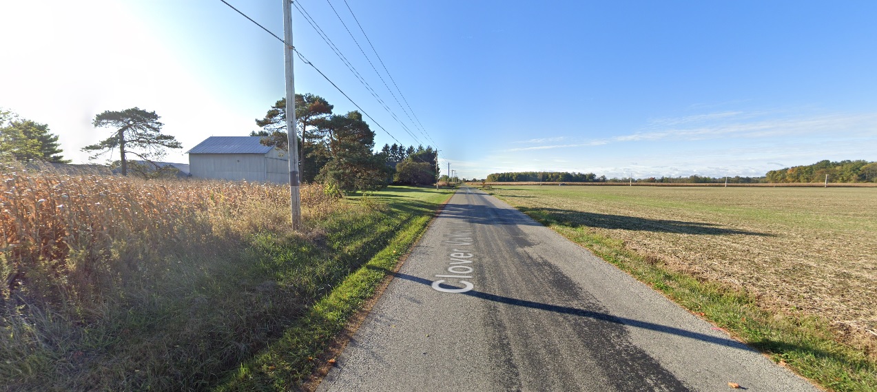
Clover Valley Road adjacent to the Intel site.

Planned/Ongoing Infrastructure Changes
2022-2023
-Jug Street between Beech Road and Clover Valley Road is being widened to 3 lanes.
-Jug Street between Clover Valley Road and Mink Street will be widened, but still be 2 lanes.
-Green Chapel Road between Rt. 62 and Clover Valley Road will be widened to 3 lanes.
-Green Chapel Road between Clover Valley Road and Mink Street will be widened to 5 lanes.
-Mink Street between 161 and Green Chapel Road will be widened to 5 lanes.
2024-2025
-Harrison Road between Clover Valley Road and Mink Street will be widened to 3 lanes and will be extended between Clover Valley Road and Jug Street.
-Clover Valley Road will be widened to 3 lanes between Jug Street and Green Chapel Road.
-Beech Road between Innovation Corridor Way and Jug Street will be widened to 5 lanes.
-Beech Road between Jug Street and Rt. 62 will be widened to 3 lanes.
-Miller Road between Beech Road and Clover Valley Road will be widened to 3 lanes.

Beyond these road changes, little of anything else is planned. Where Intel has made a presence in other communities in other states, unregulated sprawl seemed to be what mainly happened, but that doesn’t have to happen here. Here is a general outline of what could be.

Map Highlights
-Rt. 62 becomes a mixed-use commercial, retail, restaurant and residential corridor along a tree-line boulevard capable of handling either bike or transit lanes (or both). Several other roads around the area also become boulevards. A “town center” of sorts could be created at the 4-way intersection in red, with mixed-use corridors in all 4 directions. South of 62, medium to high-density residential on a street grid would be the best use, while north of 62 would be more of a mixed-density residential development on a street grid. In both cases, the residential areas would be dotted with parks and playgrounds, corner shops, cafes and other amenities.
The Intel site and surrounding area itself is already basically spoken for, with several areas of planned expansion, while further to the south, New Albany’s business park could see gradual expansion as well.

Now, none of this is more than a thought experiment. There is likely to be heavy NIMBY opposition by locals to any major development, let alone what would be considered a more urban and dense style. However, development is going to happen with or without local approval. The demand will be incredible and far too strong for it to be killed off entirely. All that opposition is likely to accomplish is to create all of the problems they think they’re trying to prevent. There are reasons to go with density and grids over not. Here are just a few of the advantages of a street-grid-based higher density plan:

1. Higher land values. Gridded street layouts tend to haver higher land values than sprawl.
2. Taxes. Gridded streets allow for the creation of higher densities, and as mentioned, higher land values. Cities and towns therefore get a much greater tax return than they would with sprawl.
3. Lower traffic. Gridded streets allow more connectivity between one street and another, and therefore provide more routes to choose from when attempting to avoid traffic. This allows for more traffic dispersal across the board.
4. Lower infrastructure costs. Higher densities allow infrastructure costs to be divided among a greater population, creating a lower general financial burden for residents, as well as local and state entities.
5. More adaptability. It is much easier and cheaper to rebuild along gridded streets than it is the winding streets in the average sprawled neighborhood. The infrastructure doesn’t need to be rebuilt to change development patterns. So low-density housing can be built on a grid initially and then gradually replaced with higher density residential or mixed-use depending on demand.
6. Better transit access. It is very difficult to build transit systems within a sprawled area. Winding roads prevent higher travel speeds for transit, making them inefficient and slow. These systems are also rarely, if ever, built during the initial creation of sprawled neighborhoods. Sprawl is not very adaptable to adding them later if the population density becomes significant enough in the future to support them.
7. Safer for pedestrians. Because gridded streets do such a better job at traffic dispersal, they can be narrower than say, your typical American stroad. As such, narrower streets tend to slow down traffic, lowering the risk of harm to pedestrians and bikers.

So the benefits are pretty clear, but will anyone see them? Johnstown’s government is currently a hot mess, New Albany- which at least has a bit of a track record in planning- doesn’t own any of the land, and neither have hinted whatsoever that they’d even be interested in coming up with a plan. Few, if any, of the developers buying up property have any sort of track record outside of sprawl.
Enormous changes are coming for this area, and for Central Ohio as a whole. It’s going to take forward-thinking leadership to step up- and soon- before it’s too late.


Random Columbus Photos 9


For the Random Columbus Photos 9 edition, we take a not-so-distant look back for a change.

Photo Location: High and Broad intersection, looking north.
Photo Date: August 31, 1991
Photo History: The Celebrate Them Home Columbus parade occurred as an event to honor returning Gulf War and Operation Desert Storm veterans, as well as veterans of previous wars. The event was held only one time. National patriotism was unusually high during this short war, and helped to revive Lee Greenwood’s 1984 song “God Bless the USA”, which often played on the radio during the conflict.
Contrary to what may be popular belief, the Beetle Bailey character represented in the balloon does not date back to WWII. Instead, he first appeared in comic strips in 1950 and continues to run today.
Random Columbus Photos 9 Columbus, Ohio

The same view today.

Not much has changed since the 1991 photo. A few buildings have been renovated and the streetscape has seen improvements, but otherwise, the view is largely the same.

Strange Columbus July 29, 1961 UFO


Strange Columbus July 29, 1961 UFO Columbus, Ohio

From the files of Project Blue Book, this incident is somewhat humorous as the person who reported the incident seemingly had reported objects in the past and was considered extremely “belligerent” in reporting information about what they witnessed. The witness testimony included in the report is full of colorful language. Whether the witness was simply trying to gain attention seems to have been a factor in concluding this event was Jupiter.


Much of the written part has faded over the last 60 years, so quite a bit is unreadable. However, it looks like it was part notes from an interviewer and part response from the interviewee/witness. It seems to be relating to how the witness was largely uncooperative in answering questions.
17. *Interviewer* Notes: I got to home of *unreadable* Mr. *Redacted*… *unreadable* conversation around following pattern.
-Witness- I can tell you something you want to know about the goddamn thing.
*Interviewer* What color was it?
-Witness- *unreadable* is that goddamn thing *unreadable*?
*Interviewer* Was it like a star?
-Witness- Are you trying to make me out (to be) a goddamn fool or something?
*Interviewer* Where did you first see it?
-Witness- I know all about *unreadable* and that sort of thing, I was in the Navy.
19. -Witness- I have a friend who was at Pearl Harbor and he saw this goddamned thing, and you know what happened at Pearl Harbor.”


The exclamation points are a good indication the interviewer was basically mocking the witness by that point.

Again, some of the writing has faded. Here is what I could decipher.
Sgt. Ashley of Lockbourne AFB first referred the call to me at 2230 HRS. He had already been talking to this man for about an hour. Lockbourne Tower personnel and Columbus police failed to see what the man described. Sgt. Ashley had by chance been on duty the other time *redacted* had called and had gotten no confirmation that time either. That was *unreadable* July *unreadable*. Ashley called back at 2300 saying that *unreadable* was calling *unreadable* again. I did not take a second call from *redacted*.

To view more incidents around the world, visit this link.
UFO Database


Building Collapse a City Failure

In recent years, Columbus has lost multiple historic buildings, but not all of them were for new development. Instead, they were largely the victims of neglect and indifference, with both owners and the City itself acting as their executioners. The most recent building collapse is a City failure, but it is just one more in a long, depressing list. Let’s take a look at just some of these cases, and how bias against poorer or less-White neighborhoods may be part of the problem.

Charles Building

Building collapse is a city failure Columbus, Ohio

The Charles Building in 2009.

905 E. Long Street
Built: 1910s
Demolished: 2010
The apartment building was first owned by Dr. William Method, a prominent figure who was often called the “dean of Negro physicians” at the time. Method was responsible for helping to build the hospital across the street, known as Alpha Hospital, which primarily served Black residents who struggled to get adequate medical care otherwise. The apartment building was named after Method’s only son, Charles.
Method didn’t own the building for very long and was in the hands of another owner by 1920. The building belonged to one owner from 1938-1966, and was largely maintained during this period. In 1970, it passed to yet new owners, and that seems to have been when the problems started. At the time, disinvestment in the Near East Side had become a powerful force in and of itself. After 70-71 had split the neighborhood off from Downtown in 1962, the population collapsed and most of the people who remained were lower-income minorities, a demographic that wasn’t exactly being prioritized in the mid-20th Century. Coinciding with the Urban Renewal period, these neighborhoods were devastated both by the lack of investment, but also by the City demolishing large swaths of what they had determined to be undesirable areas.
Part of that lack of investment was allowing many of the older buildings that didn’t immediately meet the wrecking ball to decline in condition through lax, and sometimes virtually nonexistent inspections and maintenance.
The building was old by the 1970s, but continued to be a solidly-built structure. Over the following decades, however, neglect eventually caused the building to become abandoned, and the City took over ownership of it in 2004. The City did not maintain it after that, though, and it remained abandoned and in increasingly poor shape as the years went on. In the late 2000s, a plan was finally formed to renovate it and turn it into affordable housing by the Affordable Housing Trust for Columbus & Franklin County. However, city architects argued that it would cost more to renovate the building than to tear it down and build new ($2.1 Million vs. $1.5 Million), and city leaders were concerned the federal government wouldn’t provide the funds to make up the difference, leaving Columbus on the hook for the remaining $600,000. So, the renovation plans were given up and the decision was made to demolish it.
A part of the story familiar to most of the demolitions listed here, neighborhood residents were less than happy about another part of their history being lost due to outright neglect and the hand-wringing of officials using cost as an excuse. Regardless, the building was torn down by the end of 2010. An affordable housing project was built on the site in 2012, and given the name “The Charles” as a somewhat pandering move to the site’s history.
Ironically, the new Charles building cost $2.2 million to construct, which meant that the demolition and new building ended up costing more than just renovating the old one in the first place. Curious. Worse, the new building provided only 10 units, fewer than the original building could have.


Centenary United Methodist Church

Building collapse is a city failure Centenary United Methodist Church

The church in March, 2010.

928 E. Long Street
Built: 1928
Demolished: May, 2010
In 2002, then Columbus Mayor Michael Coleman was pushing hard for revitalizing the King-Lincoln neighborhood, with 25 buildings throughout the neighborhood being designated as “major community assets”. The old Centenary United Methodist Church, the home of a long-time predominantly Black congregation, was one of those buildings. The following year, that existing congregation vacated the building and it was sold to Second Baptist Church of Columbus. Second Baptist didn’t seem to have any real plans for the building, as in 2009, it prepared to sell it to another church called Yeshua is Lord Ministries, which wanted to renovate the structure for a community center.
By 2003, the building was already 75 years old and had started to show its age. Deferred maintenance by the long-time owner had left parts of the structure, particularly the brick facade, vulnerable. Second Baptist had spent no money maintaining the structure, either, between 2003 and 2009.
The sale to Yeshua got as far as Second Baptist signing a sale contract, but for reasons that aren’t clear, the deal fell through. It’s also unclear whether Second Baptist sought other buyers after that or just decided to tear it down. In April, 2010, a city engineer’s report called the building “unsafe” due to loose brick, a few of which had fallen off the building. The City ordered the church stabilized or torn down, and Second Baptist chose the latter, with a vague plan to redevelop the site after.
Columbus Landmarks Foundation briefly got involved to either raise money to save it or find a new buyer, but they just didn’t have any time to do so. Only a month after the report, the church was demolished. To date, Second Baptist still owns the site, but it continues to be vacant more than a decade later.
In some ways, this story is more complicated than with the Charles Building, but there are familiar themes here too. The building lacked the necessary maintenance by its owners, and the City lacked the oversight necessary to make sure it was maintained before it became a public safety issue. By the time any of it was addressed, the timeline pushed to do so did not give interested parties the time necessary to save it. Furthermore, we have a common case of historic buildings being demolished with no real plans in place to replace them with anything. Churches have been a surprising force in this type of historic destruction, not just with church buildings themselves, but with surrounding blocks, often either for newer buildings or parking lots.

Commercial Building

Building collapse is a city failure 1072 E. Long Street

The building in 2009.

1072 E. Long Street
Built: Unknown, prior to 1891
Demolished: 2010
While it never seems to have had an official name, this commercial building was long an important fixture on Long Street. While articles say it was built around 1910, historic maps clearly show it being at the site as early as 1891, so it was far older than suggested. In the 1940s and 1950s, for example, it functioned as the Burns Memorial Funeral Home, a family-owned business that served the local Black community. It also served as apartments, retail space, the Crosby Funeral Home and in the early 1970s, as a Franklin County registrar to buy plates and licenses. Records after the 1970s are few, and it seems the building may have been fallen into disuse by the 1980s, coinciding with the general decline of the Near East Side. Its path to demolition is an interesting one, as it seems the City was determined to tear it down.
In November, 2009, the building went to a Sheriff’s auction, where Columbus bought it with plans to turn over the site to the Columbus Housing Partnership. At the time, though, CHP had no actual plans for it. A few weeks later and after an inspection, the City inspectors issued an emergency order that claimed the building was in such a state of decay that it could “collapse at any time”. The order gave Columbus 30 days to either fix the building or tear it down.
After the emergency order was issued, the Bronzeville Neighborhood Association, among other neighborhood groups, requested the chance to get a second opinion on the building’s condition and if there was a possibility of saving it. The Columbus Department of Development, which took ownership of the building after the auction, claimed that there was simply no time to wait for that as the building was a significant risk.
It is very strange, then, that the City did not act within the ordered 30-day timeframe. Indeed, 4 months would go by and nothing would be done with the structure, far longer than would’ve been required to honor the request of neighborhood groups for a second opinion on condition. On March 1, 2010, The Bronzeville Neighborhood Association offered Columbus $500 for the building, an amount more than the Director of the Columbus Department of Development thought the building was worth. The same day, the BNA was given until March 5th to come up with a “viable” plan to buy and renovate the building.
So to recap, city inspectors had claimed the building was in imminent danger of collapse and gave the Department of Development 30 days to either renovate or demolish. The DOD then told neighborhood groups that 30 days was just not enough time for them to get a second opinion and put together a proposal. 4 months pass with no action from Columbus, neighborhood groups put an offer for more than the building is considered to be worth, but the DOD gives them just 5 days to come up with a new proposal, something they could’ve been working on the previous 4 months as the City did nothing. It sure seems like the City wasn’t acting in good faith.
On the March 5th deadline, the City rejected the $500 offer by saying that it didn’t come with any assurances that the neighborhood groups would raise the necessary funds to renovate the structure. Just a week later, the building came down. At the time, it was one of the oldest buildings remaining on Long Street.

Charles Seefried Building

Building collapse is a city failure 555 W. Town Street

Seefried building in 2021.


555 W. Town Street
Built: 1884
Demolished: Soon
While this mixed-use building has yet to meet the wrecking ball, it seems to be only a matter of time. Charles Seefried’s life seems to not show up much in the historical record. In an 1889 directory, he is listed as a “blacksmith helper” and living at 179 1/2 N. High Street, but it’s unclear if this is the same Seefried whose name adorns the building. Either way, Seefried seems to have passed away on October 29, 1888 at age 43. The building housed apartments on upper floors with commercial space on the ground for for just about all of its existence. A general store called Couts & Downing is listed in the building as early as 1907 and were still there when WWII broke out. A bar called the Red Star Grill was there for at least a decade in the 1960s and 1970s. The exact year when the building was abandoned is unclear, but it seems the most likely period was the 1980s. Between 1979 and 2012, the building was sold at least 6 times to different owners, most of whom did almost nothing in terms of maintenance. There were minor repairs done in the mid-1990s and in 2002, but they were not the kind of repairs that would halt the deterioration. In 2016, it seems the most recent owner at least applied for a permit to replace the roof, but it’s unclear if that was done. A few years later, in March, 2019, the building was declared unsafe, with similar declarations coming into 2020, with repeated 90-day orders to stabilize or tear the building down.
Finally, in March of this year, it was reported the the owner had decided to tear it down, citing structural issues that rendered the building “too far gone”. No permits for the demolition have yet been issued, so there is a very tiny chance that the building will somehow make it, but that seems very unlikely.

And now we finally come to the latest loss.

Mixed-Use Building

building collapse a city failure 1032 E. Long Street

1032 E. Long in 2021.


1032 E. Long Street
Built: 1880s
Demolished: July, 2022
This was likely one of the oldest remaining commercial buildings on East Long Street, a very rare survivor after 70 years of demolitions in the neighborhood. How it survived so long when so many others did not is probably more luck than anything, but it still managed to meet the same fate of neglect that all these others- and so many more- did.
On July 18, 2022, part of the back half of the building completely collapsed.

In public records, there are no listed permits for any improvements or renovations, so this likely occurred simply due to neglect. After 140 years, all that deferred maintenance left the building vulnerable until it literally couldn’t stand anymore. Going back more than a decade, the only code violations I could find had to do with trash, weeds, graffiti and signage. Had there been any inspections of the building at all over the past 5 owners in the last 20 years?
Why is Columbus allowing so much of its history to rot away to the point of collapse? These buildings had history and each one arguably added more to their neighborhoods architecturally than anything being built today. Each loss is a tragedy and should serve as reason enough for change.
Building collapse is a city failure 1032 E. Long Street

The interior of L. Hicken Staple and Fancy Groceries inside 1032 E. Long Street in 1898.


Strange Columbus Atomic Bomb Evacuation Routes

In this short edition of Strange Columbus Things, we look at Ohio’s atomic bomb evacuation routes.
Back in the 1950s, many were still grappling with the implications of the birth of the Atomic Age. The US was busily testing bombs both on and outside of US soil, and souring relationships with international adversaries presented the threat of nuclear war. In March, 1955, the director of Ohio’s Civil Defense, Major General Leo M. Kreber, release evacuation routes for Ohio’s major cities should an attack take place.

Strange Columbus Atomic Bomb Evacuation Routes

For Columbus, it was either north or south. In the description of why these directions are preferred, it was suggested that it was to prevent conflict with evacuees from the Dayton area to the west, but in reality, the truth is much darker.
In the event of a nuclear attack, it wouldn’t just be Columbus. Dayton and Cincinnati would also be hit, and due to prevailing winds in this part of the world, fallout would generally move eastward. Therefore, the safest routes were thought to be up towards Morrow County or south and southeast towards Hocking County.
The logic hasn’t changed much in the past 70 years. North and south would still be the safest evacuation routes. However, evacuation from targeted locations would only offer temporary refuge. The cruel reality is that in the event of a true, global nuclear war, few places anywhere on the planet would be left unscathed. If not destroyed by bombs or irradiated by fallout, nuclear winter would bring incredibly devastation to most of the planet, even those completely untouched by bombs.
As true today as it was in 1955, the only way to really be safe is for no one to ever push the button.

To continue looking into local history, visit the history links page or Ohio’s role in the atomic bomb’s creation, Ohio History Central offers additional information.