
For the last few days, models have shown the threat of a significant and likely weekend snowstorm and ice storm across the Mid-South up through the Ohio Valley. What started off as a storm well to the south has gradually shifted further north, with most models now showing a potentially historic snowstorm for parts of Ohio including the Columbus area. This temporary post will keep track of any model updates, National Weather Service information and any other related data.
Updated as of 12:40PM, 1/22/2026.
A Winter Storm Watch was issued by NWS Wilmington early this morning. Here is that watch:
URGENT – WINTER WEATHER MESSAGE
National Weather Service Wilmington OH
205 AM EST Thu Jan 22 2026
Wayne-Fayette-Union-Franklin-Union-Delaware-Miami-Champaign-Clark-Madison-Franklin-Licking-Preble-Montgomery-Greene-Butler-
Including the cities of Richmond, Springfield, Fairborn, Oxford, Fairfield, Beavercreek, Middletown, Newark, Troy, Camden,
Delaware, Xenia, Brookville, Kettering, Downtown Columbus, Piqua, Urbana, Hamilton, Plain City, Liberty, West Jefferson,
Connersville, West College Corner, Eaton, Downtown Dayton, Tipp City, London, and Marysville
…WINTER STORM WATCH IN EFFECT FROM SATURDAY MORNING THROUGH LATE SUNDAY NIGHT…
* WHAT…Heavy snow possible. Total snow accumulations between 4 and 8 inches possible.
* WHERE…Portions of east central and southeast Indiana and central, southwest, and west central Ohio.
* WHEN…From Saturday afternoon through late Sunday night.
* IMPACTS…Travel could be very difficult.
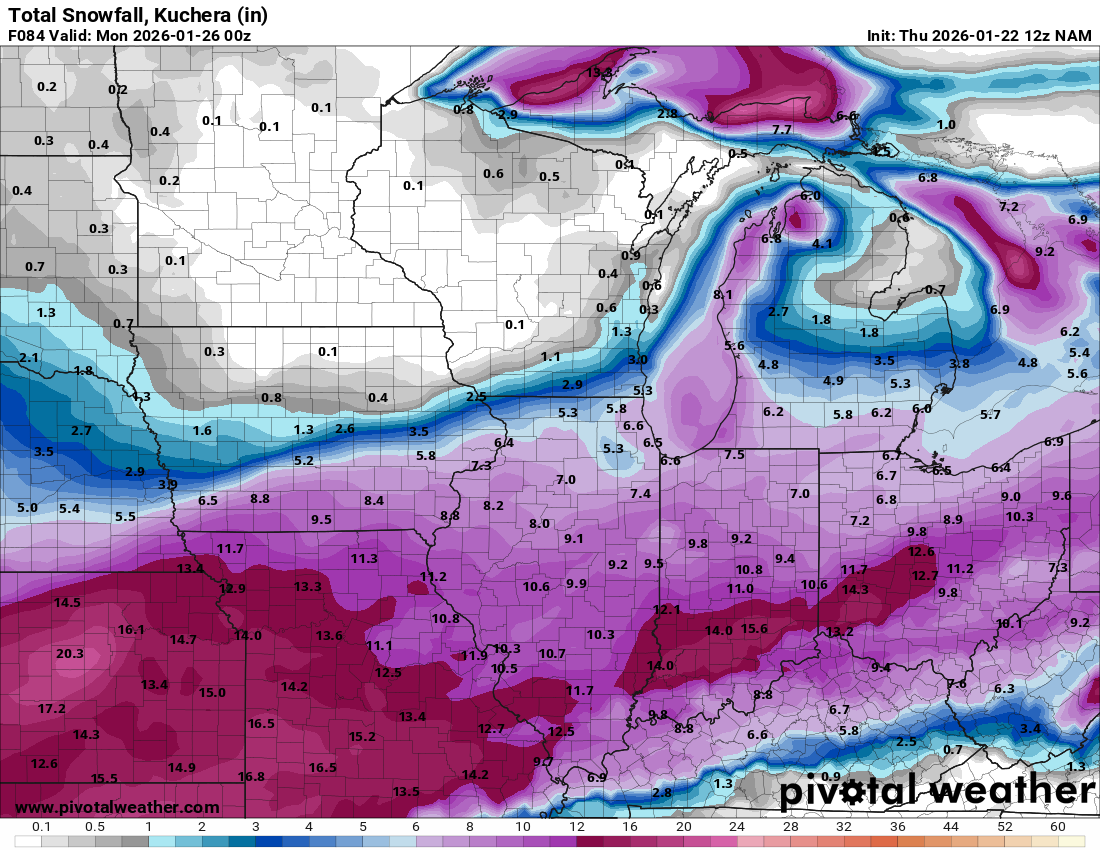
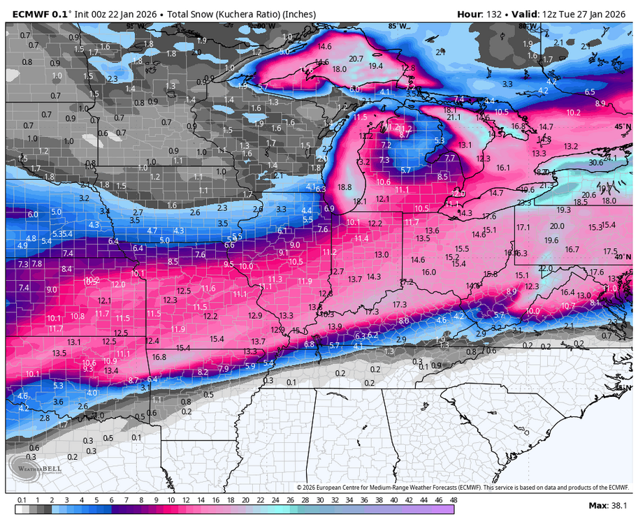
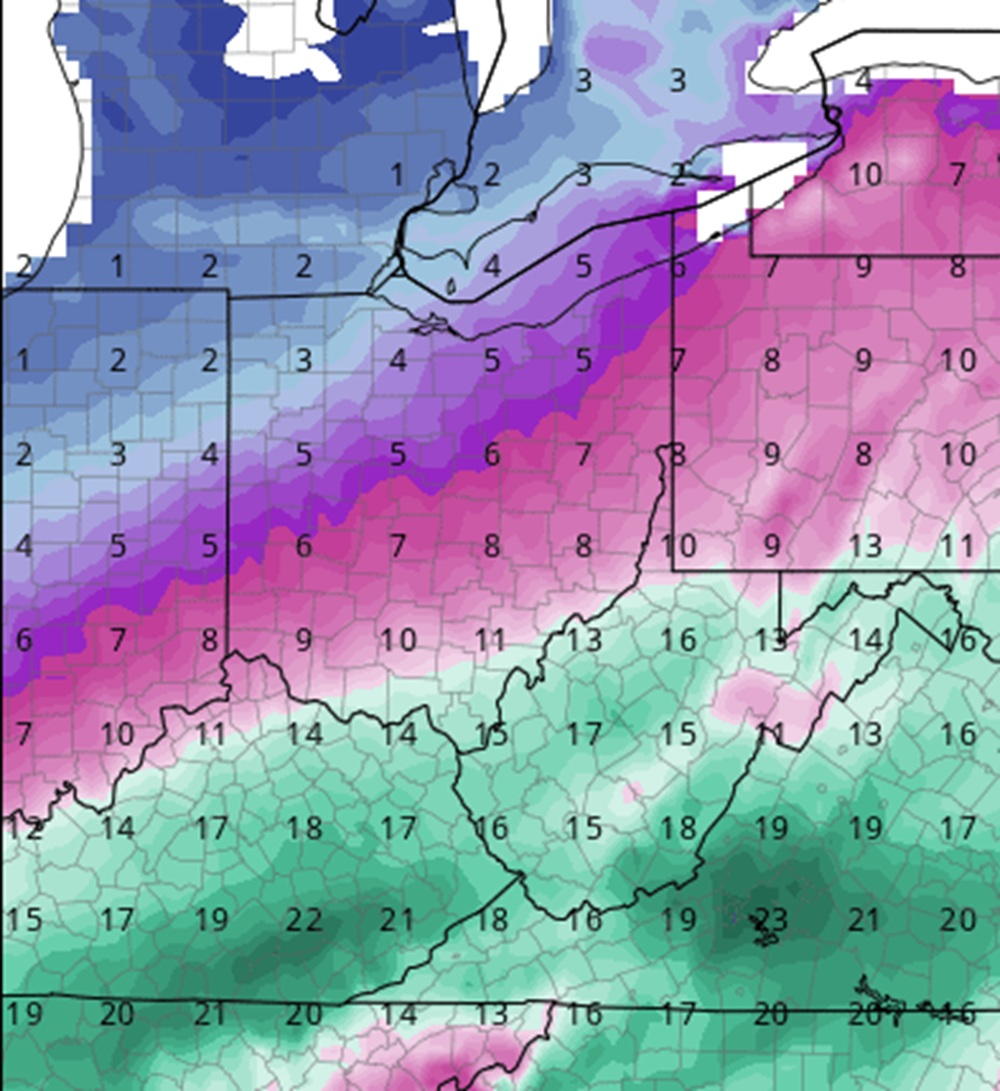
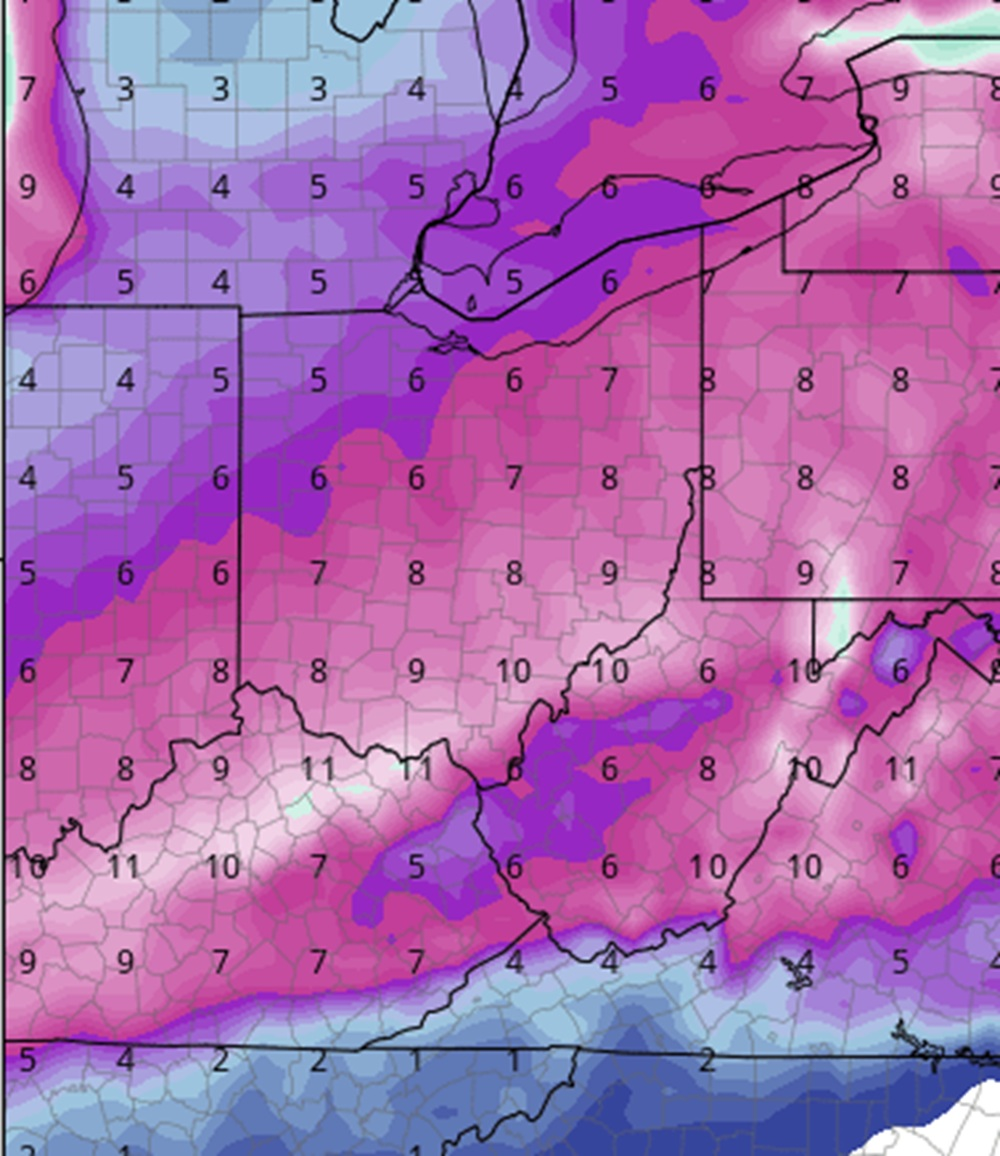
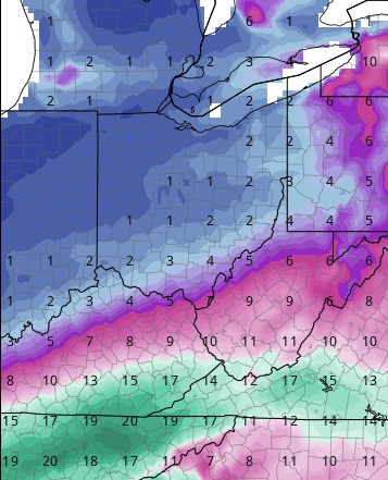
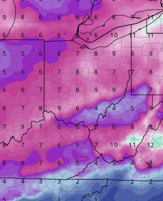
Models have gradually shifted the heaviest snows through South-Central and Central Ohio. Here are the latest model run snowfall forecast maps.
12Z NAM: 12″-14″ (True ratio)
0Z EURO: 14″-16″ (True ratio)
12Z GFS: “6-8” (10-1 ratio)
12Z GEM: 7″-9″ (10-1 ratio)
12Z ICON: 10″-12″ (True ratio)
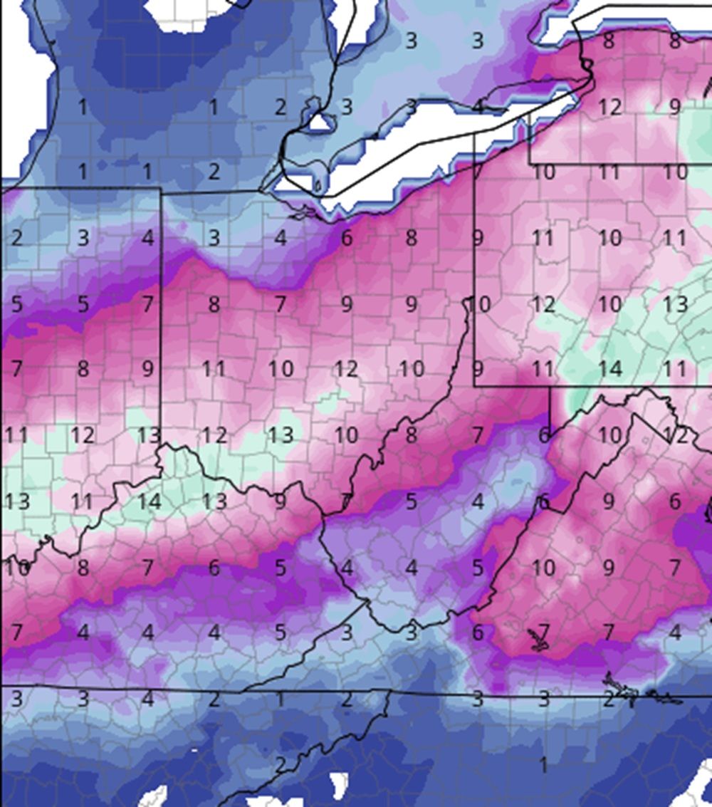
“True ratio” is the snow amounts predicted by the total liquid precipitation multiplied by how high the snow-to-liquid ratio is predicted to be. They are essentially the full totals the model believes will fall. For 10-1 ratios on some models, these are likely to be below actual totals. The ratios for this event are highly likely to be well above 10-1, perhaps double, so GFS and GEM totals using those ratios are likely to be too low, as is the NWS forecast in the Watch. Needless to say, the models are showing the most significant snowstorm for Central Ohio since March, 2008.
Previous Updates:
As of 6PM, 1/21/2026, here were the latest snowfall maps via the various models.
18z ICON: 10″-13″ (True ratio)
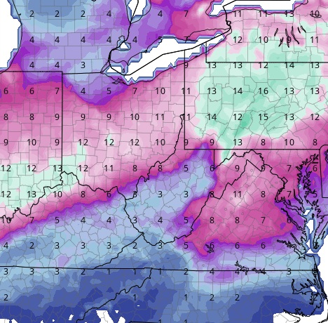
18z GFS: 1″-3″ (10-1 ratio)
12z GEM: 6″-10″ (10-1 ratio)
9z Euro: 14″-16″ (True ratio)

Obviously, there is a large range. The 18z GFS is notorious for bad runs, so keep that in mind. All others are showing a significant event.
In the meantime, Wilmington NWS office has issued a Winter Storm Watch for all of far southern Ohio. I would expect those watches to be issued further north sometime over the next day or so. WInter Storm Watch