
For the last few days, models have been hinting at a significant winter storm across the Mid-South up through the Ohio Valley. What started off as a storm well to the south has gradually shifted further north, with most models now showing a potentially historic snowstorm for parts of Ohio including the Columbus area. This temporary post will keep track of any model updates, National Weather Service information and any other related data.
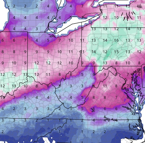
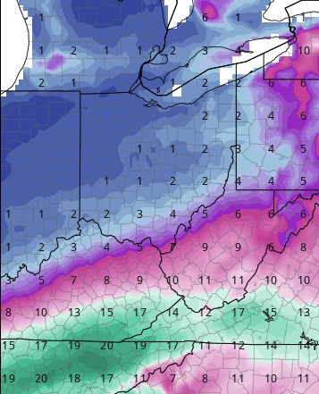
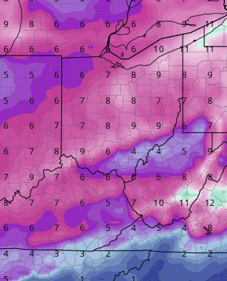
As of 6PM, here were the latest snowfall maps via the various models.
18z ICON: 10″-13″ (True ratio)
18z GFS: 1″-3″ (10-1 ratio)
12z GEM: 6″-10″ (10-1 ratio)
9z Euro: 14″-16″ (True ratio)

Obviously, there is a large range. The 18z GFS is notorious for bad runs, so keep that in mind. All others are showing a significant event.
In the meantime, Wilmington NWS office has issued a Winter Storm Watch for all of far southern Ohio. I would expect those watches to be issued further north sometime over the next day or so. WInter Storm Watch