
Part 2 is now available for more great before and after comparisons.
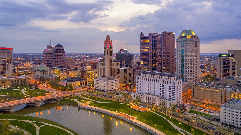
How Columbus has changed in 10 years is not always easily quantifiable. Columbus added more people in the past decade than during any previous similar period in its history. I’ve posted a lot about the 2020 Census data and updated many pages worth of information to the site. However, examining only population change through numbers is just one part of the story. How has that population growth manifested in terms of how the city appears in its built environment? This before and after look shows how the city has been transformed on a visual scale, and shows how some of the hottest neighborhoods have been radically altered in a short time.
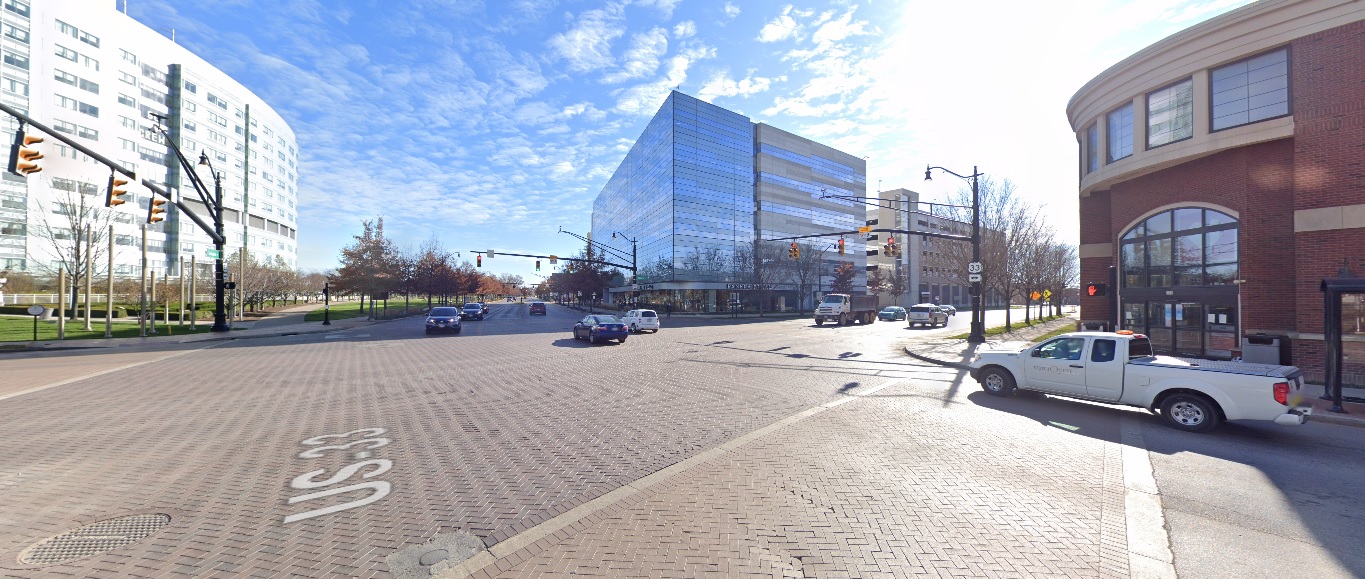
Downtown
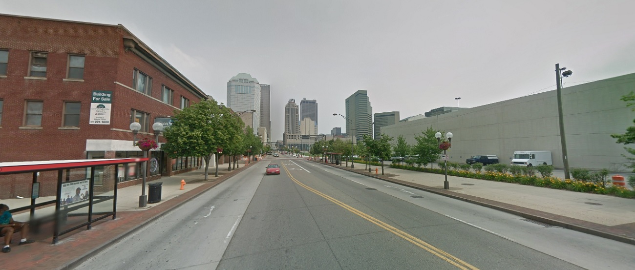
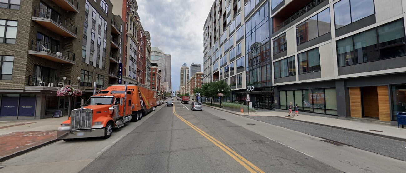
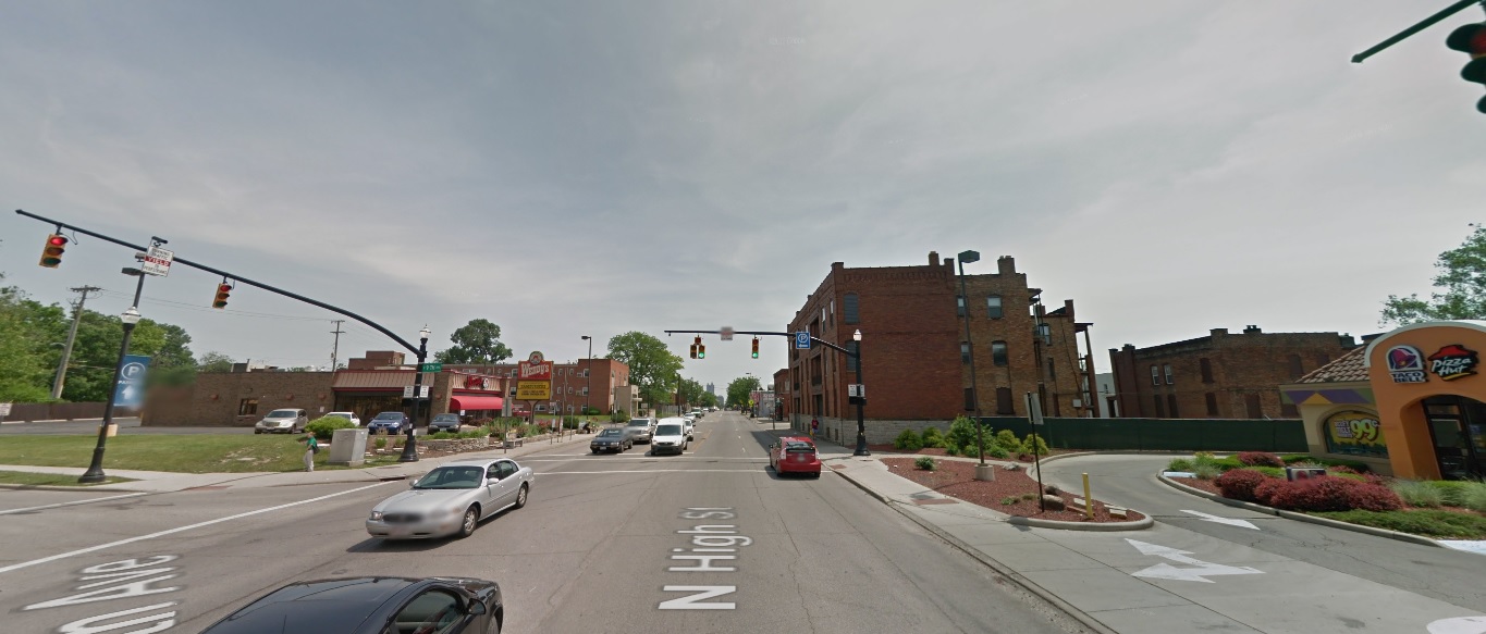
High Street, looking north from Rich Street
Before: 2011
After: 2021
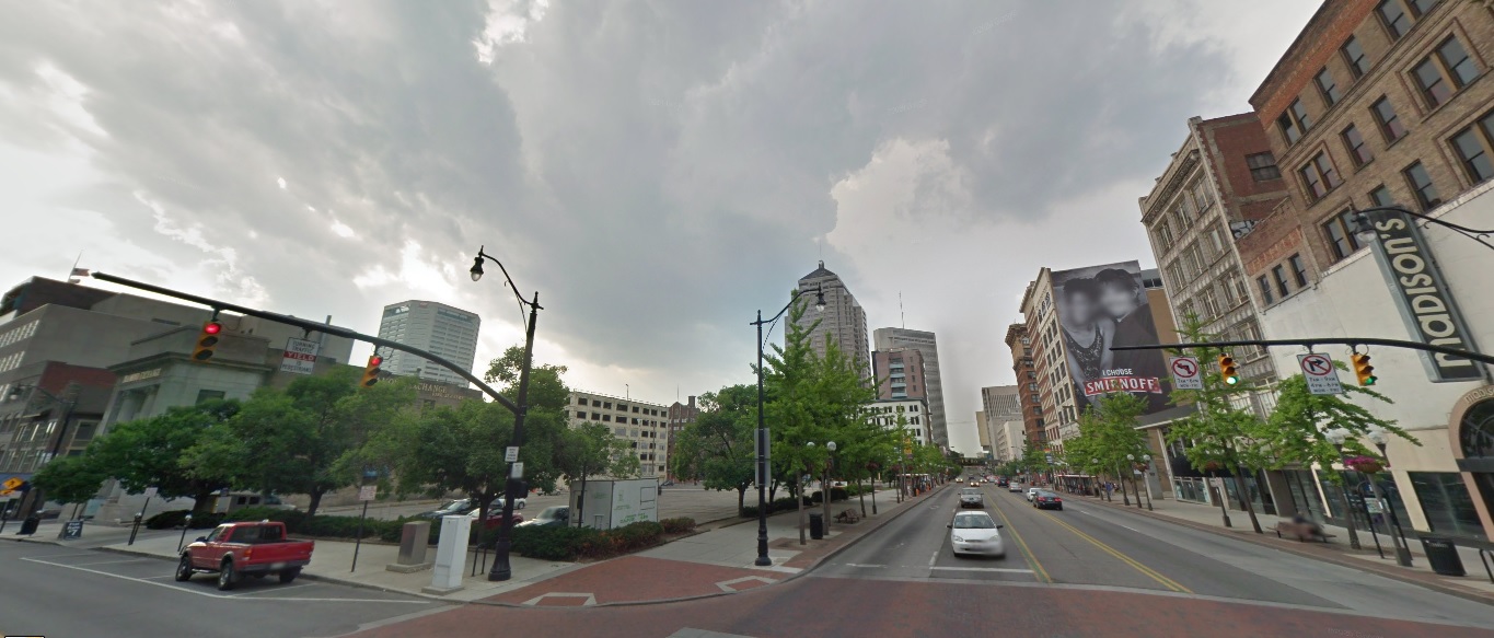
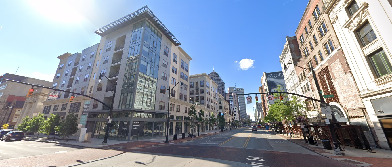
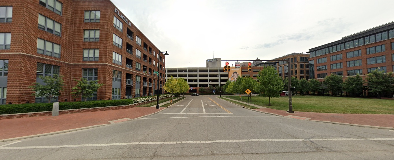
High Street, looking north from Gay Street
Before: 2011
After: 2021
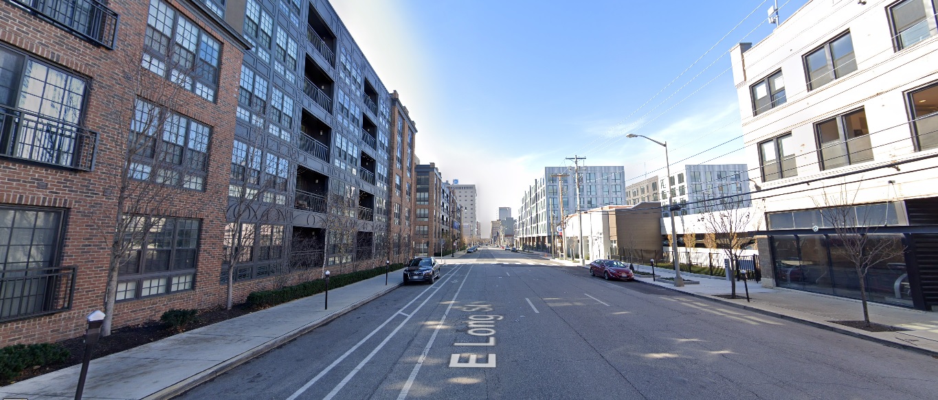
Long Street, looking east from 6th Street
Before: 2011
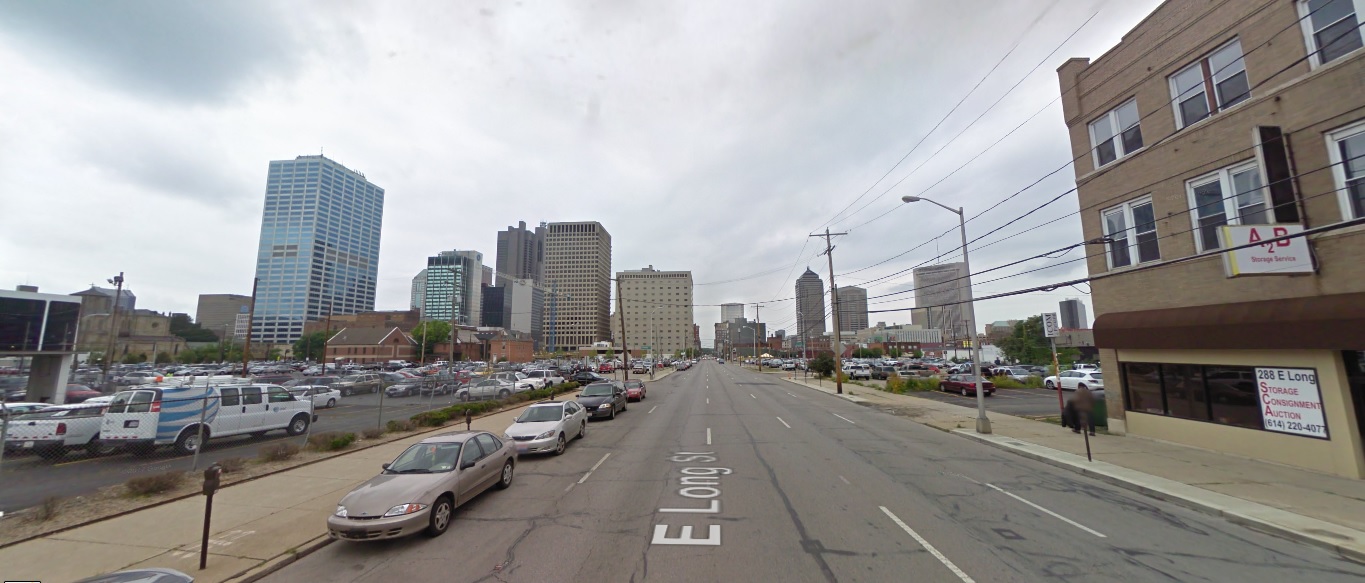
After: 2020
Neil Avenue, looking east at Broadbelt Lane
Before: 2011
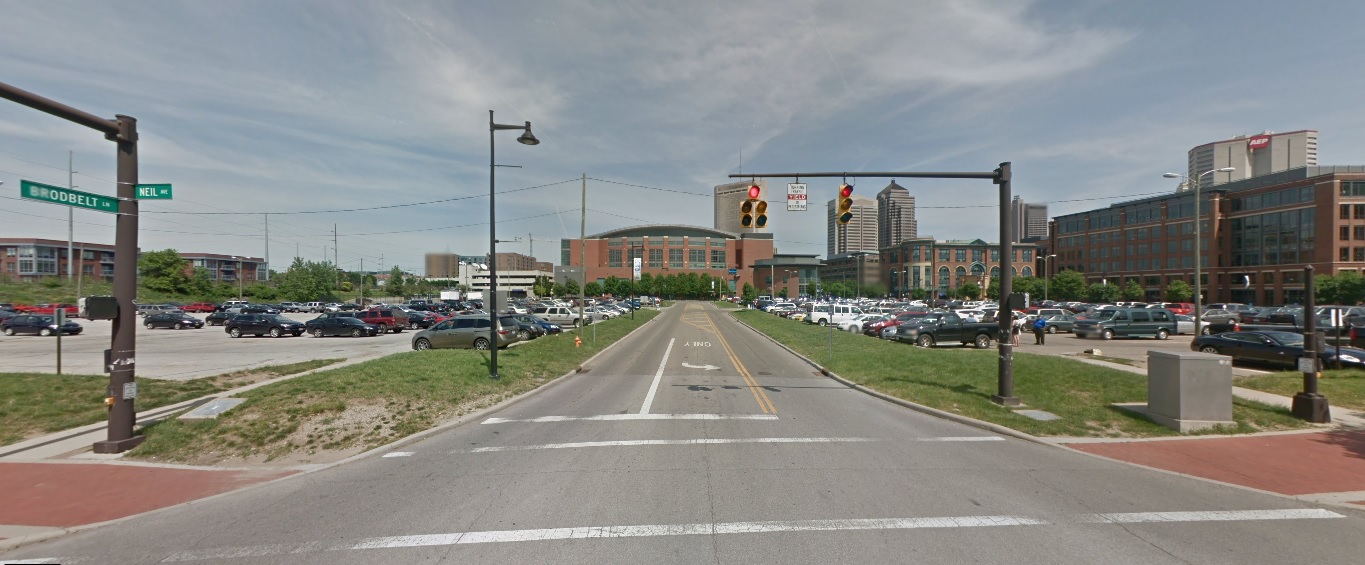
After: 2021
The Short North
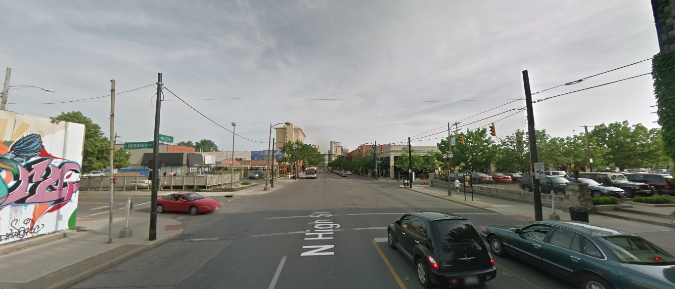
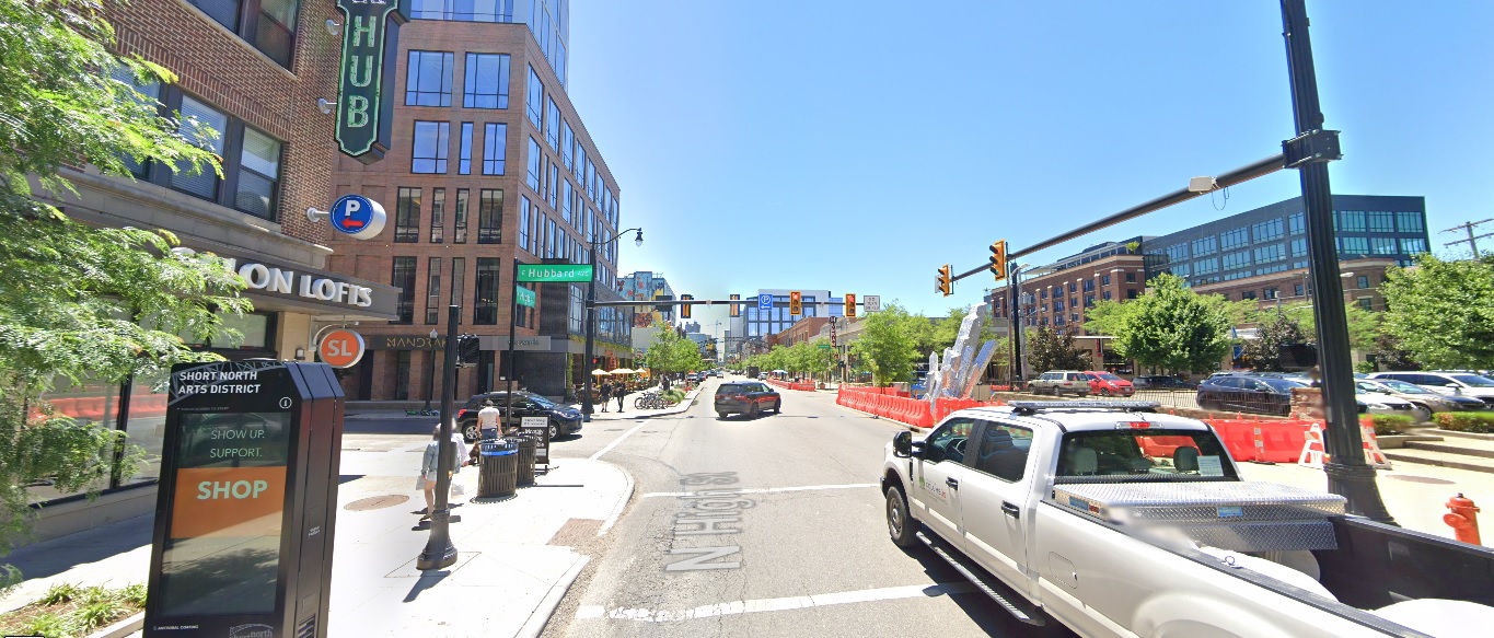
High Street, looking north from Milay Alley
Before: 2011
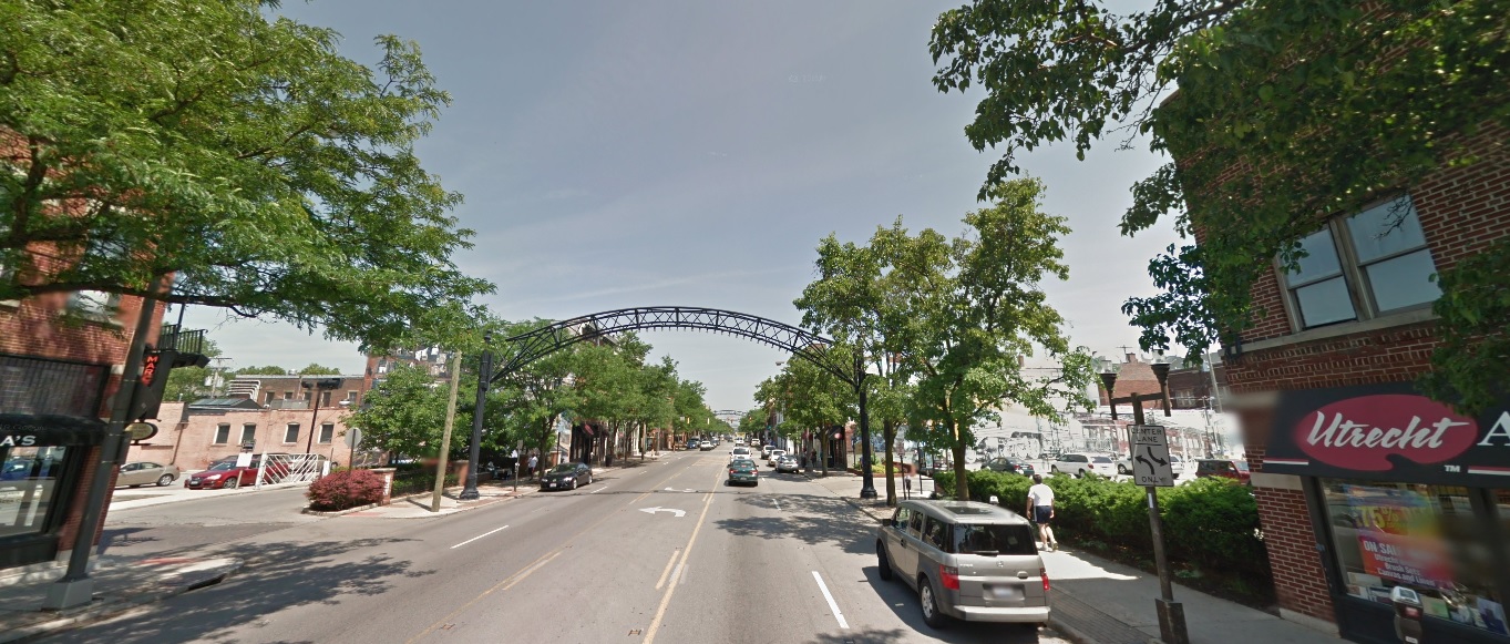
After: 2020
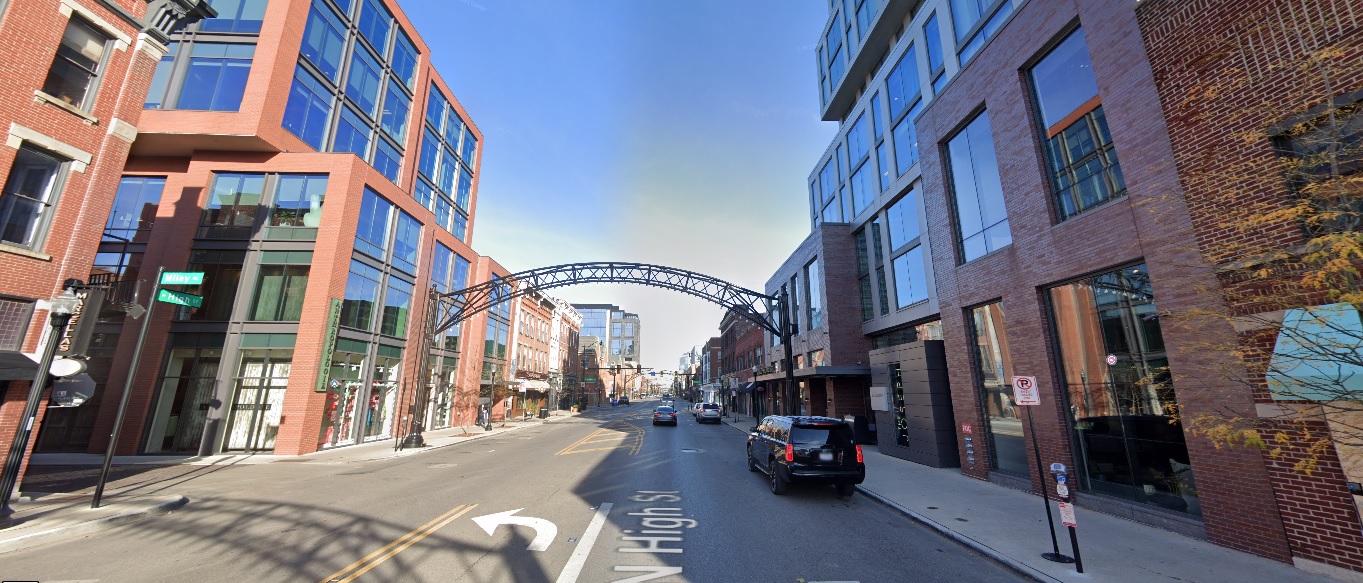
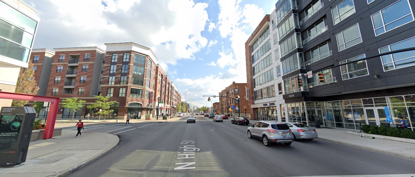
High Street, looking south from Buttles Avenue
Before: 2011
After: 2021
Fourth Street, looking east at Auden Avenue
Before: 2011
Before: 2021
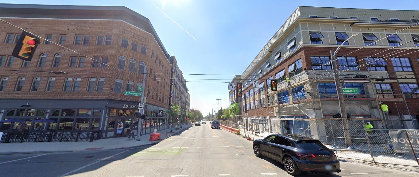
Summit Street, looking west at 5th Avenue
Before: 2011
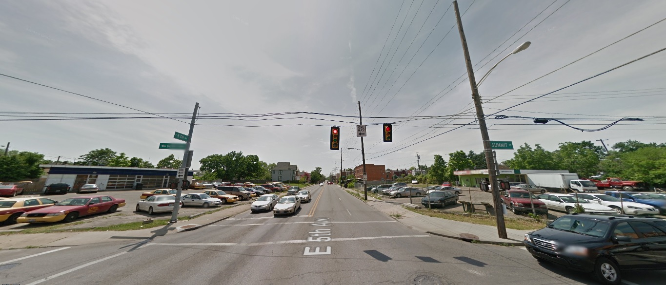
After: 2021
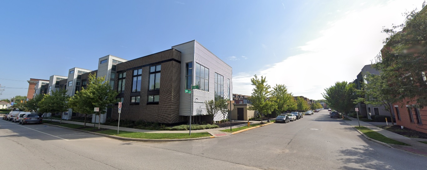
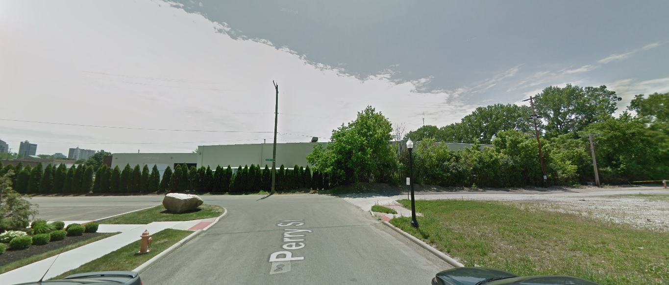
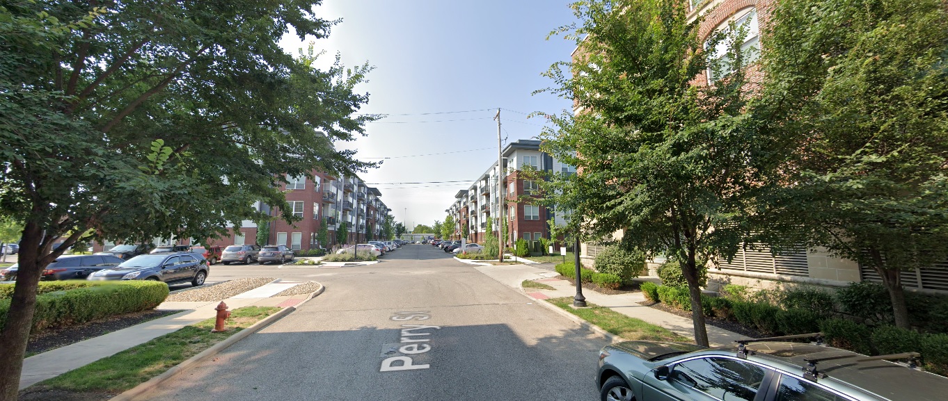
Perry Street, looking south at Quality Place
Before: 2011
After: 2021
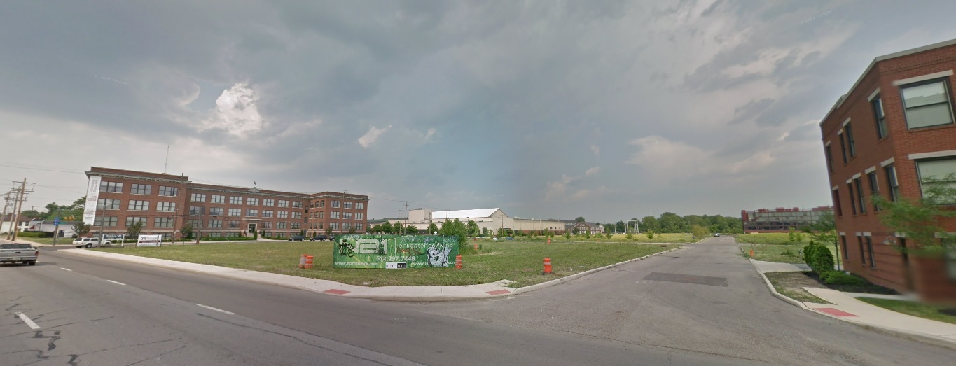
Weinland Park
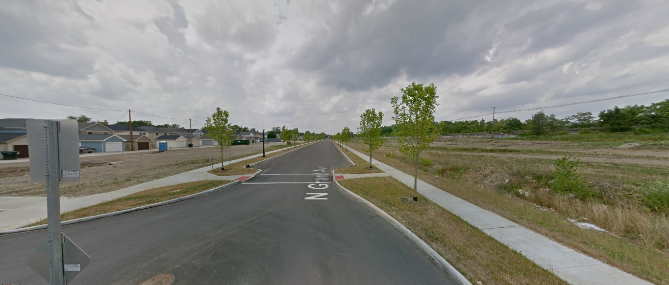
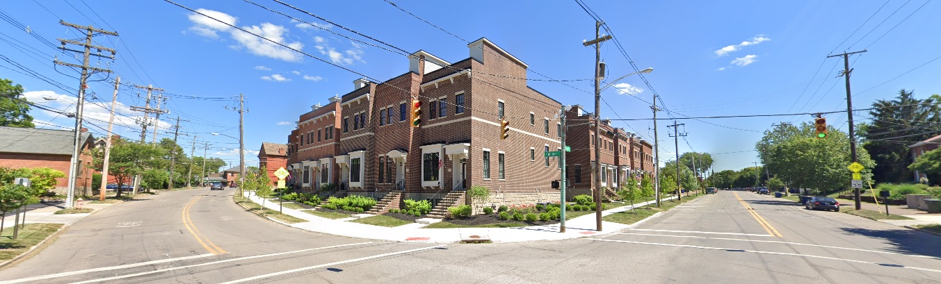
Grant Avenue, looking north from 7th Avenue
Before: 2012
After: 2021
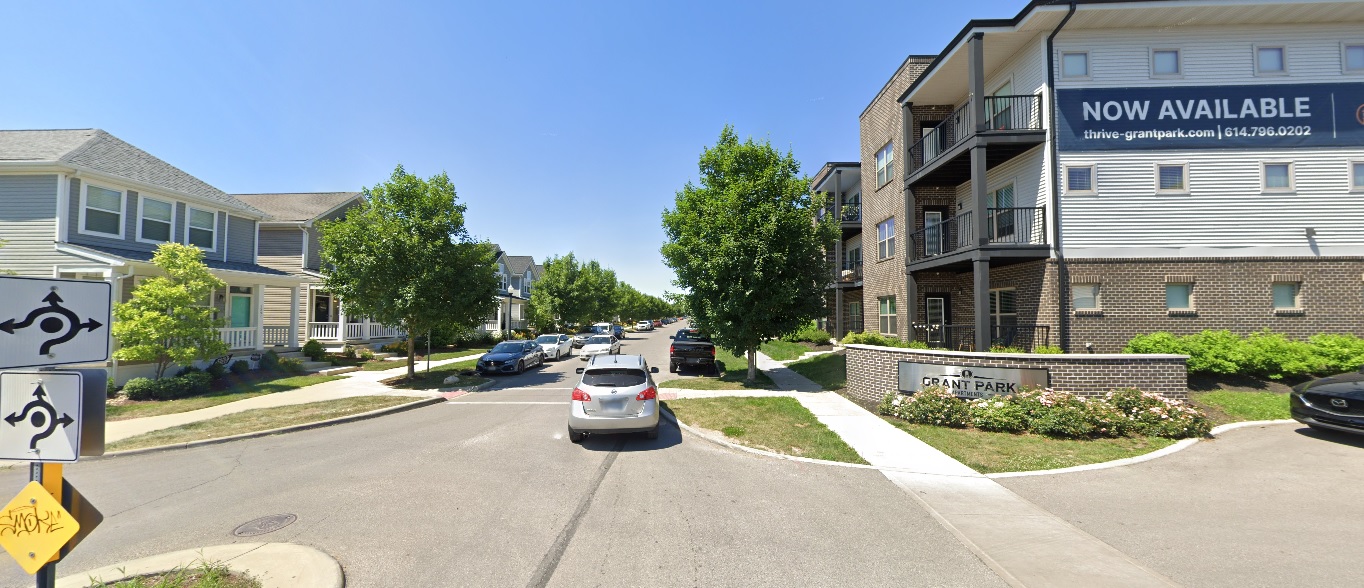
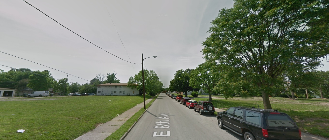
Eighth Avenue, looking west from Section Alley
Before: 2011
After: 2020
Franklinton
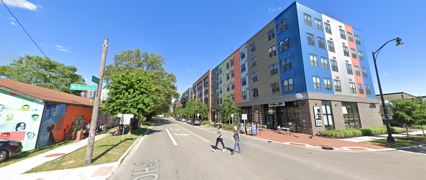
Rich Street, looking east from McDowell Street
Before: 2011
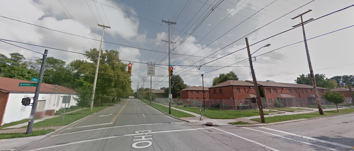
After: 2021
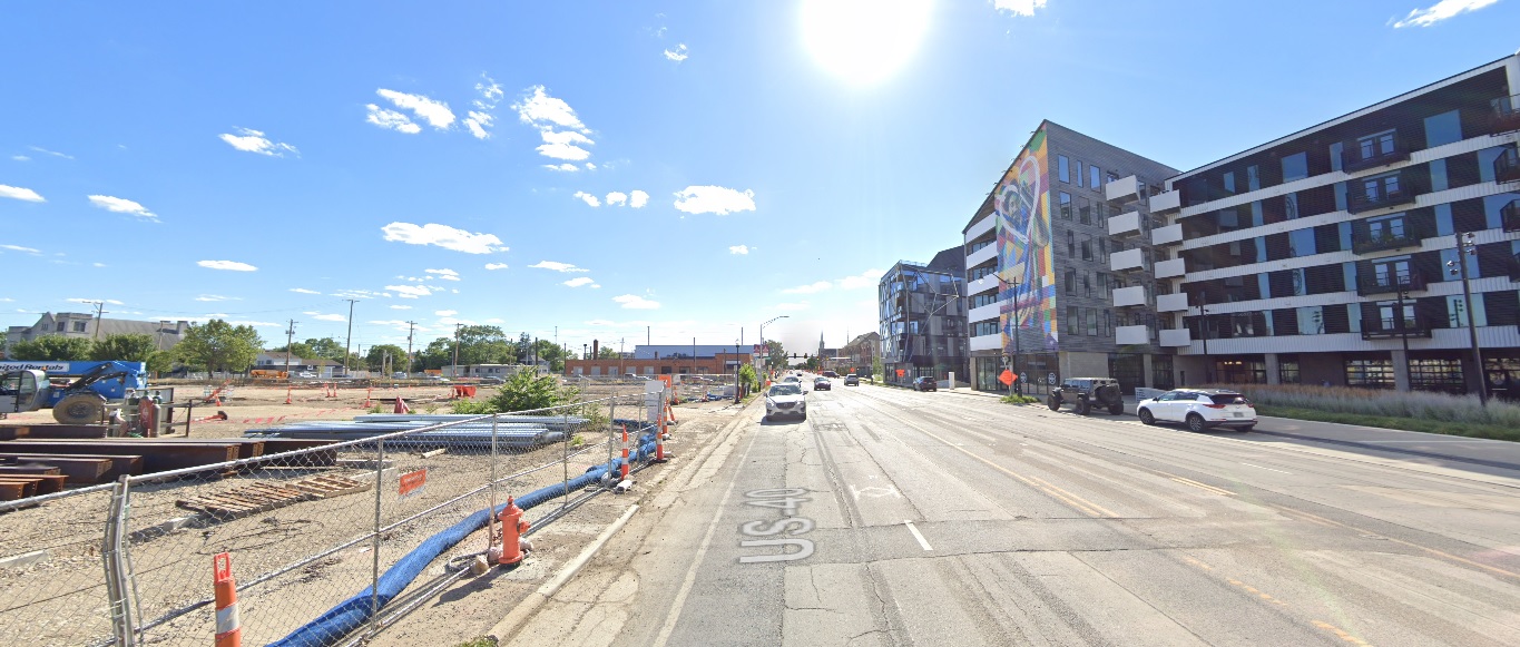
Broad Street, looking west from the railroad tracks.
Before: 2011
After: 2021
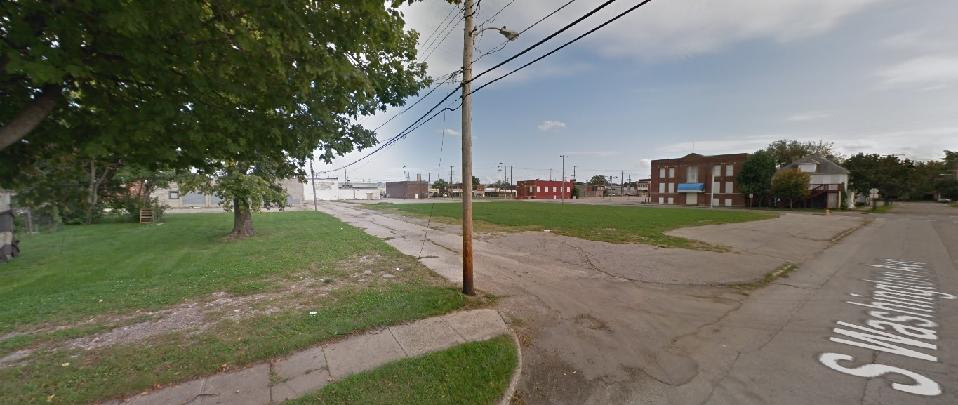
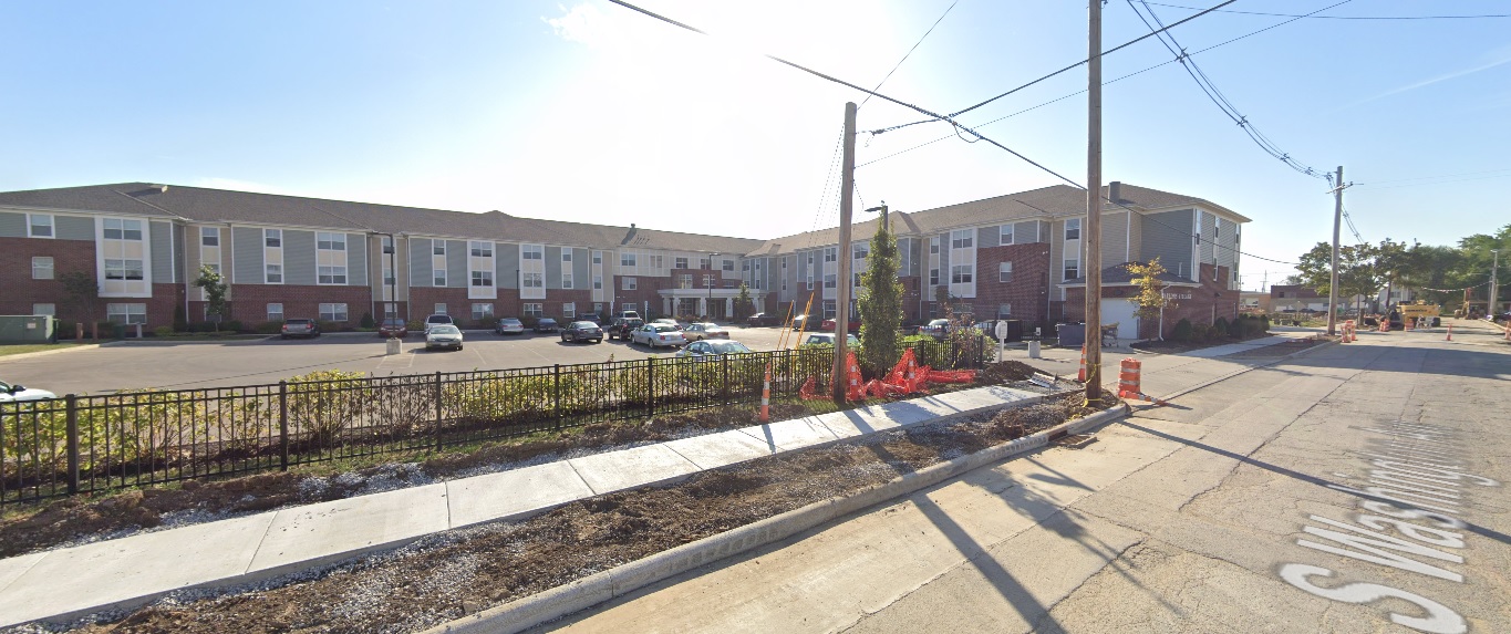
South Side
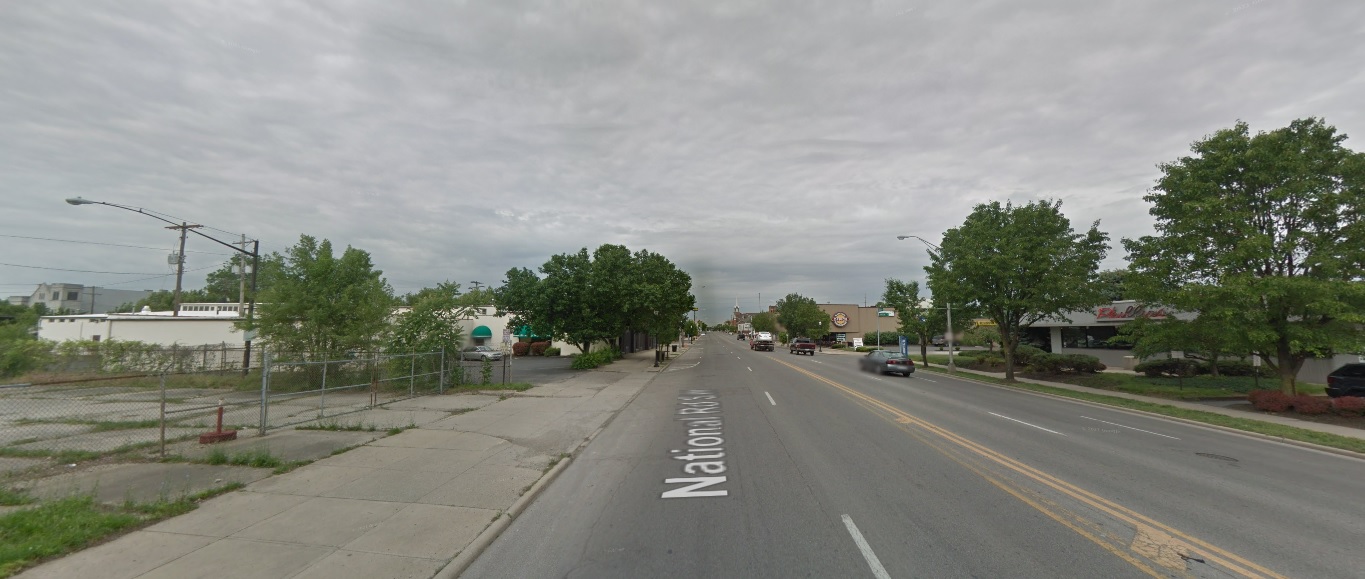
Livingston Avenue, looking east at Parsons Avenue
Before: 2009
After: 2020
Washington Avenue, looking southeast from Innis Avenue
Before: 2011
After: 2020
Front Street, looking south at Whittier Street
Before: 2011
After: 2021
Campus
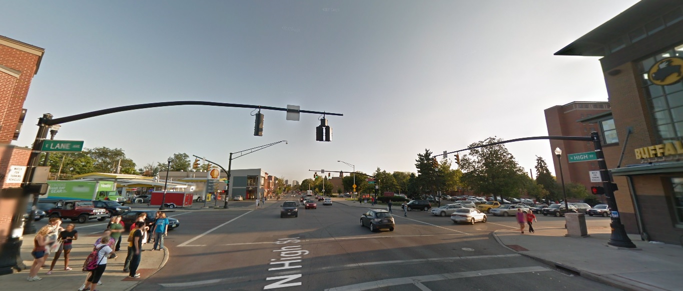
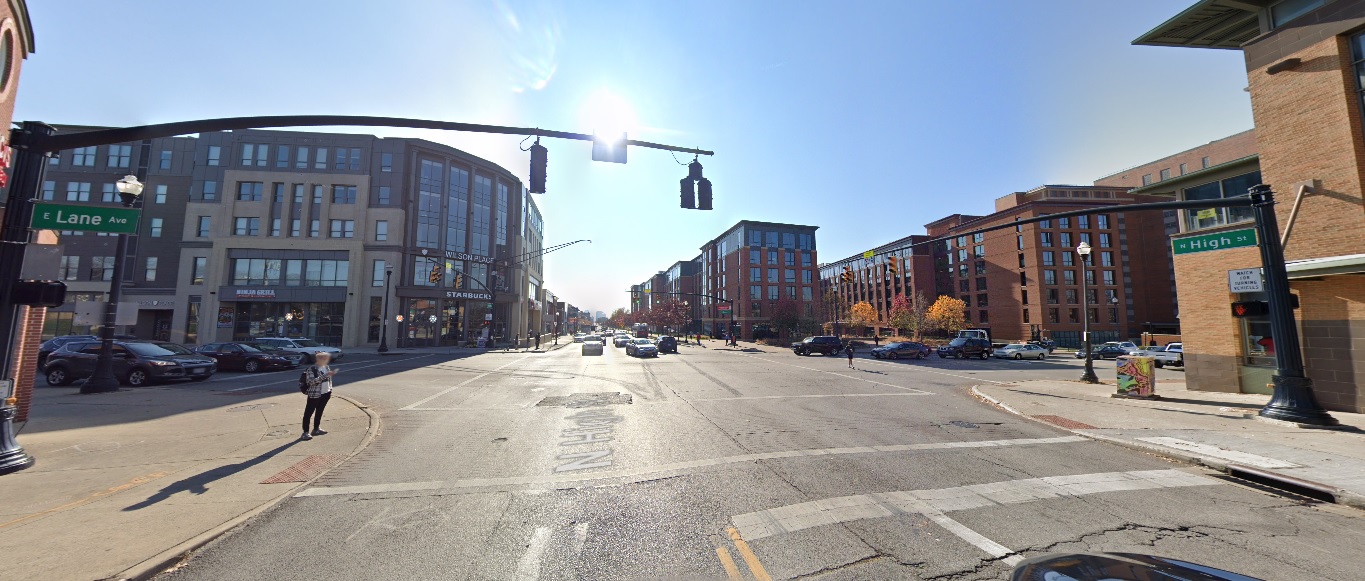
High Street, looking south from Lane Avenue
Before: 2011
After: 2020
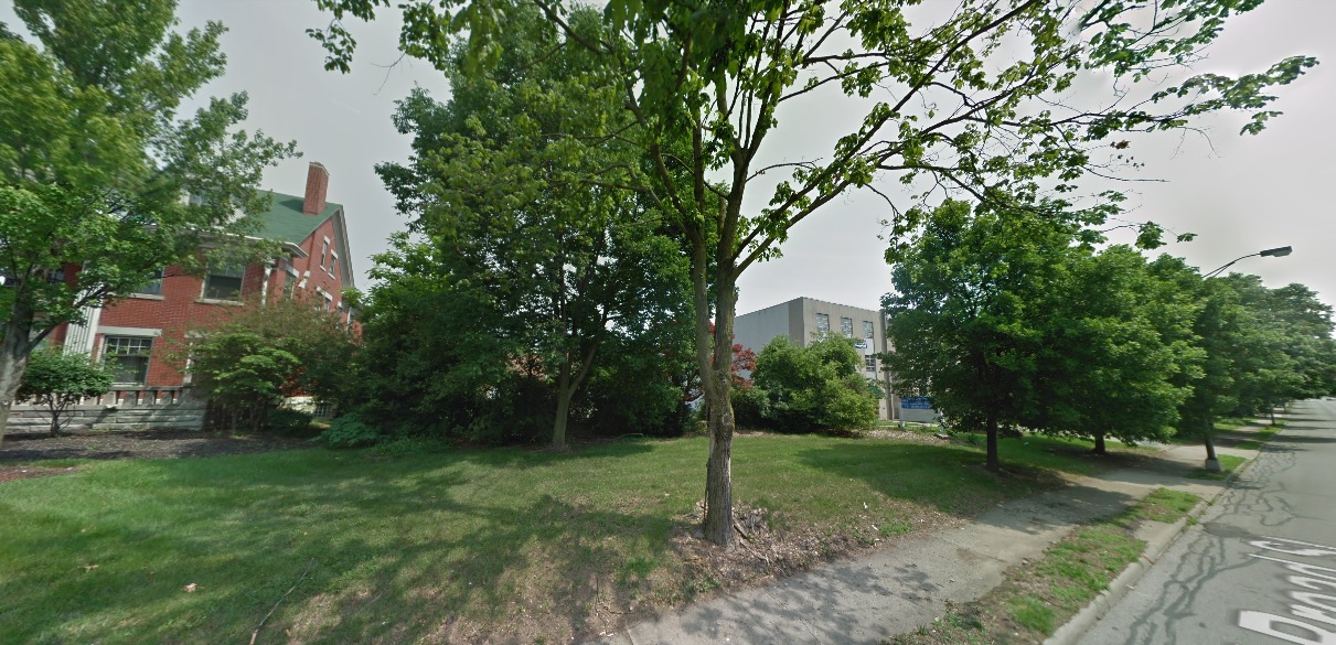
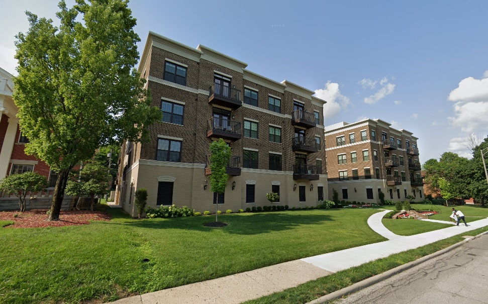
10th Avenue near Dodd Drive, looking northwest.
Before: 2011
After: 2021
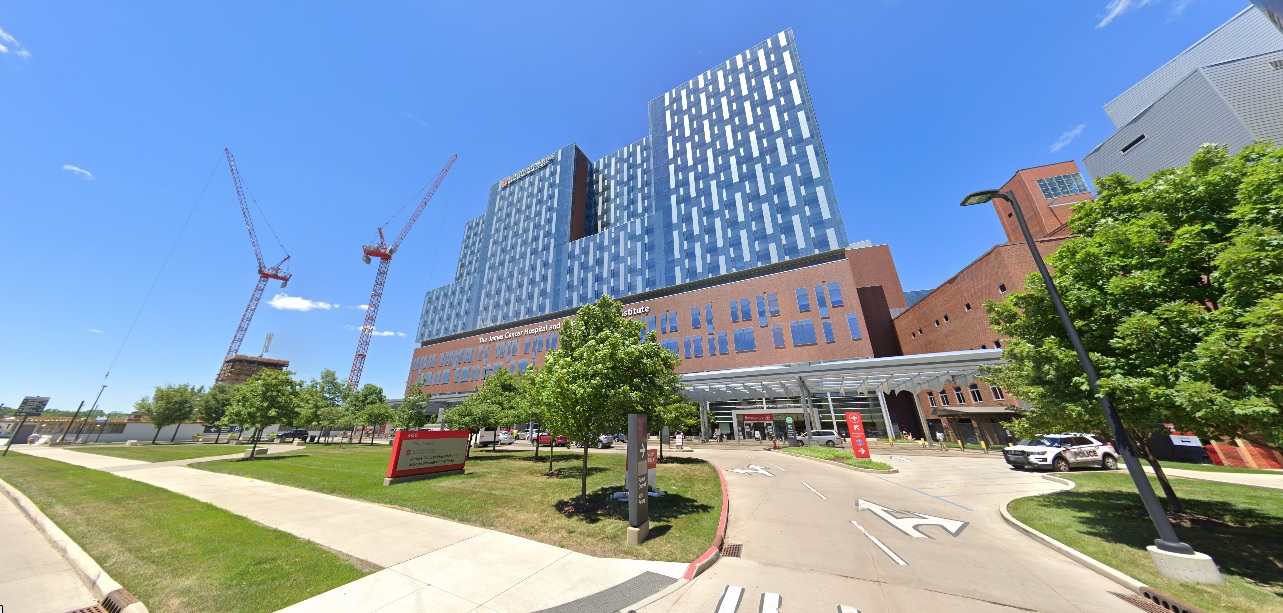
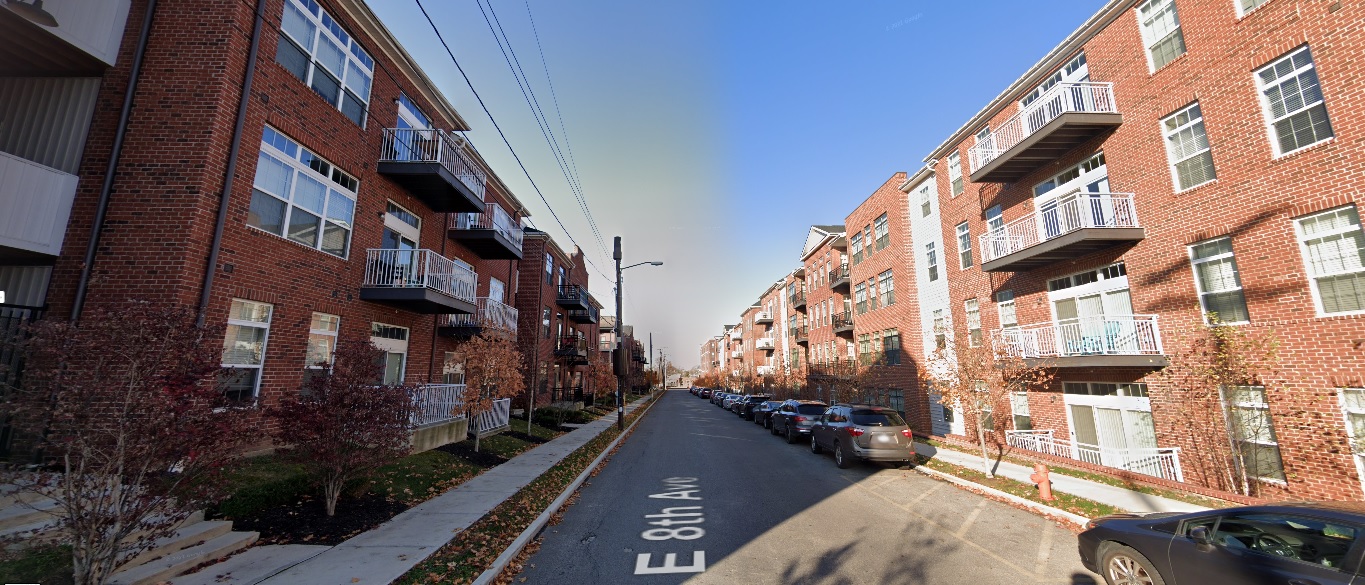
High Street, looking south from 8th Avenue
Before: 2011
After: 2021
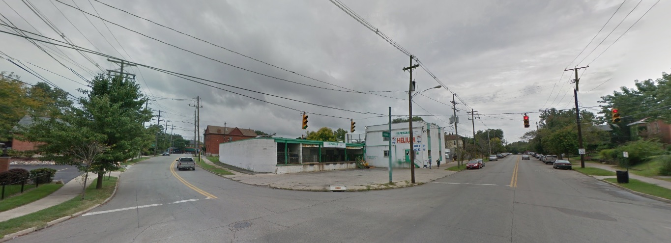
West Side
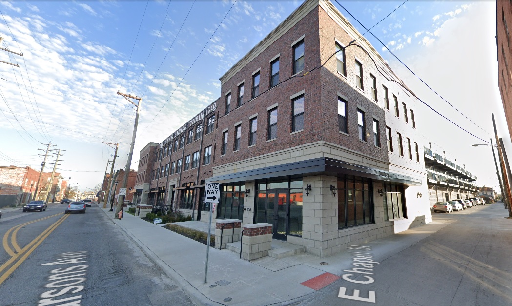
Parsons Avenue, looking northeast from Chapel Street
Before: 2011
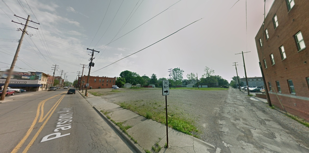
After: 2020
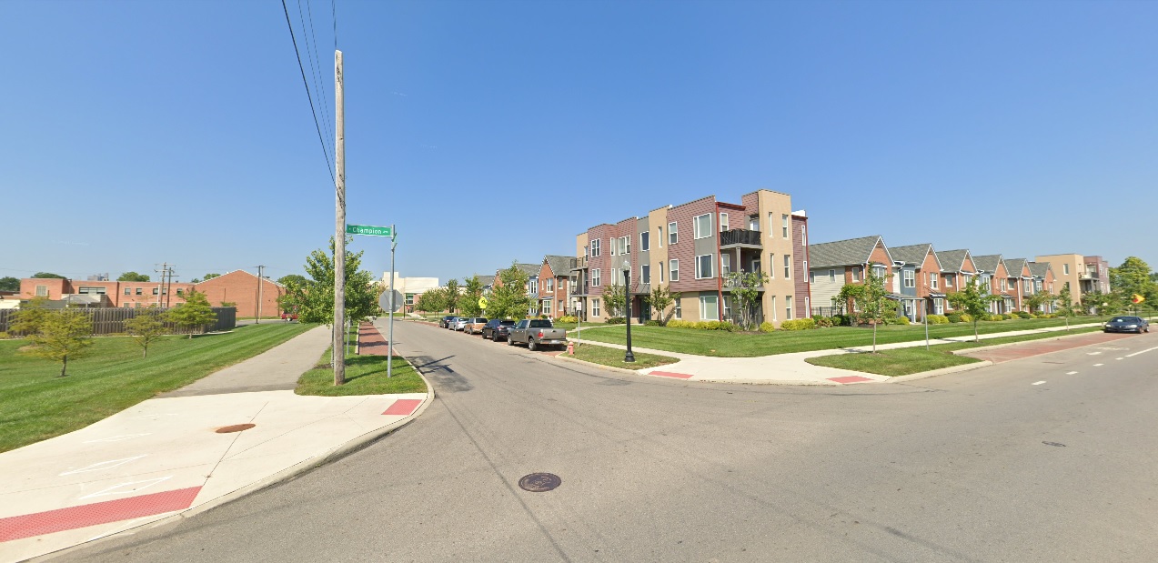
Champion Avenue, looking northwest at Phale D. Hale Drive
Before: 2011
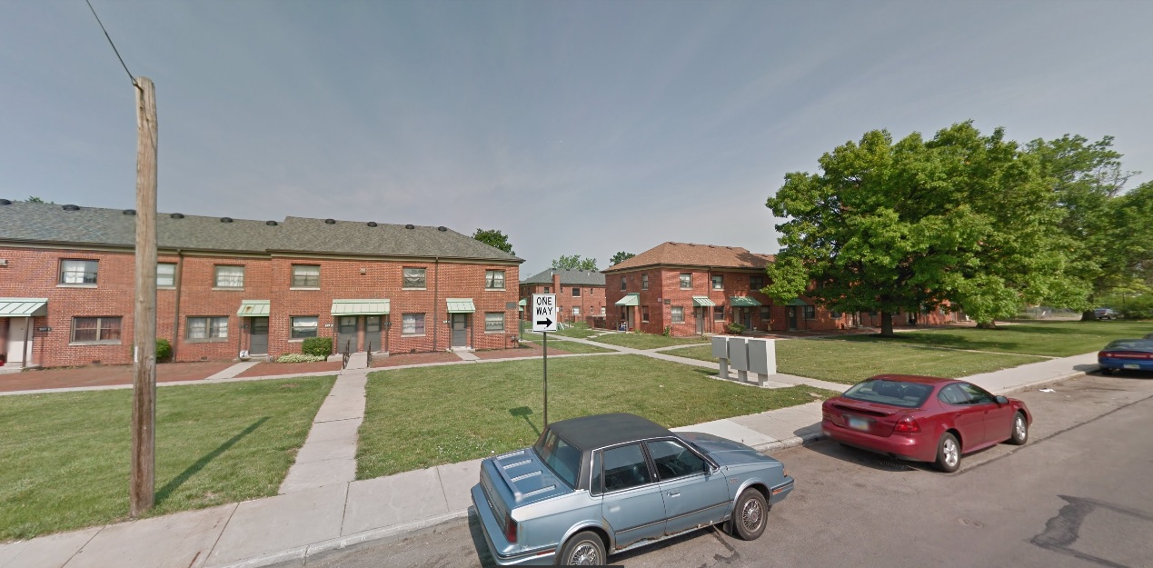
After: 2021
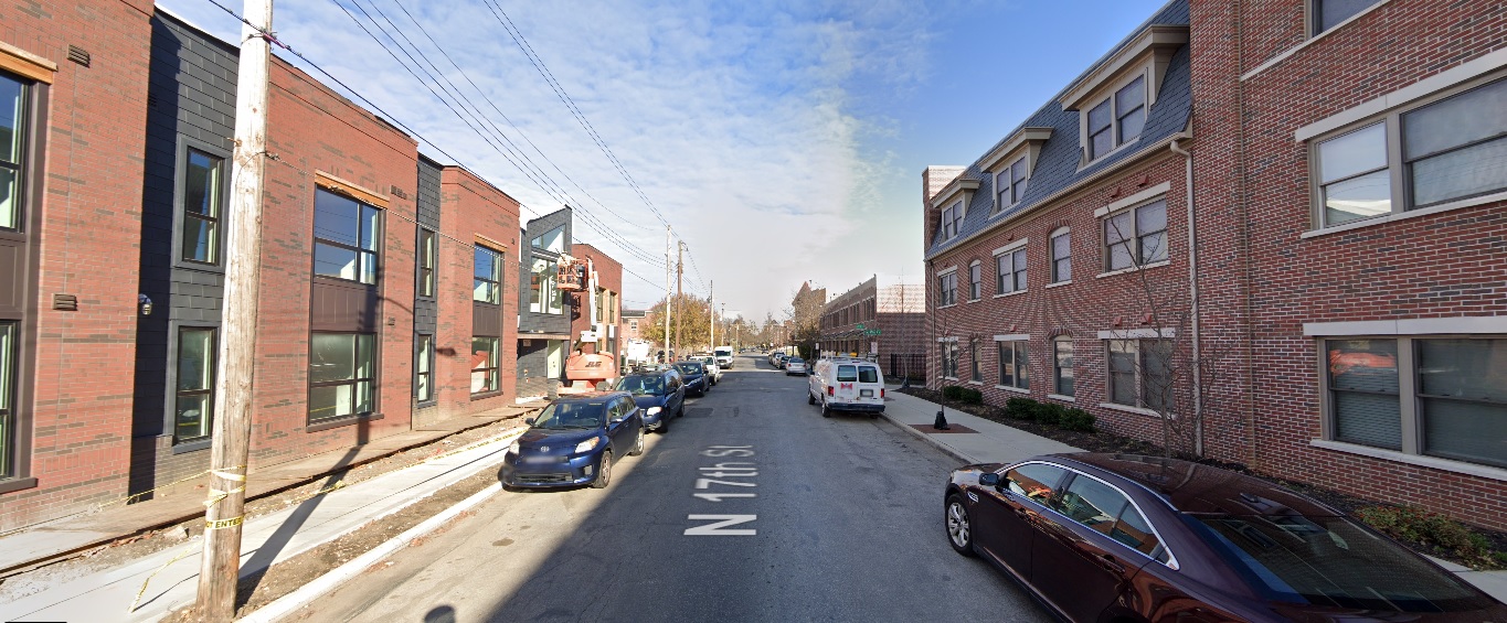
17th Avenue, looking north from Gay Street
Before: 2011
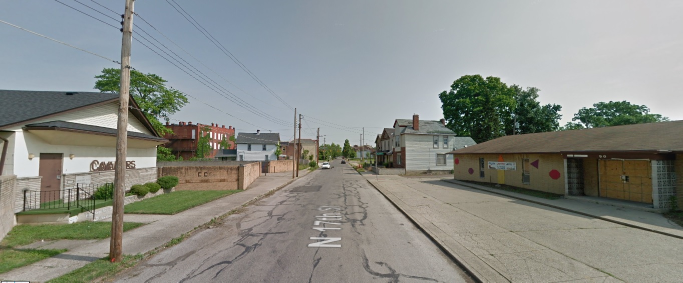
After: 2020
Broad Street, looking northeast west of Woodland Avenue
Before: 2011
After: 2021
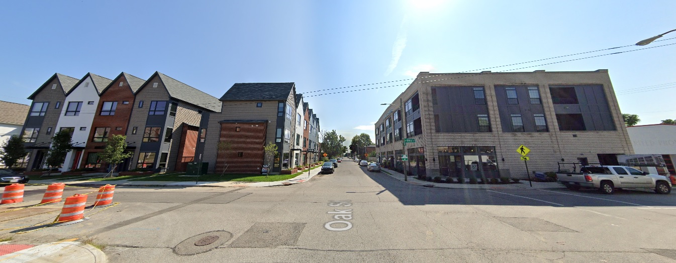
Oak Street, looking east from Ohio Avenue
Before: 2011
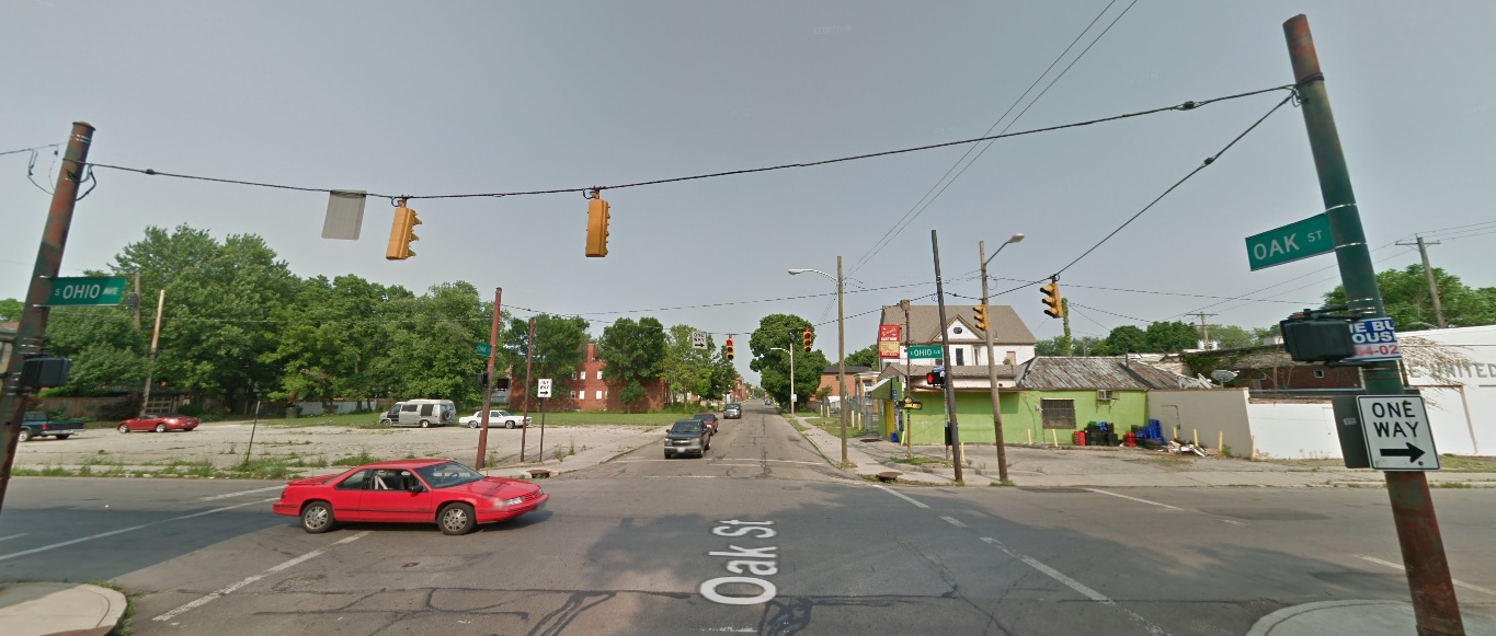
After: 2021
These images represent just a small fraction of the development and changes that have occurred in and around the city, and don’t even include the large developments in suburban areas like Grandview Yard in Grandview or Bridge Park in Dublin. The next 10 years looks to be even more significant, with new mixed-use towers for Downtown, potential skyscrapers for Easton, and large numbers of infill development projects continuing in central neighborhoods from Franklinton to Linden to the South Side. With them, the city will continue to grow more dense and more vibrant and- with any luck- will also help spur much needed change to Columbus’ underwhelming transit system.
These Columbus development links show many of the projects seen in the photos, as well as projects that are still just in the proposal stages. The City provides a master list of area development commissions to keep track of the latest proposals.